 |
| ||||||||||||||||||||||||
Prepared for the Peace Corps
by
Agro Engineering, Inc.
0210 Road 2 South
Alamosa, Colorado
81101
Authors:
LeRoy Salazar
Jim Tolisano
Keith Crane
Lee
Wheeler
Maya ter Kuile
David Radtke
Peace Corps
Information Collection and Exchange
Training
Manual T0077
September 1994
INFORMATION COLLECTION & EXCHANGE
Peace Corps' Information Collection & Exchange (ICE) was established so that the strategies and technologies developed by Peace Corps Volunteers, their co-workers, and their counterparts could be made available to the wide range of development organization and individual workers who might find them useful. Training guides, curricula, lesson plans, project reports, manuals and other Peace Corps-generated materials developed in the field are collected and reviewed. Some are reprinted "as is"; others provide a source of field based information for the production of manuals or for research in particular program areas. Materials that you submit to the Information Collection & Exchange thus become part of the Peace Corps' larger contribution to development.
Information about ICE publications and services is available through:
|
The Peace Corps Internet Web Site address: https://www.peacecorps.gov Please note the new Peace Corps Mailing Address from July 1998 on is: ICE/ Peace Corps |
|
Add your experience to the ICE Resource Center. Send materials that you've prepared so that we can share them with others working in the development field. Your technical insights serve as the basis for the generation of ICE manuals, reprints and resource packets, and also ensure that ICE is providing the most updated, innovative problem-solving techniques and information available to you and your fellow development workers. |
A technical reference to be used with the Peace Corps Irrigation Training Manual in the selection, planning, design, operation, and management of small-scale irrigation systems.
|
| ||||||||||||||||||||||||||||||||||||||||||||||||||||||||||||||||||||||||||||||||||||||||||||||||||||||||||||||||||||||||||||||||||||||||||||||||||||||||||||||||||||||||||||||||||||||||||||||||||||||||||||||||||||||||||||||||||||||||||||||||||||||||||||||||||||||||||||||||||||||||||||||||||||||||||||||||||||||||||||||||||||||||||||||||||||||||||||||||||||||||||||||||||||||||||||||||||||||||||||||||||||||||||||||||||||||||||||||||||||||||||||||||||||||||||||||||||||||||||||||||||||||||||||
Irrigation Reference Manual (Peace Corps, 1994, 485 p.)
Chapter 1 - Introduction
1.1 The role and purpose of irrigation
Irrigation is defined as the artificial application of water onto cropland for the purpose of satisfying the water requirements necessary for growing crops. Irrigation plays a key role in stabilizing food production in a number of countries by either supplementing or replacing the need for natural precipitation for the purpose of food production.
Irrigation is a key to the ability of many farmers, and even nations, to feed themselves and provide an adequate standard of living. Irrigation not only protects against drought but brings with it numerous other benefits as well as occasional problems.
Irrigation has been credited with being a primary factor in the rise and fall of civilizations. For example, in the region of Mesopotamia about 4,000 years ago, a thriving civilization depended on a highly developed irrigation system. Waterlogging and salinization, as well as the erosion and sedimentation resulting from irrigation, were instrumental in bringing about the collapse of that empire. To this day, much of the land remains saline and has not been recovered for crop production.
Currently, about one-fourth of the cultivated land in the world is irrigated. In the United States, the 10% of cultivated land that is irrigated provides some 25% of the value of agricultural production.
Irrigation can result in a number of benefits for the farmer and his or her community. Irrigation stabilizes farm production by protecting against drought and by increasing crop yields and quality when rainfall is insufficient. It permits farmers to grow moisture-sensitive, high-value crops and crops that will improve their diet. In some areas with proper climates, irrigation allows farmers to raise two or three good crops in a year. It allows them to plant on time, thus optimizing market conditions. In some areas, irrigation systems are used for frost protection. There are numerous problems, however that can be caused by poor design, construction, and management of irrigation systems. Salinization and waterlogging are other results. Poor design and management of systems often result in irrigation of only one-half or one-third of the potential area. Thus, costs per unit area may be very high, and the benefits of irrigation may extend to only a portion of the farmers who could use the water.
Irrigation is only one of many inputs to a farmer's sustainable agricultural system. Cultural practices, farmer resources, farmer preferences, and other factors will affect the selection, design, construction, and operation of an irrigation system. Therefore, it is very important that those who work in irrigated agriculture understand clearly not only the benefits and consequences of irrigation but also what it takes to maximize or optimize the benefits.
This manual was written in response to the need for providing technical information to those who work with small-scale farmers in areas where rainfall is deficient and where irrigation water is available or can be developed from existing water sources.
1.2 Introduction to the irrigation reference manual
The Irrigation Reference Manual is designed to complement and support the materials covered in the Irrigation Training Manual. These reference materials should provide sufficient background information to allow trainers, trainees or Volunteers complete basic tasks in organizing and mobilizing communities, assessing and developing water sources, and designing and managing irrigation projects. The material is not intended to be all-inclusive but rather to provide enough technical coverage to allow basic concepts to be understood and basic construction or application procedures to be applied. The Irrigation Reference Manual also includes an annotated bibliography to point trainers or other users towards other references if more detailed descriptions of any topics are needed.
The Manual has been designed to correlate information directly with the format of the Irrigation Training Manual. All of the training section headings are represented in this reference manual. Trainers or other users should be able to immediately access technical descriptive or illustrative materials that will support a specific training topic. In addition, the Reference Manual concludes with an index to assist in locating materials pertaining to any particular topic area.
The Reference Manual is organized to discuss the following:
Chapter 2 - Physical and Biological Resource Base
Trainers or other users are provided with sufficient background to interpret basic hydrologic processes, measure the supply of water available to support projects, survey an area of land, describe the relationship between soils, water, and plant development, and prepare a simple assessment of potential project environmental impacts. This information represents the foundation on which any irrigation project will be designed, constructed, or managed. A variety of techniques are included for each topic area and all of the methodologies are appropriate to the typical working conditions experienced by Peace Corps Volunteers.
Chapter 3 - Developing Water Sources
This material allows users of the manual to begin working with simple construction practices necessary to capture, convey, store, and lift water supplies. Basic principles in the use of concrete are described. Illustrations and descriptions of pumping devices typically available to Volunteers are also included.
Chapter 4 - Estimating Irrigation Requirements
This material provides representative formulas, charts, and case examples that enable users to estimate the amount of water necessary to sustain a crop. Information allowing the users to calculate water use for more than 25 different crops is included.
Chapter 5 - Farm Water Delivery Systems
Detailed discussions of the concepts and applications of hydraulic principals are included in this chapter. Students typically benefit from access to careful and thorough explanation of these concepts, and the text has been developed to make these principals as practical as possible. The chapter also includes sufficient conceptual and illustrative information to allow trainers to communicate the factors involved in designing and implementing irrigation systems using surface, sprinkler, or drip application methods.
Chapter 6 - Farm Water Management
The Manual provides a thorough description of the principals and procedures followed in preparing a schedule of water use on farms and methodologies that can be used to evaluate how effectively water and land is being used by the farmer. The chapter concludes with a comprehensive set of illustrations that communicate the techniques of irrigation scheduling in a non-verbal manner.
Chapter 7 - Waterlogging and Salinity
Technical information is presented to enable trainers to describe and demonstrate techniques for assessing the degree of waterlogging and salinity problems that may be occurring and to apply chemical amendments or cultural practices that can minimize or avoid such problems. The chapter also includes a concise description of water quality as it affects irrigation projects.
Appendix A - Math Skills and Tool Use
Common formulas, conversion charts, and algebraic and trigonometric values are included to enable trainers or other users to easily apply mathematical formulas. A list of tools commonly available to Peace Corps Irrigation Volunteers is also included.
Appendix B - Community Organization and Development
A concise review of basic concepts important in working with people-centered agricultural projects is presented. The discussion emphasizes basic techniques that can assist a Volunteer's efforts to enter, interact, and participate in community project efforts. The level of detail in this appendix is limited because it is anticipated that Volunteers will be supplied with more comprehensive community organization literature. In particular, it is anticipated that trainers will attempt to provide each Volunteer with a copy of Two Ears of Corn, an excellent reference book to guide any community-based agricultural involvement.
Appendix C - Summary of International Irrigation Center (IIC) Training Modules
The IIC has prepared a collection of 40 video modules that present basic irrigation principals and practices. These modules were specifically developed for conditions in Ecuador, but many have universal applications. A description of the length, content, and applicability of each module to Peace Corps training sessions is included for those trainers who may have access to video equipment and the actual video cassettes.
Appendix D - Case Studies
Trainers can review these examples of different problems and strategies used to develop small-scale irrigation systems worldwide to support the material content in the technical training sessions. The case studies are intended to be representative of typical conditions that may be experienced by a Peace Corps Volunteer working with irrigation issues.
Appendix E - Annotated Bibliography
The Irrigation Reference Manual is intended to serve as a primary source for basic information needed to design, implement, and manage small or medium-scale irrigation projects. It is not, however, the only reference that a practitioner would want to use. The extensive bibliography includes a concise description of the specific values of each text that can be consulted for further information by trainers or Volunteers.
Appendix F - Glossary of Terms
Concepts and principals can be most easily grasped when they are presented in simple, concise descriptions. The glossary should assist trainers in preparing descriptions that will enable trainees to comprehend terms quickly and accurately. It is anticipated that the Irrigation Reference Manual will be made available to Trainees, Volunteers, and other irrigation practitioners on an as-needed basis. The material included in the Manual would be appropriate to support a Peace Corps Volunteer's efforts in the field throughout his or her term of service, and trainers may wish to request additional copies to distribute to Trainees during the training. Alternatively, sections of the Manual can be photocopied and distributed to support specific training sessions.
<<TOC2>> Chapter 2 - Physical and biological
resource base
|
Reference: |
Primary: |
(2), (9), (14), (18), (20-21), (27-28), (39), (44), (56-59) |
| |
Other: |
(16), (24) |
2.1 Watersheds
A watershed is the area representing all the land draining moisture from the highest elevations, usually referred to as the headwaters, to a specified outlet point. A single watershed can include all of the lands draining into a main channel, often a river, including the tributary channels of the entire river basin. For example, the Senegal River basin in West Africa with its tributaries covers several hundred thousand hectares of land. A watershed can also be subdivided to include only those lands draining a single tributary, which may include only a few hundred hectares.
Watersheds are typically delineated using topographic maps. By following the contour lines on the map, the dividing points between drainage basins can be determined and the directions for flows identified (Figure 2.1). Once the watershed is delineated, soil, water, and ecological resources within the basin can be identified, and measures to protect these resources can be developed.
Irrigation specialists are concerned with protecting and developing the soil and water resources within watersheds and ensuring that irrigation projects do not result in any disruptions to balanced ecological processes. Specifically, it is important for an irrigation specialist to protect the quantity and quality of water obtainable from a water source, avoid conditions that promote flooding or extreme fluctuations in water availability, and ensure that erosion does not result in a loss of agricultural land or clogged canals and ponds.
Assessing and developing water resources requires an understanding of the hydrologic processes influencing the movement and storage of water within watersheds. Protecting the soil and water resource base requires a knowledge of watershed conditions and implementation of conservation measures that promote reliable water supplies of acceptable quality and minimal soil loss.
2.1.1 Watershed hydrology
The hydrologic cycle (Figure 2.2) is easily understood: water evaporates from the earth's oceans and other water bodies, is carried by air currents, condenses due to temperature changes, falls to earth again as precipitation, and finally flows back to water bodies to begin the cycle over again.
Within this cycle there are several processes that affect the timing and quantity of water moving through each phase. For example, as precipitation falls some of it will be intercepted by vegetation before reaching the ground. Some of this intercepted moisture will evaporate from plant surfaces directly back to the atmosphere while the remainder will reach the ground surface. Some water reaching the ground surface will evaporate, some will penetrate the soil surface, and some may run off as surface flow. The permeability of the soil surface will determine the rate and amount of water that seeps into the ground. Water infiltrating into the ground provides nutrients to plant roots to support their growth, recharges springs and aquifers, and moves slowly downslope through the soil pore spaces to recharge surface lakes and rivers.
Figure 2.1 Watershed Boundaries
on Contour Map
Figure 2.2 The Hydrologic Cycle
(Ref. 21)
Human resource management practices often greatly influence the hydrologic cycle processes. For example, the type of vegetation present will influence the amount of precipitation intercepted and the rate at which water can infiltrate into the ground. The area covered by vegetation also influences the amount of soil moisture that is recycled to the atmosphere through evaporation from exposed surfaces and plant transpiration. Land management decisions often directly influence the type and amount of vegetative cover present. Farming practices and other land use characteristics will influence soil characteristics and thus the amount and quality of water infiltrating into soils.
Water quality issues affect irrigation specialists primarily from the perspective of salinity and sedimentation. The problems of high salt content in water is discussed in detail in Chapter 7. Sedimentation is the result of poor land management that causes excessive soil loss. Eroded soils can clog canals and diversions, disrupt pipelines, fill in farm ponds or reservoirs, contaminate wells, or result in a loss of arable lands. Being able to measure hydrologic processes, and using this information to assess watershed conditions, is necessary in order for Volunteers to effectively control water quality concerns.
2.1.2 Hydrologic processes
There are standard methods used for quantifying and describing hydrologic processes. Specifically, irrigation technicians should be familiar with the concepts of precipitation, infiltration, surface runoff, evapotranspiration, streamflow, and groundwater yields.
Precipitation is usually characterized in terms of intensity, storm duration, and area covered. Rainfall intensity refers to how much precipitation occurs within a given time period. It is typically expressed in millimeters per hour (or inches per hour) and usually measured by seeing how much rain fills a container of known volume in a specific period of time. The length of time, or duration, of rain fall is expressed in minutes or hours and is directly correlated with rainfall intensity. For example:
|
Depth in mm |
13.8 |
22.4 |
45 |
64 |
108 |
|
Duration (Min) |
5 |
10 |
30 |
60 |
360 |
|
Intensity, mm/hour |
166 |
134 |
90 |
64 |
18 |
Infiltration indicates how much water is absorbed into the ground during a specified period and is typically expressed as a rate (e.g. mm per hr or cm per hour). Infiltration capacity describes the maximum amount of water that will infiltrate into a particular soil within a specific time period. If the rainfall exceeds the infiltration capacity during the specified period, then the excess water begins moving over the soil surface as runoff. The infiltration capacity is determined by soil texture and structure. Soil texture indicates the relative amounts of sand, silt, and clay particles found within the soil. Soil structure indicates the way these particles are bound together by organic materials and other adhesive substances. Typical infiltration rates for different soil texture classes are as follows:
|
Soil Texture Class |
Infiltration capacity cm/hour |
|
Loamy Sand |
2.5 - 5.0 |
|
Loam |
1.25 - 2.5 |
|
Silt Loam |
0.75 - 1.45 |
|
Clay loam |
0.25 - 0.5 |
Many soils that are initially dry will absorb large amounts of water rapidly at first, but infiltration rates decline as the soil becomes wetter. Infiltration rates can provide an important clue as to the capacity of the soil to store moisture and the rate of runoff from a watershed.
Evapotranspiration, or ET, is the combination of evaporation and transpiration. ET is generally estimated using simple formulas described in Chapter 4. ET is typically expressed as a depth over a period of time, such as mm or inches per month.
Surface Runoff describes the process of water movement over the land surface that occurs when the precipitation rate exceeds the ability of the soil to absorb the rainfall. Surface runoff is usually measured as a depth or volume over time, such as mm or cm per hour or liters per second. A hydrograph is a graphic depiction of the rate of runoff plotted over a period of time for a particular watershed. Surface runoff supplies water to lakes, ponds, wetlands, rivers, and streams. In extreme amounts, it can result in flooding and severe erosion.
Volunteers should consult local hydrologists if they suspect that flow rates might be large enough to damage irrigation structures. Stream measurements conducted by governmental agencies such as ministries of water resources, irrigation, or agriculture are important sources of streamflow information.
Agriculture are important sources of streamflow information. For small streams the information may not be available, and the Volunteer may have to measure streamflows at various times of the year (see Section 2.2 of this manual). Adjustments may need to be made to account for wet and dry years.
Aquifers or ground water reservoirs are soil, rock, or mixed materials that are totally saturated with water (Figure 2.3). The surface (top most area) of this saturated zone is called the water table. The level of the water table may vary seasonally as recharge fluctuates and people withdraw water through wells. Due to gravityground water flows from a location where the water table is higher to where it is lower.
The permeability of aquifers vary according to the aquifer material. Aquifer materials are typically a mix of consolidated and unconsolidated (or fractured) rocks. Consolidated rocks are porous materials held firmly together by compaction and cementation and are represented by sandstones, limestones, and conglomerates. Unconsolidated materials include a mix of boulders, gravel, sands, and clays.
Gravel aquifers are the most permeable and yield water easily from wells. Gravel aquifers are often sources for high capacity wells. Permeability usually relates to the coarseness of the aquifer material.
Unconfined or water table aquifers (Figure 2.3) have a free water surface. Confined or Artesian aquifers (Figure 2.3) are bounded by an impermeable or semi-impermeable layer that maintains the water in the aquifer under pressure. Wells in artesian aquifers may flow freely without the need for pumping.
One type of unconfined aquifer is known as a perched aquifer, where an impermeable layer of limited size stops the percolation of water to a deeper aquifer, thereby creating a small underground reservoir of limited volume (Figure 2.3).
Surface springs or seeps occur in places where an impermeable rock layer emerges at the ground surface. Ground water flows by gravity along this impermeable layer and exits the ground at the spring site.
Aquifers function much like a surface reservoir, except in the case of some artesian aquifers, pumps are required to extract the water from below ground. Ground water quality may also be a concern in some locations. If irrigation wells have been operating without causing problems to crop growth, the water is probably of acceptable quality. In newly pumped areas, the water should be sampled and evaluated before use in irrigation (See Chapter 7).
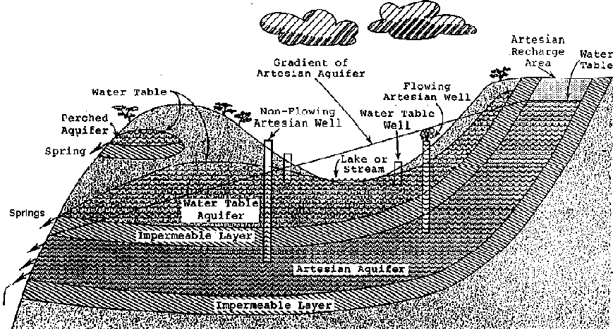
Figure 2.3 Types of Aquifers and
Location of Water
Source
2.1.3 Assessing watershed conditions
An assessment of watershed conditions should be an initial task in the development of any project. Volunteers should be prepared to spend time walking the watershed to observe and record information first-hand.
Technical aids useful in conducting an assessment of watershed conditions include maps, aerial photographs, and data forms that can be used to collect field information. Topographic maps at scales of 1:25,000 are valuable for studying specific sites within watersheds or small watersheds of less than 2 km. Larger watersheds may require map scales of 1:100,000. Maps that have been prepared to document characteristics of soils, vegetation, climate, geology, hydrology, or social conditions should also be obtained.
Aerial photographs at scales of 1:10,000 to 1:15,000 should be used wherever possible. If stereoscopic aerial photographs are available, it is important that the overlap over the area depicted is not less than 50 percent and not more than 55 percent along the flight line and 15 percent between flight lines. This makes it possible to use the photographs to create three-dimensional viewing of areas using a stereoscope.
Data forms should enable the collection of baseline technical information quickly and with sufficient depth to make professional judgments. Data forms should be prepared for information on soil characteristics, climate, water sources, vegetation, social conditions, and land use practices.
Useful tools that will facilitate field work include:
· a shovel and soil auger for
investigating soil characteristics and bags to collect soil samples;
· an Abney level for measuring changes in
elevations;
· maps, photographs, and colored
grease pencils for marking photos;
· small,
clean jars for collecting water samples; and
· clipboards and data forms.
The inventory of watershed conditions should focus on evaluating the following characteristics of the watershed:
A. Soils: list general types evident in the watershed; note areas with high potential for erosion; link soil types with natural vegetation; note soils with potential for crop productivity.
B. Topography: link steep slopes with erodible soils; note slope lengths, particularly in areas of high erosion potential; describe slope aspects.
C. Hydrology: identify all potential water supply sources; note drainage patterns, floodplains, and areas of flood potential; interpret the amount of change occurring in the shapes, depths, or directional patterns of channels; identify factors that could affect water quality, including presence of grazing animals, areas of heavy sediment loading, or heavy agrochemical use; obtain streamflow data on a daily, monthly, or annual basis depending on the needs of your inventory.
D. Vegetation: classify general vegetation types in watershed and link with soils and climatic characteristics; estimate the amount of ground that is protected or covered by the natural or planted vegetation in each vegetation type.
E. Land Use Practices: map the ways all land is currently being used within the watershed, including grazing areas, crop production lands, harvested forests; identify areas prone to inappropriate land uses; also identify environmentally sensitive or unique areas, such as wetlands, important wildlife habitat, and archeological sites.
In evaluating watershed conditions the objective is to qualify or quantify the sensitivity and resilience of the watershed. Watershed sensitivity describes a watershed's ability to withstand stress and manipulation. Watershed resilience describes the ability of a watershed to recover from damage evident on land surfaces, in stream channels, or in water bodies. All watersheds can withstand some level of impact before the quality of the soils and water degrade to a level that no longer supports biological diversity and human goals.
Watersheds that are in a declining condition typically demonstrate the following cycle of symptoms:
· reduced ground cover or increased density of drainage channels,
· increased peak flows of streams and rivers,
· deepened or widened channels resulting from the erosive power of increased peak flows,
· lowered water tables under alluvial floodplains, resulting from deepened channels and more rapid runoff,
· changes in the amount and type of streamside and floodplain vegetation, resulting from the lowered alluvial water tables,
· further channel degradation, and the development of many new side channels and gullies, resulting from changes in streamside and floodplain vegetation, and
· increased runoff rates leading to a decrease in available soil moisture, which further reduces ground cover and results in another cycle of decline in watershed condition.
Any land use or management practice that tends to speed up the delivery of precipitation to the stream channel(s) will tend to have a negative influence on watershed conditions.
2.1.4 Soil and water conservation practices
A primary objective in watershed management is to ensure balanced soil and water systems. Protecting water quality and supply and preventing erosion are the major focus of this objective.
Erosion is the removal of soil through naturally occurring processes, including wind, falling raindrops, water flowing on the surface of the ground, and the force of gravity. The impact of falling rain or wind-borne soil particles can cause more soil particles to detach and move under the force of gravity, moving water, or wind. Any factor that lessend the impact of rain or strong winds reduce the amount of soil particles detached and eroded. Removal of ground cover and changes to the natural drainage patterns are two primary causes of accelerated erosion.
Vegetative cover intercepts much of the rainfall and reduces the velocity and intensity of rain drops. Plant roots also create openings in the soil and increase infiltration of rainwater into the soil. This reduces the amount of water flowing on the surface that might otherwise accelerate the downslope movement of detached soil particles. Undisturbed forests and pastures frequently have infiltration rates that exceed rainfall rates, thus eliminating or reducing the amount of erosion due to water.
Erosion is typically classified into four categories:
Sheet Erosion - A uniform depth of surface runoff moves detached soil particles to tiny channels (rills) that have formed.
Rill Erosion - The surface of the ground is cut and deepened enough to concentrate runoff and soil particle movement in a tiny channel or rill. Rills are generally less than 1 foot or 30 cm deep.
Gully Erosion - Rills over 30 cm (one foot) deep are usually referred to as gullies. As more and more flow concentrates in rills, they deepen, speed up runoff, and lower the water table of alluvial lands. As the number of channels increase, peak flows increase and productive lands are lost.
Channel Erosion - As peak flows increase, their erosive force cuts away the banks or beds of natural stream channels, changing drainage patterns and frequently further accelerating flow rates and flooding.
Eroded soil particles are carried by flowing water or wind currents until the flow no longer has sufficient energy to carry or move a given particle. The particles are then deposited. In the case of water erosion, sediment deposits can reduce water quality, destroy the spawning and rearing areas for fish, reduce the life of.i.ponds or channels by filling and clogging, and increase downstream flooding through loss of channel capacity.
There are two simple ways to determine if serious erosion is occurring in a watershed:
1. Collect water samples at an outlet point in a drainage basin and observe the amount of sediments in the water over time.
2. Build simple runoff plots at several points in the watershed. Runoff plots can be built using large stakes or pins driven into the ground (at least 25 cm long) with a large washer at ground level. Measure the distance between the head of the stake and the top of the washer after drilling the pin into the ground. Re-measure this distance on a monthly basis for a rough estimate of monthly soil loss rates.
For example: over a one year period, the distance between the
top of the pin and the top of the washer has increased by 10 centimeters (0.1
meter). Therefore, for every hectare (100 meters  100 meters) on the slope you can estimate 100
  100
100  0.1 = 1000 cubic
meters of soil loss.
0.1 = 1000 cubic
meters of soil loss.
It is also possible simply to use visual observations of the increasing exposure of tree roots or raised soil pedestals to indicate soil loss.
Measures for erosion control are based on either reducing the energy that detaches soil particles or increasing particle resistance to movement. Where it is not possible to reduce erosive energy and/or increase resistance to particle movement, it may be necessary to use methods that trap eroded sediments before they leave the site or are delivered to channels.
Reducing erosive energy can be accomplished by:
· increasing infiltration, primarily through increasing plant cover,
· reducing the length of slopes, primarily through berms and dips,
· diverting runoff away from disturbed areas using berms and drains,
· reducing slope gradient with check dams and land shaping,
· increasing the surface roughness of the ground to slow runoff, primarily through revegetation, mulches, and planted buffer strips, and
· avoiding the creation of unmanaged channels.
Increasing particle resistance to movement can be accomplished by:
· increasing ground
cover,
· improving soil aggregate structure,
for example, by increasing soil organic matter,
· lining channels, and
· conveying runoff through pipes or other medium.
Eroded sediments can be trapped using check dams, brush cover on hillsides, and earth or brush berms.
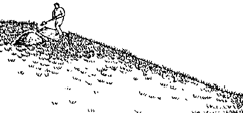
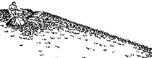
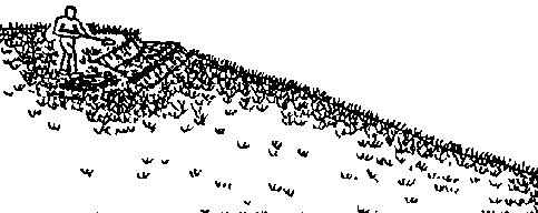
Techniques that can be applied to conserve or restore soils in a watershed or within an irrigated field include the following:
a. Protecting native vegetation.
b. Re-establishing native vegetation.
c. Establishing perennial crops (pasture, fruit trees, agroforestry systems), especially on steep slopes.
d. Practicing minimum tillage or mulching in crop cultivation systems that emphasize annual crops.
e. Using a crop rotation sequence rather than continual successive plantings of the same crop.
f. Planting strips of vegetation along the contour that serve to anchor the soil in place with their roots and slow down the movement of water downslope.
g. Constructing ditches along the contour at a 1 percent slope to divert excess water into protected drainageways.
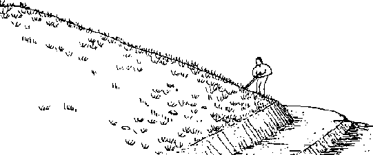
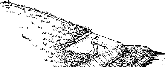
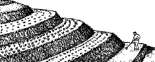
h. Constructing terraces to provide a level platform for planted crops in combination with contour ditches, thus reducing slope gradient, slope length, and runoff velocity. Terraces are flat earth ridges, perhaps 3 meters (10 feet) wide at the base, usually constructed along a contour line. They must have enough slope to drain water, but should be less than 2 percent slope to minimize erosion. Next to tree cover, terraces probably offer the best measures for conserving soil and water on steep slopes.
i. Diverting flows in gullies and constructing check dams to trap sediments and encourage revegetation within the gully bed. Gully erosion control is extremely difficult, and success is not common. Gullies are often referred to as a kind of "cancer" on the landscape. When trying to use check dams or brush to slow the velocity of flow and encourage infiltration in gullies, it is important to work from the bottom (mouth) of the gully uphill towards the head. Starting at the top of the gully and working downhill usually results in undercutting of the check dams, as the force of water at the top is frequently too strong.
j. Constructing brush "carpets" on steep slopes by using wooden stakes to pin down leafy brush, thus slowing the velocity of the runoff and encouraging it to infiltrate into the soil.
k. Building wire mesh boxes filled with stones (gabions) and placing them in a stream channel in a manner that protects the banks and bed from the erosive force of streamflows. Gabions are flexible, permeable, and generally very inexpensive to make. They can be stacked against the sides of gullies or streams to prevent bank erosion, or staggered up steep slopes to slow runoff.
l. Protecting or replanting streamside vegetation to slow and filter runoff reaching streams and strengthen the banks of channels.
m. Reducing or eliminating unmanaged fires that would otherwise rapidly eliminate vegetative cover and increase nitrate and other contaminants in runoff.
n. Reshaping natural drainageways or digging artificial drainageways of a low, broad shape that drain excess water away from fields and protecting these drainageways from erosion by lining with rocks, planting grass, or placing drop structures or check dams periodically.
o. Selecting and planting crops in a pattern that provides maximum ground cover, aerates the soil through deep rooting, and reduces the force of runoff.
Cuttings and seedlings should be planted along with any temporary erosion control structures to insure long-term erosion control when the brushwood or stakes have decayed. Examples of these conservation measures are illustrated in Figures 2.4 through 2.17 and Tables 2.1 and 2.2.
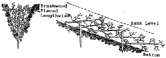
Figure 2.4 Plugging of Smaller
Gullies (Ref. 56)
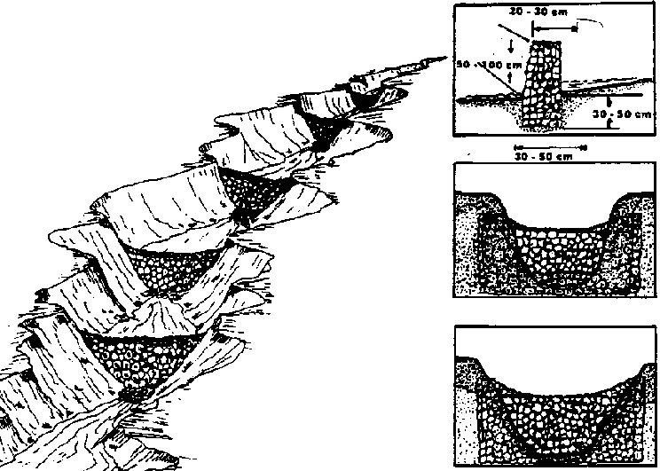
Figure 2.5 Construction of a Rock
Check Dam
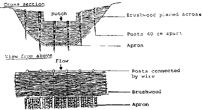
Figure 2.6 Brushwood Check Dam
(Ref. 56)
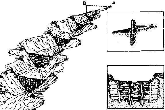
Figure 2.7 Pole or Log Check
Dam
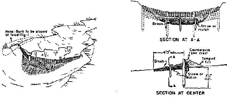
Figure 2.8 A Woven Wire Check
Due
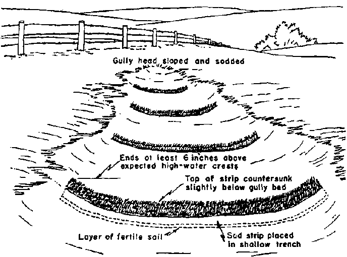
Figure 2.9 Sod Strip Checks on a
Small Gully
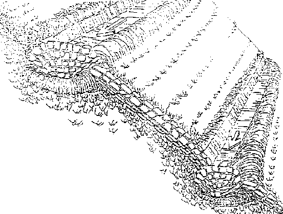
Figure 2.10 Water Drainageway
Protected Against Erosion by Rock Lining (Ref. 9)
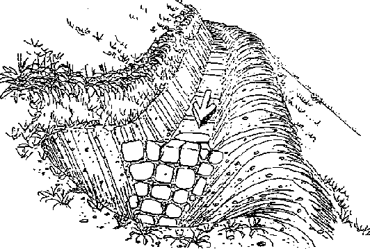
Figure 2.11 Retention Well as a
Site for Diverting Runoff eater (Ref. 9)
Figure 2.12 Discontinuous Narrow
Terrace (Orchard Terrace) (Ref. 9)
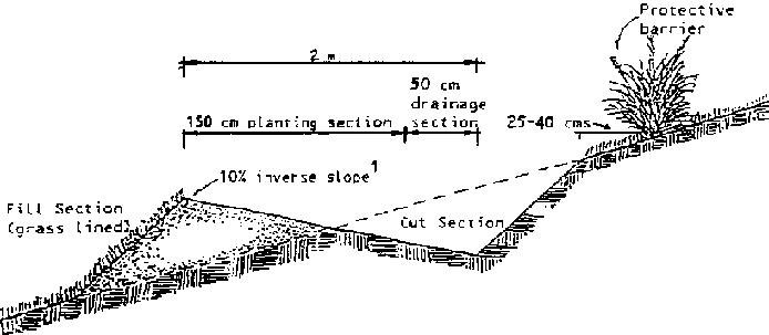
Figure 2.13 Discontinuous Narrow
Terrace (cross section) (Ref. 9)
- If initially constructed with an inverse slope of 15-20%, some self-compaction occurs resulting in a slope of approximately 10X.
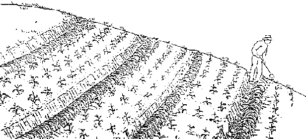
Figure 2.14 Contour Planting Beds
(Ref. 9)
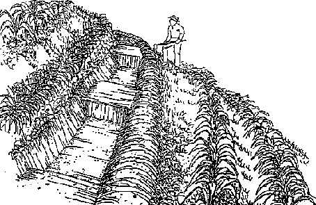
Figure 2.15 Contour Infiltration
Ditch (Ref. 9)
Figure 2.16 Bench Terrace Construction Sequence "A" (Ref. 9)
1. The lower most terrace is formed
first and compacted thoroughly
2. me topsoil from the area of the
next higher terrace is removed and distributed evenly over the lower terrace
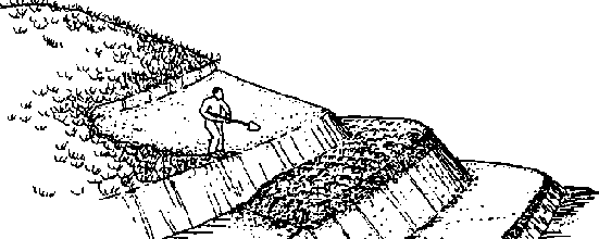
3. The second terrace is formed and
compacted, then covered with topsoil from the area of the third terrace.
4. Work progresses up slope, each
newly formed and compacted terrace is covered with topsoil taken from the slope
immediately above. Grass is planted along the risersof all terraces.
Figure 2.17 Bench Terrace Construction Sequence "B" (Ref. 9)
1. Terrace construction begins with
the uppermost terrace and with the 2 meter segment nearest the drainage side.
The topsoil is pulled over to one side of the section.
2. A well compacted section of the
terrace is formed.
3. The topsoil is then redistributed
over the same 2 meter terrace section.
4. Work progresses sideways a long
the uppermost terrace
5. Work progresses downslope. Work
begins at the drainage side of each terrace and progresses sideways

6. Grass is planted on terrace
risers.
Table 2.1 Bench Terrace Construction Guide (Ref. 9)
|
SLOPE (%) |
SOIL DEPTH* (Meters) |
TOTAL TERRACE WIDTH (Meters) |
PLATFORM WIDTH (Meters) |
| |
.2 |
1.68 |
1.30 |
| |
.3 |
2.5 |
1.94 |
|
20 |
.4 |
3.34 |
2.60 |
| |
.5 |
4.26 |
3.30 |
| |
.6 |
5.02 |
3.90 |
| |
.2 |
1.16 |
.80 |
| |
.3 |
1.72 |
1.20 |
|
30 |
.4 |
2.3 |
1.60 |
| |
.5 |
2.98 |
2.10 |
| |
.6 |
3.46 |
2.40 |
| |
.2 |
.90 |
.56 |
| |
.3 |
1.32 |
.82 |
|
40 |
.4 |
1.78 |
1.10 |
| |
.5 |
2.25 |
1.40 |
| |
.6 |
2.68 |
1.66 |
| |
.2 |
.74 |
.40 |
| |
.3 |
1.10 |
.60 |
|
50 |
.4 |
1.46 |
.80 |
| |
.5 |
1.84 |
1.00 |
| |
.6 |
2.20 |
1.20 |
* "Depth of A Horizon" in original changed to permit use in eroded areas where horizons are often indistinct.
Table 2.2 Spacing of Contour Hillside Ditches (Ref. 9)
|
SLOPE (%) |
ANNUAL CROP |
PERSONAL CROP OR PASTURE | ||
| |
Distance (m) |
Maximum Length (m) |
Distance (m) |
Maximum Length (m) |
|
2 |
42.0 |
90 | | |
|
4 |
25.0 |
120 | | |
|
6 |
19.3 |
160 | | |
|
8 |
16.6 |
200 | | |
|
10 |
14.9 |
260 |
40.2 |
140 |
|
12 |
13.8 |
280 |
33.5 |
140 |
|
14 |
13.0 |
300 |
28.9 |
140 |
|
16 |
11.4 |
340 |
25.3 |
160 |
|
18 |
10.2 |
380 |
25.0 |
180 |
|
20 |
9.2 |
420 |
24.0 |
200 |
|
22 |
8.4 |
470 |
23.2 |
200 |
|
24 |
7.7 |
500 |
21.4 |
210 |
|
26 |
7.2 |
500 |
19.8 |
220 |
|
28 |
6.6 |
500 |
19.5 |
220 |
|
30 |
6.3 |
500 |
18.9 |
220 |
|
32 | | |
18.7 |
220 |
|
34 | | |
18.6 |
230 |
|
36 | | |
17.7 |
230 |
|
38 | | |
16.9 |
230 |
|
40 | | |
16.2 |
230 |
2.2 Water flow measurement
2.2.1 Units of measurement
Generally, water measurement units may be divided into two classes: those that express a certain volume and those that indicate a discharge or volume per unit time.
The units depend on the system being used, either metric or English. In the metric system, the more common units for volume are liters, cubic meters, cm-ha, and m-ha. A cm-ha is the volume required to cover an area of one hectare with a one-centimeter depth of water and is equivalent to 100 m3. In the English system, the common units are ac-in or ac-ft, which correspond to depths of one inch and one foot, respectively, over an area of one acre (43,560 ft2). All of these units are useful in expressing water requirements, or water applied, in terms of depths, and their equivalents to units of volume.
For discharge rates, or volume per unit time, common units in the metric system are m3/see (cum/see) or liters/sec (lps) and, in the English system, ft3/sec (cusec) or gallons per minute (gpm).
2.2.2 Measuring devices in open channels
Nearly anything that partially restricts the flow in an open channel can serve as a measuring device if it is calibrated. The majority of these restrictions are not standard, however, and there are no formulas or rabies available to determine their discharge. Even "standard" structures, if not properly built, installed, and maintained may not operate as expected. Standard devices include orifices, weirs, Parshall flumes, Cutthroat flumes, and broad crested weirs. Submerged orifices may be used under limited head conditions when trash and debris are not a problem. Weirs are useful and economical where flows are not too large and sufficient head is available in the canal. They are one of the oldest and most accurate devices when used under the proper conditions.
The flow measurement device selected for installation will depend on several factors, among which are:
1. The accuracy required. Most devices have an accuracy of ±10% if they are properly installed and maintained. Many have better than ±10% accuracy with careful fabrication, installation, and maintenance.
2. Ease of construction. A simple device that can be manufactured locally with the required precision may give better measurements than a more complicated one that is beyond the ability of local craftsmen to construct.
3. Ease of use. Readings must be easily made and accurately interpreted by the user.
4. Cost of the flow measurement device. Flow measurement devices must be economical to encourage their purchase and use.
5. Topographic conditions and geometric shape of the channel where the flow will be measured and the range of the canal discharges to be measured. Some devices require large differences in head and are most suitable for canals with significant slope while others will give satisfactory measurements with small differences in head. Many devices have a limited range of discharge for which they can be practically used.
Details of several common measuring devices such as orifices, sharp crested weirs, broad crested weirs, Parshall flumes, and Cutthroat flumes, as well as horizontal and vertical pipes, are provided in other publications. The following is a presentation of various common and simple methods of flow measurement.
Methods of Measuring Channel Flow
2.2.3 Float method
(Ref. 57)
The rate of flow passing a point in a ditch or other open channel can be determined by multiplying the cross sectional area of water by the average velocity of the water. Normally, the cross sectional area can be determined by direct measurement of the channel dimensions. The velocity can be estimated by timing the passage of a small float through a measured length of channel. The procedure for estimating rate of flow by the float method is as follows:
1. Select a straight section of ditch with fairly uniform cross sections. The length of the section will depend on the current, but 30 meters usually will be adequate. A shorter length may be satisfactory for slow flowing ditches.
2. Make several measurements of depth and width within the trial section to arrive at the average cross sectional area. The area should be expressed in terms of square meters.
3. Place a small float in the ditch about a meter upstream from the upper end of the trial section. Determine the number of seconds it takes for the float to travel from the upper end of the trial section to the lower end. Make several trials to get the average time of travel. The best floats are small rounded objects that float submerged. They are less apt to be affected by wind or to be slowed by striking the side of the channel. Among small objects that make good floats are a long necked bottle partly filled with water and capped, a rounded block of wood, or an orange.
4. Determine the velocity (or speed) of the float in units of meters per second by dividing the length of the section (in meters) by the time (in seconds) required for the float to travel that distance.
5. Determine the average velocity of the stream. Since the velocity of the float on the surface of the water will be greater than the average velocity of the stream, the float velocity must by multiplied by a correction coefficient to obtain a good estimate of the true average stream velocity. The correction factor varies with the type of float used and with the shape and uniformity of the channel. With floats that sink about 2 to 5 cm below the water surface, a coefficient of about 0.80 should be used for most unlined farm ditches. A coefficient of 0.85 is appropriate for smooth uniform unlined ditches. With floats that extend two thirds or more of the water depth below the surface, the coefficient should be about 0.85 for unlined ditches and 0.90 for lined ditches.
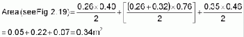
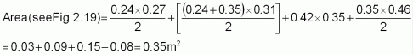
6. Compute the rate of flow. The rate of flow is obtained by multiplying the average cross sectional area (item 2) by the average stream velocity (item 5). The accuracy of these estimates of flow rates is dependent upon the preciseness with which average cross sectional areas and float velocities have been determined and upon the selection of the proper correction coefficient. The method is not accurate enough for conveyance loss measurements. An example of this method of estimating flow rates is shown in Figure 2.18 using Figure 2.19.
2.2.4 Weirs
In a weir (Figures 2.20 and 2.21), water is open to atmospheric pressure on both upstream and downstream sides. Types of weirs are identified by their shape. The most common are the:
· rectangular weir,
· trapezoidal weir, and
· triangular weir.
Sharp-Crested Contracted Rectangular Weirs
The standard contracted rectangular weir is built so that the outlet sides and crest are away from the bottom and sides of the canal in which it is set. The weir contracts the flow of the channel and causes it to fall over a crest.
Extensive experiments on weirs have resulted in the following guideline for accurate measurement of flow:
1. The upstream face of the bulkhead should be smooth and in a vertical plane perpendicular to the axis of the channel.
2. The upstream face of the weir plate should be smooth, straight, and flush with the upstream face of the bulkhead.
3. The entire crest should be a level, plane surface that forms a sharp, 90 edge where it intersects the upstream face.
4. The upstream corners of the notch must be sharp.
5. The distance of the crest from the bottom of the approach channel (weir pool) should not be less than twice the depth of water above the crest and in no case less than 20 cm.
6. The distance from the sides of the weir to the sides of the approach channel should be no less than twice the depth of water above the crest and never less than 20 cm.
7. The overflow sheet (nappe) should touch only the upstream edges of the crest and sides.
8. Air should circulate freely both under and on the sides of the nappe.
9. The measurement of head on the weir should be taken at a point upstream from the weir a distance of four times the maximum head on the crest.
Figures 2.20 and 2.21 indicate typical weir installation. Figure 2.22 summarizes the formulas used for different weirs.
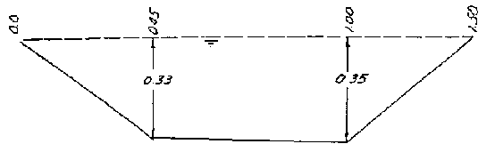
FIGURE 2.18. Estimating Flow Rates by Float Method (Ref. 57)
* Assume a straight section of unlined irrigation ditch 30 meters in length. Representative cross sections at stations 00+0, 12+0 and 28+0 (Figure 2.19).
Cross Section Data
Station 00+0
|
Distance from left water edge |
(m) |
0.00 |
0.45 |
1.00 |
1.50 |
|
Water depth |
(m) |
0.00 |
0.33 |
0.35 |
0.00 |

* (1.00-0.45 = 0.55 and 1.50-1.00 = 0.50)
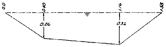
Station 12+0
|
Distance from left water edge |
(m) |
0.00 |
0.40 |
1.16 |
1.58 |
|
Water depth |
(m) |
0.00 |
0.26 |
0.32 |
0.00 |
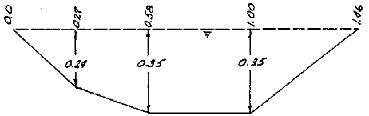
Station 28+0
|
Distance from left water edge |
(m) |
0.00 |
0.27 |
0.58 |
1.00 |
1.46 |
|
Water depth |
(m) |
0.00 |
0.24 |
0.35 |
0.35 |
0.00 |

Velocity Data
Time for float (wooden sphere) to travel 30 meters
|
Trial Number |
1 |
2 |
3 |
4 |
Average |
|
Time (seconds) |
95 |
91 |
90 |
88 |
91 |

Average stream velocity = 0.33  0.80 = 0.26 m/see
Flow Rate
Q = AV = 0.35 m2  0.26 m/see = 0.091 cubic m/sec
or 0.091 cum/see  1000 L/sec/cum/sec = 91 L/sec (lps)
Figure 2.19 Ditch Cross Sections for Example (Ref. 57)
Station 00 + 0
Station 12 + 0
Station 28 + 0
Figure 2.20 Rectangular Weir Used
as Measuring Device and Drop

Figure 2.21 Ninety Degree V-Notch
Weir (Ref.
41)
2.2.5 Siphon tubes
Siphon tubes (Figure 2.23), used to remove water from a head ditch and distribute it over a field through furrows, corrugations, or borders, are also used to measure the rate of flow into these distribution system.
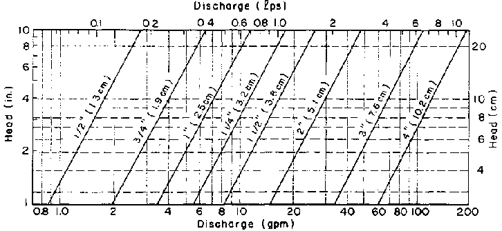
These tubes, made of aluminum, plastic, or rubber, are usually preformed to fit a half cross section of the head ditch. The normal diameter range is from 2.5 to 15 cm (1 to 6 inches), although both smaller and larger sizes are available. The smaller sizes are used with furrows and corrugations and the larger sizes with borders. Various lengths are available.
Siphon tubes are portable. For this reason, a low number of tubes is required to irrigate a given area resulting in low initial cost for equipment. Flow into individual furrows or borders can be controlled effectively by using the number of tubes that will divide the total head ditch flow into individual streams of the desired size.
Figure 2.22 Summary of weir formulas
|
Measuring Device (all sharp crested) |
Front Views |
Formula |
|
Rectangular Weir (with contraction) |
* |
Q = 0.018(L - 0.2H)H3/2 |
|
90° Triangular Weir |
** |
Q = 0.014H5/2 |

Rectangular Weir (with contraction)*

90° Triangular Weir**
Weir Side View
Siphon tube use is limited to fields with little cross slope in order to maintain a near-constant operating head on each tube. A disadvantage to their use is that each tube needs to be primed individually. This priming is the principal labor requirement when siphon tubes are used for surface irrigation.
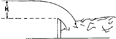
The discharge of a siphon tube depends on: (1) the diameter of the tube, (2) the length of the tube, (3) the roughness of the inside surface and the number and degrees of bends in the tube, and (4) the head under which the tube is operating. When the outlet end of the tube is submerged, the operating head is the difference in elevation between the water surfaces measured at the entrance and outlet ends of the tube. When the tube is flowing free, the operating head is the difference in elevation between the water surface at the entrance of the tube and the center of the outlet end (Figure 2.23).
Method of Measuring Pipe Flow
2.2.6 Bucket and stopwatch method
This method for measuring flow is generally well adapted to small flows. It is very simple to set-up and conduct, requires no special equipment, and gives good results. The necessary equipment to perform this test are a bucket of known volume (preferably 20 liters), a 1 m long PVC tube (the diameter will depend on the flow rate), and an ordinary wrist watch with a second hand.
To use this method, first dam the water source and insert the PVC tube into the dam so that all the flow goes through the tube. The PVC tube will have to be high enough above the base level of the dam so the bucket can be placed under the tube. Measurements should not be taken until the flow in the tube stabilizes. The procedure works best with two people: one person filling the bucket and the other timing the event.
To measure the flow, record the time it takes to fill the bucket. The procedure should be repeated at least twice. The flow is calculated by:

2.2.7 Orifices
An orifice is an opening in a plate that has well-defined and sharp edges. It may be round or rectangular. The water surface upstream must be above the top of the opening, if orifice flow is to occur. The orifice is mounted on a flat plate or is cut out from a flat metal plate. The flat plate or wall on which the orifice is mounted is placed perpendicular to the direction of flow across the channel. Knowing the size of the orifice and the head across the orifice, the flow can be estimated. Figure 2.24 provides a definition of the terms.
Figure 2.23 Siphon Tubes: Bead Measurement and Discharge
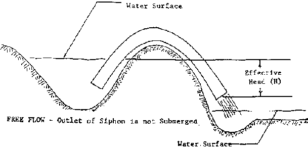
FREE FLOW - Outlet of Siphon is not
Submerged
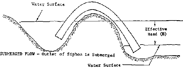
SUBMERGED PLOW - Outlet of Siphon is
Submerged
Discharge
For a freely discharging orifice, the only head measurement required is the water level height above the center of the orifice. For an orifice that is submerged on both sides, the head across the orifice must be measured. The equation and units are given in Figure 2.24. The conditions that should be met for accurate flow measurements are:
1. The upstream edges of the orifice should be sharp and smooth.
2. The distance from the edges of the orifice to the sides of the canal or stream bed should be greater than twice the least dimension of the orifice.
3. The face of the orifice wall should be vertical.
4. In a rectangular orifice, the top and bottom edges of the orifice should be level.
5. The cross-sectional area of the water in the canal should be at least 8 times the cross-sectional area of the orifice.
An orifice plate for measuring flows in small streams can be constructed easily by cutting either a rectangular or circular hole in a piece of sheet metal. The orifice should be carefully cut to the proper dimensions, and the edges should be sharp. The sheet metal plate can then be installed across a stream as part of a check dam while the measurements are taken. A 2 1/2 cm circular orifice is useful for flow rates to 1/2 liters per second. A circular orifice with a 5 cm diameter opening is useful for flows to 3 liters per second with 30 cm of head. A 10 cm orifice is useful for flows to 9 liters per second.
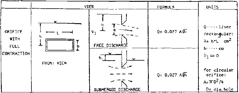
Figure 2.24 Definition Sketch and
Formulas for
Orifice
2.3 Surveying
Topographic surveying provides some of the basic information required for the design, construction, and operation of an irrigation system. Some of the most important aspects of surveying are:
1. Profiling. Measurement of the elevations of the ground surface along a route (for example, where a pipeline will be installed) or where a structure will be installed.
2. Area measurements.
3. Topographic mapping. Determination of ground surface elevations in a field in order to construct a contour map is necessary for determining land leveling requirements, placement of ditches or structures, etc.
Every Volunteer working with irrigation should have, at a
minimum, a hand level (at least 4  power) or an
Abney level; a surveying rod; a measuring tape (minimum of 30 meters); a
carpenter's level; and a scientific calculator (capable of computing roots and
powers). This will allow the Volunteer to determine elevation differences,
profiles, and area measurements. Some topographic mapping can be accomplished
with this equipment. For significant leveling work, however, an engineer's level
and/or transit is often required. This equipment is not often available to the
Volunteer. The theory and practice of land leveling is beyond the scope of this
manual. The Volunteer should consult appropriate references and obtain
assistance from an engineer or surveyor before undertaking significant land
leveling.
power) or an
Abney level; a surveying rod; a measuring tape (minimum of 30 meters); a
carpenter's level; and a scientific calculator (capable of computing roots and
powers). This will allow the Volunteer to determine elevation differences,
profiles, and area measurements. Some topographic mapping can be accomplished
with this equipment. For significant leveling work, however, an engineer's level
and/or transit is often required. This equipment is not often available to the
Volunteer. The theory and practice of land leveling is beyond the scope of this
manual. The Volunteer should consult appropriate references and obtain
assistance from an engineer or surveyor before undertaking significant land
leveling.
This section covers the basics of profiling and topographic mapping. It also includes some appropriate techniques for laying out contour lines and determining elevation differences.
2.3.1 Profiling
(Ref. 21)
Accurate knowledge of the ground profile along a pipeline route is often critical for proper pipeline design. Correct profiling depends on correct use of simple equipment. "Eyeball" methods of profiling are sufficient only in the simplest of situations. The following is a general description of profiling methods.
Theory of Leveling
1. The line of sight of a properly used level is always at the same elevation, regardless of the direction in which it is pointed.
2. If the elevation at any point on the ground is known, the elevation of the level line of sight may be found by measuring up from the known point. Because most work requires knowledge of relative elevations only, the known point is often assumed to be 100 or 1000.
3. If the elevation of the level line of sight is known, the elevation of any point on the ground may be found by measuring down from the line of sight.
4. By successive use of the above concepts, the elevation of any point may be found.
Equipment
1. Surveying level and tripod or hand level. Levels are surveying instruments that have a telescope and means for orienting the telescope's line of sight on a horizontal plane.
2. A stick marked with distance measurements (e.g. feet or meters). This stick is called a "rod."
3. Distance measuring equipment, such as a measuring tape, engineer's chain, or optical distance estimating equipment. Pacing is adequate only for flat terrain or short distances.
4. A notebook, properly set up.
Theory of Profiling
1. Profiling involves measurement of elevations (leveling) along a line, together with measurement of horizontal distances.
2. Distances must be measured on a straight line between points for which elevations are taken.
Notekeeping
1. Notekeeping is one of the most critical portions of surveying. Many surveying mistakes can often be traced back to poor notation. A notebook should always be properly set up and time taken to make notes clear and readable.
2. A site sketch should accompany the measurements. This will help the notetaker remember important surface features of the area. The sketch should show salient features such as houses, streams, hills, and trees along the pipeline route. A North arrow should also be included.
Terminology
1. Sta = Station. This is the point on the profile line at which an elevation was measured. These are normally numbered by hundreds of feet. For example, a station 10 may be 1000 feet from the beginning of the survey. Intermediate distances are indicated by pluses: Sta 10 + 50 would equal 1050 from the beginning.
2. Bm = Benchmark. This is a monument or point of known description that includes elevation.
3. Tbm = Temporary Benchmark. This is an object that is relatively permanent, such as large rocks or trees, where the elevation has been determined.
4. Bs = Backsight. This is a rod reading at a point of known elevation.
5. HI = Height of Instrument. This is the elevation of the line of sight of the instrument.
6. Fs = Foresight. This is a rod reading at a point of unknown elevation.
7. Elev = Elevation.
8. Dist = Distance between points.
9. Tp = Turning Point. This is a point used primarily to serve as a reference elevation to move the instrument. Both a foresight and backsight are taken on the point. The point may be on or off the profile line but should be a solid point that is easy to relocate.
Profiling Procedure
1. Setup and level instrument.
2. Sight Benchmark (point of known elevation) for Backsight reading.
3. Enter rod reading in Backsight (Bs column 2).
4. Add rod reading (column 2) to Benchmark (column 5) to get Height of Instrument (HI column 3).
5. Sight point to be determined (Foresight) and enter reading in Foresight (Fs column 4).
6. Subtract Foresight (column 4) from Height of Instrument (column 3) to get elevation of Foresight (column 5).
Turning Point
1. Rodman maintains position at Foresight.
2. Move setup, and level the instrument at new location (Tp 1).
3. Sight rod at Backsight (last foresight station) and enter reading in column 2.
4. Add rod reading (column 2) to elevation of backsight (column 5) to get Height of Instrument (column 3).
5. Proceed with Foresight (steps 5 and 6 above).
Example 1: An example survey is presented in Figure 2.25. Notation for this survey is presented in Table 2.3
TABLE 2.3 Survey Notation (meters) for Figure 2.25 (Ref. 27)
|
1 |
2 |
3 |
4 |
5 |
6 |
| |
+ | |
(-) | | |
|
Sta |
Bs |
HI |
Fs |
Elev |
Notes |
|
Pt A |
2.5 |
102.5 | |
100 |
Assumed elev. |
|
Pt B | | |
11.5 |
91 | |
|
Tp 1 |
4.2 |
95.2 | | |
Pt B. |
|
Pt C | | |
12.3 |
82.9 | |
The steps used in the example problem are different from those used by professional surveyors. They have been simplified in an attempt to reduce confusion and are more than adequate for the type of surveying that is necessary in small-scale piped water systems. When using this method, always remember the following simple calculations:
1. Known elevation + Backsight reading = Height of Instrument
2. Height of Instrument - Foresight = Next Elevation
Practical Hints for Surveying
1. Before starting, walk the course to be surveyed and mark the line to be profiled. If the survey is conducted for a piped water system, remember to keep in mind that pipe will have to be laid in trenches along the course. Whenever possible, avoid obstacles that will make laying difficult.
2. Mark with a sturdy stake all turning points, foresights, and backsights as work progresses so they will be visible if a recheck is necessary.
3. After you have finished your calculations, redo the survey if unacceptable errors occur. It is much easier to correct a surveying mistake before pipe has been laid in the ground.
4. It is desirable to recheck horizontal distances as well. Approximate methods, such as pacing, will catch major errors with a minimum effort.

Figure 2.25 Profiling: Example
(Ref. 21)
Plotting the Profile
Once the horizontal distances and elevations are surveyed in the field, the data is brought back to the office and plotted on graph paper. This completed profile can be used for sizing pipelines and locating storage tanks, air valves, and washout points among other requirements. Normally, the vertical scale is greater (numerically smaller) than the horizontal scale. For example, the vertical scale may be ten times the horizontal: in the vertical scale, one cm may equal 1 meter and in the horizontal, one cm may equal ten meters. Other similar ratios may be used.
Example 2: Figures 2.26 and 2.27 show a ground sketch of the area to be surveyed and the completed profile for the survey. The following are measurements taken during this survey:
|
At |
0 + 00 |
100.0 + 0.2 = 100.2 |
(equals HI) |
|
At |
0 + 47 |
100.2 - 9.7 = 90.5 |
(equals next elevation) |
This is repeated for the next instrument setup:
|
At |
0 + 47 |
90.5 + 1.3 = 91.8 |
(equals HI) |
|
At |
1 + 03 |
91.8 - 9.9 = 81.9 |
(equals next elevation) |
Many different ground elevations may be found from a single Height of Instrument sight, as shown by the following:
|
At |
1 + 03 |
81.9 + 4.2 = 86.1 |
(equals HI) |
|
At |
1 + 30 |
86.1 - 5.5 = 80.6 |
(equals ground elevation) |
|
At |
1 + 37 |
86.1 - 8.9 = 77.2 |
(equals ground elevation) |
|
At |
1 + 45 |
86.1 - 5.2 = 80.9 |
(equals ground elevation) |
|
At |
2 + 00 |
86.1 - 4.2 = 81.9 |
(equals ground elevation) |
2.3.2 Steps in making a topographic man
1. Clear field of all debris, ensure clear line of sight to all points on the field.
2. Measure boundaries of the field and determine its area.
3. Collect and make a sufficient number of marker stakes.
4. Stake out a square grid over entire field. Use one side of the field (straightest side, if possible) as a starting point and set stakes at the recommended spacing of:
a. 10 m if broken or irregular land relief.
b. 20 m if flat
or uniform land relief.
The use of a 3-4-5 right triangle will assist in laying out the grid evenly and at 90° degree angles.
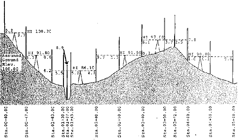
Figure 2.26 Typical Profile (Ref.
21)
LOCATION:
SURVEYOR:
DATE:
|
STA |
+B. S. |
H. I. |
-F. S. |
ELEV. |
NOTES |
|
0+00 | |
Assumed |
100.0 |
Spring | |
| |
0.2 |
100.2 | | | |
|
0+47 | | |
9.7 |
90.5 |
TP #1 |
| |
1.3 |
91.8 | | | |
|
1+03 | | |
9.9 |
81.9 |
TP #2 |
| |
4.2 |
86.1 | | | |
|
+30 | | |
5.5 |
80.6 |
Stream West Edge |
|
+37 | | |
8.9 |
77.2 |
Stream |
|
+45 | | |
5.2 |
80.9 |
Stream East Edge |
|
2+00 | | |
4.2 |
81.9 |
TP #3 |
| |
9.7 |
91.6 | | | |
|
2+50 | | |
5.3 |
86.3 | |
|
3+00 | | |
0.7 |
90.9 |
TP #4 |
| |
6.1 |
97.0 | | | |
|
+30 | | |
3.7 |
93.3 | |
|
+72 | | |
2.5 |
94.5 |
Top of Hill |
|
4+00 | | |
7.8 |
89.2 |
TP #5 |
| |
1.6 |
90.8 | | | |
|
+50 | | |
6.1 |
84.7 | |
|
5+00 | | |
9.6 |
81.2 |
E.O.L. |
Figure 2.27 Survey Sketch and
Notations (Ref. 21)
5. Establish a benchmark (permanent or semipermanent object) on or near the field.
6. Take readings of elevational differences for each stake in the grid with reference to the benchmark with some type of leveling device and rod.
7. Take field notes for the entire field.
8. Sketch topographical map of field:
a. Sketch field to scale on graph paper.
b. Place grid on sketch.
c. From the field notes, fill in all of the elevational readings for each point on the grid.
d. With a continuous smooth line, connect the points of the same elevation reading and extrapolate points in between where need be; this is a contour line.
e. Incrementally increase (or decrease) value of elevation reading and repeat step (d) for each new elevation.
f. Complete topographic map for the range of elevation readings. Make sure there is an incremental progression of elevation readings so that the contour lines will have equal elevational differences between them. The contour line increment will depend on the range of elevation readings, the detail required, and the size of the area being mapped. For example, a 1 meter increment between contour lines will provide more detail than a 10 meter increment in one given area.
2.3.3 Abney level surveying
(Adapted from Reference 27 with appropriate modifications. For greater details on surveying, and adjustment of the level, the user should consult Reference 27 or books on surveying. The Abney level should also be periodically checked to insure that it is properly adjusted.)
Abney level surveying is especially useful for rapidly determining elevation differences, particularly in hillside situations, where great precision is not required.
The Abney level consists of a square tube (dimensions of about
16  1.5
1.5  1.5
cm) with an eyepiece at the observer's end, a horizontal cross-hair at the
objective end, a bubble level, a 45° mirror, and a moveable indexed arc.
1.5
cm) with an eyepiece at the observer's end, a horizontal cross-hair at the
objective end, a bubble level, a 45° mirror, and a moveable indexed arc.
Conducting a survey with the Abney requires two persons. An Abney level, a 30 meter tape measure, and a field book are necessary; a compass may be used if bearings are desired.
The survey is begun at some fixed reference point (such as the water source or some prominent landmark along the route) and proceeds long the route of proposed construction.
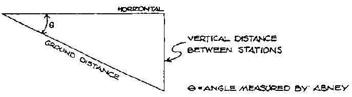
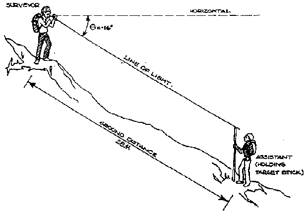
The surveying technique is simple: the surveyor sights through the Abney at a target held by the other person, and the ground distance between them is measured. This distance, and the vertical angle (angle measured by the Abney) are recorded in the field book. It is important that the target that the surveyor sights upon is the same height above the ground as the Abney, which is the same as the surveyor's eye-level. If the assistant is not as tall as the surveyor, then the assistant should carry a target stick cut exactly to the same length as the surveyor's eye-level. A red cloth can be tied to the top of the stick, or the assistant's hand can be placed over the end of it, to provide a clear target. It is also useful for the surveyor to use a forked stick as a stand to rest the Abney on, in order to obtain a steadier reading (in this case, the target stick should be cut to the same length as this forked stick).
Figure 2.28 shows the basic arrangement and calculation used in
trigonometric leveling with the Abney: the surveyor and assistant are 28 meters
apart (ground distance), and the vertical angle is - 16° (the negative
angle indicates that the surveyor was sighting downhill). Use a calculator or
trigonometric table to determine the sine of the angle. In this case the sin of
16° is 0.2756 so 28  0.2756 is 7.7 meters
elevation difference.
0.2756 is 7.7 meters
elevation difference.
Field Methods
While conducting the survey, the surveyor and assistant must also observe the terrain being walked. The surveyor must constantly keep in mind that, at some later time, other people will actually have to dig a trenchline along that route. Notes must be made about the type of terrain being traversed, such as stretches of jungle, cultivated fields, footpaths, gullies, soil conditions (e.g. gravel, soft dirt, bare rock). It is easy to survey across terrain over which might be exceedingly difficult or impossible to lay a pipeline!
The surveyor should make use of as many reference points as possible so that if a section of the pipeline needs to be resurveyed at a later time, a convenient starting point can be found. Reference points should be permanent or semi-permanent. Suitable examples are prominent trees, rock outcroppings, etc. If the surveyor carries flagging, spray paint, lime, nailpolish or enamel paint, landmarks can be identified with a permanent label.
Figure 2.29 shows a good, precise format for recording accurate and complete notes.
Figure 2.28 Trigonometric Surveying with an Abney Level (Ref. 27)
|
VERTICAL DISTANCE = GROUND DISTANCE |
 SIN q
SIN q EXAMPLE ILLUSTRATED BELOW:
(= -16° (NEGATIVE SIGN INDICATES SIGHTING DOWNHILL)
SIN
(= 0·276 (FROM TRIGONOMETRIC TABLE)
GROUND DISTANCE = 28
METERS
VERTICAL DISTANCE = 28  0.276 = 7.73
METERS.
0.276 = 7.73
METERS.
Figure
ABNEY LEVEL
SURVEYING WITH AN ABNEY LEVEL
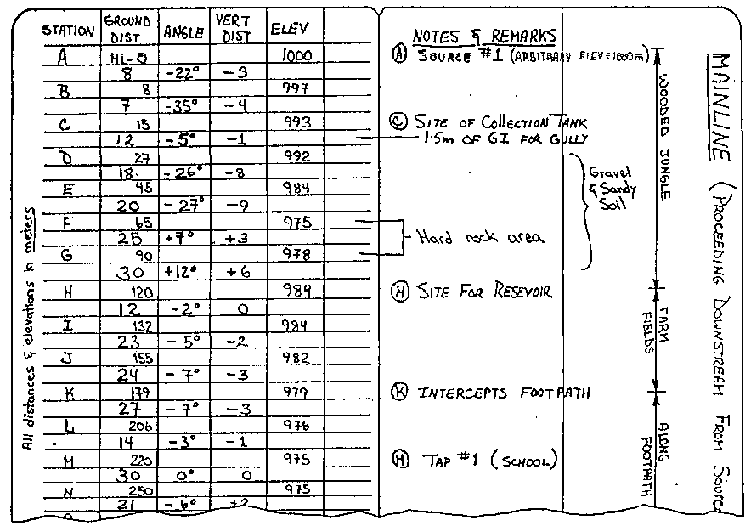
Figure 2.29 Example: Field Book
Notes (Ref. 27)
Closing the Survey
Closing the survey means tying the survey to two reference points of known elevations, thus providing a check on the surveyed elevations. Closing a survey can be done by repeating it entirely, beginning from the original endpoint and ending at the original starting point, but not necessarily along the same original route.
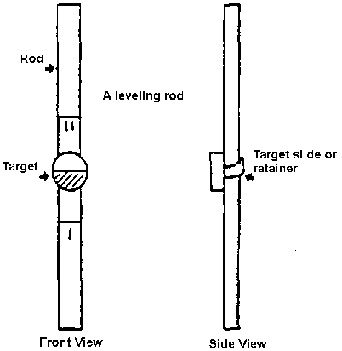
Leveling Rods
A leveling rod is used to measure the vertical distance from the surface of the ground to the line of sight of a surveying level (Figure 2.28). It can be constructed as a land measuring rod but the "0" m should just be the end of the rod. The overall length should be about 3 m and the rod should be marked in meters, decimeters, and centimeters.
Attach a moveable target to the rod. This might be a small board held against the rod with something such as a short piece of rubber (from an old inner tube) to hold it in place after the height is adjusted.
When the surveying instrument is sighted on the rod, the target is moved up or down until it is centered on the line-of-sight. The vertical distance is then read.
2.3.4 Simple levels for use in surveying contour lines
(Ref. 9, with appropriate modifications)
In many areas, sophisticated surveying levels are not available to farmers interested in designing soil conservation structures. Even where they are available, it is often more practical for the farmer to build a cheap, simple, effective level for use in surveying contour lines. Although less accurate than more sophisticated levels, the A-Frame level (Figure 2.30), the Line Level (Figure 2.31), and the Hose Level (Figure 2.32), when properly constructed and used, are sufficiently accurate for the work on small hillside farms.
A. How to build and use an a-frame level
1. Construction
The materials required are 3 straight boards or sticks, 3 nails or screws, a thin string, and a plumb-bob -- a screw-capped glass bottle or uniform-shaped rock. A small level is very convenient and is easier to use on windy days.
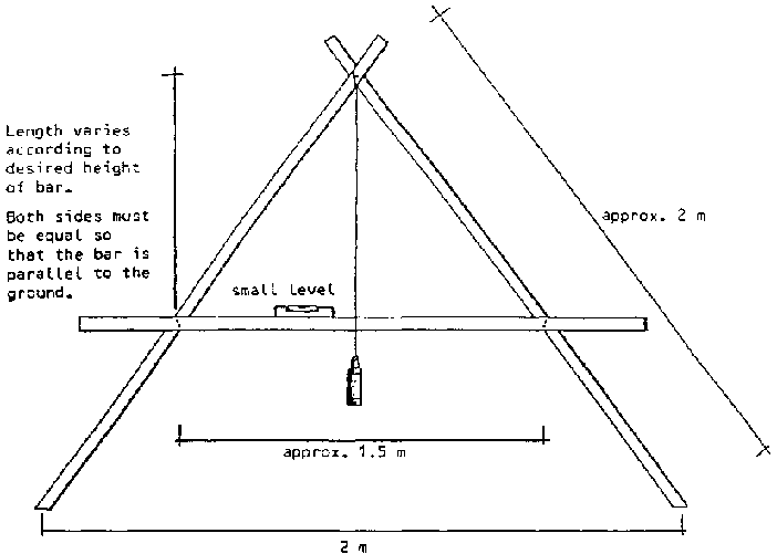
Figure 2.30 A-Frame Level for
surveying Contour Lines (Ref. 9)

Figure 2.31 Simple Line Level for
surveying Contour Lines (Ref. 9)
Figure 2.32 Use of a Hose Level (Ref. 42)
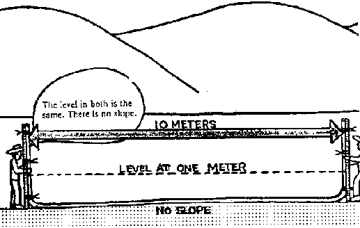
No slope
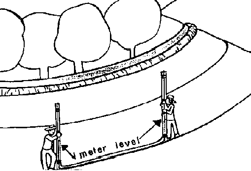
Meter level
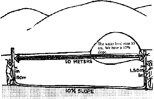
10% Slope

20% Slope
Important points to consider in building the A-frame level:
a. The symmetry of the level is important (two legs should be the same length and crossbar should be positioned identically on the legs so that it is parallel to the ground.)
b. The dimensions of the level are not important, but if constructed in larger dimensions than the one in Figure 2.31, the level should be assembled with screws so that it can be disassembled for transportation. Measuring an exact distance (2 m) between the feet makes calibrating the 1% slope position easier.
c. The plumb-bob must be attached so that it does not deflect the string to either side. If a screwcap bottle is used, it should be hung by a hole made exactly in the center of the cap. If a rock is used, it is important that a very uniformly shaped rock be chosen.
2. Calibration
The level should be calibrated every day before use, as warping of the wood can greatly change the results.
a. Calibration of 0%
1. The level should be positioned with both feet on firm surfaces but with one end obviously higher than the other.
2. The level is gently rocked, allowing the string with the plumb-ob to gently strike the crossbar.
3. When the plumb-bob stops swaying side to side and the string strikes the crossbar at the same point repeatedly (5-10 times), mark this position in pencil on the crossbar.
4. Reverse the position of the level so that the other foot is now at the higher point. Care must be taken to position the feet of the level in exactly the same points as before.
5. Repeat steps 2 and 3, obtaining a second mark on the other side of the center of the crossbar.
6. The 0% position of the level is exactly in between the two marks obtained in this trial. This position can be marked by measuring with a ruler or paper (half the distance between the 2 marks). Now when the feet of the level are even the string will strike the crossbar at the 0% position. This position is used to survey contour lines for barriers, terraces, or ditches be used for retention, rather than diversion, of water.
7. Once calibrated, a small carpenter's or line level can be fastened to the crossbar to facilitate use on windy days.
b. Calibration of 1%
1. Position the level so that the feet are on the same level and the string strikes the crossbar at the 0% position. The feet should be on firm surfaces.
2. Raise one foot by the distance required to position the level at a 1% slope. For example, if the distance between the feet is 2 m (200 cm), then a 2 cm tall object (e.g. a 2 cm tall stack of coins) should be placed under one foot. [2 cm (raised foot)/200 cm (distance between feet) = 0.01; 0.01100% = 1%.]
3. Rock the level gently, now the string strikes the 1% slope position. Mark this position on the crossbar.
4. Since this type of contour line will be used to construct structures to divert water, an arrow should be placed pointing toward the lower foot to indicate the direction of water flow.
5. As in previous calibration, if desired, a small level can be fastened to the crossbar.
3. Use of the A-frame level
The A-frame level is used to survey contour lines by placing stakes at the position of the feet when the level gives the desired reading. Stakes should all be placed on the same side of the level, all upslope or all downslope, in order to avoid errors. When not being used, the level should be stored in a dry, shady place.
B. How to Build and Use a Line Level
1. Construction
The materials required are 2 straight boards or sticks, a string of desired length, and a line level (Figure 2.31).
2. Calibration
The level should be calibrated every day before using as bending of the hooks on the line level or warping or chipping of the sticks can greatly change the results.
a. Calibration of 0%
1. Slots are cut in each stick at the same distance from one end.2. The string is tied firmly to each stick so that it cannot slip out of the slots.
3. Hook the line level on the string and find a place on firm ground which gives a level reading.
4. Reverse the direction of the line level on the string while maintaining the position of the sticks. If the reading changes, the hooks of the line level must be adjusted slightly by bending them.
5. Repeat steps 3 and 4 until the line level gives identical readings upon reversal.
b. Calibration of 1%
1. Repeat the steps as in the calibration of 0%. However, this time the slots on the sticks should be placed so that a 1% drop occurs over the distance of the string. (For example, if the string measures 2 m then the slot on one stick should be 2 cm higher than on the other.)
2. Remember that the stick that has the slot located higher actually represents the lower ground surface when the reading of the string is level. Remember to mark the sticks so that no confusion as to the direction of water flow will arise when surveying contour lines.
3. Use of the Line Level
This type of level is easiest to use with at least three people, two holding the sticks and the third reading the line level and placing stakes. When not in use, the line level should be protected so that the glass vial and hooks are not damaged.
C. How to Build and Use a Hose Level
(Ref. 42)
1. Construction:
A simple hose level (Figure 2.32), useful for laying out a grade line, can be constructed using the following materials:
a. A transparent plastic hose, 16 m long and 1.5 to 2 cm in diameter.
b. Two thin rods or boards, or other thin, rigid material about 2.6 m long.
c. Strips of wire, rubber, or string with which to tie the hose.
d. Small cans of white and black paint.
e. Measuring tape.
The level can be constructed as follows:
a. Mark the rods every 5 cm, starting 10 cm from one end.b. Tie the hose to the graduated rods so that it lies against the rods from top to bottom.
c. Place the two rods side by side on the same level. Stretch the hose downhill on a slope.
d. Fill the hose with water so that is rises to the 1 m mark on each end of the hose. Make sure that no air bubbles remain in the hose. The simple level is complete!
2. Use:
This simple tool can be used to determine slope as follows:
1. Separate the rods by 10 m.
2. Note how much the water has changed in the hose. If the water level at both rods are equal, then the two points are at the same elevation. The slope between the two points is 0%.
If the water level lowers 5 cm from the 1 m mark on the upper rod, it will rise 5 cm above the 1 m mark on the lower rod. (10 cm total difference.)
With each 5 cm change against either of the rods, there is a 1 percent change in slope, so that with a 5 cm change the slope is 1 percent, with a 10 cm change the slope is 2 percent, with a 50 cm change the slope is 10 percent, and with a 1 m change the slope is 20%.
If the water in the downhill end goes over 2 m, the slope is greater than 20% and should be measured as described below.
3. Slopes between 20 and 40 percent can be measured as follows:
a. Separate the rods by 5 m.
b. Note the change in water level on either side. A 50 cm change indicates 20 percent (for each 5 cm change there is 2% more slope). If the water level changes 75 cm, the slope is 30%. If the water level changes 100 cm, the slope is 40%.
The simple level can be used to mark a level contour line in the field in the following way:
1. Select a starting point and mark it with a stake.2. Separate the rods by 10 m or some convenient distance.
3. Move the leading rod up or down, until its water level is the same as that in the rod at the initial point. Mark this point.
4. Follow the same procedure from point 2 to point 3, point 3 to point 4, and so on.
We can also mark lines with one, two, or three percent slope.
1. Choose a starting point.2. Separate the rods by 10 m. The water level at each rod must change:
5 cm for 1% slope
10 cm for 2% slope
15 cm for 3% slope
If the water level indicated in the leading rod rises, the slope is downhill. If the water level drops, the slope is uphill.
3. Repeat the procedure for succeeding points.
2.3.5 Compass use
In the field it may be necessary to measure the angle between two different lines or points. This can be done by direct measurements with a protractor if the lines can be drawn on a flat surface. Another more accurate and easier method is the use of a simple compass. To do this, it is important that the compass have peripheral degree graduations that are 360° to make a full circle.
To measure a horizontal angle, the compass holder stands at a fixed point, usually a corner of a field, and visually aligns the north reading of the compass along the line of sight to another point (another corner in field). Since the needle automatically points to negative north, the compass holder notes the difference in degrees between the needle reading and the north reading on the compass. This is known as the negative bearing of the object from the fixed point. A second bearing is taken on a second object (another corner of field) and the difference between the two bearing readings will give the angle between the two points in relation to the fixed point.
The compass method can be used with a tape measure or long string for surveying the area of an irregular plot of land. The area is first walked over, and the points in the corners of the field are located and staked. With a tape measure, the distances between the corners are measured and recorded. At a corner of the field, the compass holder takes magnetic and adjoining corners bearings and determines the angle. This is done at each corner of the field.
With the aid of a protractor, the area is plotted to scale on a sheet of graph paper. The square units of the graph paper are given an area that will depend on the scale. The number of unit squares in the area of the field are totalled and an area is determined for the field.
In using the compass, be sure that it is free from the effect of magnetism due to iron objects carried by yourself or in nearby surroundings.
2.4 Soil-Plant-Water relationships
Proper irrigation requires knowledge of soil water storage and movement of water in the soil, as well as availability of this water to the plant. Irrigation also requires knowledge of plant root development, crop water use rates, and of the irrigation system itself. This section covers basic definitions and relationships that must be understood by those who work with irrigation management at the field level.
2.4.1 Soil moisture storage and availability
Figure 2.33 indicates the availability of soil water. A soil is at saturation or near saturation following a heavy irrigation or rainfall in which most or all of the spaces between soil particles are filled by water. The force of gravity is greater than the force with which soil particles hold water, so between saturation and field capacity (see below), water is free to drain through the soil by the force of gravity.
Field capacity (FC) is the amount of water that a soil can hold against drainage by gravity.
Permanent wilting point (PWP) is the moisture content in a soil at which plants permanently wilt and will not recover.
Available water (AW) is the water content that the soil can hold between field capacity and wilting point.
Readily available water (RAW) is that portion of available water that the crop can use without affecting its evapotranspiration and growth. This portion is often indicated as a fraction of available water (p) and is dependent primarily on the type of crop and evaporative demand. A p value of 0.5 is commonly used. Shallow rooted crops such as most vegetables, however, require high moisture levels for acceptable yields, so p is about 0.3. Deeper rooted crops will generally tolerate higher depletions, so p = 0.6 to 0.7. During critical stages of growth (for example, flowering in corn), less depletion should be allowed than at other stages.
Soil moisture is typically measured as a percent of dry weight of soil, or as a volume percentage. Expression as a volume percentage or depth of water per unit depth of soil is most common and convenient in irrigation management.
The most useful measurement gives available water-holding capacity (AW) as a depth of water per unit depth of soil expressed as mm of water per meter of soil depth (mm/m) or inches of water per foot of soil depth (in/ft).
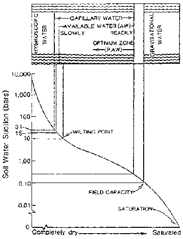
Figure 2.33 Soil Water and its
Availability
- Soil Moisture
The total available water (TAW) for a crop with root zone depth (D) is the product of the available water-holding capacity (AW) per unit of soil depth and the root depth in the same units, or:
TAW = DAW
The readily available water in the root zone (RAW) is:
RAW = pTAW
p = percent of allowable depletion not resulting in crop stress
Field Capacity
Although there are several lab methods for determining field capacity, it may be faster and more practical to estimate as follows:
(1) select a recently irrigated plot with no plants on it or make a small basin and fill with water;(2) cover the saturated soil with canvas or plastic to prevent evaporation; and
(3) take samples after the soil has drained to field capacity. The time required is usually one day in coarse-textured soils, two days in medium-textured soils, and three to four days in fine-textured soils. Samples of the soil taken after the indicated time period will be approximately at field capacity. Table 2.5 can then be used to understand the concept of field capacity for different soil textures by the "feel" method.
Typical relationships, such as that illustrated in Figure 2.34, which indicates field capacity as a function of texture, are often sufficiently accurate for planning scheduling programs. For more details on determination of soil moisture in quantifiable terms, see Ref. 44.
Permanent Wilting Point
Permanent wilting point can be established by determining the moisture at which plants permanently wilt.
A simple criterion satisfactory for water management is that PWP is 50% of FC for coarse to medium-textured soils and about 67% of FC for clays and clay loams. Typical relationships, such as those illustrated in Figures 2.33 and 2.34 often provide sufficient accuracy in estimating wilting point for water management purposes.
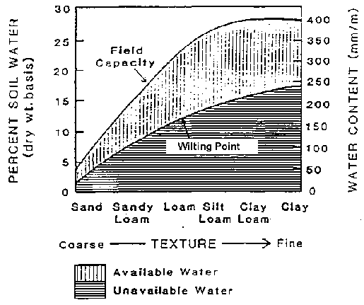
Figure 2.34 Typical Relationship
Between Soil Moisture Characteristics and Texture
Available Water
Available water-holding capacities for soils are a function of soil texture, structure, organic matter, and salt content. For general agricultural soils without salt, compaction, or other types of problems, information such as that in Figure 2.34 or Table 2.4 on water-holding capacities as a function of texture and soil water tension can be used for planning. The factors that affect soil available water-holding capacity are:
1) Soil texture: as Table 2.4 shows, the smaller the soil particles, the greater the surface area, and hence the greater the area on which water can cling. This results in a higher available soil water holding capacity. In the case of heavy clay soils, the soil water's availability to plant roots is limited by the soil denseness, since the water is so tightly held.
2) Soil structure is the arrangement of soil particles into groups or aggregates. The spaces between these aggregates provides places for soil drainage, soil aeration, and root growth. This is especially important in heavy soils with small soil particles. Four common soil structures are:
· Crumb or Granular: Roundish aggregates that are porous and easily worked.
· Blocky: Blocklike soil aggregates that are relatively porous.
· Columnar: Column-like soil aggregates that are relatively porous.
· Platy: Platelike, flat soil aggregates that can overlap and impair soil permeability.
A soil with poor structure and drainage will tend to trap water in the profile, increasing soil water-holding capacity, but also creating problems with waterlogging and restricted root development.
3) Hardpans are hardened or cemented layers caused by physical or chemical processes and restrict soil drainage. This results in a similar situation as poor structure.
4) Organic matter can increase a soil's water-holding capacity, mainly by improving its physical condition.
5) A soil's salt content restricts a plant's ability to take up water from the soil solution.
TABLE 2.4 Available Water-holding Capacities for General Soil Types
|
Coarse sands - gravelly sands |
40 - 70 mm/m |
|
Fine sands - loamy sands |
70 - 100 mm/m |
|
Sandy loams |
120 - 160 mm/m |
|
Loams |
180 - 220 mm/m |
|
Silt loams |
230 - 270 mm/m |
|
Silty clay loams, silty clays, heavy clays |
160 - 200 mm/m |
2.4.2 Estimating soil water characteristics on site
Soil maps developed by local or national agencies often provide sufficient information on soil water characteristics for developing irrigation management programs. If such sources are not detailed enough (as is often the case with very non-uniform soils), quick on-site evaluations can be conducted. This usually involves estimating soil texture and correlating it with available water through use of tables and/or experience.
Interviews with owners or managers of the farm will help to identify areas of different soils. Often simple observations of differences in crop development, superficial soil texture, and color of soil may help to define such areas.
The soil texture and structure can be evaluated by the visual and feel method using a soil probe or shovel and taking samples to typical rooting depths in increments. Table 2.5 describes properties often associated with specific textures. Figure 2.35 demonstrates an easy, visual method of assessing soil texture. Figure 2.36 shows typical water extraction patterns.
In tropical areas with high rainfall and good drainage, centuries of weathering have washed out much of the soils' mineral nutrients. This changes the characteristics of the clay fraction of these soils. These "tropical clays" are considerably less sticky and plastic than temperate clays described in Table 2.5. Unfortunately, most of the soils' natural fertility is also lost in this process. These soils are usually characterized by their distinctive red or yellow color.
Figure 2.35 Demonstrating the Particulate Make-Up of Soils (Ref. 9)
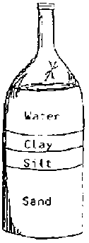
SANDY SOIL
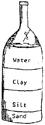
LOAM SOIL
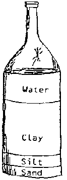
CLAY SOIL
Place soil in a bottle, add water, shake, and set on a stable level surface, me heavier sand-sized particles will settle out first followed by silt-sized and then clay-sized particles. This demonstration illustrates the particulate nature of soils and can be used to help farmers understand what soil texture means and how it can be important in affecting the drainage or erodability of a soil. The bottles should be allowed to remain undisturbed for 2 full day in order for the finer, clay-sized particles to settle out.
TABLE 2.5 Textural Properties of Mineral Soils
|
Feel and Appearance of | ||
|
Soil Class |
Dry Soil |
Moist Soil |
|
Sand |
Loose, single grains that feel gritty. When squeezed, the soil falls apart when pressure is released. |
Forms cast when squeezed that crumbles when touched. Doesn't form a ribbon. |
|
Sandy loam |
Aggregates easily crushed; very faint velvety feeling initially; continued rubbing gives gritty feeling. |
Forms cast requiring careful handling without breaking. Doesn't form a ribbon. |
|
Loam |
Aggregates crushed under moderate pressure; firm clods. When pulverized it feels velvety, becoming gritty with continued rubbing. Casts bear careful handling. |
Cast can be handled quite freely without breaking. Very slight tendency to ribbon. Rubbed surface is rough. |
|
Silt loam |
Aggregates firm, but may be crushed under moderate pressure. Clods firm to hard. When pulverized, it feels smooth, flour-like. |
Cast freely handled without breaking. Slight tendency to ribbon. Rubbed surface has a broken or rippled appearance. |
|
Clay loam* |
Very firm aggregates. Hard clods strongly resist crushing. When pulverized, it feels gritty from the small aggregates left behind. |
Cast bears much handling without breaking. Forms ribbon feeling slightly gritty when wet and rubbed. Plastic, sticky, and puddles easily. |
|
Clay* |
Hard aggregates and clods that strongly resist crushing. When pulverized it feels gritlike due to harshness of numerous small aggregates that persist. |
Casts bear considerable handling without breaking. Forms a flexible ribbon and retains its plasticity when elongated. Satin feeling when rubbed. Sticky when wet and easily puddled. |
* The properties described for the clayey soils refer to those of the clayey soils found in the temperate regions.
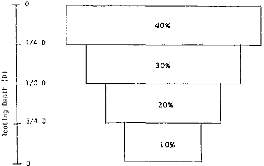
Figure 2.36 Typical Crop Water
Extraction
Patterns
2.4.3 Development of the soil water reservoir
The soil water reservoir available to the plant changes as the root system develops. Root depth varies with crop and variety, stage of growth, soil chemistry, structure, drainage and management. For example, excessive irrigation or inadequate wetting of the root zone may limit root development. The root system of a plant develops from seed depth at germination to a maximum depth at full vegetative development, or until it encounters impermeable barriers or other obstacles to root development. Typical rooting depths for several crops divided into four groups are described in Table 2.6.
TABLE 2.6 Rooting Depths of Various Crops (Ref. 44)
|
Rooting Depth (m) |
Crops |
|
0.3 - 0.5 |
Cabbage, celery, lettuce, onion, pineapple, potatoes, sisal, spinach, leafy vegetables |
|
0.5 - 1.0 |
Bananas, beans, beets, carrots, peas, clover, groundnuts, peppers, soybeans, sugar beets |
|
1.0 - 1.5 |
Barley, citrus, cucumber, flax, small grains, maize, melons, sunflower, sweet potato, wheat |
|
1.5 - 2.0 |
Alfalfa, cotton, deciduous orchard, grapes, sunflower, sorghum, sugar cane |
For management purposes such as irrigation scheduling, the root zone is often assumed to develop linearly from planting depth at time of planting, or shortly after, to typical maximum root depth at full cover. In monitoring the moisture on many field crops, the primary rooting system may be assumed to be from one to two times the crop height, or to the depth where hardpans or other obstacles are encountered. Moisture monitoring to the depth of plant height is adequate for many crops other than alfalfa, tree crops, and some other deep-rooted crops.
2.4.4 Soil water availability and crop use patterns
Readily Available Water and Allowable Depletion
Table 2.7 groups several crops according to permissible soil moisture depletion for maximum yield conditions. Table 2.8 indicates the fraction allowable depletion of available moisture (p) as a function of crop group and evaporative demand. The readily available water that can be extracted from the root zone without limiting yield is obtained by multiplying p by the total available water (TAW) to root zone depth.
Fungal and bacterial pathogens proliferate faster at higher moisture levels. Crop quality, such as protein in wheat and color in cotton, may improve with lower available water. Irrigation system flexibility or limited water supplies may dictate allowable depletions. Osmotic potentials created by salts in the soil create the same effects as soil moisture tensions. Salts may inhibit water and nutrient uptake from the soil, therefore, and maintenance of higher moisture levels than those indicated may be desirable in saline soils. Tables 2.7 and 2.8 should serve only as guidelines when water supplies are abundant and flexible.
TABLE 2.7 Crop Groups According to Soil Water Depletion (Ref. 11)
|
Group |
Crops |
|
1 |
Onion, pepper, potato |
|
2 |
Banana, cabbage, grape, pea, tomato |
|
3 |
Alfalfa, bean, citrus, groundnut, pineapple, wheat, sunflower, watermelon |
|
4 |
Cotton, maize, olive, safflower, sorghum, soybean, sugarbeet, sugarcane, tobacco |
Note:
Group 1 -- Most sensitive to water stress
Group 4 -- Least
sensitive to water stress
TABLE 2.8 Practical Depletion Values (Fraction) not Resulting in Significant Water Stress
|
Crop Group |
Hot High Water Use |
Cool Low Water Use |
|
1 |
0.25 |
0.40 |
|
2 |
0.30 |
0.50 |
|
3 |
0.40 |
0.60 |
|
4 |
0.50 |
0.70 |
Moisture Extraction Patterns
Plants maintained at high moisture levels will take their water from the root zone approximately in proportion to the concentration of roots. A typical extraction pattern of water from the soil is indicated in Figure 2.36, with 70% of the moisture extraction taking place from the upper half of the root zone. Moisture-sensitive crops such as potatoes, maintained at high moisture levels, may take 80% to 90% of their water from the upper half of the root zone. As plants are subjected to stress, they will take more of their water from where it is available in the lower reaches of the root zone.
2.4.5 Soil intake characteristics
Soils that take up water rapidly will wet the root zone rapidly after the onset of irrigation, and thus irrigations will usually be of short duration. The rate at which soils take water is called the soil intake rate, and the rate at which water goes into the soil is the infiltration rate. The intake rate of a soil will affect such management and design factors as irrigation durations, flow rates to be used, and dimensions of the system.
Factors Affecting Intake Rates
The most important factors influencing the infiltration rate of water into the soil are:
1. Soil texture and structure. The coarser the texture and the more highly structured, the higher the infiltration rates.
2. Soil surface conditions. Orientation of soil particles and compaction: after water moves over a soil surface, soil particles are rearranged and the soil surface tends to seal.
3. Soil moisture content and moisture gradients. Generally, the drier the soil, the faster the infiltration rate.
4. Time since the start of irrigation. Infiltration rate decreases with time until the basic intake rate is reached.
5. Salt content in the water and soil. Soils high in soluble salts will typically exhibit higher intake rates than soils from which salts have been leached.
6. High levels of sodium on the soil's exchange sites will severely affect infiltration if structure collapses. See Chapter 7 for details.
Infiltration rate, as used in border irrigation and sometimes in furrow irrigation, has the units of velocity (l/t) and is the depth of water entering the soil profile per unit time. It can also be thought of as the volume of water absorbed by a unit area per unit time. The metric units commonly used to express infiltration rate are mm/hr or mm/mint In furrow irrigation, where infiltration rate is expressed as a depth per unit time, an equivalent depth is usually implied since movement is horizontal as well as vertical. The depth is obtained by dividing the volume rate of infiltration per unit of furrow length by the product of unit length and furrow spacing. In furrow irrigation, infiltration rate is commonly expressed as the volume absorbed by a unit length of furrow in a unit time.
Most soils exhibit an initially high infiltration rate that decreases with time and eventually reaches a constant or nearly constant rate called the basic intake rate. Figure 2.37 demonstrates the typical infiltration rate behavior with time, as well as cumulative infiltration with time.
The basic intake rates for loamy sands and sands may be 2 to 3 cm per hour or greater. For sandy loams, it is typically 1 to 2 cm per hour. For silt loams and clay loams, it is typically 0.5 to 1.0 cm/hr. For silty clays, it may be 0.2 to 0.5 cm/hr or less. With poorly structured soils, these values may decrease by 25% to 50%. With highly structured and loose soils, the values may be 50% to 100% higher than those indicated.
Because infiltration can change so much during the season, infiltration data should be used with caution, and sound judgment should be exercised in interpreting it. To use such data requires knowledge of crops and cropping history, irrigation methods and management, tillage, soil type and structure, and time of season.
Infiltration Equations
In management of irrigations systems, several infiltration equations and methods for establishing these have been used. One common method for estimating infiltration rate uses ring infiltrometers. These are installed by penetrating the soil surface by 15 to 20 cm. They are then covered with plastic film, filled with water, and then the film is removed rapidly. A water level reading is taken immediately on removal of the plastic because water begins to infiltrate the soil at this time. The decline of the water surface is measured as a function of time and these results are recorded and graphed (see Figure 2.37).
To obtain an approximation of infiltration rate in a field
situation, small 1 m  1 m basins are
constructed with well compacted banks. A sheet of plastic is placed in the basin
and 15 to 20 cm of water introduced to the basin. The plastic sheet is removed
from the bottom, and the decline of the water surface is measured as a function
of time. Results can be graphed to provide an approximation of the time required
to infiltrate a certain depth of water. Base infiltration rates may require
additional water to be added to the
basin.
1 m basins are
constructed with well compacted banks. A sheet of plastic is placed in the basin
and 15 to 20 cm of water introduced to the basin. The plastic sheet is removed
from the bottom, and the decline of the water surface is measured as a function
of time. Results can be graphed to provide an approximation of the time required
to infiltrate a certain depth of water. Base infiltration rates may require
additional water to be added to the
basin.
2.4.6 Soil chemistry and fertility
Soil is made up of mineral particles derived from the weathering of rocks and organic matter resulting from decomposing plants. Soil mineral particles decrease in size from sand to silt to clay. Sand and silt usually contribute very little to a soil's fertility but are important to a soil's pore space and drainage.
Clay particles, on the other hand, are very small and have tremendous surface area. The surfaces and edges of clay particles are negatively charged. These negatively charged sites on the clay particles act like weak magnets for positively charged ions or cations. Certain fractions of soil organic matter also have negatively charged sites. This organic matter and clays are termed the soil colloids by virtue of their charge and size. The sum of all the negative charged sites on clay and organic matter in a soil is called the Cation Exchange Capacity (CEC) and is expressed as meq/100 g.
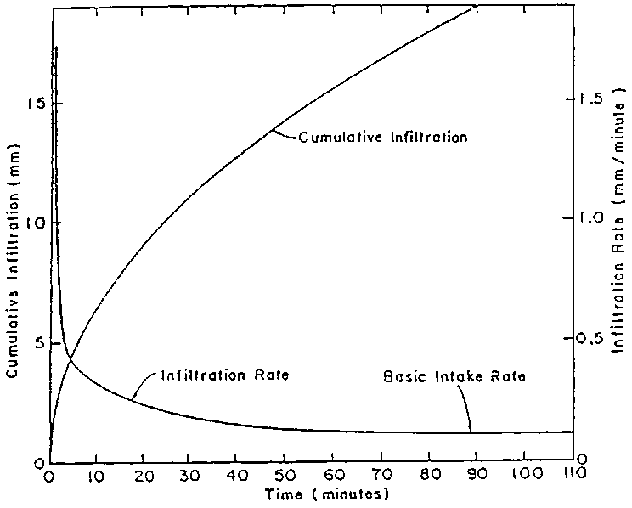
Figure 2.37 Infiltration Curve
Many nutrients required by a plant are positively charged ions. They are loosely held by these negatively charged sites and are not washed out (leached) from the root zone when water travels through. For this reason, the CEC is a good measure of soil fertility. Clay particles and organic matter also have plant nutrients in their structure that are slowly released by soil weathering and decomposition. This natural fertility and the CEC of the soil are components of a soil's potential fertility. Negatively charged ions are not held by soil colloids and can thus be readily leached out.
Organic matter has a very high CEC and can dramatically affect a soil's ability to hold nutrients. Organic matter is thus very important to a soil's productivity. This is especially important in severely weathered "tropical clays,'" which rapidly lose most of their natural fertility and whose clay particles have few negatively charged sites. Addition of organic matter to these soils can be very beneficial.
Nitrogen is a very important plant nutrient involved in plant growth, photosynthesis, and plant proteins. In the ammonium form, nitrogen is positively charged and readily held on the negative exchange sites on soil. Soil microbes, however, change ammonium into nitrate, and this occurs at a very rapid rate in warm climates. The nitrate form of nitrogen is negatively charged and is easily leached out of the root profile. Proper irrigation water management is required to reduce the potential for leaching and ensure good nitrogen fertility levels.
Other nutrients are more or less resistant to being leached out of the soil, but it is a likely event when nutrient ions are negatively charged. As more of these nutrients are leached out and minerals continue to weather, the soil becomes more and more dominated by the hydrogen ion, resulting in acid soil. High rainfall tropical areas will often have tropical clay soils, red or yellow in color, exhibiting very acidic reactions (low pH).
Leaching of nutrients can also result in imbalances that can severely affect plant growth. Chapter 7 discusses the effect of excess ions (salts) in the soil solution. Soil chemistry is complicated, so a more complete reference should be consulted.
2.5 Conducting initial environmental evaluations of irrigation projects
Irrigation projects can result in a wide variety of impacts to surrounding ecosystems, both positive and negative. On the positive side, irrigation projects in Thailand have been credited with reducing the destruction of tropical rainforests by enabling rural people to increase food productivity on smaller parcels of land, thus eliminating the need for continuous clearing of forests for agricultural development. Irrigated fields have improved habitat for some species, particularly birds and small mammals. Some Asian farmers have integrated fish production into their irrigated rice fields, thus creating habitat while maximizing food productivity. In addition, the use of irrigation has improved human welfare dramatically, providing foods and fibers to a large percentage of the world's population that might otherwise have none.
Some irrigation projects, however, have contributed to significant environmental degradation, primarily through poor project planning and administration. Irrigation projects reshape the land surface and change the way water moves, is stored, and is recycled in the hydrologic cycle. Poor management of water applications in irrigation projects has frequently resulted in high salt content of soil, in some cases rendering these lands useless for further crop production. Poor drainage and poor scheduling of water applications have resulted in waterlogged soils in some locations.
For more than 7,000 years, people have constructed diversion and conveyance systems that enable water supplies to nurture crops on previously unproductive or less productive lands. The consequence has been a proliferation of crops, enabling regions to expand population levels, accumulate wealth, and develop cultural and political power. Improper management of the soil and water resources that support irrigated lands, however, can result in salinization of the irrigated soils, silting of canals, and contamination of water supplies. Several formerly powerful ancient cultures virtually disappeared, in part due to poor administration and management of irrigation systems.
Even today, productivity on approximately 25 million hectares (7 percent) of the world's irrigated lands is seriously affected by these problems (Ref. 3). Salinization of fertile croplands affects approximately 1.5 million hectares per year. World Bank studies in Pakistan and Egypt indicate that waterlogging and salinization have decreased the yields of major crops by 30 percent. Approximately 20 percent of the 40 million hectares irrigated in India are also affected by these problems.
Construction of water storage reservoirs and irrigation channel networks affect the amount of moisture in the soil, and the height of the ground water table, and can influence water quality through increased sediments, organic materials, and agrochemicals. Diversion of water for irrigation from the huge Aral Sea in central Russia has largely eliminated local fisheries and wildlife habitat, resulting in the loss of employment for people who fish, creating health hazards, and threatening the very existence of this sea.
Poorly developed and managed water supply sources for irrigation projects have resulted in a considerable loss of the world's wetland habitats and have created new vector breeding environments, contributing to the spread of serious infectious diseases, notably malaria, bilharzia, and yellow fever. In the Sudan, incidents of bilharzia (schistosomiasis) increased more than 80 percent after the development of reservoirs and canals for irrigation systems.
2.5.1 The role of environmental assessment
Many of these adverse impacts are difficult to predict accurately or quantify. In some cases, the effects are the cumulative result of several land alteration practices, with irrigation systems being only one of the causative agents. Still, the fact that irrigation systems can result in or contribute to environmental problems requires all irrigation workers to take full account of potential environmental impacts before any project activities are implemented.
In most countries, an environmental review is now required for virtually all projects that will involve some construction or modification of the environment. In most cases, the general public has insisted that projects consider several alternatives for achieving the same goal, and implement only the alternative that has been demonstrated to represent the least environmental risk. All signs indicate that both professional and public concern over adverse environmental impacts will continue to grow. The irrigation specialist will increasingly be required to document not only the wider impacts of his or her decisions but also the greatest balance that can be achieved between development and conservation.
Volunteers who will be participating in projects that divert water or otherwise alter water sources, construct canals, cultivate fields, or result in any other potential changes to the social or natural environment should be prepared to conduct a careful analysis of potential environmental impacts. The most important output from this analysis should be a documentation of potential impacts and the development of mitigative measures that will be implemented as part of the project to guarantee that any potential environmental problems will be avoided or minimized. Examples of mitigative measures include such actions as ensuring that the vegetation along streams is protected or restored; stocking Gambusia or other larvae-feeding fish in storage ponds to minimize the incidents of mosquito-borne diseases; and building terraces and drains in irrigated fields to minimize waterlogging and soil loss.
The process should begin with an initial environmental review that uses field observations and professional judgment to determine if a proposed project is likely to result in any significant environmental impacts. The review is intended to rely on qualitative analyses and to be done fairly rapidly. An illustrative form that can be used by Volunteers to complete an initial environmental review is included in the next section of this chapter. For most small projects that will not involve the construction of permanent dams, extensive canal systems, or the irrigation of more than 10-15 hectares of land, this initial environmental review should be sufficient to ensure that careful environmental management will be built into all project components.
Larger projects that are likely to result in more extensive environmental impacts can still be initially reviewed using this simple environmental review form. If significant impacts are identified it may be necessary to conduct a more thorough environmental assessment of the project. A comprehensive environmental assessment (EA) will require much more time and professional expertise than may be available to many Peace Corps Volunteers. If a comprehensive EA is deemed necessary for a project, then the Volunteer will most likely need to contact qualified government staff, private sector firms, or international donors to assist with the effort. Volunteers should be aware of the content of any comprehensive EA, which includes the following:
· A concise but thorough description of the proposed actions that will occur, a statement of project purpose, and a review of the roles and responsibilities of all agencies, organizations, or individuals to be involved in the project.
· A detailed description of the physical, biological, and social environment that will, or could potentially, be affected by the proposed project actions. This description should be quantified, wherever possible.
· A discussion of the relationship of the proposed project actions to existing land use plans, policies, and controls for the affected area.
· A detailed description of alternative strategies that can be taken to achieve the stated project purpose. This description should include the project plan (unamended) and a "No Action" alternative, which essentially indicates how the stated project purpose will be affected if the project is not implemented at all.
· A detailed description of predicted environmental impacts that should result from the implementation of each alternative. Environmental impacts should include both beneficial and negative consequences and secondary or indirect effects that may occur. This description should include quantified predictions wherever possible.
· Identification of environmental impacts that cannot be avoided with any of the alternatives, including the "No Action" alternative.
· Identification of the preferred alternative and use of some kind of quantifiable process to show why this alternative is the most preferable selection.
· A detailed description of measures that can be incorporated into the preferred alternative to ensure that any adverse environmental impacts will be minimized or avoided and to guarantee that careful environmental management will be built into the overall project effort.
2.5.2 Illustrative environmental review form for irrigation or water resource development projects
The following illustrative form provides a scheme that can be used by Volunteers or technicians to identify and rank probable environmental impacts from proposed field work prior to the initiation of construction or development activities. The form can also be used to help identify mitigative measures that will eliminate these environmental impacts. Impacts are identified as to whether they are of MINOR, MODERATE, OR SIGNIFICANT environmental concern. Any MODERATE impact should identify measures that can improve the scheme. Any SIGNIFICANT impacts should identify alternative activities that can replace the initial proposed project.
PART I PROJECT CHARACTERIZATION
Project Description
_______________
_______________
1. Obtain topographic map(s) covering the area within or including the proposed project development scheme.
2. Delineate the watersheds, natural drainage directions, and approximate affected area within which the project will occur. Affected area includes lands directly upstream and downstream from the proposed project, which the project could alter by changing runoff or flood flows, vegetation cover, or soil conditions.
3. Obtain land use, vegetation, soils, or flood maps for the affected area if available.
4. Obtain information on the likelihood of occurrence of important wildlife, fisheries, or habitat types, and the presence of threatened or endangered species in the affected area.
5. Obtain information on the likelihood of occurrence of important cultural resources in the affected area.
Note: Bring the topographic map to the field when doing the field review.
PART II FIELD EVALUATION
Based on available information and field observations, evaluate the predicted effect of the proposed project on the following resources. Include proposed mitigation resources, if necessary.
|
N |
NO environmental impact or IMPROVED environmental conditions. |
|
L |
MINOR negative environmental impact. |
|
M |
MODERATE negative environmental impact. |
|
S |
SIGNIFICANT negative environmental impact. |
|
U |
UNKNOWN environmental impact. |
I Water Resources
Use the topographic map to make a brief sketch of the proposed development scheme. Identify significant local features, including rivers, canals, ponds, lakes, forest lands, wetlands, other unique habitats, and archeological sites. Show the apparent flow directions for floods and note any obvious signs of flood depths or flood locations for a 10-year flood. Include a map scale.
1. The project is located in a floodplain area. (Yes) (No)
2. The project will increase/decrease/have no effect on the duration of floods (circle one answer). If yes, the ranking of impact is ________.
3. The project will change the location of floods. (Yes) (No) If yes, the ranking of impact is _______.
4. The project will change stream channel shapes, or the amount or type of vegetation alongside streams. (Yes) (No)
Impact Ranking
|
MINOR |
MODERATE |
SIGNIFICANT |
|
Some change, but overall channel/vegetation remains the same. |
Causes measurable change in shape or vegetation. |
Causes major change in channel shape or vegetation. |
5. Recommended measures to mitigate (reduce) effects: _________.6. Explain how recommended measures will mitigate moderate or significant impacts.
7. What moderate or significant impacts cannot be mitigated and why?
II Fish and Wildlife
1. Project will result in destruction or degradation of habitat for fish or wildlife. (Yes) (No) If yes, the ranking of this impact is ________.
2. Project will block fish or wildlife migratory pathways. (Yes) (No) If yes, the ranking of the impact is ________.
Impact Ranking
|
MINOR |
MODERATE |
SIGNIFICANT |
|
Impacts localized and no impacts to migratory pathways or habitat. |
May temporarily block pathways or eliminate habitat. |
Will block migratory pathways or will eliminate habitat. |
3. Endangered or threatened species are likely to occur in the project area. (Yes) (No) If yes, list.
4. Proposed project will result in loss of individual threatened or endangered species. (Yes) (No) If yes, which one(s) and how?
5. Will any loss of habitat affect the survival of species? Explain.6. Recommended measures to mitigate effects: ________.
7. Explain how recommended measures will mitigate moderate or significant impacts.
8. What moderate or significant impacts cannot be mitigated and why?
III Vegetation
1. Vegetation types found in the area include _______.
2. Project will result in cutting of trees, or loss of vegetative cover. (Yes) (No) The ranking of the impact is _______.
Impact Ranking
|
MINOR |
MODERATE |
SIGNIFICANT |
|
No loss of important plant communities or changes in runoff. |
Some loss of important plants and change in runoff patterns. |
More than 50 percent of plant cover lost and runoff patterns vary greatly. |
3. Recommended measures to mitigate effects: ________.4. Explain how recommended measures will mitigate moderate or significant impacts.
5. What moderate or significant impacts cannot be mitigated and why?
IV Soils
1. Changes in soil moisture:
(a) waterlogging ________.
(b) drought ________.
2. Project will cause soil loss from farm fields. (Yes) (No) If yes, ranking is ______.
3. Project will result in adverse changes to soil physical or chemical conditions. (Yes) (No) If yes, ranking is ________.
Impact Ranking
|
MINOR |
MODERATE |
SIGNIFICANT |
|
Soil loss less than 5 tons/ha/year, and no salt or chemical concentration. |
Soil loss greater than 5 tons/ha/year, and some salt or chemical concentration. |
Soil loss greater 10 tons/ha/year, and high salt or chemical concentration. |
4. Recommended measures to mitigate effects: ________.5. Explain how recommended measures will mitigate moderate or significant impacts.
6. What moderate or significant impacts cannot be mitigated and why?
V Cultural Resources
1. Proposed project will result in the loss of archeological, historical or cultural resources. (Yes) (No) If yes, identify resources and rank the impact.
Impact Ranking
|
MINOR |
MODERATE |
SIGNIFICANT |
|
Project will make cultural resource less accessible. |
Project will result in loss or damage to less important resources. |
Project will result in the loss or damage of important resources. |
2. Recommended measures to mitigate effects: ________.3. Explain how recommended measures will mitigate moderate or significant impacts.
4. What moderate or significant impacts cannot be mitigated and why?
VI Summary of Moderate and Significant Impacts and Recommended Mitigative Measures ________.
<<TOC2>> Chapter 3 - Developing water
sources
|
Reference: |
Primary: |
(5), (15), (20), (28), (39), (54), (58) |
| |
Other: |
(13), (28), (59) |
3.1 Diversions
3.1.1 Types
Diversion structures are used to separate all or part of the flow in a stream to a location where it will be used or stored. Diversion structures may be either temporary or permanent. If high flows make a permanent structure very expensive, then temporary structures that can be easily and economically reconstructed might be installed.
In streams or springs that have constant flow year-round, or stream beds that are very wide, a permanent diversion can be used to channel water, generally at an angle, towards the bank. The diversion may be constructed across only a part of the stream's bed.
In streams with narrow beds and small flow rates, the diversion may span the stream and pond up the water.
3.1.2 Types of construction materials
Depending on the availability and cost of materials, and the size and purpose of the structure, the following materials are commonly used:
· soil,
· boulders and rocks,
· logs,
· sand bags,
· gabions,
· masonry, and
· concrete.
3.1.3 Construction and maintenance factors
1. Many diversions are only temporary structures, so they should be built with the understanding that they will be destroyed by flood water during hard rainfall.
2. Diversions can be constructed so that part of the structure is permanent and the other part temporary. In areas where there is a large variation in stream flow during a relatively short period of time, this system of diversion reduces the amount of labor required to reconstruct the structure after each rainfall.
3. Design of any permanent structure should take into consideration the amount of sediment that will settle upstream and reduce water storage volume. Sediment traps can be constructed upstream of the diversion to reduce some of the sediment. Maintenance will have to be performed after each rainfall to clean the sediment traps. In watersheds with steep slopes, special precautions should be taken for the probable movement of large rocks in the stream bed during high flow.
4. If the diversion structure will be used as a check dam to allow for water storage, the site of the diversion should have a natural basin upstream to maximize water storage volume and decrease the necessary height of the diversion or dam.
5. Gabions are baskets made of heavy duty galvanized wire mesh that are filled with rocks and wired shut. The gabion provides an easily constructed unit that is large enough and heavy enough to remain stable in moving water. Gabions can be made to any convenient size ranging from 2-4 m long by 1 m wide by 0.5-1 m deep. The wire mesh is usually 2-3 mm in diameter. Evenly graded stones are used so that the gabions are well packed with few empty spaces, and the largest stone should not be more than two-thirds of the minimum gabion dimension.
6. Diversions constructed of materials that allow excess amounts of seepage may require some type of impervious core or barrier to reduce losses. These barriers are generally installed during the construction of the structure. A common core, if available, is clay. Other barriers include heavy grade plastic sheets, used fertilizer/animal feed sacks, and sod.
7. Diversion structures require upstream and downstream side slopes to assure their stability. The ratio generally depends on the construction material, but, for small structures, values of 2:1 upstream and 1.5:1 downstream are acceptable.
8. A spillway, overflow structure, or other bypass structure is necessary to allow water from the stream to pass over the diversion structure and flow back into the natural watercourse without washing out or damaging the structure. Water needs to be channeled through a bypass so that it does not flow over the top of the entire length of the diversion, which could cause erosion problems. Additionally, the energy of the water falling from the outlet to the stream bed must be dissipated. Rocks or other durable materials can be placed at the base of the downstream side of the bypass structure for protection.
9. If the diversion provides water to a pipeline, a trash removal system may be required to prevent blockage of the pipe. Sometimes a simple screen over the inlet may suffice. If sediment is a problem, an offstream sedimentation pond may be required.
<<TOC3>> 3.2 Concrete
Concrete is widely used for irrigation systems. It has several desirable properties that make it a versatile and popular building material. Freshly mixed concrete can be formed into practically any shape.
Rules for making good concrete are simple:
· Use proper ingredients (cement, sand, and gravel).
· Proportion the ingredients correctly.
· Measure the ingredients accurately by volume.
· Mix the ingredients thoroughly.
Table 3.1 provides an initial estimate of the ratios of ingredients to be used to make common small-scale concrete structures:
TABLE 3.1 Concrete Ratios by Volume
|
Coarse Aggregate, |
Cement |
Sand |
Coarse |
Water |
|
Maximum Size, mm (in) | | |
Aggregate |
|
|
10 (3/8) |
1 |
2 1/2 |
1 1/2 |
1/2 |
|
13 (1/2) |
1 |
2 1/2 |
2 |
1/2 |
|
19 (3/4) |
1 |
2 1/2 |
2 1/2 |
1/2 |
|
25 (1) |
1 |
2 1/2 |
2 3/4 |
1/2 |
|
38 (1 1/2) |
1 |
2 1/2 |
3 |
1/2 |
3.2.1 Hand mixing
Mixing should be carried out on a clean, hard surface or in a mortar box. Concrete should not be mixed on the ground. Commonly, the correct proportion of ingredients is measured by shovelfuls. A small bucket is also a good measuring device. The ingredients are first thoroughly mixed together dry until the mix is of a uniform color and consistency. Clean water is added slowly and in small quantities; with each addition of water, the mix is turned over a few times with a shovel. Water is added until the concrete is at the desired consistency. Concrete should not be any runnier than is necessary to work with because it loses strength if it is too watery.
Wet concrete is poured; it should not be dumped from any height since separation may occur. Before it sets, the concrete must be settled and compacted (rodded) to eliminate air pockets and make sure that there is good contact with the foundation materials. Excessive trowelling causes segregation of the aggregates and should be avoided. Forms are removed after the concrete has hardened (a few days). It should be kept wet for at least 3 days, preferably 7, to assure adequate curing time.
<<TOC3>> 3.3 Designing structures for springs and seeps
Protective structures for springs and seeps assure a clean water supply to irrigation systems. The protective structure increases the volume of water that can be diverted from the spring and protects the site from contamination by runoff or animals.
Developing a spring or seep requires some understanding of ground water flow (see Chapter 2) and preparation of a thorough construction plan. The construction plan should include (a) a map of the area identifying the location of the spring, the locations of water use, distances from source to use outlet points, and surveyed changes in elevations; (b) a complete list of all labor, materials, and tools needed; and (c) a spring box design with diagrams of the top, side, and front views, and the dimensions of a cover. Spring box structures can be costly in terms of the amount of time and finances invested, so careful planning is essential.
3.3.1 Spring box designs
There are several possible designs for springs boxes, but, in general, their basic features are similar. Two basic design choices are a box with one pervious side for collection of water from a hillside and a box with a pervious bottom for collection of spring water flowing from a single opening on level ground. To determine which design to use, dig out around the area until an impervious layer is reached, locate the source of the spring flow, and design to fit the situation. Figures 3.1 through 3.10 and Table 3.2 provide sample drawings and work sheets.
General Construction Steps
The following steps are appropriate for either design choice:
1. Locate the spring site and mark out the area with measuring tape, cord, and wooden stakes or pointed sticks.
2. Clean out the area around the spring to ensure a good flow. If the spring flows from a hillside, dig into the hill far enough to determine the origin of the flow. Where water is flowing from more than one opening, dig back far enough to ensure that all the water flows into the collecting area. If the flow cannot be channeled to the collection area because openings are too diffuse, drains will have to be installed. Flow from several sources may be diverted to one opening by digging farther back into the hill. Always try to dig down deep enough to reach an impervious layer. An impervious layer makes a good foundation for the spring box, and provides a better surface for a seal against underflow.
3. Pile loose stones and gravel against the spring before putting in the spring box. The stones serve as a foundation for the spring box and help support the ground near the spring opening to prevent dirt from washing in.
4. Approximately 8 meters above the spring site dig a trench for diverting surface runoff. Use large stones, if available, to line the diversion trench and prevent erosion.
5. Mark off an area about 9 meters by 9 meters for a fence. Place the fence posts 2 meters apart and string the fence.
Concrete Construction Steps
In order to have a strong structure, concrete must cure at least 7 days. Strength increases with curing time. Be sure that all tools and materials needed to build the forms and mix the concrete are at the site.
1. Build wooden forms. Once the dimensions of the box have been drawn, cut wood to the appropriate sizes and set up the forms on a level surface. The outside dimensions of the forms should be 0.1 meter larger than the inside dimensions. An open bottom or back should be planned, depending on the spring source location. The size of the opening in the form depends on the area that must be covered to collect the maximum water. When building forms for a box with a bottom, be sure to set the inside forms 0.1 meter above the bottom for the floor. This is done by nailing the inside form to the outside form so that it hangs 0.1 meter above the floor. Make holes in the forms for the outflow and overflow pipes. Place small pieces of pipe in them so that correctly sized holes are left in the box as the concrete sets. Build a form for the box cover. Build all forms at the site.
2. Set the forms in place. Forms must be well secured and braced before pouring the concrete. The braces can be tied together with wire. Use a stick to tighten the wire and force the forms together. If the forms are set and concrete is poured at the permanent site, water must be diverted from the area to allow the concrete to cure. If diversion is not possible, pour the concrete near the permanent site, and plan to have 6-8 people available to help move the box later after the concrete has cured.
Clay/Cement Mixture
- Mix equal parts dry cement and dry powdered cement
- Add
water till plastic (not too wet)
- Slap down mixture around spring onto nerd
surface to start (It will not erode in flowing water)
- Build up walls
capturing spring and add tubes as level is reached
- Add large rocks in water
flow leaving a good water path
- Cover large rocks with progressively liar
rocks and than gravel
- Finish off with a layer of sand or dirt
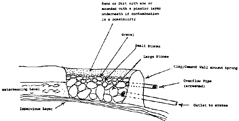
Figure 3.1 Spring Box Design
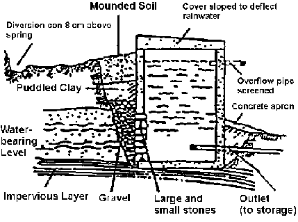
Figure 3.2 Spring Box with Open
Sides (Ref. 39)
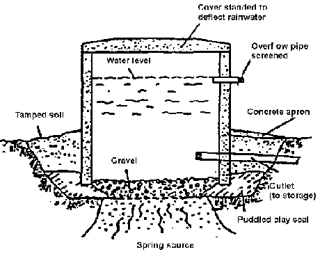
Figure 3.3 Spring Box with Open
Bottom (Ref. 39)
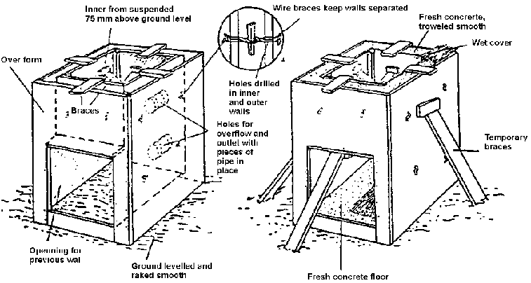
Figure 3.4 Forms for Spring Box
with Open Side (Ref. 39)
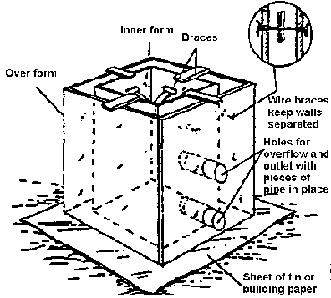
Figure 3.5 Forms for spring Box
with Open Bottom (Ref. 39)
Figure 3.6 Excavating Spring Site
(Ref. 39)
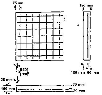
Figure 3.7 Placement of Rebar in
Concrete Slab (Ref. 39)
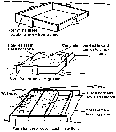
Figure 3.8 Forms for spring Box
Cover (Ref. 39)
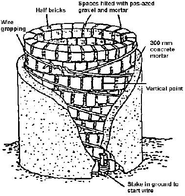
Figure 3.9 Brick Spring Box (Ref.
39)
Figure 3.10 Calculating Quantities Needed for Concrete (Ref. 39)
(CaIculations for a box 1m  1m
1.0m with open bottom)
1m
1.0m with open bottom)
Total volume of box = length (1)  width (w)
  height (h)
Thickness of walls = 0.10m (t)
1. Volume of top = 1 1.2 m  w 1.2 m
  t
0.10 m = 0.144 m3
t
0.10 m = 0.144 m3
2. Volume of bottom = 1 0 m
 w 0 m
w 0 m  t 0 m = 0 m2
3. Volume of two sides = 1 1 m
 w 1 m
w 1 m  t 0.10 m
  2 = 0.20
m3
2 = 0.20
m3
4. Volume of two ends - 1 1 m  w 1 m
w 1 m  t
0.10 m
t
0.10 m  2 = 0.20
m3
2 = 0.20
m3
5. Total volume = sum of steps 1, 2, 3, 4, 5 = 0.54
m3
6. Unmixed volume of materials = total volume  1.5; 0.54 m3
  1.5 = 0.81 m3
7. Volume of each
material (cement, sand, gravel, 1:2:3):
cement: 0.167  volume from Line
6 0.81 = 0.13 m3 cement.
volume from Line
6 0.81 = 0.13 m3 cement.
sand: 0.33  volume from Line 6 0.81 = 0.26
m3 sand.
volume from Line 6 0.81 = 0.26
m3 sand.
gravel: 0.50  volume
from Line 6 0.81 = 0.4 m3 gravel.
volume
from Line 6 0.81 = 0.4 m3 gravel.
8. 
volume of cement 0.13 m3/.033 m3/bag = 4 bags.
9. Volume of water = 28 liters  4 bags of cement - 112 liters.
(NOTE:
1) Do not determine volume for an open side or bottom.
2) The
top slab has a 0.1m overhang on each side.
3) The same calculations will be
used to determine the quantity of materials for construction of a seepage
wall.
4) To save cement a 1:2:4 mixture can be used.)
Table 3.2 Sample Materials List (Ref. 39)
|
Item |
Description |
Quantity |
Estimated Cost |
|
Labor |
Foreman Laborers |
______ |
______ |
|
Supplies |
Portland cement |
______ |
______ |
| |
Clean sand and gravel, if available or locally available sand and gravel. |
______ |
______ |
| |
Water (enough to make a stiff mixture) |
______ |
______ |
| |
Wire mesh or rein forcing rods |
______ |
______ |
| |
Galvanized steel or plastic pipe (for outlets, overflow, and collectors) |
______ |
______ |
| |
Screening (for pipes) |
______ |
______ |
| |
Boards and plywood (for building forms) |
______ |
______ |
| |
Old motor oil or other lubricant (for oiling forms) |
______ |
______ |
| |
Baling wire |
______ |
______ |
| |
Nails |
______ |
______ |
|
Tools |
Shovels and picks (or other digging tools) |
______ |
______ |
| |
Measuring tape or rods |
______ |
______ |
| |
Hammer |
______ |
______ |
| |
Saw |
______ |
______ |
| |
Buckets |
______ |
______ |
| |
Carpenter a square or equivalent (to make square edge) |
______ |
______ |
| |
Mixing bin (for mixing concrete) |
______ |
______ |
| |
Crowbar |
______ |
______ |
| |
Pliers |
______ |
______ |
| |
Pipe wrench |
______ |
______ |
| |
Wheelbarrow |
______ |
______ |
| |
Adjustable wrench |
______ |
______ |
| |
Screwdriver |
______ |
______ |
| |
Trowel |
______ |
______ |
|
Total Estimated Cost |
________ | ||
3. Oil the forms. This prevents the concrete from sticking.
4. Prepare the reinforcing rods (rebar) in a grid pattern for placement in the forms for the spring box cover. Make sure there is 0.15 meters between the parallel bars and that the rods are securely tied together with wire. Then position the reinforcing rods in the form. Four bars tied together to form a square should be placed in the forms.
5. Mix the concrete in a proportion of 1 part cement, 2 parts sand, and 3 parts gravel. Add just enough water to form a thick paste. More gravel can be used to conserve cement.
6. Pour the concrete into the forms. Tamp the concrete to avoid pockets or voids. Smooth all surfaces. Make the middle of the cover a little higher than the sides to encourage drainage away from the spring box.
7. Cover the concrete with canvas, burlap, empty cement bags, plastic, straw or some other protective material to prevent it from losing moisture. The covering should be kept wet so water from the concrete is not absorbed. If concrete days, it no longer hardens, its strength is lost, and it begins to crack. Keep the cover on for as long as the concrete is curing.
8. Let the concrete structures set for at least 7 days, wetting the concrete daily. After 7 days, the forms can be removed and the box installed.
Installing a Spring Box
The spring box must be properly installed to ensure that it fits on a solid, impervious base, and that a seal with the ground is created to prevent water seeping under the structure.
1. Place the spring box in position to capture the maximum flow. Place gravel around the box or in the basin so that water flows through it before entering the box.
2. Seal the area where the spring box makes contact with the ground. Use concrete or puddled clay to form a seal.
3. Be sure that the area where the spring flows from the ground is well lined with gravel, and then backfill the dug out area with gravel. The gravel fill should reach as high as the inlet opening in the spring box so that the water flowing into the structure passes through gravel. For spring boxes on level ground, gravel backfill is unnecessary.
4. Place the pipes in the box. Use concrete to seal around the pipes and prevent leaks. Place screening over the pipe openings and secure with wire.
5. Disinfect the inside of the box with a chlorine solution. Before the spring box is closed, wash its walls with a light solution of chlorine.
6. Place the cover on the box.
<<TOC3>> 3.4 Ponds for irrigation water storage
Ponds or small reservoirs can be extremely important water storage structures for the irrigated farm. Some reasons for constructing water storage ponds are to:
· collect water from small spring flows so that it can be used efficiently when needed in large flow rates;
· provide overnight storage of canal water that is available at night;· store water for times of critical need; and
· regulate flow.
Water for ponds can come from irrigation supply canals, natural streams, springs, wells, or even rainfall runoff. In selecting a site for a pond, one should consider the location of the water supply, the availability of water, the soils, and the topography of the site. One should not normally construct ponds and small reservoirs in streams, ponds, gullies, or places where severe storms could create high flows that would wash away the dam. Small, off-stream ponds and reservoirs generally will not have to handle intense storm runoff.
3.4.1 Location of the pond
The pond should be located on or above the highest part of the farm to avoid the need for pumping. Water can flow freely from the pond. The pond should be located downslope from the water supply, unless water must be pumped to a higher elevation. Preferably water will flow freely from the source to the pond. A topographic survey will indicate the correct elevations to optimize flow from the water source to the pond.
3.4.2 Availability of water
Generally, one liter per second will allow the farmer to irrigate one hectare of land. If water from a spring or other source will be stored and emptied at a given interval from the pond, the pond must be able to hold the maximum amount of water that the farmer needs to hold. For example, if a spring supplies 1/2 liter per second, and the farmer plans to store water for 12 hours, he must be able to store:
Volume = Q  T =.0005
m3/sec
T =.0005
m3/sec  3600 sec/hr
  12 hrs = 21.6
m3
12 hrs = 21.6
m3
3.4.3 Soils
Ponds should be as impermeable as possible to prevent leakage. The soils should contain a layer of material that is impervious and thick enough to prevent excessive seepage. Clays and silty clays are excellent for this purpose; sandy clays are usually satisfactory. Coarse-textured sands and sand-gravel mixtures are highly pervious and, therefore, usually unsuitable. The absence of a layer of impervious material over part of the ponded area does not necessarily mean that you must abandon the proposed site. However, the pond will have to be sealed in other ways.
You can generally determine if the soil has sufficient amounts of clay by wetting it, feeling it in your hand, and squeezing it between your fingers. If the soil can be molded, and if it can be ribboned out between the thumb and forefinger, the clay content is usually adequate.
3.4.4 Topography
Generally, reservoirs 2 to 3 meters in height can be constructed by any small-scale farmer if the design and construction are proper. Topography may determine the type of pond that can be built. Sloping topography will allow the farmer to fill and drain ponds using gravity. The topography may determine whether the farmer will be able to build an above-ground or below-ground reservoir or pond.
Some ponds are made by constructing a dam across a creek bed or gully to intercept water that would otherwise be lost after rainfall or to intercept water coming from a small creek or spring. This is possible only for very small watersheds that do not develop high flows during severe storms. One must be careful, however, to provide spillways and bypasses for excess water. Offstream ponds connected to a stream diversion structure provide protection against failures due to flooding.
3.4.5 Design end construction
A pond consists of 4 components - the walls (dikes or levees), the floor, the inlet works, and the outlet works. The walls should be impermeable (or nearly) and capable of withstanding the pressure exerted outward by the pond. The floor must be as nearly impermeable as possible. The inlet works must be able to receive the expected amount of water. The outlet works should have the ability to regulate flow from the pond and also provide for the overflow of excess water.
Figure 3.11 provides some ideas for outlet works. Inlets often consist of a simple pipe of sufficient diameter to carry the maximum expected inflow. The Rivaldi valve (a flexible irrigation hose that can be submerged to allow water to flow from the pond) provides a convenient means of regulating the outflow, as does the siphon tube(s).
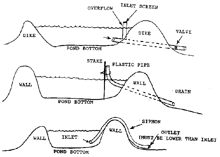
Figure 3.11 Outlet Works for Small
Irrigation Pond
The walls and floor are best made of a mixture of sand and clay. If the soil is of a sandy or sandy loam texture, clay or other lining materials must be used. If clay is hard to come by, a 15 cm layer of sand/clay mixture (at least 20% clay) may be laid on the bottom of the pond and used as a core in the side walls (see Figure 3.12.) In all cases, the soils should be well compacted to ensure that leakage is held to a minimum.
Waterproof linings made of plastic, vinyl, or butyl rubber may be used. These can be expensive, however, and, if not properly installed, can quickly develop leaks. All of these linings should be laid over a smooth bed and have an earth cover of not less than 15 cm (at least 8 cm of material not coarser than sand). Keep livestock out of the pond to prevent puncturing the lining. Linings should be overlapped 15 cm at the seams. All vegetation and roots of woody vegetation should be cleared to prevent the plants from breaking through the lining. Polyethylene plastic should be laid out with 10% slack.
The side slopes of the inside of the pond should be no steeper than 3 to 1 on the inside (water side) of the bank and 2 to 1 on the outside banks. Top width for ponds up to 3 meters in height should be a minimum of 2 meters to assure stability.
The freeboard, or distance between the maximum expected high water and the top of the berm (a berm is the wall of a pond), for small ponds of less than 3 meters in height and 1 acre (0.4 hectares) in size can be 60 cm.
The spillway should not allow water to come closer than 30 cm from the berm during periods of overflow.
If water has a significant amount of silt in it, a desilting pond may be necessary for removal of sediment before the water enters the storage pond.
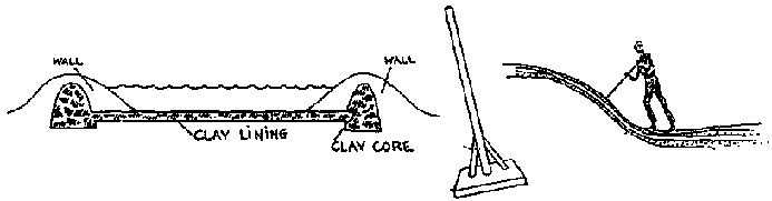
Figure 3.12 Lining and Compaction
of Irrigation Pond (Ref.
7)
3.5 Pumps and water lifting devices
Human and animal-powered water-lifting devices have been in use for thousands of years. These water-lifting devices have been used to provide water for irrigation as well as for drinking and other uses. More recently, machine-powered pumps have become the primary means of lifting water from wells and surface water sources.
The use of hand-dug wells as a source of water for irrigation also dates back several thousands of years. Hand-dug wells are still an important means of securing a reliable source of water in many developing countries. Hand-dug wells, however, are generally limited to areas where the water tables are within 20 meters of the ground surface. Modern well drilling technologies now permit wells to be drilled to several hundred, and even thousands, of feet in depth.
The design, construction, and use of deep wells requiring the application of modern technology is beyond the scope of this manual. Some basic concepts about shallow and deep wells, however are presented to allow the Volunteer to gain a basic understanding of types of wells and their characteristics. Hand-drilled wells and driven (sand point) wells are low-cost and appropriate technologies for many applications where water tables are shallow. These methods are presented in some detail. Other wells drilling methods that require the use of costly commercial drilling techniques and higher technologies are described very superficially. The Volunteer should consider these technologies where appropriate and can read a number of references for greater understanding (See Ref. 13). Design and construction of these wells should be left to the experienced engineer and/or commercial water well contractor.
The selection, design, construction, and maintenance of pumps to provide water from deep wells should be done with the assistance of experienced engineers and well installers. Basic concepts required for the selection, installation, and operation of some pumps and water lifters that can take water from streams, ponds, or shallow wells, are presented in this section. (Extensive information on the use of human and animal-powered water lifters is included in Refs. 28, 58, and 59.)
3.5.1 Types of pumps
The type or kind of pumping system selected depends upon many factors, including (1) the total dynamic head (TDH) or pumping lift; (2) the required discharge (Q); (3) the source of available energy; and (4) the operating conditions.
The use of mechanical power and modern pumps makes possible the lifting of large quantities of water to considerable heights.
The supply of oil and electricity have made modern pumping economically feasible. Worldwide energy shortages have recently caused concerns in countries where fuel oil must be imported. Man and animal pumps are still used in some areas where irrigation is primarily associated with subsistence agriculture. Several types of hand and animal powered pumps are illustrated in Figures 3.13 through 3.25.
3.5.2 Pumps powered by humans and animals
The simplest form of a manual lifting device is the water bucket or scoop used to lift water from shallow wells, reservoirs, or canals. The use of a bucket, rope, and roller or pulley increases the possible lift and allows the lifter to use his weight to assist in pulling down. Animals have also been used in some countries.
Labor costs of human powered irrigation are high unless there is no alternative demand for the labor supply. Where crop failure may result in serious malnutrition, the use of human and animal pumps for irrigation may be necessary.
3.5.3 Animal-powered pumps
Animal power has long been used for water lifting. Animals in good condition can develop about 0.10 HP per 100 kg of body weight. A 1,000 kg horse produces approximately one horsepower. Many different systems are used.
When animals are used for lifting water, the cost of owning and feeding them must be included in the cost of pumping water. A major problem in the use of manual and animal lifting devices for irrigation is the small amount of water that can be pumped. Irrigated areas are generally limited to garden-size plots of less than one-fourth hectare and very shallow lifts.
3.5.4 Mechanically driven pumps
Pumps powered by mechanical means other than man or animal can be classified as positive displacement pumps or variable displacement pumps. Positive displacement pumps (piston pumps, diaphragm pumps, gear pumps, screw pumps) are seldom employed for irrigation and will not be discussed in this manual.
Variable displacement pumps include the centrifugal, mixed flow, turbine, propeller and jet pumps, and the hydraulic ram. The first four of these are commonly used for irrigation.
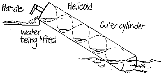
Figure 3.13 Archimedean Screw
(Ref. 28)
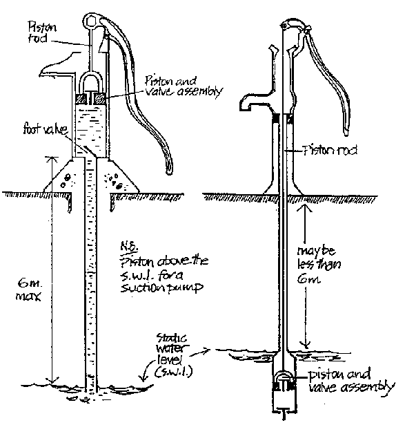
Figure 3.14 Hand (Piston) Pumps
(Ref. 28)
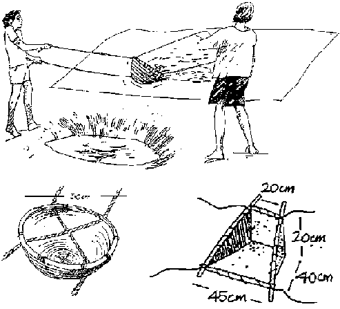
Figure 3.15 Swing Baskets (Ref.
28)
Wicker swing basket of average capacity 8 litres.
Swing basket made from metal sheets

Figure 3.16 eater Scoop (Ref.
28)
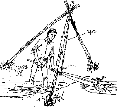
Figure 3.17 Suspended Scoops
(Ref. 28)
Figure 3.18 Noria: (Ref. 58) (a)
With Fixed Buckets, Driven by Currents
Figure 3.18 Noria: (Ref. 58) (b)
With Larger Paddles
Figure 3.18 Noria: (Ref. 58) (c)
With Moveable Buckets
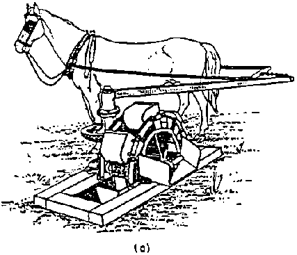
Figure 3.19 Modified Persian
Wheel or Zawafa (Ref. 58) (a)
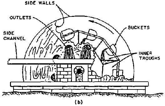
Figure 3.19 Modified Persian
Wheel or Zawafa (Ref. 58) (b)
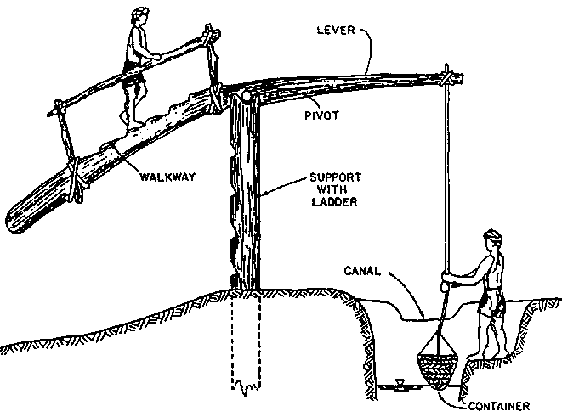
Figure 3.20 Picottah, Using Man as
Moveable Counterweight
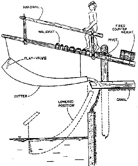
Figure 3.21 Picottah style Doon
with Flap Valve (Ref. 58)
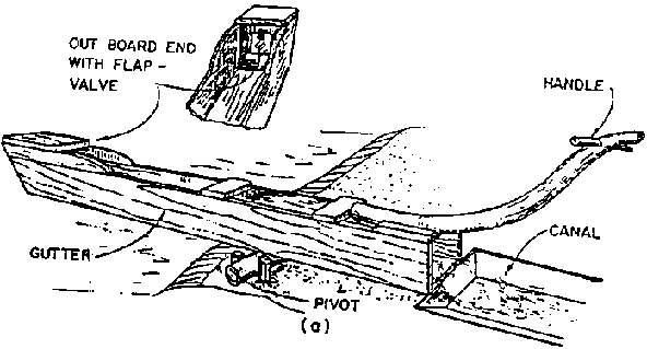
Figure 3.22 Gutters: (Ref. 58)
(a) Single with Handle
Figure 3.22 Gutters: (Ref. 58)
(b) "See-Saw"
Figure 3.22 Gutters: (Ref. 58)
(c) Modified to Increase Capacity
Figure 3.23 Modifications of the
Doon (Ref. 58) (a)
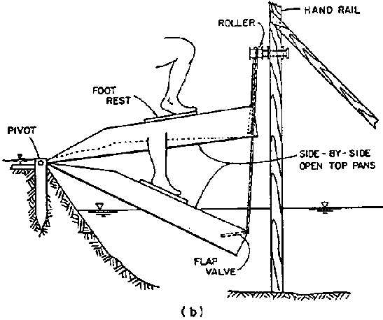
Figure 3.23 Modifications of the
Doon (Ref. 58) (b)
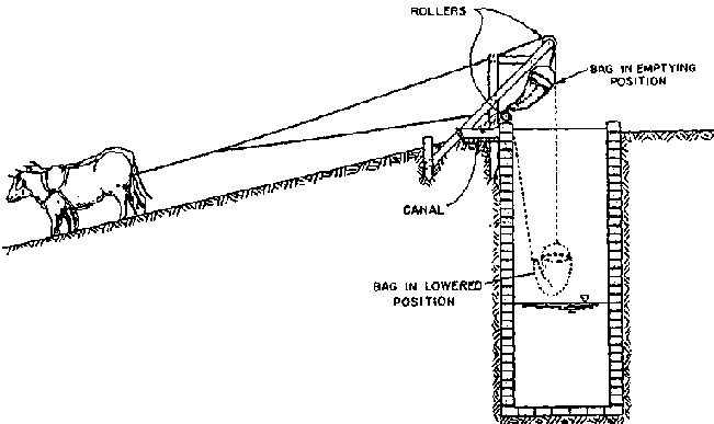
Figure 3.24 Self- Emptying Not
with Inclined Tow Path (Ref. 58)
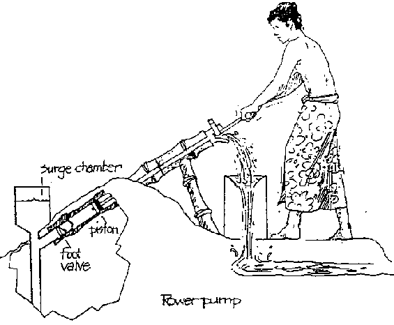
Figure 3.25 Rower Pump (Ref.
28)
Each type of pump has advantages for a given set of conditions, such as suction lift, total lift, discharge, efficiency of operation, and cost. Pumping systems (combinations of pump motor and accessories) need to be designed or selected for the range of conditions expected under normal operation.
3.5.5 Centrifugal pumps
In centrifugal pumps, water enters the center of the impeller (Figure 3.26), is picked up by the vanes, and accelerated to a high velocity by rotation of the impeller. The water is forced to discharge into the casing, where much of the velocity energy is converted to pressure. When water is forced away from the center, or the "eye" of the impeller, a vacuum is created and atmospheric pressure pushes more water in.
Centrifugal pumps are available in a wide range of sizes and flow rates and can be used for both low and high head or pressure applications. Centrifugal pumps are recommended for pumping from rivers, lakes, canals, and wells. Usually, but not always, the pump is located above the water source.
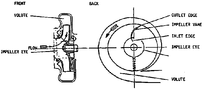
Figure 3.26 Components of a
Centrifugal Pump (Ref.
20)
3.5.6 Propeller or axial flow pumps
Propeller pumps are usually selected for pumping large volumes of water against relatively low (lifts) heads. Capacities range from 40 to 6,000 L/s (liters per second). Total dynamic head (TDH), which is pump lift plus friction losses, is usually from 1 to 2 meters but not more than 10 meters under certain design conditions. As the term "axial flow'' implies, the impellers lift the water and push it forward perpendicular to the plane of rotation, or parallel to the axis.
3.5.7 Mixed flow pumps
Mixed flow pumps both lift the water and accelerate it. Mixed flow pumps are used for intermediate lifts over a wide range of flow rates. Most mixed flow pumps are installed where head requirements do not exceed 15 m, although they are available for heads ranging from 6 to 25 m. Capacities vary from 40 to 6,000 L/s.
3.5.8 Turbine pumps
Turbine pumps are centrifugal pumps used in shallow to deep well applications. A turbine pump is designed so that it can be easily multistaged, developing several times the pressure obtained from a single stage pump. Deep well turbines are usually multistage types - that is, the turbines (impellers) or "bowls" are placed directly above each other. Each turbine picks up the flow and boosts, or increases, the pressure, thus making it possible to lift the water to higher elevations. Turbine pumps can be designed for discharges of less than one liter per second to more than 600 L/s. Deep well turbines are either installed with a motor at the surface, utilizing a long drive shaft, or with a submersible electric motor installed below the various stages of impellers. The submersible motor is often selected if the well has a crooked bore, if the drive shaft would be excessively long, if there is danger of flooding at the surface, and where economy and initial cost are favorable. A summary of pump types is given in Table 3.3.
TABLE 3.3 A Summary of the Type of Pump Needed to Meet various Pumping Conditions (Ref. 20)
|
Condition |
Pump Type |
|
A. Low to high lift, suction not exceeding 4 to 4.5 m, and low to moderate capacity. |
Centrifugal (end suction) |
|
B. Low lift and large capacity. |
Propeller or axial flow |
|
C. Low to moderate lifts and moderate to high capacities. |
Mixed flow |
|
D. Deep well with high lift over wide range of capacities (usually low to moderate). |
Deep well turbine(semi-enclosed or enclosed multiple-stage impellers) |
Centrifugal pumps in end section and deep well turbine configurations are illustrated in Figure 3.27
3.5.9 Sources of power
The kind of power used to pump or lift water depends to a large extent upon cost, availability, and the amount of water to be pumped. Countries that do not have, and cannot afford, an adequate supply of mechanical energy may use man and animal power. (Both of these require energy in the form of food or fodder.) Wind and solar power have been used to pump small amounts of water. These sources of power will probably increase significantly in use as technology improves.
Table 3.4 is a comparison of various energy sources. Note that a liter of fuel provides about the equivalent energy of three to five person days of work. A person's output is about 0.08 to 0.10 horsepower (HP) and, when pumping water, the overall efficiency is about 60 percent; therefore, the usable horsepower a person can develop is about 0.05. If water is pumped to a height of 4 meters, three people, working continuously during the growing season in 8-hour shifts each, could pump 1 liter per second, which is taken as the normal maximum irrigation requirement for general crops other than rice for one hectare in many parts of the world.
Where large amounts of water are to be pumped to higher elevations, mechanical pumps are necessary. Gasoline engines are suitable for small commercial developments. Diesel engines, however, are used for most commercial pumping operations where electricity is not available. Diesel engines are usually more economical than other internal combustion engines and have a longer life. Gasoline engines, including tractors, are more expensive to operate than diesel. They are lighter in weight, however, can be more easily moved, and are adaptable to many conditions where not more than 15 to 20 HP is required.
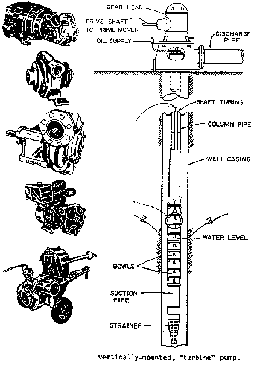
Figure 3.27 Pump Types and
Configuration.
TABLE 3.4 Comparative Costs to Pump 1,000 Cubic Meters of Water to a Height of 2 Meters (Ref. 20)
|
Energy |
Energy |
|
Energy or Fuel |
Time |
Costs | |
|
Source |
HP |
KWH |
Energy Units |
Required |
Required |
(U.S. $) |
|
Human |
0.09a |
0.32b |
person-dayc |
16.90 person-days |
8 hrs |
$84.50g |
|
Animal |
0.10e |
1.79f |
per day/100 kg weight |
3.04 animal-days |
8 hrs |
$91.20g |
|
Diesel |
9.12h |
6.82 |
liters |
3.12 liters |
1 hr |
$ 0.82i |
|
Gasoline |
9.12h |
6.82 |
liters |
4.07 liters |
1 hr |
$ 1.36j |
|
Propane |
9.12h |
6.82 |
liters |
5.16 liters |
1 hr |
$ 1.08k |
|
Electric |
9.17h |
6.82 |
KWH |
6.82 KWH |
1 hr |
$ 0.61l |
a In this table, a person is assumed to produce 0.09
HP.
b 0.09 HP  0.746 KW/HP
 8 hr/day
  60%
eff. = 0.32 KWH
60%
eff. = 0.32 KWH
c 8 hours
d Labor costs of
$5.00/person per day
e Assumes 0.10 HP per 100 kg of animal
weight
f 500 kg animal  0.10
HP/100 kg
0.10
HP/100 kg  0.746 KW/HP
  8 hrs/day
  60% pump;
efficiency = 1.79 KWH
60% pump;
efficiency = 1.79 KWH
g $30.00 per animal/day
h Pump
efficiency 80%
i Diesel fuel at $0.26/liter
j
Gasoline at $0.33/liter
k Propane at $0.21/liter
l
Electricity at $0.09/KWH
The electric motor can be a fraction of horsepower or of many thousands of horsepower. Smaller sizes are usually single phase, while above 3 HP horsepower, motors are normally 3-phase. The initial cost is usually lower than for other motors. Costs of operation and maintenance are low, and they have a long and useful life. Electricity has often been considered the ideal source of energy, and electric motors are suitable for all sizes of installation, from very small to very large. There is much variability in cost and dependability of electrical energy, however, and availability, dependability, and uniformity of the electric power need to be considered. Voltage fluctuations can damage a motor. Power outages during critical periods can result in serious loss of crop production.
Wind has historically been an important source of power, particularly for domestic and livestock water. Wind velocities are not significant in many interior valleys. Conditions are more favorable on hill tops along coastal plains and on islands. Generally, the velocity increases with elevation above a base that breaks the wind. Costs of constructing windmills increase exponentially with the height of the tower. Windmills can pump water for garden-size plots if sufficient wind is available.
Water provides the lifting power for some irrigation projects and small enterprises. The noria (Fig. 3.18) or water wheel is a cheap and economical means of lifting water up to 3 or 4 meters (10 or 12 feet) above the water surface of a river or small stream. A large metal wheel welded onto a wheel from an old automobile, operating on its original bearings, is inexpensive and effective. In some developing areas, the use of pumping projects organized as small cooperatives has largely eliminated the use of both human and animal power.
3.5.10 Selection of pumps and power units
The selection of pump and power units depends upon several factors, including:
· amount of water to be pumped;
· the operating efficiencies (this includes the efficiencies of individual components such as impellers, gearheads);
· the pumping head (lift and/or pressure requirements);· horsepower requirements;
· available energy (e.g. electricity, gasoline, diesel);
· cost and returns on investment; and
· the size of farm, type of irrigation, and the available labor supply.
Pumps are usually designed for a specific set of operating conditions. A significant departure from these conditions decreases efficiency; therefore, the pump must be operated at or near the design values.
In designing a pumping system, it is best to plan activities so that the pump operating conditions will be as constant as possible and that changes in water requirements will be compensated by increasing or decreasing the hours of pump operation.
3.5.11 Amount of water to be pumped
The amount of water to be pumped depends upon crop water requirements, the area to be irrigated, and the irrigation efficiency. The size of the pumping plant needed depends upon the amount of water required and the time that will be devoted to pumping.
The most economical use of investment capital is to select a pump for continuous operation. In irrigated agriculture, however, pumps are usually designed and operated continuously only during peak crop water requirements. During other growing stages, the pump is operated at intervals to meet crop water use. Some irrigators prefer to irrigate only during daytime hours. In the design of a system, the decision should be made so as to economize both labor and pumping plant costs.
A first approximation of the size of the pumping plant needed can be made by assuming that, for maximum crop growth, the plants will require an application equivalent to one liter per second per hectare (1 L/sec/ha), or 6.4 gpm/acre (gallons per minute/acre) of continuous pumping. This assumes that rainfall is negligible. Another rough estimate is that crop water requirements during the growing season are seldom less than 3 mm per day (0.12 inches per day) and usually will not exceed 8 mm per day (0.32 inches per day) during maximum use.
The amount of water a pump must deliver can be calculated from the continuity equation:
Qt = 28ad (metric)
where
Q = required pump discharge in liters/second
t = time in hours
a = area in hectares
d = desired irrigation depth in centimeters
and, in the English system, approximately by
Qt = ad (English)
where
Q = cubic feet/second (cfs)
t = time in hours
a = acres
d = inches
Note that in the metric system a pump discharge of 1 liter per second will cover one hectare to a depth of 8.64 mm in 24 hours, or 0.36 mm per hour. In the English system, 1 cfs will cover 1 acre to a depth of 1 inch each hour.
3.5.12 The pumping lift or head
The total pumping lift or amount of pressure that a pump must develop to force the water through pipes, sprinklers, etc., and to the desired elevation is referred to as "head" or total dynamic head (TDH). The relationship, if water were standing-in a vertical pipe, is
| |
Head | |
Pressure |
|
English system |
100 feet |
= |
43.3 psi |
|
Metric system |
100 meters |
= |
10 kg/cm2 |
Figure 3.28 shows a typical pump installation for a centrifugal pump drawing water from a canal or pond and discharging through a sprinkler system.
The total dynamic head (TDH) is a measure of the energy per unit weight added to the pumped water by the pump, and is the sum of the changes in pressure, elevation, and velocity heads between the pumping water level in the well and the point of discharge, along with any friction losses between the two points.
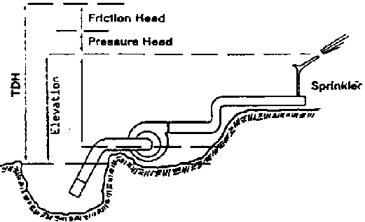
Figure 3.28 Diagram of a
Centrifugal Pump Installation Showing Head and Lift Concepts
Total dynamic head must be determined as accurately as possible in order to design a pump. The TDH in Figure 3.28 can be determined as follows:
TDH = hp + hz + hv + hf
where:
hp = pressure head. This is usually the pressure required at the discharge point, eg., to force water out through sprinklers.
hz = elevation head. This is the difference in elevation between the pumping water level and the point of discharge or the point at which hp is measured. The pumping levels should be determined while the pump is running and after the pumping levels have stabilized. In pumping from a reservoir or stream, the pumping water level may stabilize immediately. In pumping from a deep well, the pumping level may not stabilize for several hours. In measuring pumping water levels in deep wells, electric sounders, air lines, or other methods may need to be used.
hv = velocity head. This can be visualized as the vertical distance water would flow out of the end of the pipe as a result of its velocity. It is given by the equation:

g is the acceleration of gravity (32.2 ft/sec2 in English system, 9.8 m/sec2 in metric system).
Because of friction losses, possible water hammer and other structural damages may occur, and the velocity in most irrigation pipes should be kept below 2 m/see (7 ft/sec). Therefore, the velocity head is minimal. It is usually negligible when estimating TDH and thus is not even accounted for.
hf = friction head. This is the pressure or head that the pump must produce to overcome friction, i.e., the loss that occurs as water "rubs" against pipe walls and fittings.
Example: Determine the required TDH for a centrifugal pump as shown in Figure 3.28. Q = 411 m3/hr (1811 gpm); v = 2 m/see (6 ft/sec).
| |
Metric |
English |
|
Elevation at discharge |
933.00 m |
3061.00 ft |
|
Elevation at pump |
922.00 m |
3024.00 ft |
|
Elevation at water surface |
919.00 m |
3015.00 ft |
|
Pressure head (32 psi) |
22.50 m |
73.90 ft |
|
Friction head |
| |
|
(18 in. Suction, elbows, etc., 20 ft.) 0.01 m |
0.03 ft | |
|
(16 in. Diameter, 1,000 ft) 1.16 m |
3.80 ft | |
|
Velocity head (v = 2 m/see, or 6 ft/sec) | |
|
|
|
0.20 m |
0.56 ft |
|
hz = discharge head + static suction | |
|
|
lift = (3061 - 3024) + (3024 - 3015) = |
14.00 m |
46.00 ft |
|
TDH = hz + hp + hf + hv | | |
|
Metric = 14 + 22.5 + 1.17 + 0.2 |
7.90 m | |
|
English = 46 + 73.9 + 3.83 + 0.56 | |
24.30 ft |

3.5.13 Horsepower and efficiency
The power output (energy per unit time) of a pump is the energy that the pump provides to the water in the form of discharge and head. This quantity is called water horsepower (WHP). With discharge, Q. in gpm, and TDH in feet, the equation is:

If Q is in L/sec, and TDH is in meters, m, the equation is:

The power needed at the output shaft of the power unit to run the pump is called brake horsepower (BHP) and is determined by the WHP and the pump efficiency (Ep). For Ep expressed as a decimal fraction, the equation is:

The efficiency given in the manufacturer's pump characteristic curves is the laboratory efficiency. It is determined for a new pump under closely controlled conditions. Minimum length of column and pump shaft is used, and impellers are adjusted for ideal clearance. Ep in a field installation is usually several percentage points lower than the efficiency in the manufacturer's pump curves. A value of 70%, or Ep = 0.7, should generally be the minimum acceptable for new pumps that are directly coupled to an electric motor, even though theoretical values could be near 80% (Ep = 0.8).
A right angle gearhead will usually have an efficiency (Kg) of about 95%. If the power from either an electric or internal combustion engine is transmitted to the pump through a gearhead, the efficiency of the transmission device must be accounted for in determining the horsepower requirements as follows:

Example: For the previous example, Q = 411 m /fur, or 114 L/sec (1811 gpm), and TDH = 37.9 m (124.3 ft). If a pump with Ep = 0.70 will be powered by either a diesel gasoline engine or electric motor through a gearhead with Eg = 0.95, what size of engine or motor will be needed?
WHP = (11437.9)/76 (metric) = 57, or
WHP = (1811 gpm
124 ft)/3960 (English) = 57
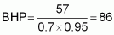
3.5.14 Pump characteristic curves
The amount of energy (head) a pump will add to a given discharge of water, the pump required, and the efficiency are all measured by laboratory testing. The results are displayed on a diagram known as a "pump characteristic curve." An example of a typical characteristic curve is shown in Figure 3.29 for a centrifugal pump. A pump that operates near the flattest portion of the efficiency curve should be selected so that a small change in conditions will not significantly change the pump efficiency.
The total head (TDH) that a pump will develop is plotted on the graph versus the pump discharge. Often more than one curve is shown. Each curve is for a different sized impeller or rotation speed. The efficiencies at which the pumps will operate under various conditions, together with the required brake horsepower curves, are superimposed over the other curves. In Figure 3.28, the total dynamic head for which the pumps would be designed would be the head required to lift the water from its source through the pipe and sprinklers or into the ditch as shown. In the example, it was 37.9 meters (124.3 ft) at 114 L/sec (1811 gpm).
After the required discharge (Q) and TDH are determined, a search is made through a manufacturer's pump curves to find the pump with a high operating efficiency that meets these conditions. In Figure 3.29, a pump with 13.75 inch impellers, operating at 1750 RPM, with an efficiency of 80%, meets the requirements of the previous example.
The calculated BHP at a pump efficiency of 80% is:

The operating efficiency of a pump in the field is generally lower than that given in the catalogs. Thus, a 75 HP direct couple (no gearhead) motor would probably operate quite satisfactorily, unless bearing, shaft, and other mechanical losses were high.
3.5.15 Power source and power Costs
To estimate precisely the cost per hour of pumping, one would need to measure the energy consumption of an engine or electric motor under normal operation. One would then need to multiply this consumption by the cost per unit of energy consumption. For new pumping plants that are properly designed, one can estimate what the cost per hour of pumping will be if one knows the required BHP and the cost per gallon or liter of fuel, propane, or diesel. For electric units, one needs to know the cost per kilowatt hour (KWH). The basic equations are:
Diesel. Gasoline. Propane (see Table 3.5)

Example: With gasoline at $0.30/liter, and with 100 BHP required, what will the per hour costs be?

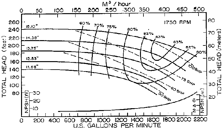
Figure 3.29 Pump Curve
Electric (Assume electric motors are about 85% efficient)
$/fur = BHP required0.85
cost per KWH
Example: With electric power rates at $0.07/KWH, and 100 BHP required, what will the per hour costs be?
$/fur = 100x.85  $0.07 = $5.95
TABLE 3.5. Performance Standards for Engines (Adapted from University of Nebraska Tractor Tests) (Ref. 20)
|
Energy |
Brake Horsepower Developed | |
|
Source |
BHP-Hr/$ U.S. Gal. of Fuel |
BHP-Hr/Liter of Fuel |
|
Diesel |
14.75 |
3.90 |
|
Gasoline |
11.30 |
2.98 |
|
Propane |
8.92 |
2.36 |
3.5.16 Pump location
The physical location of the pump in relation to the water level in the sump (well, reservoir, pond) from which water is being pumped is critical. If the pump is too high, cavitation may occur. The liquid is pulled apart as it goes through the impeller, causing vapor pockets that collapse after they have passed the impeller. This process, called cavitation, can destroy a pump or cause it to deteriorate rapidly. The pump may operate very inefficiently. If the pump is too high above the water surface, it may also lose its prime.
The height or distance that a pump can be located above a water surface varies with elevation above sea level, properties of the water, friction loss in the suction pipe, and the net positive suction head requirements of the pump.
Net positive suction head (NPSH) is the head that causes water to flow through the suction pipe into the pump. NPSH required is the suction head (pressure) required at the inlet of the impeller to ensure that the liquid will not boil or form vapor pockets that result in cavitation. NPSH required is a function of the pump design and is supplied by the manufacturer (e.g., Figure 3.29). It varies between different makes of pumps and the capacity and speed of any one pump.
NPSH available represents the pressure head available to force the liquid into the pump impeller and is a function of the system in which the pump operates. It determines how high a pump can be located above a water surface and can be calculated for any installation. To operate successfully, any pump installation must have an available NPSH equal to or greater than the required NPSH at the desired pump condition. Thus:

To calculate how high above or below the pumping water level the impellers may be located, consider the following:
PL = atmospheric pressure - NPSH required - friction losses in suction - vapor pressure.
If PL is positive, the pump may be set above the pumping water level a distance PL.If PL is negative, the pump must be set a distance PL below the pumping water level.
Example - for the pump with impellers from Fig. 3.29:
|
Discharge |
408.6 m3/hr (1800 gpm) |
|
Friction loss in suction pipe |
1.16 m (3.8 ft) |
|
Elevation of pump |
930 m above sea level (3061 ft) |
|
NPSH required |
4.86 m (16 ft.) |
|
Water temperature |
15.6°C (60°F) |
|
Vapor pressure of water at 60°F: |
0.17 m (0.57 ft) (Appendix A) |
|
Atmospheric pressure at 3000 ft: |
9.26 m (30.4 ft) (Appendix A) |
|
NPSH available = 9.26 m - (suction lift + 1.16 m + 0.17 m) = 3.06 | |
Solution: PL = 9.26 m - 4.86 m - 1.15 m - 0.17 m = 3.08 m
This is also shown graphically in Figure 3.30. Thus, the static suction lift (height of pump above the pumping water level) cannot be greater than 3.08 m. In practice, stormy conditions can reduce atmospheric pressure by more than 10% at times. Therefore, to assure good pump operation and prevent cavitation, the pump may need to be placed as much as 0.6 m to 0.9 m (2 to 3 feet) lower than the NPSH would indicate at normal atmospheric conditions. For this reason, the static suction lift should be 2.1 m to 2.4 m (7 to 8 feet).
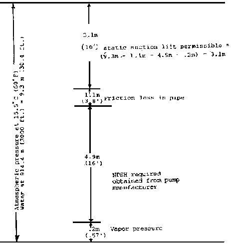
Figure 3.30 Graphical Solution of
NPSH (Ref.
20)
3.5.17 Pump installation
Figures 3.31 and 3.32 show a top and side view of a recommended pump installation when pumping from a sump. Figure 3.33 shows a recommended installation when pumping from a well.
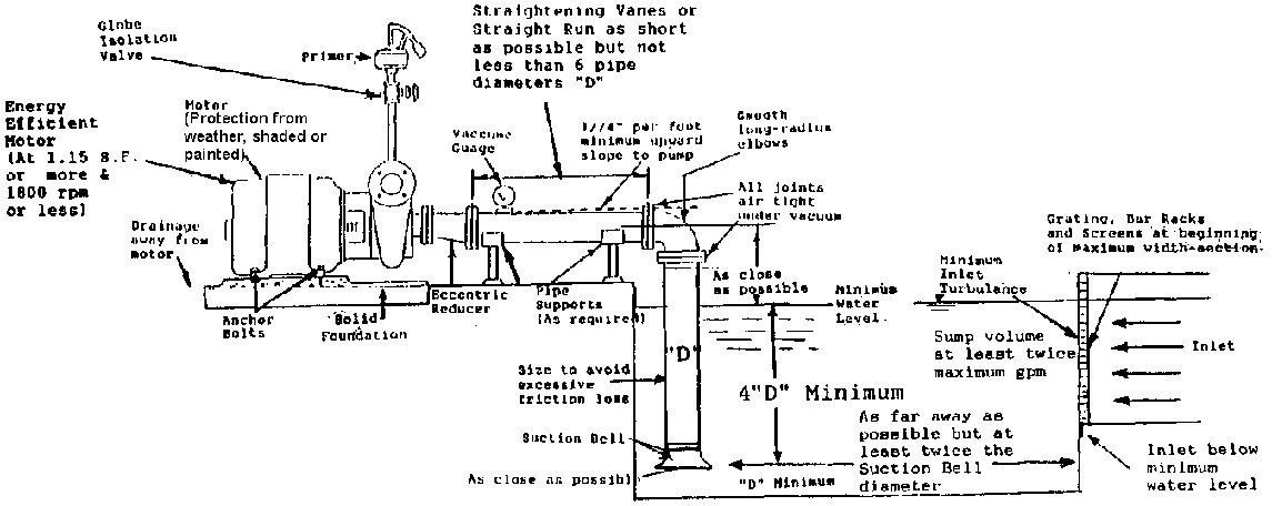
Figure 3.31 Recommended Pump
Installation - Side View (Ref. 54)
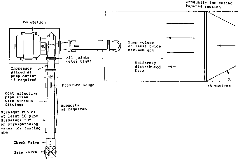
Figure 3.32 Recommended Pump
Installation - Top View (Ref. 54)
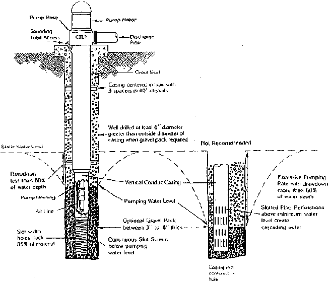
Figure 3.33 Recommended Pump
Installation (Turbine) (Ref. 54)
Suction Pine Design
When pumping water from a sump, the proper design of the suction pipe is essential to good pump performance. If a centrifugal pump is designed with a suction pipe that is too long, with too many bends, or too small a diameter, cavitation and poor pump performance may result, much the same as if the pump is located too high above the water surface.
Another critical factor in the suction pipe design is the potential for entrapped air. Improper design can result in "high spots" in the suction piping that trap air and either decrease capacity or periodically permit large air bubbles to enter the pump. The pump may lose its prime, not operate at expected efficiency, or give somewhat erratic discharge and pressure increases. Remember that the suction line is generally under negative pressure, and air release valves cannot be used to remove air.
Improper approach just upstream of the pump entrance may cause flow to enter the pump with spiral velocities or non-uniform flow profiles. The pump will not perform efficiently at the design flow if the water is spiralling.
The guidelines for suction pipe design are formulated with these potential problems in mind. The closer the designer can follow the guidelines, the more trouble-free his or her pumping system will be.
The following recommendations apply to suction pipe design:
1. Keep velocity as low as possible. This is accomplished with larger diameter suction pipe.2. Avoid bends in the suction pipe but, if bends are necessary, use long radius bends.
3. Keep suction pipe horizontal or continually sloping upward towards the pump. Avoid high spots in the line.
4. If suction pipe is to be reduced in diameter as it enters the pump, use a reducer of a length at least twice the diameter of the small pipe.
5. If the reducer is in a horizontal portion of the pipe, an eccentric reducer, placed with the flat side up, should be used. If a conventional reducer is used, the pipe must be inclined sufficiently to prevent air entrapment.
6. Make sure the joints in the suction pipe are well sealed, otherwise difficulty in pumping will be experienced and air will continually be sucked into the system.
7. Ideally, a straight pipe eight diameters in length just upstream from the pump suction inlet should be used to provide uniform, non-spiralling flow.
8. Suction pipe should be of equal or greater diameter than the pump suction connection.
9. Do not use screens on suction pipe inlet, as they may clog and reduce flow and pressure at impeller inlet. Screens should be placed at some distance from the suction pipe.
10. Use a streamlined suction bell at the inlet of the suction pipe if possible. If not possible, use an inlet that minimizes friction loss.
In summary, keep suction pipe velocities low, minimize bends and friction losses, avoid high spots, and direct the flow into the suction side of the pump with a uniform, non-spiralling flow.
3.5.18 Turbine and propeller pumps
In general, turbine and propeller pumps are used in situations where no suction piping is required. They are usually placed in a pumping pit with the pumps submerged, so no suction pipe is necessary. As a result, they are generally supplied with a suction bell attached to the bottom of the pump. No suction pipe design is required.
If these types of pumps are to be installed in a situation that would require suction pipe, the same guidelines for design as were advised for centrifugal pumps would be used.
3.5.19 Intake structures
Geometry and Positioning
Intake structures, pumps, or pits should be designed to supply an evenly distributed flow of water to the suction bell to prevent vortices that introduce air into the pump, reducing capacity and efficiency. Water should not flow past one pump to reach another pump. The suction bell(s) should be as close as possible to the back wall and not less than the suction bell diameter above the bottom of the sump. False back walls should be installed when the location of driving equipment prevents normal positioning. Centering pumps in the sump leaves large vortex areas behind the pumps. Figure 3.34 shows a top view of a recommended sump design when pumping from a canal, stream, or lake.
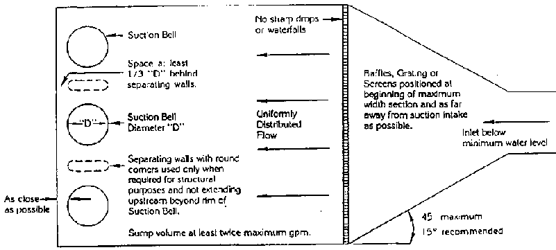
Figure 3.34 Recommended Sump
Design for Installation of one or More Pumps (Ref. 54)
Inlet
The sump inlet should be designed with gradually increasing tapered sections, as shown in Figure 3.34. Abrupt changes in size from inlet to sump can cause turbulent, cascading water and a vortex effect, which can cause uneven operation of the pump, air entering the pump, or a vacuum effect, all of which can cause excessive wear on the pump.
The sump inlet should be below the minimum water level and as far away from the pump suction as the sump geometry will permit. No sharp drops or waterfalls should be permitted. The flow should not hit directly on the pump suction, or enter the sump in such a way as to cause rotation of water in the sump.
Protective Screens
Protective screens should be provided whenever there is any possibility of debris entering the pump (or pipe and sprinklers). Screens must be cleaned frequently to allow water to pass through to the pump easily.
Sump Volume
The usable sump volume in cubic meters should equal or exceed twice the volume pumped in one minute. This ensures adequate size to dissipate inflow turbulence.
3.5.20 Minimum water level
Minimum water level should be adequate to satisfy the particular pump design requirements to prevent cavitation, but suction submergence ought never be less than four times the diameter of the suction pipe (not the bell).
Some examples of pumping plant installations for pumping from streams, ponds, or shallow wells are provided in Figures 3.35 and 3.36.
3.5.21 Typical pump design
As stated before, a pump should be designed for the maximum crop water requirements and possible operational changes, such as a declining water table. Decreasing efficiency should be anticipated and provided for.
Listed below are typical designs:
1. Centrifugal pump - conditions:
a. Pumping from a river or reservoir into a canal at a higher elevation.b. Area to be irrigated 2 hectares (4.9 acres).
c. Elevation 912 meters (3000 feet).
d. Irrigation efficiency = 67%, including conveyance losses.
e. Maximum monthly crop ET in July of 206 mm with no rainfall, or an average of 6.65 mm/day average continuous flow:
Irg = Irn/Ea
Ec = 6.65/.67 = 9.9 mm = 1 cm
from QT = 28 a d: Q = 28
2
1/24= 2.31 L/s (37 gpm)
f. Vertical distance from pump to canal (discharge head) = 62 meters (204 feet).
g. Vertical distance from water level to pump inlet = 3 meters (10 feet).
h. Friction loss = 2 meters (6 feet).
Figure 3.35 Designs of Centrifugal Pump Installations
PUMPING FROM A STREAM OR POND
Irrigation can be accomplished by pumping from ponds and streams if the lift is not too great. A small horizontal centrifugal pump set not higher than 10 feet above the water and powered by a gasoline engine is the equipment ordinarily used. Pumps of this type are made in sizes which will deliver from 30 to 1,000 gallons or more per minute.
PUMPING FROM SHALLOW IRRIGATION WELLS
Along river bottoms where the ground-water level is permanently within 10 feet or /055 from the surface, small irrigation wells may be successfully used for the irrigation of farm land. Casings for such wells are ordinarily made from sheet metal slotted to permit water to enter. In some instances old range boilers with the ends cut out are welded together and slotted with a welding torch Small centrifugal pumps set at the ground surface are quite satisfactory
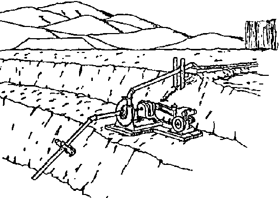
PUMPING SYSTEM FROM STREAM OR POND
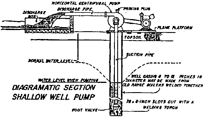
DIAGRAMMATIC SECTION SHALLOW WELL
PUMP
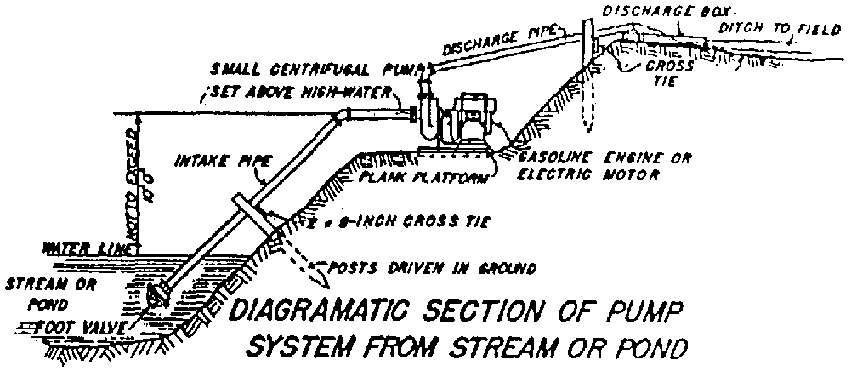
DIAGRAMMATIC SECTION OF PUMP SYSTEM
FROM STREAM OR POND
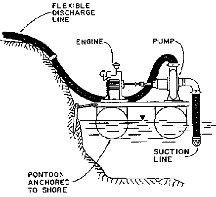
Figure 3.36 Pump and Driver
Mounted on Pontoon in Water Supply (Ref.
58)
3.5.22 Size of pumps


If the pump is powered by an electric motor, a 3 BHP direct coupled motor would probably be selected.
If an internal combustion engine (diesel or gasoline) were used, a gearhead would probably be used to transmit the power and the operating conditions could be obtained by throttle adjustment.
In this case, the motor will also have to overcome losses at the gearhead.
The Peace Corps Volunteers working with irrigation need not be experts on pumps. They must know, however, the fundamentals of design, installation, and maintenance. This will enable them to provide the basic specifications to the supplier and supervise the installation. A pump supplier can provide the correct pump and accessories if provided with information on the flow, head required, the power source to be used, and the configuration for installation. The technicians (irrigation specialist) should in all cases demand that the pump curves and maintenance instructions come with the pump. Often, the pumps in stock are not the correct ones, and the Volunteer should not settle for pumps that are extremely oversized or undersized or which do not operate with good efficiencies.
3.5.23 Costs
In considering the economics of any pumping system, all costs and benefits should be included. Initial or capital investment costs are important because they are usually high, and the purchaser is often required to finance this capital investment by obtaining a loan. The best measure of the economics of a system is to compare the annual costs with the annual returns.
Annual costs should include:
· interest, depreciation, insurance, and taxes,
· repairs and maintenance,
· operating costs (energy),
· irrigation labor costs, and
· production and fixed costs.
The expected life of various components used in pump irrigation is included in Appendix B. In irrigation by pumping, the annual energy and maintenance costs may be significantly higher than the amortized capital costs. Therefore, it is extremely important that good estimates of these costs be made before a pumping plant is purchased.
3.5.24 Evaluation of pumping plants
Proper design of pumping plants is only the first step to successful operation. Equipment that is expected to last 10 to 20 years requires good maintenance. Inadequate maintenance causes shorter life of equipment, operational delays, and increases in the overall operating costs.
Pumping plant evaluations may be conducted to determine the following:
· discharge of pump,
· discharge and pressure at normal operating conditions and under varying conditions,
· pump adjustment for optimum efficiencies,
· well characteristics,
· whether the pumping plant is operating as designed (quality control),
· whether the pump and power unit are properly matched, and
· problems within components of the pumping plant or its management.
When the pump is new, and periodically after that, it should be checked. As a minimum, a pressure gauge should be installed at the outlet side of the pump to determine whether it is generating the desired pressure or head. If the pump has an open discharge into a canal or pond, the pressure will be zero and the flow rate will be the best indicator of whether the pump provides an adequate or close to the design flow rate. When possible, measurements of both discharge and head will provide a good indication of how the pump is performing.
3.5.25 Rower puma
The Rower pump (Figure 3.25) is a reciprocating-action piston pump whose PVC cylinder is inclined at an angle of 30° to the horizontal. A unique feature of this pump is that it is fitted with a surge chamber at the pump suction. This absorbs the impact of the accelerating and decelerating column of water within the tube-well pipe and so provides a steadier upward flow of water. This in turn enables the operator to make easier and quicker strokes. A person can pump 50% more water in a given time using a pump with a surge chamber fitted. The addition of the surge chamber enables children (who would otherwise be too small to operate a conventional hand pump) to pump water quite easily. The pump is being used to irrigate small plots in Bangladesh and other countries.
3.5.26 Hydraulic ram
The hydraulic ram is a pumping device for lifting water to heights of over 100 m. It works solely on the power of falling water carried in a drive pipe. It is completely automatic and has an exceptional record of trouble-free operation. It can be constructed from commercial pipe fittings and adapts well to low input rural use. The disadvantage in the use of the hydraulic ram, in irrigation in particular, is the low water yields that it produces. Figure 3.37 shows the simple assembly of a hydraulic ram and the necessary building materials.
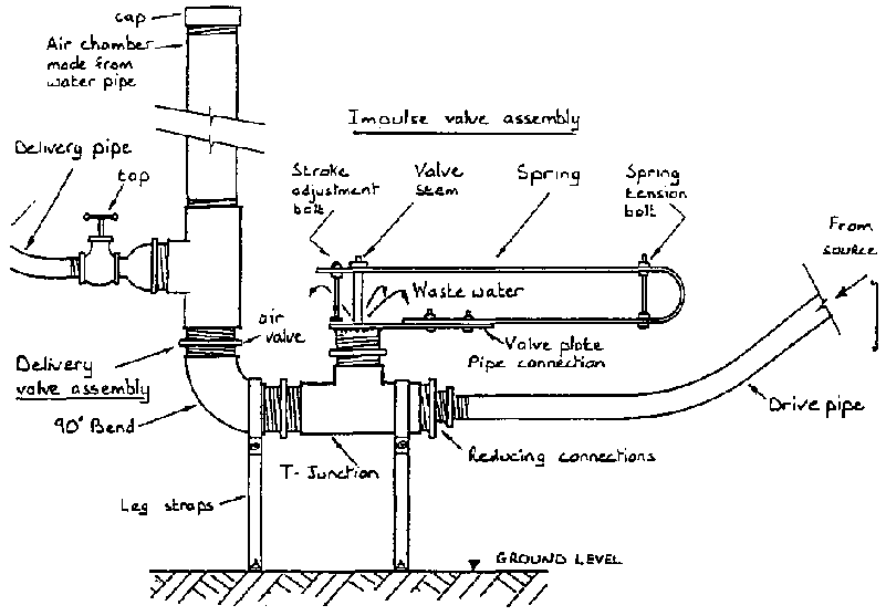
Figure 3. 37 Hydraulic Ram (Ref.
55)
3.6 Wells
A well is a structure that consists of an open hole that penetrates into the water bearing strata below the surface of the ground. The walls of the well are kept open by a liner or casing, which is typically made of plastic, metal, or rock. Holes in this casing (the so-called screened portion) permit water to enter the well from which it is extracted. Wells may be dug by hand, drilled mechanically with hand or machine tools, or the casing may be driven into the ground, creating the hole as it penetrates. The hydraulics, hydrogeology, and methods of well drilling are generally too complex and extensive to be treated in this manual. The irrigation specialist who must know more about wells should review References 5, 13, and 15. In this manual, some basic concepts of well drilling are discussed. Details are presented on the construction of only driven wells and hand drilled wells. These wells are low cost and, in areas where water tables are within 30 feet (10 meters) of the surface, will generally provide sufficient water for irrigating garden-sized farm plots.
3.6.1. Methods of drilling: Percussion drilling
In percussion drilling, a heavy bit is repeatedly lifted and dropped, progressively boring through the earth. In rotary drilling, the drilling results from the continuous scraping of the bit under constant pressure. The hole is cleaned out as the drilling progresses, either with a drilling fluid (mud), with high velocity air or, in auger drilling, by the mechanical lifting of the auger.
Cable tool drilling is one of the most common methods of percussion drilling. It is usually done by commercial well drillers with motorized equipment. In some countries, however, manual means of raising and lowering the bit have been developed.
In cable tool drilling, a chisel faced bit is repeatedly raised and dropped. The bit breaks and pulverizes the materials. A slurry of water and cuttings, which is formed by the drilling action, is periodically removed by a bailer. Water is continually added to the borehole as needed. With manual methods, the 40 to 80 kg drill is lifted and dropped through a tripod and pulley arrangement operated by four to six people.
Wells may often be constructed by communities or individuals, without the need for commercial drillers. The three types of wells commonly encountered, which can be constructed relatively inexpensively, are the driven wells, hand augered wells, and hand dug wells. The description of driven and hand auger techniques that follows is extracted from "Appropriate Well-Drilling Technologies" by the National Water Well Association (Ref. 15). Sketches of other types of drilling equipment useful in drilling small capacity irrigation wells are included in Figures 3.38 through 3.44.
EQUIPMENT AND METHOD - Driven Wells
Whenever the water table lies at shallow depths (23 feet or 7 meters), a well screen equipped with a drive point may be driven through the overlying soil and into the water-bearing formation. This method employs a drive hammer. Three basic types of drive hammers are in common use: (1) the hand driver, consisting of a sliding weight and an attached pipe that fits over the riser pipe (Figure 3.38), (2) an internal driving bar, which strikes directly upon the driving point (Figure 3.38), or (3) a sliding weight and drive stem or guide that attaches to the uppermost riser pipe coupling (Figure 3.39).
The basic equipment required for a driving rig ranges from a 4-foot (1.2 meter) section of oversized pipe (used as a sliding hand driver) to more elaborate systems requiring a tripod, pulley, rope, and driving bar or drive stem and sliding hammer. The driving rig will also require two or three pipe wrenches and a shallow well hand pump to develop and remove soil debris from the well screen.
Geological Applications
Driven wells are generally one of the most efficient methods of drilling whenever the water table is within 23 feet (7 meters) of the surface and the soil consists principally of sand with minor quantities of silt and clay. Under ideal soil conditions, a small diameter well point may be driven to a depth of 25 feet (7.6 meters) in 15 minutes. In heavy soils such as stiff clay, or soils that contain numerous boulders, drilling with an auger or percussion bit is faster than driving with a well point.
Hand-driven well points of 1 1/4 to 2 inches (3 to 5 centimeters) in diameter can be driven up to 25 feet (7.6 meters). If heavy, 100-300 lb. (45 to 135 kg) drive hammer assemblies are used, 4-inch (10 centimeters) well points and casings can be driven to depths of 33 to 49 feet (10 to 15 meters).

Figure 3.38 Methods for Driving
Well Points (Ref. 15) (a) Hand Driver
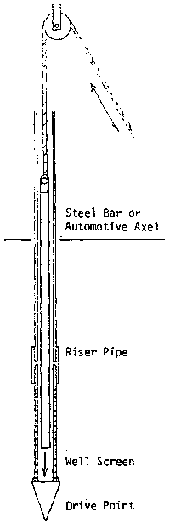
Figure 3.38 Methods for Driving
Well Points (Ref. 15) (b) Internal Rod Driver
These assemblies provide an effective means for driving both well screens and casings.
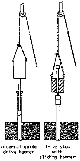
Figure 3.39 Heavy Duty Sliding
Hammer and Drive Stem Assemblies (Ref. 15) (a) Internal guide driver hammer
& Drive stem with sliding hammer
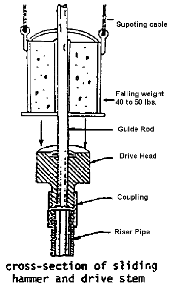
Figure 3.39 Heavy Duty Sliding
Hammer and Drive Stem Assemblies (Ref. 15) (b) Cross-section of sliding hammer
and drive stem
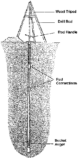
Figure 3.40 Hand Auger Drilling
(Ref. 15)
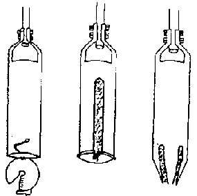
Figure 3.41 Typical Hand Augers
and Equipment (Ref. 15) (a) Sand Augers for Non-Cohesive Soils

Figure 3.41 Typical Hand Augers
and Equipment (Ref. 15) Helical Auger
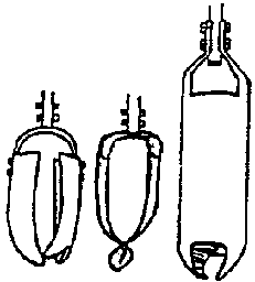
Figure 3.41 Typical Hand Augers
and Equipment (Ref. 15) (b) Cohesive Soil Augers
Figure 3.41 Typical Hand Augers
and Equipment (Ref. 15) Bucket Auger
Figure 3.41 Typical Hand Augers
and Equipment (Ref. 15) Typical Drill Rod Connection
Figure 3.41 Typical Hand Augers
and Equipment (Ref. 15) Hard-Wood Rod Handle
Figure 3.42 Rod or auger Fork
Locally Fabricated From 1/4" (6 mm) Steel Plato (Ret. 15)
- When placed around a drill rod or auger, the fork acts as a support for the drilling tools. In this manner, rods and augers may be added or removed from the drill string with little danger of dropping sections down the bore hole.
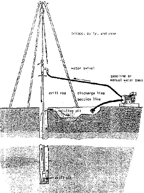
Figure 3.43 Manual Jetting
Equipment (Ref. 15)
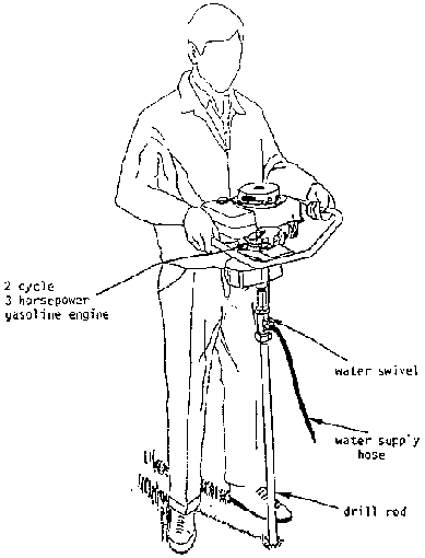
Figure 3.44 Hydra-Drill (Ref.
15)
- One person may operate this equipment to depths of 50 feet (15 m). Greater depths may be attained when the engine and drill rod are suspended from a tripod.
Labor Requirements
Given the proper soil and water table conditions, small diameter driven wells may be completed by one to two unskilled persons. Large diameter driven wells require a heavy-duty drive hammer and a tripod assembly. The crew necessary for operation of this equipment consists of six people for manual methods, and two or three for a motorized cathead system.
Fabrication Skills
All well point driving equipment can be constructed easily from locally available scrap pipe or steel bars and standard pipe fittings. The fabrication of simple drive hammers requires basic metal working and blacksmith abilities. Construction of heavy-duty drive hammers, which weigh in excess of 50 lbs. (22.5 kg), will require the aid of an electric arc welder or basic metal casting techniques.
Cost of Equipment
Excluding the initial cost of a well screen, drive point, and riser pipe, a locally constructed hand drive system that requires no tripod will be relatively inexpensive. Heavy-duty systems may cost more for the fabrication of both drive hammer and drive stem, depending on the type of tripod used. If a driving rig incorporates a motorized cathead, the system price could increase again. A hub-driven cathead would cost considerably less but would require a support vehicle.
3.6.2 Methods of drilling: Hand auger rig
EQUIPMENT AND METHOD - Hand auger Rig
The hand auger method of drilling is one of the oldest and most basic forms of low-cost labor intensive well drilling. In hand augering, the drilling action is applied by manually rotating a cutting blade or auger (Figure 3.40). AS drilling progresses, the auger fills with soil and must be periodically lifted to the surface and emptied. Drilling by this method is fairly rapid for the first 20 feet (6 m). Thereafter, the number of drill rod sections that must be coupled and uncoupled each time the auger is brought to the surface adds considerably to the drilling time.
The basic components of a hand auger rig are:
· support tripod,
· drill rod, fork, and auger handle,
· auger,
· rope and pulley,
· sand bailer,
· temporary casing to case hole through caving soil, and
· drill bit to break up hard soil and boulders.
Most light duty hand auger drilling systems utilize an inexpensive wood or pipe tripod.
Drill rods are constructed from locally available 3/4 inch (2 centimeters) galvanized or black iron pipe. All connections between drill rods and augers are of box and pin-type construction (Figure 3.41). Joining pins for the connections are made from either toggle bolts or standard nut and bolt assemblies. Both pin systems have proven to be highly reliable.
To avoid dropping a disconnected section of drill rod down the borehole, a rod fork or auger fork is slid under a coupling to support and retain lower sections of the drill stem (Figure 3.42). This rod fork may be constructed from a 1/4 inch (6 millimeter) steel plate, or from a notched hardwood board. In either case, the notch must be wide enough to slide around the drill rod, but narrow enough to retain a coupling.
An auger handle is constructed by clamping two hardwood handle sections around the drill rod (Figure 3.41). As the borehole advances, the bolts are loosened, and the handle is relocated to a more convenient height.
Auger construction falls into two main categories, those for use in cohesive soils and those for non-cohesive soils. The cohesive soil augers (Figure 3.41) are designed for use in soils that adhere or stick together. These soils commonly contain a mixture of sand, silt, and clay. Augers designed for use in non-cohesive soils (Figure 3.41) are best suited to loose sand and gravel formations.
Each type of auger can be produced locally using discarded sections of casing, pipe, sheet metal, or perhaps the tubular section of an automobile drive shaft. Local soil types determine the type of construction used. In general, the best performance in soft cohesive soils can be obtained with an open blade or helical auger. Hard clay soils may be excavated with the bucket auger. In non-cohesive soil, the tapered tube auger is most effective (Figure 3.41).
In addition to a tripod, rope and pulley are also primary components of the drilling equipment. On a hand auger rig, a rope and pulley are often used to handle the drill rods when a long pull of 20 or more feet (6 meters) is necessary to raise the auger. This long pull saves time and eliminates the need for disconnecting numerous drill rods.
A rope and pulley are also necessary to handle other drilling equipment such as well casings, wet bailers, and percussion bits. These accessories provide a useful means for continuing
the well when water saturated or hard-pan formations are encountered.
The most frequently used wet bailer on a hand auger rig is the flap valve bailer, also used in bail-down drilling.
A percussion drill bit is also commonly used in conjunction with hand auger equipment. Its ability to break up and loosen hard soil and boulders that cannot be excavated with a hand auger permits drilling under a wide variety of conditions.
Geological Applications
Hand augered wells are particularly well adapted to alluvial deposits consisting primarily of silt, clay, sand, and limited quantities of gravel. Maximum depths for hand augered wells range up to 122 meters (400 feet); however, normal hand augering, is best suited to maximum depths ranging from 15 to 25 meters (49 to 80 feet). Hand auger wells of these depths were used for an extensive hydrological survey of specific community well sites in Tanzania. Other significant hand auger well projects include wells in the following locations: Western Pakistan, Vietnam, Sri Lanka, India, Togo and the Ivory Coast Region of Africa, and in Ecuador.
Labor Requirements
The operation of a hand auger rig requires a minimum crew of four to five people. One member of the crew must be trained in basic well drilling, as well as development techniques. The remainder of the crew may be unskilled local labor. Under ideal conditions, inexperienced crews have drilled to depths of 49 feet (15 meters) in a single morning. However, greater drilling depths will require a considerably longer period due to the time and effort spent in removing and emptying the auger.
Fabrication Skills
All hand auger tools and equipment are easily produced using locally available sheet metal and pipe.
3.6.3 Other drilling equipment
Other types of equipment used in drilling operations are shown in Figures 3.45. and 3.46.
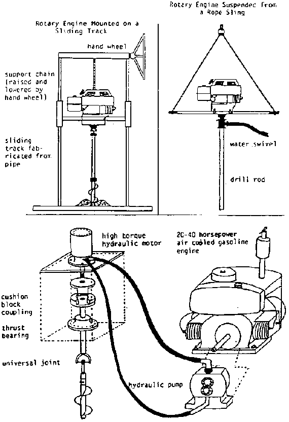
Figure 3.45 Drilling Equipment
(Ref. 15)
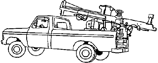
Figure 3.46 Hydraulic Rotary Rig
Mounted on a 1-Ton Pickup Truck (Ref.
15)
3.6.4 Hand dug wells
Hand dug wells have been used through the centuries as a source of water for domestic and irrigation uses. Figure 3.47 shows a schematic of one such well. Most hand dug wells are less than 20 meters in depth, even though some wells have been constructed deeper than 60 meters.
The use of hand dug wells is limited to areas with fairly shallow water tables (generally 20 meters or less), in contrast to some wells that can be drilled to several meters. The construction of hand dug wells is a very slow process, especially in rock formations that require blasting for the penetration process. These wells are generally limited to small flow rates, as the wells generally do not penetrate deep below the water table. Fluctuations in water tables will usually cause significant variations in the yield of the well.
Constructing a hand dug well is a labor-intensive process requiring a minimum of five workers for wells deeper than 5 meters. In loose soil, the excavation speed may be 1/3 to 1 meter per day, while in rock formations it may be even slower. Hand dug wells should be dug during the dry season, when the water table is lowest.
Details on the construction of hand dug wells are presented in ICE Manual M-9, entitled "Wells Construction." This manual should be considered indispensable for Volunteers who are contemplating well construction for the development of water supplies.
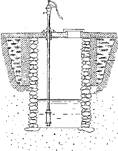
Figure 3.47 Hand Dug
Well
|
| ||||||||||||||||||||||||||||||||||||||||||||||||||||||||||||||||||||||||||||||||||||||||||||||||||||||||||||||||||||||||||||||||||||||||||||||||||||||||||||||||||||||||||||||||||||||||||||||||||||||||||||||||||||||||||||||||||||||||||||||||||||||||||||||||||||||||||||||||||||||||||||||||||||||||||||||||||||||||||||||||||||||||||||||||||||||||||||||||||||||||||||||||||||||||||||||||||||||||||||||||||||||||||||||||||||||||||
Irrigation Reference Manual (Peace Corps, 1994, 485 p.)
Chapter 4 - Estimating irrigation requirements
|
Reference: |
Primary: |
(11), (12), (22),(44) |
4.1 Introduction
Proper irrigation design and management requires that net and gross irrigation requirements be accurately estimated. This information is necessary for determining the timing and amounts of irrigation (irrigation schedules) and the design capacities of the water storage and distribution systems.
Crop water use and requirements, rainfall, stored soil water and contributions of ground water to the crop needs are generally expressed as equivalent depths of water over the crop growing area (e.g., cm or mm). In determining delivery requirements, the crop irrigation requirements are then usually expressed in terms of volume per unit time or flow rate (e.g., liters/sec).
The net irrigation requirement for a crop maintained without water stress for any time period can be determined through the following relationship:

where:
Irn is the net irrigation requirement for a given crop.
ETc is the crop evapotranspiration or crop water use under no stress conditions.
Pe is the effective precipitation.
Gw is the ground water contribution.
Wb is the available stored soil water at the beginning of the period.
Evapotranspiration is the process by which water is transferred from the plant and soil into the atmosphere. It includes evaporation of water from the plant and soil surfaces, as well as transpiration of water through the plant tissue.
Evapotranspiration rates or amounts are determined by climatic, plant, and soil conditions. Solar radiation, temperatures, wind, and humidity are the primary climatic influences. Crop ground cover, physiology, and metabolism are some of the plant factors. Soil moisture, composition, and salinity also affect evapotranspiration rates.
Irrigation requirements are usually estimated with the assumption that the crop(s) will be kept at or near optimum growth conditions. The crop evapotranspiration (ETc) can be estimated by multiplying a reference crop evapotranspiration (ETo) by corresponding crop coefficients (Kc). The relationship is usually expressed as:

<<TOC3>> 4.2 Reference crop evapotranspiration (ETo)
A method known as the Hargreaves Temperature Method, which requires only maximum and minimum temperature data, has been used in many developing countries for determining ETo (mm). The equation is:

Ra is the evaporation equivalent of extraterrestrial solar radiation (mm per day), which is a function of latitude and time of year. It can be obtained from Table 4.1.
Td is the difference between average daily maximum and minimum temperatures for the period in °C.
T°C is the average temperature in °C for the period, i.e., T°C = (Tmx + Tmn)/2.
The relationship between crop ET and the reference crop evapotranspiration is affected by climatic conditions, soil profile moisture, soil surface moisture, crop variety, canopy, stage of growth, and other factors.
Maximum and minimum temperature data are the most common and reliable data obtained in field meteorologic stations worldwide. The irrigation Volunteer should be able to access this data, along with precipitation data, from the local or national weather service.
Example: In the Azua region of the Dominican Republic, the Ciaza station (latitude 18° north) has weather records from 1981 to 1988 that include the maximum and minimum temperature data. The average maximum and minimum temperatures and precipitation from the station and the extraterrestrial radiation (Ra) from Table 4.1 (for a latitude of 18°) are as follows:
|
Month |
Jan |
Feb |
Mar |
Apr |
May |
Jun |
Jul |
Aug |
Sep |
Oct |
Nov |
Dec |
|
Tmax (°C) |
30.5 |
30.2 |
31.8 |
30.8 |
30.6 |
30.5 |
32.4 |
32.1 |
31.9 |
32.0 |
31.3 |
31.3 |
|
Tmin (°C) |
20.1 |
19.0 |
19.9 |
20.8 |
22.2 |
22.4 |
22.6 |
21.6 |
23.3 |
21.7 |
22.8 |
19.7 |
|
Precip1 |
10.0 |
13.0 |
15.0 |
38.0 |
121 |
67.0 |
51.0 |
77.0 |
124 |
138 |
55.0 |
16.0 |
|
Ra |
11.6 |
13.0 |
14.6 |
15.6 |
16.1 |
16.1 |
16.1 |
15.8 |
14.9 |
13.6 |
12.0 |
11.1 |
1(mm/m)
ETo for January:
ETo
=.0023 (11.6) (30.5-20.1)½ [(30.5+20.1)/2 + 17.8]
=.0023 (11.6) (10.4)½ (25.3 + 17.8)
=.0023 (11.6) (3.22) (43) = 3.7 mm/day
Table 4.1 Extraterrestrial Radiation (Ra) Expressed in Equivalent Evaporation in mm/day (Ref. 12)
|
Northern Hemisphere | |
Southern Hemisphere | ||||||||||||||||||||||
|
Jan |
Feb |
Mar |
Apr |
May |
June |
July |
Aug |
Sept |
Oct |
Nov |
Dec |
Lat |
Jan |
Feb |
Mar |
Apr |
May |
June |
July |
Aug |
Sept |
Oct |
Nov |
Dec |
|
3.8 |
6.1 |
9.4 |
12.7 |
15.8 |
17.1 |
16.4 |
14.1 |
10.9 |
7.4 |
4.5 |
3.2 |
50° |
17.5 |
14.7 |
10.9 |
7.0 |
4.2 |
3.1 |
35 |
55 |
8.9 |
12.9 |
16.5 |
18.2 |
|
4.3 |
6.6 |
9.8 |
13.0 |
15.9 |
17.2 |
16.5 |
14.3 |
11.2 |
7.8 |
5.0 |
3.7 |
48 |
17.6 |
14.9 |
11.2 |
7.5 |
4.7 |
3.5 |
4.0 |
6.0 |
9.3 |
13.2 |
16.6 |
18.2 |
|
4.9 |
6.6 |
9.8 |
13.0 |
15.9 |
17.2 |
16.5 |
14.5 |
11.5 |
8.3 |
5.5 |
4.3 |
46 |
17.7 |
15.1 |
11.5 |
7.9 |
5.2 |
4.0 |
4.4 |
65 |
9.7 |
13.4 |
16.7 |
18.3 |
|
5.3 |
7.5 |
10.6 |
13.7 |
16.1 |
17.2 |
16.6 |
14.7 |
11.9 |
8.7 |
6.0 |
4.7 |
44 |
17.8 |
15.5 |
12.2 |
8.8 |
6.1 |
4.9 |
5.4 |
7.4 |
10.6 |
14.0 |
16.8 |
18.3 |
|
5.9 |
8.1 |
11.0 |
14.0 |
16.2 |
17.3 |
16.7 |
15.0 |
12.2 |
9.1 |
6.5 |
5.2 |
42 |
17.8 |
1.55 |
12.2 |
8.8 |
6.1 |
4.9 |
5.4 |
7.4 |
10.6 |
14.0 |
16.8 |
18.3 |
| | | | | | | | | | | | | | | | | | | | | | | | | |
|
6.4 |
8.6 |
11.4 |
14.3 |
16.4 |
17.3 |
16.7 |
15.2 |
12.5 |
9.6 |
7.0 |
5.7 |
40 |
17.9 |
15.7 |
12.5 |
9.2 |
6.6 |
5.3 |
5.9 |
7.9 |
11.0 |
14.2 |
16.9 |
18.3 |
|
6.9 |
9.0 |
11.8 |
14.5 |
16.4 |
17.2 |
16.7 |
15.3 |
12.8 |
10.0 |
7.5 |
6.1 |
38 |
17.9 |
15.8 |
12.8 |
9.6 |
7.1 |
5.8 |
6.3 |
8.3 |
11.4 |
14.4 |
17.0 |
18.3 |
|
7.4 |
9.4 |
12.1 |
14.7 |
16.4 |
17.2 |
16.7 |
15.4 |
13.1 |
10.6 |
8.0 |
6.6 |
36 |
17.9 |
16.0 |
13.2 |
10.1 |
7.5 |
6.3 |
6.8 |
8.8 |
11.7 |
14.6 |
17.0 |
18.2 |
|
7.9 |
9.8 |
12.4 |
14.8 |
16.5 |
17.1 |
16.8 |
15.5 |
13.4 |
10.8 |
8.5 |
7.2 |
34 |
17.8 |
16.1 |
13.5 |
10.5 |
8.0 |
6.8 |
7.2 |
9.2 |
12.0 |
14.9 |
17.1 |
18.2 |
|
8.3 |
10.2 |
12.8 |
15.0 |
16.5 |
17.0 |
16.8 |
15.6 |
13.6 |
11.2 |
9.0 |
7.8 |
32 |
17.8 |
16.2 |
13.8 |
10.9 |
85 |
7.3 |
7.7 |
9.6 |
12.4 |
15.1 |
17.2 |
18.1 |
| | | | | | | | | | | | | | | | | | | | | | | | | |
|
8.8 |
10.7 |
13.1 |
15.2 |
16.5 |
17.0 |
16.8* |
15.7 |
13.9 |
11.6 |
9.5 |
8.3 |
30 |
17.8 |
16.4 |
14.0 |
113 |
8.9 |
7.8 |
8.1 |
10.1 |
12.7 |
15.3 |
17.3 |
18.1 |
|
9.3 |
11.1 |
13.4 |
15.3 |
16.5 |
16.8 |
16.7 |
15.7 |
14.1 |
12.0 |
9.9 |
8.8 |
28 |
17.7 |
16.4 |
14.3 |
11.6 |
9.3 |
8.2 |
8.6 |
10.4 |
13.0 |
15.4 |
17.2 |
17.9 |
|
9.8 |
11.5 |
13.7 |
15.3 |
16.4 |
16.7 |
16.6 |
15.7 |
14.3 |
12.3 |
10.3 |
9.3 |
26 |
17.6 |
16.4 |
14.4 |
12.0 |
9.7 |
8.7 |
9.1 |
10.9 |
13.2 |
15.5 |
17.2 |
17.8 |
|
10.2 |
11.9 |
13.9 |
15.4 |
16.4 |
16.6 |
16.5 |
15.8 |
14.5 |
12.6 |
10.7 |
9.7 |
24 |
17.5 |
165 |
14.6 |
12.3 |
10.2 |
9.1 |
95 |
11.2 |
13.4 |
15.6 |
17.1 |
17.7 |
|
10.7 |
12.3 |
14.2 |
15.5 |
163 |
16.4 |
16.4 |
15.8 |
14.6 |
13.0 |
11.1 |
10.2 |
22 |
17.4 |
165 |
14.8 |
12.6 |
10.6 |
9.6 |
10.0 |
11.6 |
13.7 |
15.7 |
17.0 |
17.5 |
| | | | | | | | | | | | | | | | | | | | | | | | | |
|
11.2 |
12.7 |
14.4 |
15.6 |
16.3 |
16.4 |
16.3 |
15.9 |
14.8 |
13.3 |
11.6 |
10.7 |
20 |
173 |
16.5 |
15.0 |
13.0 |
11.0 |
10.0 |
10.4 |
12.0 |
13.9 |
15.8 |
17.0 |
17.4 |
|
11.6 |
13.0 |
14.6 |
15.6 |
16.1 |
16.1 |
16.1 |
15.8 |
14.9 |
13.6 |
12.0 |
11.1 |
18 |
17.1 |
16.5 |
15.1 |
13.2 |
11.4 |
10.4 |
10.8 |
12.3 |
14.1 |
15.8 |
16.8 |
17.1 |
|
12.0 |
13.3 |
14.7 |
15.6 |
16.0 |
15.9 |
15.9 |
15.7 |
15.0 |
139 |
12.4 |
11.6 |
16 |
16.9 |
16.4 |
15.2 |
13.5 |
11.7 |
10.8 |
11.2 |
12.6 |
14.3 |
15.8 |
16.7 |
16.8 |
|
12.4 |
13.6 |
14.9 |
15.7 |
15.8 |
15.7 |
15.7 |
15.7 |
15.1 |
14.1 |
12.8 |
12.0 |
14 |
16.7 |
16.4 |
15.3 |
13.7 |
12.1 |
11.2 |
11.6 |
12.9 |
14.5 |
15.8 |
16.5 |
16.6 |
|
12.8 |
13.9 |
15.1 |
15.9 |
15.7 |
15.5 |
15.5 |
15.6 |
15.2 |
14.4 |
13.3 |
12.5 |
12 |
16.6 |
16.3 |
15.4 |
14.0 |
12.5 |
11.6 |
12.0 |
13.2 |
14.7 |
15.8 |
16.4 |
16.5 |
| | | | | | | | | | | | | | | | | | | | | | | | | |
|
13.2 |
14.2 |
15.3 |
15.7 |
15.5 |
15.3 |
15.3 |
15.5 |
15.3 |
14.7 |
13.6 |
12.9 |
10 |
16.4 |
163 |
15.5 |
14.2 |
12.8 |
12.0 |
12.4 |
13.5 |
14.8 |
15.9 |
16.2 |
16.2 |
|
13.6 |
14.5 |
15.3 |
15.6 |
15.3 |
15.0 |
15.1 |
15.4 |
15.3 |
14.8 |
13.9 |
13.3 |
8 |
16.1 |
16.1 |
15.5 |
14.4 |
13.1 |
12.4 |
12.7 |
13.7 |
14.9 |
15.8 |
16.0 |
16.0 |
|
13.9 |
14.8 |
15.4 |
15.4 |
15.1 |
14.7 |
14.9 |
15.2 |
15.3 |
15.0 |
14.2 |
13.7 |
6 |
15.8 |
16.0 |
15.6 |
14.7 |
13.4 |
12.8 |
13.1 |
14.0 |
15.0 |
15.7 |
15.8 |
15.7 |
|
14.3 |
15.0 |
15.5 |
15.5 |
14.9 |
14.4 |
14.6 |
15.1 |
15.3 |
15.1 |
14.5 |
14.1 |
4 |
15.5 |
15.8 |
15.6 |
14.9 |
13.8 |
13.2 |
13.4 |
14.3 |
15.1 |
15.6 |
15.5 |
15.4 |
|
14.7 |
15.3 |
15.6 |
15.3 |
14.6 |
14.2 |
14.3 |
14.9 |
15.3 |
15.3 |
14.8 |
14.4 |
2 |
15.3 |
15.7 |
15.7 |
15.1 |
14.1 |
13.5 |
13.7 |
14.5 |
15.2 |
15.5 |
15.3 |
15.1 |
|
15.0 |
15.5 |
15.7 |
15.3 |
14.4 |
13.9 |
14.1 |
14.8 |
15.3 |
15.4 |
15.1 |
14.8 |
0 |
15.0 |
15.5 |
15.7 |
15.3 |
14.4 |
13.9 |
14.1 |
14.8 |
15.3 |
15.4 |
15.1 |
14.8 |
ETo for February is:
ETo =.0023 (13.0) (30.2-19)½ [(30.2+19)/2 + 17.8] = 4.2
Likewise, for all months we have:
| |
Jan |
Feb |
Mar |
Apr |
May |
Jun |
Jul |
Aug |
Sep |
Oct |
Nov |
Dec |
|
ETo |
3.7 |
4.2 |
5.1 |
4.9 |
4.7 |
4.7 |
5.3 |
5.3 |
4.6 |
4.5 |
3.6 |
3.7 |
In very hot, dry climates with long days, ETo can often reach 10 mm per day. In cool, humid climates, ETo may be as low as 3 mm per day.
Locations that have long, hot, sunny days (14 hours or more) in summer may exceed an average of 8 mm per day of ETo. Individual days may exceed 10 mm per day. Locations nearer the equator will typically have 5 to 6 mm of water use per day in the hotter months and around 4 mm per day during the cooler, cloudier months. ETo decreases with elevation, as temperatures decrease with elevation.
A designer in a hot, dry climate might need to design irrigation systems using 8 mm per day as a value for ETo while, in a more moderate climate, a value of 5 mm might be more acceptable. The previous table, however, clearly shows the need for using local data to establish ETo. Table 4.2 provides an index of general levels of ETo as a function of climatic zones. The following example provides an indicator of how ETo can vary with factors such as latitude and elevation.
|
Location |
J |
F |
M |
A |
M |
J |
J |
A |
S |
O |
N |
D |
|
Indonesia1 |
3.7 |
4.1 |
4.1 |
4.2 |
4.0 |
3.8 |
4.0 |
4.5 |
4.7 |
4.5 |
4.2 |
3.9 |
|
Egypt2 |
2.0 |
2.9 |
3.8 |
4.9 |
6.2 |
6.8 |
6.8 |
6.3 |
5.3 |
4.1 |
2.7 |
2.0 |
|
Phillipines3 |
3.1 |
3.2 |
4.6 |
5.6 |
5.1 |
4.7 |
3.7 |
3.8 |
3.7 |
3.8 |
3.6 |
3.5 |
|
Ecuador4 |
3.6 |
3.6 |
3.4 |
3.2 |
3.0 |
2.8 |
2.9 |
3.1 |
3.2 |
3.0 |
3.0 |
3.0 |
|
Ecuador5 |
5.3 |
5.4 |
5.5 |
5.4 |
4.6 |
3.9 |
4.3 |
4.2 |
4.2 |
4.7 |
4.8 |
4.9 |
|
Bolivia6 |
5.6 |
5.7 |
5.2 |
5.1 |
3.5 |
3.9 |
3.9 |
4.5 |
5.0 |
5.3 |
6.4 |
5.8 |
|
U.S7 |
2.1 |
3.0 |
4.3 |
5.9 |
7.4 |
8.4 |
7.9 |
7.5 |
6.1 |
4.2 |
2.6 |
1.9 |
1 Jakarta, Lat. = 6°S, Elev. = 5
m
2 Cairo, Lat. = 3°N, Elev. = 74 m
3 Manila,
Lat. = 15°N, Elev. = 15 m
4 Quito, Lat. = 0°S, Elev. =
2818 m
5 Talara, Lat. = 5°S, Elev. = 90 m
6
Tarija, Lat. = 22°S, Elev. = 1905 m
7 Yuma, Arizona, Lat. =
33 N. Elev. = 63 m
TABLE 4.2 Reference Crop Evapotranspiration (ETo in mm/day) for Various Agroclimatic Zones (Ref. 11)
Mean Daily Temperature
(C)
<10----------------20----------------->30
|
Region |
Cold |
Moderate |
Hot |
|
TROPICAL | |||
|
Humid |
3-4 |
4-5 |
5-6 |
|
Sub-humid |
3-5 |
5-6 |
7-8 |
|
Semi-arid |
4-5 |
6-7 |
8-9 |
|
Arid |
4-5 |
7-8 |
9-10 |
|
SUBTROPICAL | |||
|
Summer Rainy Period | |||
|
Humid |
3-4 |
4-5 |
5-6 |
|
Sub-humid |
3-5 |
5-6 |
6-7 |
|
Semi-arid |
4-5 |
6-7 |
7-8 |
|
Arid |
4-5 |
7-8 |
10-11 |
|
Winter Rainy Period | |||
|
Humid, sub-humid |
2-3 |
4-5 |
5-6 |
|
Semi-arid |
3-4 |
5-6 |
7-8 |
|
Arid |
3-4 |
6-7 |
10-11 |
|
TEMPERATE | |||
|
Humid, sub-humid |
2-3 |
3-4 |
5-7 |
|
Semi-arid, arid |
3-4 |
5-6 |
8-9 |
4.3 FAO crop coefficients
Table 4.3 presents a set of crop coefficients, using grass as the reference crop, for various stages of crop growth. In this case, the crop evapotranspiration (ETc) under optimum condition is:
ETc = KcETo
where:
Kc is the coefficient for crops growing under conditions of optimum fertility and soil moisture and achieving full production potential.
During germination and initial crop development, the majority of water loss from the plant and soil surface is evaporation. A soil surface that is kept continually wet will have very high evaporation; thus, ETc can be almost equal to ETo. With infrequent wetting of the soil surface, ETc will be much lower than ETo during initial development stages, and Kc is generally less than 0.5. When the crop has developed a full canopy and shading of the soil is almost complete, the majority of water loss is through transpiration. Evapotranspiration is generally at or near maximum, and the crop coefficient is usually between 1.0 and 1.2. As the crop begins to mature, its physiological ability to use water is decreased, and the crop coefficient rapidly decreases.
Until most of the ground is shaded, Kc is dependent on the stage of crop development, frequency of irrigation or significant rainfall, and the evaporative potential (as indicated by ETo). After effective cover, the coefficient is primarily dependent on stage of growth and climatic conditions of wind and humidity.
In developing the crop coefficients for the growing season, different stages of crop development are considered:
1. Initial state: from planting through germination and plant emergence, and until about 10% ground cover is achieved. Water loss is practically all evaporation.
2. Crop development stage: from 10% of ground cover to effective full ground cover. This occurs at about 70% or 80% ground cover.
3. Mid-season stage: from effective cover to the start of maturity. The crop is physiologically capable of the highest water use during this time. The crop coefficient is highest.
Table 4.3 Crop Coefficients (Kc) (Ref. 11)
Crop Coefficients (kc)
|
CROP |
Crop Development Stages |
Total | |||||
| |
Initial |
Crop development |
Mid- season |
Late season |
At harvest |
growing period | |
|
Banana | |||||||
| |
tropical |
0.4-0.5 |
0.7-0.85 |
1.0-1.1 |
0.9-1.0 |
0.75-0.85 |
0.7-0.8 |
| |
subtropical |
0.5-0.65 |
0.8-0.9 |
1.0-1.2 |
1.0-1.15 |
1.0-1.15 |
0.85-0.95 |
|
Bean | |||||||
| |
green |
0.3-0.4 |
0.65-0.75 |
0.95-1.05 |
0.9-0.95 |
0.85-0.95 |
0.85-0.9 |
| |
dry |
0.4 |
0.7-0.8 |
1.05-12 |
0.65-0.75 |
0.25-0.3 |
0.7-0.8 |
|
Cabbage |
0.4-0.5 |
0.7-0.8 |
0.95-1.1 |
0.9-1.0 |
0.8-0.95 |
0.7-0.8 | |
|
Cotton |
0.4-0.4 |
0.7-0.8 |
1.05-125 |
0.8-0.9 |
0.65-0.7 |
0.8-0.9 | |
|
Grape |
0.35-0.55 |
0.6-0.8 |
0.7-0.9 |
0.6-0.8 |
0.55-0.7 |
0.55-0.75 | |
|
Groundout |
0.4-0.5 |
0.7-0.8 |
0.95-1.1 |
0.75-0.85 |
0.55-0.6 |
0.75-0.8 | |
|
Maize | |||||||
| |
sweet |
0.3-0.5 |
0.7-0.9 |
1.05-1.2 |
1.0-1.15 |
0.95-1.1 |
0.8-0.95 |
| |
grain |
0.3-0.5 |
0.7-0.85 |
1.05-1.2 |
0.8-0.95 |
0.55-0.6 |
0.75-0.9 |
|
Onion | |||||||
| |
dry |
0.4-0.6 |
0.7-0.8 |
0.95-1.1 |
0.85-0.9 |
0.75-0.85 |
0.8-0.9 |
| |
green |
0.4-0.6 |
0.6-0.75 |
0.95-1.05 |
0.95-1.05 |
0.95-1.05 |
0.65-0.8 |
|
Pea, fresh |
0.4-0.5 |
0.7-0.85 |
1.05-1.2 |
1.0-1.15 |
0.95-1.1 |
0.8-0.95 | |
|
Pepper, fresh |
0.3-0.4 |
0.6-0.75 |
0.95-1.1 |
0.85-1.0 |
0.8-0.9 |
0.7-0.8 | |
|
Potato |
0.4-0.5 |
0.7-0.8 |
1.05-1.2 |
0.85-0.95 |
0.7-0.75 |
0.75-0.9 | |
|
Rice |
1.1-1.15 |
1.1-1.5 |
1.1-1.3 |
0.95-1.05 |
0.95-1.05 |
1.05-12 | |
|
Safflower |
0.3-0.4 |
0.7-0.8 |
0.7-0.8 |
0.65-0.7 |
0.2-0.25 |
0.65-0.7 | |
|
Sorghum |
0.3-0.4 |
0.7-0.8 |
1.0-1.15 |
0.75-0.8 |
0.5-0.55 |
0.75-0.85 | |
|
Soybean |
0.3-0.4 |
0.7-0.8 |
1.0-1.15 |
0.7-0.8 |
0.4-0.5 |
0.75-0.9 | |
|
Sugarbeet |
0.4-0.5 |
0.75-0.85 |
1.05-1.2 |
0.9-1.0 |
0.6-0.7 |
0.8-0.9 | |
|
Sugarcane |
0.4-0.5 |
0.7-1.0 |
0.7-1.0 |
0.75-0.8 |
0.5-0.6 |
0.85-1.05 | |
|
Sunflower |
0.3-0.4 |
0.7-0.8 |
1.05-1.2 |
0.7-0.8 |
0.7-0.8 |
0.75-0.85 | |
|
Tobacco |
0.3-0.4 |
0.7-0.8 |
1.0-1.2 |
0.9-1.0 |
0.75-0.85 |
0.85-0.95 | |
|
Tomato |
0.4-0.5 |
0.7-0.8 |
1.05-1.25 |
0.8-0.95 |
0.6-0.65 |
0.75-0.9 | |
|
Waterrnelon |
0.4-0.5 |
0.7-0.8 |
0.95-1.05 |
0.8-0.9 |
0.65-0.75 |
0.75-0.85 | |
|
Wheat |
0.3-0.4 |
0.7-0.8 |
1.05-1.2 |
0.65-0.75 |
0.2-0.25 |
0.8-0.9 | |
|
Alfalfa |
0.3-0.4 | |
| |
1.05-1.2 |
0.85-1.05 | |
|
Citrus | |||||||
| |
clean weeding |
| | |
| |
0.65-0.75 |
| |
no weed control |
| | |
| |
0.85-0.9 |
|
Olive | | | | | |
0.4-0.6 | |
First figure: Under high humidity (RHmin>70%) ant low wind
(U<5m/sec).
Second Figure: Under low humidity (RHmin<20%) and strong
wind (U>5m/sec).
4. Late season stage: from the start of maturity until full maturity or harvest.
The procedures for establishing the crop coefficient are as follows:
1. Establish planting dates and length of growing season for local crop varieties under irrigation. This may vary significantly from dryland to irrigated conditions, from well-fertilized to non-fertilized crops, and even for plantings at different times of the year (e.g., if temperature and radiation conditions vary significantly through the season).
2. Establish the length of the crop development stages. Local research and extension agencies, interviews with farmers and agricultural technicians, or crop data from similar climatic zones can be used to establish these. Since the dates when crops reach these stages, or the length of these stages, are not typically recorded by research or extension personnel or farmers, it is often necessary to correlate these dates with more identifiable characteristics. For grain crops, 10% ground cover is usually reached from 10 to 15 days after emergence. Effective cover for annual crops occurs approximately at the time of flowering. The start of maturity for many crops is indicated by discoloring or dropping of leaves.
3. From Table 4.3, determine the Kc values for Stage 1 (initial state), Stage 2 (development), Stage 3 (midseason), and Stage 4 (the maturing phase). The lower values should be used for low advective conditions (low wind and high humidity) and the higher values for higher advection (high wind and low humidity).
Example: Corn is an important crop in the Azua region of the Dominican Republic. It is a 4-month crop, often planted in March and harvested at the end of June. Determine the average water use for each stage of growth during the growing season. Azua is fairly humid, as it is near the ocean, and winds are generally calm, so use the lower values in the table, or use the ETo values from the previous example. Each growth stage is about 1 month in length.
Solution:
|
Month |
March |
April |
May |
June |
|
Crop stage |
1 |
2 |
3 |
4 |
|
ETo |
5.1 |
4.9 |
4.70 |
4.70 |
|
Kc |
0.3 |
0.7 |
1.05 |
0.55 |
|
ETc |
1.5 |
3.4 |
4.94 |
2.59 |
Table 4.4 provides a range of seasonal ET values for a number of common crops.
TABLE 4.4 Seasonal ET Requirements for Maximum Yields of Crops (Ref. 11)
|
Crop |
Seasonal ET (mm) |
|
Alfalfa |
800-1600 |
|
Banana |
1200-2200 |
|
Beans |
300- 500 |
|
Cabbage |
380- 500 |
|
Citrus |
900-1200 |
|
Cotton |
700-1300 |
|
Grapes |
500-1200 |
|
Peanuts |
500- 700 |
|
Maize |
500- 800 |
|
Olives |
600- 800 |
|
Onions |
350- 550 |
|
Peppers |
600- 900 |
|
Pineapple |
700-1000 |
|
Potatoes |
500- 700 |
|
Rice |
350- 700 |
|
Sorghum |
450- 650 |
|
Sugar beets |
550- 750 |
|
Sugar cane |
1500-2500 |
|
Sunflower |
600-1000 |
|
Tobacco |
400- 600 |
|
Tomato |
400- 600 |
|
Watermelon |
400- 600 |
|
Wheat |
450- 650 |
4.4 Dependable precipitation
In areas where rainfall provides any significant portion of the crop water supply, it is essential that water availability from precipitation be evaluated in planning water delivery requirements, adjusting irrigation schedules, and even in developing possible crops and cropping patterns.
A probability analysis of rainfall based on historical precipitation is generally a part of this evaluation for large projects. Average rainfall can usually be obtained by the Peace Corps Volunteer from local weather stations, government agencies, or from a climatic atlas. The use of average precipitation for the planning and design of a small project will result in the design of a project that will ensure the farmer against crop failure, and crop yields will generally be near to their potential.
<<TOC3>> 4.5 Effective precipitation
Many definitions of effective precipitation are found in the literature. One of the more popular and useful definitions is that effective rainfall is that portion of the rainfall that contributes to the evapotranspiration requirements of a crop. Thus, that portion of rainfall that is not lost from the farm, either as surface runoff or as deep percolation to subsurface drainage, may be considered effective.
Even small amounts of water retained on the plant surface may be considered effective, as they help to satisfy evapotranspiration demand. It is common to discount small amounts of up to 4 or 5 mm, however, when ground cover is incomplete and evaporation from the soil surface would be very rapid.
High intensity rains producing a large amount of runoff and soils that have little capacity to store moisture may determine what little of the precipitation is effective. Rainfall that is lost during the non-cropped season as evaporation is ineffective.
Since effective rainfall is difficult to determine, it may be necessary to evaluate soil moisture after a rainfall event to evaluate the effectiveness of the rainfall in replenishing the soil profile so that irrigation can be adjusted accordingly. Generally, low intensity rainfall that does not exceed the soil water deficit is highly effective after significant canopy has been established.
Since effective rainfall is determined by rainfall intensity, soil infiltration characteristics, soil moisture deficit, surface storage, and evaporative conditions, it is difficult to estimate precisely. For planning purposes, it is generally adequate to assume that on deep rooted crops, flat ground, or sandy soils, the effective precipitation will usually be around 80%, if rainfall is generally not of great intensity and if moisture conservation practices are used. On steep terrains, heavy soils, and in areas of high intensity rainfall, the effective rainfall may be less than 50%.
<<TOC3>> 4.6 Ground water contributions to crop requirements
The rate of upward capillary movement from the ground water depends on the depth of water table below the root zone, soil moisture content and gradient, soil texture, structure and capillary properties, and on evaporative conditions. Generally, in coarse textured soils, rapid movement can occur over short distances with large moisture gradients. Water can move greater distances in fine textured soils, but movement is slower.
Because upward movement of the ground water is so greatly influenced by texture, structure, and other conditions, it is difficult to determine ground water contributions without detailed studies.
Although a significant portion of the total water requirement may be supplied from ground water at shallow depths, it is important to consider the detrimental effects of shallow water or waterlogged soils on crops. Shallow water tables may prevent adequate root development, which will result in low moisture storage capacity in the root zone if water tables drop. Some sugar cane varieties, potatoes, and broad beans can do well with water tables at 50 cm, while corn will be affected by water at 1 meter.
Upward movement of water may also result in salinization unless excess water and adequate drainage for leaching fraction can be provided at some time of year.
For these reasons, it may sometimes be necessary to plan for the elimination of shallow ground water, rather than to consider it as a contributor to crop requirements. Generally, water tables lower than 1 meter below the surface will not contribute significantly to most crops.
<<TOC3>> 4.7 Gross irrigation requirements
Not all water available at the head of a canal is available to fulfill the net irrigation requirements (Irn). Losses to deep percolation, evaporation, and surface runoff, as well as leaching requirements, must be accounted for in the conveyance systems and in the farm application system. The gross irrigation water requirement (Irg) can be determined if field application and canal distribution system efficiencies are known or can be estimated.
The basic equation for determining gross irrigation requirements is:

where:
|
Irn |
is the net irrigation requirement per day (depth). |
|
Ea |
is the farm application efficiency (fraction), or the ratio between the water that enters and stays in the root zone to meet crop needs and that which is delivered to the field. |
|
Ec |
is the canal conveyance efficiency (fraction), or the ratio of the water delivered to the field and that which enters the irrigation canal. |
Primary factors affecting conveyance losses are management aspects that cause fluctuations or require adjustments in the supply, as well as physical factors such as seepage losses through canal banks and canal outlets. Typically, canal losses are very high when a large number of canals serve many small farms, and where organizational control of water is not strict and orderly. Highly permeable soils and poor maintenance of canals are other primary causes.
Primary factors affecting or resulting in low application efficiencies are improper irrigation system design, construction, and maintenance, as well as inadequate farmer knowledge of crop water requirements and irrigation scheduling criteria, irrigation system evaluation and monitoring criteria, and delivery system behavior. Many times, the delivery of water to the farm may be untimely, in improper amounts, and with excessive variation in the available discharge. These factors, which are beyond the farmer's control, may make efficient irrigation an impossibility.
Table 4.5 indicates some typical efficiencies for both the delivery system and the irrigation system. Irrigation scheduling, proper maintenance, and other techniques can significantly improve efficiencies above those given in the table.
Table 4.5 Irrigation System Efficiency
|
IRRIGATION SYSTEM |
EXPECTED APPLICATION EFFICIENCY | |
|
Surface methods |
| |
|
|
light soils |
0.55 |
| |
medium soils |
0.70 |
| |
heavy soils |
0.60 |
|
Sprinkler | |
|
| |
hot, dry climate |
0.60 |
| |
moderate climate |
0.70 |
| |
humid and cool |
0.80 |
|
Flooded rice |
0.30 | |
|
Drip or Trickle Irrigation |
0.80 | |
Expected conveyance efficiencies in small, short canals (<2 km) are about 80% (0.8) for heavy soils. 70% (0.7) for medium soils, and 60% (0.6) for sandy soils. Canals with lower efficiencies should be evaluated to diminish the losses. Pipeline conveyance systems should always have close to 100% efficiencies.
Gross requirements can be expressed as a depth required per day, or as a flow rate required per unit area per day. The following equations help us to determine the maximum flow rate that we will require on a daily basis for a farm.

where:
|
Q |
is the flow rate required (liters/sec). |
|
A |
is the area to be irrigated (hectares). |
|
Irg |
is the gross daily water requirement (mm). |
|
t |
is the number of hours per day that the farmer expects to irrigate during the peak season. |
Example: For the Azua region of the Dominican Republic, we have determined crop water use of corn on a daily basis during the months of March through June. We have obtained the mean precipitation from local sources, and we know that in this dry,
flat region with a deep rooted crop such as corn, the rainfall will be about 80% effective. Water tables are lower than 1 meter, and there will be no ground water contribution. Soils are medium textured. Farmers use surface irrigation methods, and they will generally irrigate 12 hours per day. Canals are well maintained and generally less than 2 km long. Neglect soil moisture storage in your analysis, and estimate what the flow rate required will be for each hectare.
Solution:
|
Month |
March |
April |
May |
June |
|
ETc |
1.5 |
3.4 |
4.9 |
2.6 |
|
P mean |
0.5 |
1.3 |
3.9 |
2.2 |
|
Pe |
0.4 |
1.0 |
3.1 |
1.8 |
|
Irn |
1.1 |
2.4 |
1.8 |
0.8 |
|
Irg |
2.2 |
4.9 |
3.7 |
1.6 |
P mean monthly precipitation divided by days in month.
Pe
effective precipitation = mean precipitation  0.8 (in this case).
Irn is ETc - Pe - Gw - Wb = ETc - Pe - 0 - 0.
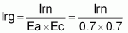
The month with the highest gross water requirement is April, with 4.9 mm/day of gross requirement. On a flow rate basis, this is:
In summary, the crop during April will use 3.4 mm/day. Considering effective precipitation, our average daily water need would be 2.4. Due to efficiency losses, however, the gross amount of water that will be required will be 4.9 mm/day on average. If this amount is to be applied on a 12-hour per day schedule, we will need to be able to supply 1.1 liters per second for each hectare during the month of April. If we will irrigate only once per week for 12 hours, we will need seven times the flow rate.
<<TOC2>> Chapter 5 - Farm water delivery
systems
|
References |
Primary: |
(21), (41) |
5.1 Control of irrigation water
5.1.1 Components of farm irrigation systems
Some of the components of a water supply and distribution system are shown in Figure 5.1. The primary components are canals or pipelines, control structures in canals, and the field application systems, which are generally surface, sprinkler, or drip irrigation systems. This section covers all of these components.
Good water control is an essential requirement for an efficient irrigation system, both at the project level and at the farm level. Conveyance systems should be designed and maintained to minimize seepage losses, provide for adequate control by the operator, and allow for efficient irrigation. Generally, pipelines or lined ditches that provide for greater seepage control with low maintenance will have higher initial costs.
5.1.2 Open channel systems
(Adapted from Ref. 41, with appropriate modifications)
Unlined ditches are commonly used because of their low cost and ease of construction. They may be bare, temporary earth ditches or protected with some type of vegetation, commonly sod. Special precautions are required in erodible soils, and seepage losses are likely to be high in non-cohesive, coarse textured soils.
Ditches are usually designed for a capacity equal to the crop water requirement during peak demand, plus irrigation and operational losses.
Delivery Channels and Ditches (Extracted from Ref. 41)
Channel Design
In order to determine the channel size required, the maximum discharge, the shape of the planned section, and an estimate of the channel roughness, must be known. The Manning Equation is the most commonly used relationship for determining channel discharge and will be used in this handbook.

where:
Q = discharge, m3/sec (or cfs).
A = cross-sectional area of ditch, m2 (ft2).
R = hydraulic radius - area divided by the wetted perimeter, m (ft).
s = longitudinal slope, m/m (ft/ft).
n = Manning roughness coefficient, m1/6 or ft1/6 (same value for both metric and English units).
C = 1.0 when using metric units, 1.49 for English units.
Figure 5.1 A Farm Irrigation
System (Ref. 41)
The Manning roughness coefficient, n, varies from 0.010 for smooth concrete to over 0.10 for channels with weeds and brush. Table 5.1 lists values of n that can be used for design of earthen and lined channels. The value for n should be chosen only after a careful study of the field situation.
The channel design problem is usually determining the width and depth required for a given flow with a measured slope in a given material or with a selected lining of a predetermined shape. In other situations, an estimate of the discharge is required while one knows the ditch size and slope, with an estimate of the roughness (Manning n from Table 5.1). Figure 5.2 gives a solution for the Manning Equation that can be used to make estimates of the ditch shape and flow. Two examples using Figure 5.2 follow.
Example 1: Earth canal in clay loam after weathering, clean; n = 0.022 (Table 5.1).
|
Assume: |
Bottom width, B = 0.45 m (1.5 ft) |
| |
Longitudinal slope, s = 0.001 |
| |
Side slope, z = 1.5 (1.5 horizontal to 1 vertical) |
| |
Discharge, Q = 0.10 m3/s (3.5 cfs) |
|
Problem: |
Determine the depth of flow. |
|
Solution: |
Solve for the Em in Figure 5.2. |
| |
Em = (Qn/1/2)/B8/3 = [(0.10)(0.022)/(0.032)]/(0.12) = 0.57 |
| |
From Fig. 5.2, if z = 1.5 and Em = 0. 57, then D/B = 0.60 m |
|
|
Because B = 0.45 m (1.5 ft), then D = 0.27 m (0.89 ft) |
TABLE 5.1 Values of Manning Roughness Coefficient, n, for Earthen and Lined Channels (Ref. 41)
| |
Roughness coefficient n | ||||
|
Type of Channel and Description |
Minimum |
Normal |
Maximum | ||
|
A. Excavated earthen channels | |||||
| |
a. Straight and uniform | ||||
| | |
1. Clean, recently completed |
0.016 |
0.018 |
0.020 |
| | |
2. Clean, after weathering |
0.018 |
0.022 |
0.025 |
| | |
3. Gravel, uniform section, clean |
0.022 |
0.025 |
0.030 |
| | |
4. With short grass, few weeds |
0.022 |
0.027 |
0.033 |
| | |
5. With long grass and weeds |
0.030 |
0.040 |
0.045 |
| |
b. Winding and sluggish | ||||
| | |
1. No vegetation |
0.023 |
0.025 |
0.030 |
| | |
2. Grass, some weeds |
0.025 |
0.030 |
0.033 |
| | |
3. Dense weeds or aquatic plants in deep channels |
0.030 |
0.035 |
0.040 |
| | |
4. Earth bottom and rubble sides |
0.028 |
0.030 |
0.035 |
| | |
5. Stony bottom and weedy banks |
0.025 |
0.035 |
0.040 |
| | |
6. Cobble bottom and clean sides |
0.030 |
0.040 |
0.050 |
| |
c. Channels not maintained, weeds and brush uncut | ||||
| | |
1. Dense weeds, high as flow depth |
0.050 |
0.080 |
0.120 |
| | |
2. Clean bottom, brush on sides |
0.040 |
0.050 |
0.080 |
| | |
3. As c.2., highest state of flow |
0.045 |
0.070 |
0.110 |
| | |
4. Dense brush, high stage |
0.080 |
0.100 |
0.140 |
|
B. Lined or built-up channels | |||||
| |
a. Cement | ||||
| | |
1. Neat, smooth surface |
0.010 |
0.011 |
0.013 |
| | |
2. Mortar |
0.011 |
0.013 |
0.015 |
| |
b. Concrete | ||||
| |
|
1. Trowel finish |
0.011 |
0.013 |
0.015 |
| | |
2. Float finish |
0.013 |
0.015 |
0.016 |
| | |
3. Finished, with gravel on bottom |
0.015 |
0.017 |
0.020 |
| | |
4. Unfinished |
0.014 |
0.017 |
0.020 |
| |
c. Brick | ||||
| | |
1. Glazed |
0.011 |
0.013 |
0.015 |
| | |
2. In cement mortar |
0.012 |
0.015 |
0.018 |
| |
d. Masonry | ||||
| | |
1. Cemented rubble |
0.017 |
0.025 |
0.030 |
| | |
2. Dry rubble |
0.023 |
0.032 |
0.035 |

Figure 5.2 Manning Equation
Solution for Determining Canal Design (Ref. 41)
Example 2: Brick with vertical wall, mortar trowel finished surface, n = 0.013 (Table 5.1).
|
Assume: |
Bottom width, B = 0.45 m (1.5 ft) |
| |
Depth of section, 0.45 m (1.5 ft) |
| |
Freeboard, 0.15 m (0.5 ft) |
| |
Depth of flow, D = 0.30 m (1.0 ft) |
| |
Longitudinal slope, s = 0.001 |
| |
Side slope, z = 0 |
|
Problem: |
Determine the discharge. |
|
Solution: |
From Fig. 5.2 for D/B = 0.67 and z = 0, then Em = 0.28 m |
| |
Em = (Qn/s1/2)/B8/3 or m |
| |
Q = Ems1/2B8/3/n = (0.28)(0.032)(0.12)/0.013 m |
| |
Q = 0.083 m3/s (2.93 cfs) |
Note that the amount of flow is inversely proportional to the roughness, n; i.e., an increase in roughness decreases the discharge in direct proportion, with shape, slope, and depth remaining the same. If the discharge remains constant and the roughness increases (such as from growing vegetation), then the depth of flow must increase.
So that water does not overflow the ditch, there should be a freeboard (distance from the maximum water surface to the top of the banks) of at least 15 cm (6 in) for small canals. The banks tend to lower with seasoning, aging of the canal, and use of the banks by traffic.
Earth Ditches
Unlined earth ditches are the most common means of conveying irrigation water to farm fields. Unlined ditches are preferred by many farmers because they can be built cheaply and easily and maintained with farm equipment. Also, unlined ditches provide flexibility - it is easy to change the layout, increase capacity, or even eliminate ditches after a rotation and rebuild them the next season. Unlined ditches have many disadvantages, however, that make them less desirable than lined ditches or underground pipe:
· They occupy more land than lined ditches.
· They usually lose more water due to seepage, leakage, and spillage.
· Rodents can cause leakage.
· If weed growth is a problem, frequent cleaning is needed.
· Earth ditches can erode and meander, creating problems in maintaining straight or proper alignment.
The slope for an earth ditch may be as low as 0.00018. (Egyptian irrigation canals generally have slopes ranging from 0.00018 to 0.00020.) Small slopes result in slow flow velocities, large cross sections, and possible sediment deposition on the bed.
It is customary to use a gradient of 0.001 in many areas. The slope of the ditch should be such that the bed does not erode and the water flows at a self-cleaning velocity, i.e., there is no deposition. A heavy clay soil will allow fairly high velocities without eroding (Table 5.2). At times it is necessary to insert drops into the ditch to reduce velocities and prevent scour and erosion. For soils normally encountered, the maximum velocities given in Table 5.2 should not be exceeded. For Example 1 above, the average velocity for an earth canal in clay loam is 0.43 m/s (1.4 ft/s). For Example 2, and lined ditch, the velocity is 0.61 m/s (2.0 ft/s). Both of these velocities are in the safe range. For unlined ditch side slopes, the lower value (steeper slopes) given in Table 5.2 should be used for cuts and the higher value (flatter slopes) for canals excavated in a fill section.
The approximate sizing of earth ditches with a side slope of 1.5:2 (Z = 1.5) is given in Figure 5.3 and can be used for preliminary design. With an estimate of slope, roughness factor, and desired discharge, several possible ditch sizes can be determined. Conversely, with a known ditch shape (bottom width), roughness, and discharge, the required depth and slope can be estimated. By using the Manning Equation, tables similar to that in Figure 5.3 can be developed for other ditch shapes, roughness, and slopes.
Ditch locations should be carefully planned to serve the irrigated area adequately. If adjacent fields are being levelled, any needed fill material for the ditch can be easily obtained. Earth ditches can be formed manually or with pulled ditchers. The animal-powered V-ditcher can be run in furrows opened by a moldboard-type plow. Two furrows are made adjacent to each other, with the furrow slice thrown in opposite directions. The V-ditcher then moves the soil to form a berm on each side. It is usually necessary to plow a second or third time to obtain more earth for the banks.
Table 5.2 Suggested Maximum Flow Velocities and Side Slopes for Lined and Unlined Channels
|
Type of Surface |
Maximum Flow Velocities m/sec |
Side Slopes ft/sec |
Range (z)a | ||
|
Unlined Ditches, Seasoned | |||||
|
Sand |
0.3 - 0.7 |
1.0 - 2.3 |
3 | ||
| |
Sandy loam |
0.5 - 0.7 |
1.6 - 2.3 |
2 to 2.5 | |
| |
Clay loam |
0.6 - 0.9 |
2.0 - 3.0 |
1.5 to 2b | |
| |
Clays |
0.9 - 1.5 |
3.0 - 5.0 |
1 to 2b | |
| |
Gravel |
0.9 - 1.5 |
3.0 - 5.0 |
1 to 1.5 | |
| |
Rock |
1.2 - 1.8 |
4.0 - 6.0 |
0.25 to 1 | |
|
Lined Ditches | |||||
| |
Concrete | ||||
| | |
Cast-in-place |
1.5 - 2.5c |
5.0 - 8.2c |
0.75 to 1.5 |
| |
|
Precast |
1.5 - 2.0 |
5.0 - 6.5 |
0 to 1.5d |
| |
|
Brick |
1.2 - 1.8 |
4.0 - 6.0 |
0 to 1.5d |
| |
Asphalt | ||||
| | |
Concrete |
1.2 - 1.8 |
4.0 - 6.0 |
1 to 1.5 |
| | |
Exposed membrane |
0.9 - 1.5 |
3.0 - 5.0 |
1.5 to 2 |
| | |
Buried membranee |
0.7 - 1.0 |
1.6 - 3.3 |
2 |
| |
Plastic | ||||
| | |
Buried membranee |
0.6 - 0.9 |
2.0 - 3.0 |
2.5 |
a z is the horizontal unit to one (1) vertical
unit.
b Side slopes of 1:1 for small canals in clay and clay loam
are common.
c Flows in this velocity range may be supercritical
(see definitions) and difficult to control. They are not recommended except for
special uses.
d Small precast and brick channels may have vertical
walls (z = 0).
e Maximum flow velocities will depend on the cover
over the membrane.
Many ditches erode and deteriorate. It is better to remove old ditches and form new ones. Figure 5.4 gives a procedure for doing so that will result in a new, more stable channel that will lose less water than the old one. The compaction and forming of the new channel can be done manually or with a machine. Soil that has a high percentage of silt and clay will form the best channel from all standpoints.
|
Flat bed before ditch is formed |
Finished ditch section | ||||||||||||||||||||||||||||
| | | | | | | | | | | | | | |
s = 0.00005 |
s = 0.001 |
s = 0.002 |
s = 0.003 | ||||||||||||
| |
| | |
| | |
| | |
| | |
|
n = 0.03 |
n = 0.04 |
n = 0.03 |
n = 0.04 |
n = 0.03 |
n = 0.04 |
n = 0.03 |
n = 0.04 | ||||||||
|
B |
D |
F |
W |
T |
A |
R |
Q |
Q |
Q |
Q |
Q |
Q |
Q |
Q | |||||||||||||||
|
m |
ft |
m |
ft |
m |
ft |
m |
ft |
m |
ft |
m2 |
ft2 |
m |
ft |
m1/s |
ft1/s |
m1/s |
ft1/s |
m1/s |
ft1/s |
m1/s |
ft1/s |
m1/s |
ft1/s |
m1/s |
ft1/s |
m1/s |
ft1/s |
m1/s |
ft1/s |
|
0.15 |
0.5 |
0.30 |
1.0 |
0.15 |
0.5 |
0.30 |
1.00 |
2.6 |
1.5 |
0.19 |
2.00 |
0.15 |
0.49 |
0.04 |
1.4 |
0.03 |
1.0 |
0.05 |
1.9 |
0.04 |
1.5 |
0.01 |
2.7 |
0.06 |
2.1 |
0.10 |
1.4 |
0.07 |
2.5 |
|
0.30 |
1.0 |
0.30 |
1.0 |
0.15 |
0.5 |
0.46 |
1.50 |
3.0 |
10.0 |
0.23 |
2.50 |
0.16 |
0.54 |
0.05 |
1.8 |
0.04 |
1.4 |
0.07 |
2.6 |
0.06 |
2.0 |
0.10 |
3.7 |
0.08 |
2.1 |
0.13 |
4.5 |
0.10 |
3.4 |
|
0.46 |
1:5 |
0.30 |
1.0 |
0.15 |
0.5 |
0.61 |
2.00 |
3.5 |
11.5 |
0.21 |
3.00 |
0.11 |
0.59 |
0.07 |
2.3 |
0.05 |
1.7 |
0.09 |
3.3 |
0.07 |
2.5 |
0.11 |
4.7 |
0.10 |
3.5 |
0.16 |
5.7 |
0.12 |
4.3 |
|
0.61 |
2.0 |
0.30 |
1.0 |
0.15 |
0.5 |
0.76 |
2.50 |
4.0 |
13.0 |
0.33 |
3.50 |
0.19 |
0.62 |
0.08 |
2.8 |
0.06 |
2.1 |
0.11 |
4.0 |
0.01 |
3.0 |
0.16 |
5.6 |
0.12 |
4.2 | | |
0.15 |
5.2 |
|
0.10 |
1.0 |
0.17 |
1.2 |
0.21 |
0.7 |
0.31 |
1.25 |
3.4 |
11.3 |
0.31 |
3.16 |
0.19 |
0.61 |
0.0 |
2.7 |
0.06 |
2.0 |
0.11 |
1.9 |
0.01 |
2.9 |
0.16 |
5.5 |
0.12 |
4.1 | | |
0.14 |
5.0 |
|
0.46 |
1.5 |
0.37 |
1.2 |
0.21 |
0.7 |
0.46 |
1.50 |
1.7 |
12.1 |
0.17 |
3.96 |
0.21 |
0.61 |
0.10 |
3.4 |
0.07 |
2.5 |
0.14 |
4.8 |
0.10 |
3.6 | | |
0.14 |
5.1 | | |
0.18 |
6.2 |
|
0.61 |
2.0 |
0.17 |
1.2 |
0.21 |
0.7 |
0.61 |
2.00 |
4.2 |
13.8 |
0.42 |
4.56 |
0.22 |
0.72 |
0.12 |
4.1 |
0.08 |
1.1 |
0.16 |
5.7 |
0.12 |
4.3 | | |
0.17 |
6.1 | | | | |
|
0.46 |
1.5 |
0.41 |
1.13 |
0.24 |
0.8 |
0.51 |
1.75 |
4.1 |
11.6 |
0.43 |
4.65 |
0.23 |
0.74 |
0.12 |
4.2 |
0.09 |
3.2 | | |
0.13 |
4.5 | | | | | | | | |
|
0.61 |
2.0 |
0.41 |
1.33 |
0.24 |
0.1 |
0.61 |
2.00 |
4.5 |
14.6 |
0.49 |
5.31 |
0.24 |
0.71 |
0.14 |
4.9 |
0.11 |
3.1 | | |
0.15 |
5.3 | | | | | | | | |
|
0.61 |
2.0 |
0.46 |
1.5 |
0.10 |
1.0 |
0.46 |
1.50 |
4.7 |
15.5 |
0.59 |
6.31 |
0.26 |
0.86 |
0.18 |
6.4 |
0.14 |
4.1 | | | | | | | | | | | | |
|
0.91 |
3.0 |
0.46 |
1.5 |
0.30 |
1.0 |
0.61 |
2.00 |
5.3 |
17.5 |
0.73 |
7.11 |
0.29 |
0.94 | | |
0.18 |
6.3 | | | | | | | | | | | | |
|
A - cross sectional area | |
|
R - hydraulic radius | |
|
n - Manning's roughness coefficients | |
| |
0.03 - soil with gravel |
| |
0.04 - soil with grass |
|
!s - slope | |
|
Q - ditch flow capacity | |
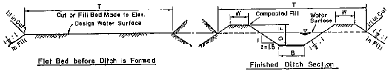
Figure 5.3 Earth Irrigation Ditch
Sizes for Different Slopes, Roughness, and Discharges (Ref. 41)
The importance of good construction for earth channels depends a great deal on expected ditch usage. Some ditches, such as those run on a contour for grain and rice, are used only one season and then filled in. Other ditches are relatively permanent and should be constructed with more effort and care. Ditches intended for furrow or border irrigation directly from the ditch need substantial banks, and the banks might be higher for using spires and siphon tubes than for open ditch bank cuts. In this case, the top of the banks should be a minimum of 25 cm (10 in.) above the surrounding field surface. Banks must be high enough to allow the water level to be increased by checks, if needed. If seepage is excessive, compaction of the banks or deposition of a clay blanket can be tried.
5.1.3 Control structures
Good control structures are required to reduce labor requirements and simplify irrigation by providing easy and positive control of the water. Structures are used to control the water as it is conveyed from the main canal or lateral headgate to its destination on the field. Structures may be required to control the channel or ditch itself. These water control structures ensure adequate water levels, dissipate energy, provide accurate distribution, and deliver water to the field without erosion.
Grade control structures (Figures 5.5, 5.6, and 5.7) are used to prevent erosive velocities where unlined canals are on steep slopes. The water is lowered over drops and carried down the slope in a series of "stair steps." Stair steps basically consist of either vertical or inclined drops and a stilling pool or other means of dissipating the energy. Stair steps may also be used in combination with check structures, which are used to control the water level in field ditches. Drop heights in conveyance channels should generally be limited to 1 m, with the recommended height at about 0.6 m.
Drop heights in field distribution ditches are more limited because of delivery capability requirements; the maximum height should be limited to 0.3 m, with the recommended height at about 15 to 20 cm. For small drop structures, prefabricated structures may be used. Erosion control is improved by the use of wide stilling basins with low end sills and/or gravel lined stilling basins. Where steep ditch slopes require the use of many closely spaced drop structures, a lined ditch or a buried pipeline may be an economical alternative. A pipe drop is a commonly used structure for grade control, particularly when a combined road crossing is needed.
Figure 5.4 Suggested Procedure for Mechanical Reconstruction of Earthen Channels with a Tractor-Drawn Scraper, Ditcher, and Compactor (Ref. 41)

1) Remove the Old Banks and Pile the
Organic, Vegetation Filled Bank Soil away from the New Channel Site.

2) Build a Pad of Clean, Moist Soil
on the New Channel Site and Compact the Pad in 10-15 cm (4-6 in.) Layers.

3) Pull the Ditch in Stages,
Compacting the Bank Soil between each Excavation In 10-15 cm (4-6 in.) Layers.

4) Continue Enlarging the Channel
and Compacting the Moist Soil Deposited on the Banks in Layers.

5) Trim and Shape the New Compacted
Banks to the Design Crass Section
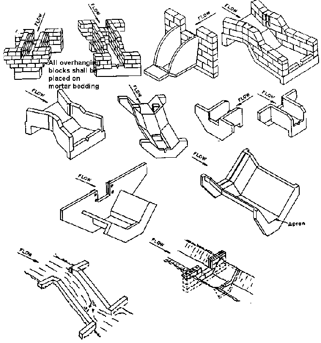
Figure 5. 5 Examples of Small Drop
Structures (Ref. 41)

Figure 5.6 Sloping Rock Drop
Structure (Ref. 41)
Note:
1. Gravel (if available) should be used to fill between Rock.
2. Rocks con be Grouted
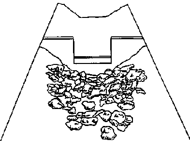
Figure 5.7 Drop Structure with
Gravel/Rock Stilling Basin (Ref. 41)
Check structures (Figures 5.8, 5.9, and 5.10) are used to maintain or increase the water level in an open channel above the normal flow depth. If provided with flashboards, drop structures can also serve as check structures. When a constant water level is desired upstream from the check structures, an Overflow-type check is generally used. The structure is usually fitted with grooves to accept flashboards or stop logs that permit water to flow over them while maintaining the water level upstream. Flow over such a type of check may be estimated by the general weir equation.
Discharge control structures (Figure 5.11), also referred to as outlets or turnouts, are used to control the release of water to laterals or ditches, or from a field irrigation ditch to borders, basins, or furrows. One of the most frequently used turnout is a concrete or metal pipe with a slide gate on the inlet or upstream end. For unlined ditches, the headwall and slide gate are usually vertical. Discharge through these pipes can be estimated by the orifice equation. Weir type openings are also used, and their capacity can be estimated with the general weir equation.
Siphon tubes are widely used for distributing water from field ditches into furrows, basins, or borders on the field. The flow through these siphon tubes depends on their length, diameter, number of bends, and material from which they are constructed.
Siphons eliminate the need for cutting the ditch bank, thus reducing labor and ditch maintenance. Spiles are sometimes used in place of siphon tubes; they consist of short pipes or other small conduits through the ditch bank.
Division boxes (Figure 5.12) are used to divide water into two or more ditches. Flow measurement of both streams assures the most equitable and accurate division, but flows can be considered to be proportional to the size of the divisions if approach and exit conditions are adequate. Some boxes are designed to give fixed proportional division while others have a moveable splitter to vary the proportions. Usually, more accurate proportions can be obtained by dividing the flow at a control section where super critical flow occurs, such as at a free overfall. Satisfactory division can also be made without the critical flow section if the approach channel is long and straight and the flow conditions downstream do not favor one channel or the other.
Sediment, trash, and weed seed can cause serious problems in irrigation systems by clogging sprinklers, pipelines, and siphon tubes. Trash racks, screens, settling or distilling boxes, and sediment traps of various design can be utilized to minimize the effects of these problems.
Figure 5.8 Wooden Ditch Checks with Different Openings (Ref. 41)

(a) Top-opening Gate with Removable
Section Cover
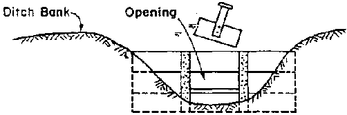
(b) Center-opening Gate with Unit
Slide Cover

(c) Bottom-opening Gate with
Swinging Cover
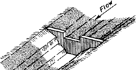
Figure 5.9 Small Concrete Ditch
Check (Ref. 41)
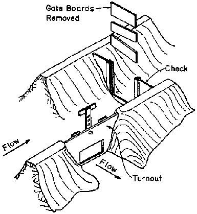
Figure 5.10 Wood, Single Well
Check with Turnout (Ref. 41)
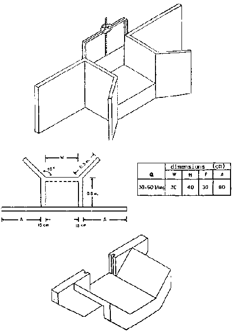
Figure 5.11 Turnout Structures
| |
dimensions (cm) | |||
|
Q |
W |
H |
P |
A |
|
30-60 1/sec |
30 |
40 |
30 |
80 |

Figure 5.12 Flow Dividers
| |
dimension (m.) | |
|
FLOW |
W |
H |
|
30- 60 1/sec |
.5 |
.5 |
All water control structures must be periodically checked and maintained. Follow these recommendations:
· Remove weeds and trash that restrict the flow of water. Clean the canals and raise their banks when necessary.
· Don't put more water in the canal than it can carry.· Fix seeps and leaks in the canal.
· Don't cut ditchbanks just anywhere where water is needed. Select a few places and use the appropriate outlet structure.
· Keep animals away from the canal and its banks. They destroy the banks and protective vegetation.
· Fix breaks in the structures promptly before they become serious.
<<TOC3>> 5.2 Pipeline hydraulics and design
The design of pipelines requires an understanding of hydraulics. Hydraulics describes water and its behavior in closed conduits (pipelines). The most basic concepts that irrigationists should understand and be able to work with include:
· the continuity equation,
· head, pressure, and energy,
· friction, and
· water hammer.
5.2.1 Continuity equation
The continuity equation is often written as:

where:
Q = flow rate.
V1 = velocity of the water at Point 1.
A1 = cross-sectional area of the flow at Point 1.
V2 = velocity of the water at Point 2.
A2 = cross-sectional area of the flow at Point 2.
The equation assumes that the water is incompressible and there are no fluid losses between points 1 and 2. For example, a pipeline that carries 2.5 liters/sec, or 2500 cm3/sec, will have a velocity of 178 cm/sec in a 50 mm diameter pipeline, and 112 cm/sec in a 63 mm diameter pipe.
Example: If we need to carry 2.5 liters/sec at a maximum velocity of 2.0 m/sec, what size pipe would be needed?
Step 1. Find the area of the pipe required.

Step 2. Find the inside diameter of the pipe required. (Remember
the area of a pipe A = pr2, with p = 3.142 and D = 2r, where r is the
radius and D is the diameter.)
Thus, the diameter,
D = 2r = 2
.79 = 1.58"
D = 2r = 2
2 = 4 cm
Step 3. Choose the closest pipe size available. (Remember, pipe is usually available in 1/2, 3/4, 1, 1 1/2, 2, 2 1/2, 3, 4, 5, 6, 8, 10, 12, and 15 inches.)
We would normally ask for a 1 1/2" pipe.
5.2.2 Pressure, head, and friction losses
(Adapted with appropriate modifications from Ref. 21)
Pressure Exerted by a Column of Water
A column of water exerts a force due to the weight of the water. The pressure, or force per unit area, is dependent on the height of the column of water. Therefore, head, or water pressure, is usually expressed in terms of the equivalent height of water needed to exert that pressure. The pressure under static conditions is not dependent on pipe diameter. (See Figure 5.13)
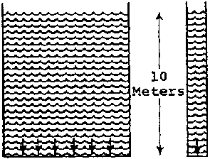
Figure 5.13 Example of Static Head
(Ref. 21)
The pressure at the bottom of each column of water is the same. It is 10 meters of head, or 1.0 kg/cm2. The pressure midway in each column would be 5 meters of head, or 0.5 kg/cm.
Pressure in a Static System
In a system under static conditions, the pressure at any point is dependent on the difference in height between the point in question and the highest point in the system. If an opening is made in the pipe in any part of the system and a tube connected to it, the water level will rise until it is the same as the highest point. (See Figure 5.14)

Figure 5.14 Head on System with
No Flow (Ref. 21)
The system in Figure 5.14 is static, and no flow occurs. The pressure or head at Points B, C, F, and H is the same; i.e., 10 meters. The pressure or head at Point E is 5 meters, or the difference in height between Points A and E. If the pipeline were opened and a tube connected to it at Point C or F, then the water would rise 10 meters and would be at the same level as Points A, D, and G.
Pressure in a Flowing System When water in the pipeline is flowing, the pressure is no longer dependent solely on the height difference with respect to the highest point. There is a loss of pressure or head due to friction between the water and the pipe. The pressure or head at any point is equal to the static head (relative height difference) minus the head loss due to friction and is known as the dynamic head level. Because of the head loss, the water will not rise to the same level as the highest point but only as high as the pressure or head at that point. Head loss occurs only when water is flowing. (See Figure 5.15)

Figure 5.15 Hydraulic Gradient
Line With and Without Flow (Ref. 21)
Under flowing conditions, the pressure is no longer the same, and the pressure at Point C or C1 is not sufficient to raise the water level to Points D or F. The height difference between Points D and E, or Points F and G, is the head loss due to friction in the pipeline. If the flow were stopped, the water level would return to Points D and F.
5.2.3 Factors influencing head loss
The amount of head loss is influenced by the following factors:
a. The length of pipe.
The longer the pipeline, the greater the head loss. This loss is directly proportional to the length; i.e., the head loss for 200 meters of pipe would be twice that for 100 meters under the same conditions.
b. The diameter of the pipe.
The smaller the diameter of the pipeline, the greater the friction will be for the same flow of water. The differences are not proportional.
c. The velocity of water in the pipe.
The higher the flow rate of water in a given pipe, the greater the head loss due to friction. Friction increases as the square of the velocity.
d. The nine material.
The smoother the inner surface of the pipe, the lower the head loss. Thus, since PVC pipe is smoother than steel or cast iron, it has a lower head loss for identical conditions.
e. The number of fittings or bends in the pipeline.
A straight pipeline would have a lower head loss than one of the same length with fittings or bends.
5.2.4 Pine design
In designing a gravity flow pipeline, several factors are of primary importance. The design flow is calculated by the designer to fit the needs. A pipe size is then chosen that will result in adequate flow and pressure at the discharge after head losses are accounted for. The following data are required as a minimum for a design:
· flow rate required,
· pressure or head required at outlet,
· length of pipeline,
· elevation profile of the land where the pipeline will be laid from source to discharge,
· availability and cost of materials,
· description of soils and terrain on which pipe will be laid and storage and inlet facilities located.
5.2.5 The hydraulic gradient line (HGL)
The Hydraulic Gradient Line (HGL) is determined by subtracting the head loss in the pipeline from the static head. The difference between the ground profile and the HGL is the pressure in the pipeline while the water is flowing. If an opening were made in the pipeline and a tube connected to it, then the water would rise to the level of the HGL. The HGL should always lie above the profile. If it does not, the water may still flow but in sections where the profile lies above the gradient, a negative pressure ensues that can cause air or contaminants to enter the pipeline. Sections of the pipeline where negative pressures occur should be redesigned. Figures 5.16 and 5.17 illustrate redesign to eliminate negative pressure.
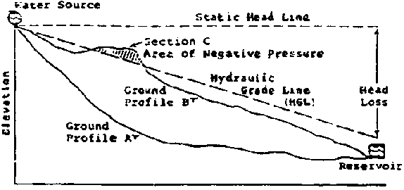
Figure 5.16 Hydraulic Gradient
Line with Uniform Pipe Size (Ref. 21)
In Figure 5.16, if the pipeline followed ground profile A, the choice of pipe with the given HGL would be acceptable. If the pipeline followed ground profile B, negative pressure would exist in section C, so the pipeline should be redesigned.
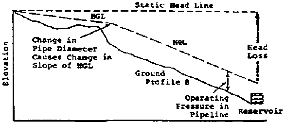
Figure 5.17 Hydraulic Gradient
Line with Change in Pipe Diameter (Ref. 21)
In Figure 5.17, the pipe diameters have been changed with larger pipe in the initial section (less head loss), thus changing the HGL. Use of a larger diameter pipe near the source ensures that the HGL lies entirely above the ground profile and is acceptable. Note that two pipe diameters are now used between the source and reservoir. For each diameter, the HGL has a different slope. The slope is directly dependent on the head loss, so a smaller diameter pipe has a steeper slope.
5.2.6 Pipeline design sample problems
Plotting the pipeline profile is a process of trial and error. The calculated values for head losses from different sizes of pipe are compared to the available head on the profile drawing. The smallest diameter pipe that results in acceptable flow and pressure is chosen for each continuous section of the pipeline.
Example 1: A spring with a flow of 0.5 L/s is 1,000 meters from the farmer's field, and the available head is 20 meters. It is planned to convey the entire flow to a small reservoir. What size pipe is recommended?
Add 10% additional friction losses to the friction losses estimated from using Tables such as 5.3 and 5.4 or the Hazen-Williams equation (see section 5.2.8, "Calculating Friction Losses”). Using Table 5.4 with an additional 10% friction loss and assuming the use of galvanized iron pipe, a flow of 0.5 L/s, and a length of 1,000 meters, a 1.5-inch pipe results in a head loss of 11 meters. For 1.25-inch pipe, the head loss is 26 meters. Thus, the required flow will not be obtained with a 1.25-inch pipe. A 1.5-inch pipe could be used; however, the most economical solution is a combination of two pipe sizes. A 1.5-inch GI pipeline of 500 meter length with a flow of 0.5 L/s has a head loss of 6 meters, and 500 meters of 1.25-inch GI pipe has a head loss of 13 meters. Thus, the total head loss for the 1,000 meter pipeline is 19 meters, which closely matches the available head. The pipeline profile and HGL are plotted in Figure 5.18.

Figure 5.18 Example: Sketch for
Pipeline 1 (Ref. 21)
Table 5.3 Rigid PVC Frictional Bead Loss Factors (Ref. 21)
RIGID PVC FRICTIONAL HEADLOSS FACTORS
These are the approximate headless factors, in m/100 m (%), for new rigid PVC pipe. Flows are in liters/second.
|
FLOW |
1/2" |
3/4" |
1 |
1 1/4" |
1 1/2" |
2" |
2 1/2" |
3" |
4 |
|
0.1 |
4.2 |
1.0 |
0.25 |
0.08 | | | | | |
|
0.15 |
8.8 |
2.2 |
0.53 |
0.17 |
0.07 | | | | |
|
0.2 |
15.0 |
3.7 |
0.9 |
0.28 |
0.12 | | | | |
|
0.25 |
22.0 |
5.5 |
1.35 |
0.44 |
0.18 | | | | |
|
0.3 |
31.0 |
7.8 |
1.9 |
0.6 |
0.25 | | | | |
|
0.35 |
41.0 |
10.0 |
2.45 |
0.8 |
0.34 | | | | |
|
0.4 |
53.0 |
13.0 |
3.1 |
1.0 |
0.43 | | | | |
|
0.45 |
66.0 |
16.3 |
4.0 |
1.25 |
0.54 |
0.13 | | | |
|
0.5 | |
19.0 |
4.8 |
1.5 |
0.65 |
0.16 |
- | | |
|
0.55 | |
23.5 |
5.6 |
1.8 |
0.78 |
0.19 | | | |
|
0.6 | |
27.5 |
6.6 |
2.1 |
0.9 |
0.22 | | | |
|
0.65 | |
32.0 |
7.8 |
2.4 |
1.04 |
0.25 | | | |
|
0.7 | |
36.0 |
8.7 |
2.7 |
1.19 |
0.28 | | | |
|
0.75 | |
41.0 |
9.9 |
3.1 |
1.32 |
0.33 |
0.1 | | |
|
0.8 | |
45.0 |
11.0 |
3.5 |
1.5 |
0.37 |
0.12 | | |
|
0.85 | |
52.0 |
12.5 |
4.0 |
1.7 |
0.41 |
0.14 | | |
|
0.9 | |
57.0 |
14.0 |
4.5 |
1.9 |
0.45 |
0.15 | | |
|
0.95 | |
63.0 |
15.0 |
4.9 |
2.1 |
0.5 |
0.17 | | |
|
1.0 | | |
16.5 |
5.4 |
2.25 |
0.55 |
0.18 |
0.08 | |
|
1.05 | | |
18.0 |
5.8 |
2.5 |
0.6 |
0.20 |
0.09 | |
|
1.1 | | |
19.5 |
6.3 |
2.7 |
0.67 |
0.22 |
0.1 | |
|
1.15 | | |
21.5 |
6.9 |
2.95 |
0.71 |
0.24 |
0.11 | |
|
1.2 | | |
23.0 |
7.3 |
3.2 |
0.78 |
0.26 |
0.12 | |
|
1.3 | | |
26.5 |
8.6 |
3.75 |
0.9 |
0.29 |
0.13 | |
|
1.4 | | |
30.0 |
10.0 |
4.25 |
1.0 |
0.34 |
0.15 | |
|
1.5 | | |
35.0 |
11.2 |
4.9 |
1.15 |
0.39 |
0.17 | |
|
1.6 | | |
39.0 |
12.5 |
5.5 |
1.3 |
0.43 |
0.19 | |
|
1.7 | | |
44.0 |
14.2 |
6.05 |
1.45 |
0.49 |
0.21 | |
|
1.8 | | |
49.0 |
15.9 |
6.9 |
1.6 |
0.54 |
0.24 | |
|
1.9 | | |
55.0 |
17.4 |
7.5 |
1.8 |
0.6 |
0.26 | |
|
2.0 | | |
60.0 |
19.0 |
8.0 |
2.0 |
0.66 |
0.28 | |
|
2.2 | | | |
22.5 |
9.7 |
2.35 |
0.79 |
0.34 | |
|
2.4 | | | |
26.8 |
11.5 |
2.75 |
0.9 |
0.4 | |
|
2.6 | | | |
31.0 |
13.3 |
3.2 |
1.05 |
0.45 | |
|
2.8 | | | |
35.1 |
15.2 |
3.7 |
1.2 |
0.52 | |
|
3.0 | | | |
40.0 |
17.0 |
4.2 |
1.36 |
0.6 | |
|
3.2 | | | |
45.0 |
19.3 |
4.7 |
1.52 |
0.68 | |
|
3 4 | | | |
50.0 |
21.9 |
5.25 |
1.6 |
0.75 | |
|
3 6 | | | |
56.0 |
24.0 |
5.8 |
1.9 |
0.84 |
0.2 |
|
3.8 | | | |
62.0 |
26.0 |
6.3 |
2.1 |
0.9 |
0.22 |
|
4.0 | | | |
69.0 |
29.0 |
7.0 |
2.3 |
1.0 |
0.24 |
|
4.5 | | | | |
36.0 |
8.8 |
2.8 |
1.2 |
0.3 |
|
5.0 | | | | |
44.0 |
10.5 |
3.5 |
1.5 |
0.37 |
|
5.5 | | | | |
62.0 |
12.5 |
4.2 |
1.75 |
0.44 |
|
6.0 | | | | | |
14.7 |
4.9 |
2.1 |
0.52 |
|
6.5 | | | | | |
17.0 |
5.6 |
2.4 |
0.6 |
|
7.0 | | | | | |
19.5 |
6.5 |
2.8 |
0.7 |
Table 5.4 GI Frictional Head Loss Factors (Ref. 21)
GI FRICTIONAL HEADLOSS FACTORS
These are the approximate headless factors, in m/100 m (%), for new GI pipe. Flows are in liters/second.
|
FLOW |
1/2" |
3/4" |
1 |
1 1/4" |
1 1/2" |
2" |
2 1/2" |
3" |
4" |
|
0.1 |
5.9 |
1.58 |
0.38 |
0.12 | | | | | |
|
0.15 |
12.25 |
3.4 |
0.82 |
0.26 | | | | | |
|
0.2 |
21.45 |
5.65 |
1.4 |
0.44 |
0.19 | | | | |
|
0.25 |
31.65 |
8.5 |
2.1 |
0.68 |
0.28 | | | | |
|
0.3 |
44.91 |
11.9 |
2.9 |
0.92 |
0.4 | | | | |
|
0.35 |
58.2 |
15.8 |
3.8 |
1.2 |
0.52 | | | | |
|
0.4 |
75.5 |
19.9 |
4.8 |
1.55 |
0.67 | | | | |
|
0.45 |
91.9 |
25.0 |
6.0 |
1.93 |
0.84 | | | | |
|
0.5 | |
30.0 |
7.3 |
2.35 |
1.0 |
0.25 | | | |
|
0.55 | |
36.0 |
8.7 |
2.75 |
1.2 |
0.3 | | | |
|
0.6 | |
42.0 |
10.2 |
3.25 |
1.4 |
0.35 | | | |
|
0.65 | |
48.0 |
11.9 |
3.8 |
1.63 |
0.4 | | | |
|
0.7 | |
55.0 |
13.6 |
4.35 |
1.82 |
0.46 | | | |
|
0.75 | |
63.0 |
15.4 |
4.9 |
2.15 |
0.52 |
0.17 | | |
|
0.8 | | |
17.4 |
5.55 |
2.4 |
0.59 |
0.19 | | |
|
0.85 | | |
19.4 |
6.15 |
2.65 |
0.68 |
0.21 | | |
|
0.9 | | |
21.8 |
6.9 |
2.9 |
0.74 |
0.23 | | |
|
0.95 | | |
24.0 |
7.5 |
3.25 |
0.82 |
0.26 | | |
|
1.0 | | |
26.2 |
8.2 |
3.6 |
0.88 |
0.28 |
0.12 | |
|
1.1 | | |
31.0 |
9.8 |
4.2 |
1.05 |
0.34 |
0.15 | |
|
1.15 | | |
34.6 |
10.6 |
4.6 |
1.15 |
0.37 |
0.16 | |
|
1.2 | | |
36.0 |
11.3 |
5.0 |
1.25 |
0.39 |
0.17 | |
|
1.3 | | |
42.5 |
13.3 |
5.7 |
1.45 |
0.45 |
0.2 | |
|
1.4 | | |
48.0 |
15.3 |
6.6 |
1.65 |
0.52 |
0.23 | |
|
1.5 | | |
55.0 |
17.5 |
7.65 |
1.9 |
0.59 |
0.26 | |
|
1.6 | | |
62.0 |
19.5 |
8.45 |
2.1 |
0.67 |
0.29 | |
|
1.7 | | |
69.0 |
22.0 |
9.5 |
2.35 |
0.75 |
0.33 | |
|
1.8 | | | |
24.2 |
10.5 |
2.6 |
0.82 |
0.36 | |
|
1.9 | | | |
26.5 |
11.7 |
2.85 |
0.9 |
0.4 | |
|
2.0 | | | |
29.5 |
12.8 |
3.2 |
1.0 |
0.44 | |
|
2.2 | | | |
35.0 |
15.3 |
3.8 |
1.2 |
0.52 | |
|
2.4 | | | |
42.0 |
17.9 |
4.45 |
1.4 |
0.61 | |
|
2.6 | | | |
48.5 |
20.5 |
5.15 |
1.6 |
0.71 |
0.17 |
|
2.8 | | | |
55.0 |
24.0 |
5.95 |
1.85 |
0.82 |
0.2 |
|
3.0 | | | |
62.5 |
26.7 |
6.7 |
2.1 |
0.92 |
0.22 |
|
3.2 | | | | |
30.0 |
7.6 |
2.35 |
1.02 |
0.25 |
|
3.4 | | | | |
34.0 |
8.4 |
2.65 |
1.15 |
0.28 |
|
3.6 | | | | |
38.0 |
9.4 |
2.95 |
1.28 |
0.32 |
|
3.8 | | | | |
41.0 |
10.3 |
3.25 |
1.42 |
0.35 |
|
4.0 | | | | |
45.0 |
11.2 |
3.55 |
1.55 |
0.38 |
|
4.5 | | | | |
56.0 |
14.0 |
4.45 |
1.95 |
0.46 |
|
5.0 | | | | | |
17.0 |
5.45 |
2.25 |
0.56 |
|
5.5 | | | | | |
20.0 |
6.5 |
2.8 |
0.68 |
|
6.0 | | | | | |
24.0 |
7.5 |
3.35 |
0.8 |
|
6.5 | | | | | |
28.0 |
8.65 |
3.9 |
0.92 |
|
7.0 | | | | | |
32.0 |
10.0 |
4.45 |
1.05 |
Example 2: A water source is 1,000 meters from Farm A, and it is 1,000 meters farther to Farm B. The available head between the source and Farm A is 20 meters, and between Farm A and Farm B it is also 20 meters. The design flows are 2.0 L/s from the source to Farm A, and 0.5 L/s from Farm A to Farm B. What are suitable pipe diameters?
A suitable selection of GI pipe would be 2.5-inch pipe for the first 1,000 meters and 1.25-inch pipe for the second 1,000 meters. The total head loss is then 37 meters, which closely matches the total available head of 40 meters. Note that the second 1,000 meters has a head loss of 26 meters and an available head of only 20 meters. This deficit is allowable because there is excess head available from the first 1,000 meters of the pipeline, and the HGL is always above the pipeline profile. See Figure 5.19.

Figure 5.19 Example: Sketch for
Pipeline 2 (Ref.
21)
5.2.7 Pipes and pipeworking
Types of Pipe
The proper selection and use of pipe is a vital component of all gravity and pumped water systems. Therefore, it is important for all water technicians and engineers to be familiar with the characteristics of various types of pipe and learn the correct methods of working with pipes in the field. The three types of pipe that are widely distributed around the world and commonly used for piped water systems are discussed below.
Galvanized iron pipe (GI) is regular iron pipe that is coated with a thin layer of zinc. The zinc greatly increases the life of the pipe by protecting it from rust and corrosion. GI usually comes in 6-meter (21-foot) lengths, and is joined together by threaded connections.
Plastic polyethylene pipe (PE) is black, lightweight, flexible pipe that comes in large coils 30 meters or more in length. The pipe varies in density and is joined by inserted fittings with clamps or heat fusion.
Plastic polyvinyl chloride pipe (PVC) is a rigid pipe, usually white or gray in color. It comes in 3 or 6 meter lengths and is joined primarily by solvent cement but can also be threaded. The pipe varies in density and, when buried, is extremely resistant to corrosion.
Table 5.5 lists some of the characteristics of the three types of pipe.
5.2.8 Working with pipes
Galvanized Iron
Before the advent of plastic pipe, GI was the primary type of pipe used in water systems. Much of it is still in use today. GI has several advantages in a water system: it is very durable in the field, able to withstand high pressure heads, and resistant to water hammer. Leakage is also rare because the pipe is very hard to puncture, and the threaded joints tend to seal themselves over time. GI pipe may be laid above ground, under roads, or across streams, performing well under all these conditions. The threaded joints, however, can be broken much more easily than the solid pipe and, therefore, must always be well supported.
GI pipe also has a number of disadvantages: its weight makes it difficult to transport, threaded joints are difficult and time consuming to make, certain kinds of water can corrode and rust the pipe, and it is difficult to repair in the field or tap in new branch lines.
The tools necessary for working with GI pipe are costly. If such tools are properly maintained, however, they can last a lifetime. The basic tools for such work are: pipe vise or clamp, pipe threader, pipe reamer, cutting oil, pipe dope or Teflon tape, pipe cutter or hacksaw, steel file, wire brush, and large pipe wrenches (14", 18").
A variety of fittings are used to connect the pipe. Pipe threads are called "male" for outside threads, and "female" for inside threads. The pipes themselves usually come in 21-foot (6-meter) lengths and are factory threaded at both ends; usually one coupling is also provided. A variety of diameter sizes are available, from small (3/8", 1/2", and 1") to large (4" and 6"); these sizes always refer to the inside diameter of the pipe. The outside diameter would measure 1/4" larger because of the wall thickness. The typical procedure for cutting, threading, and joining GI pipe is as follows:
Table 5.5 Characteristics of Different Pipe Materials (Ref. 21)
| |
GI |
PE |
PVC |
|
Life Expectancy Resistance to Corrosion Underground |
Very long life expectancy of 30 years or more. However, joints are subject to rust and may break if not properly supported. |
Generally good life expectancy. However, has low stress resistance and poor rigidity. |
Long life expectancy if properly laid and backfilled. |
|
Resistance to Corrosion or Chemicals Inside Pipe |
Will corrode in acid, alkaline, and hard water. |
Very resistant. However, very soft or very hard water can corrode. |
Very resistant. However, very soft or very hard water can |
|
*Safe Working Pressures (PSI) |
Adequate for all pressures found in small scale water systems. |
Rating from 80-160 PSI. |
Ratings from 80-600 PSI. |
|
Resistance to Puncturing and Rodents |
Very high resistance. |
Low resistance. |
Good resistance, |
|
Effect of Sun and Weather |
No effect; however, threaded ends may rust. |
Weakens with exposure. |
Weakens with exposure. |
|
Ease of Joining, Laying, Bending |
Difficult to join, lay and bend. Very heavy. |
Easy to join and lay because of few joints and light weight. B ends readily, but will collapse on short bends. |
Easy to join and lay. Rigid, but will bend on long radius. Can be bent by heating. |
|
Cost |
Very high cost, especially in larger diameters. |
Low cost. |
Moderate cost. |
* Always check pressure ratings with local manufacturer.
1. Clamp the pipe securely in the vise, with 6"-8" protruding from the vise jaws.
2. If the pipe needs cutting, cut with a pipe cutter or hacksaw. Make the cut straight, and clean all burrs with a pipe reamer or steel file. It is very important to remove all burrs.
3. Carefully place the pipe threader on the end of the pipe. Make sure that you are using the correct size pipe die, and that you have the teeth facing the correct way. The large end of the tapered teeth should go on first. Start the guide onto the pipe by firmly holding the die with one hand and turning the ratchet handle clockwise several turns with the other hand. Check to make sure that the threader is on straight and the die teeth are cutting properly. Squirt cutting oil generously onto the end of the pipe as you continue to rotate the threader. Every couple of turns, back off the threader a quarter turn to clear off the burr, especially if the teeth bind. Keep going one full turn past the point where the pipe emerges from the die. Stop, reverse the ratchet, and back the threader off the pipe. The threads should be clean, sharp, and continuous, with no broken points or burrs. Clean the threads with a wire brush and cloth rag.
4. At this point, you should always test the thread size by putting on a fitting. If you plan to install a fitting, start by applying pipe dope compound to the male thread, not the fitting itself. This will allow the fitting to be easily installed and, more importantly, removed at a later date if necessary. Teflon tape can be used instead of pipe dope. The tape is wrapped tightly, 1 1/2 layers around the threads in a clockwise direction.
5. Start the fitting with your hand by turning clockwise. Make sure that it is on straight and not cross-threaded. It should turn two or three rotations with your hand before it becomes tight. Now tighten with a pipe wrench, pulling the handle towards the open jaws, not away from the jaws. This will make the teeth bite and hold. Keep turning until the fitting is tight. Usually, the fitting is tight when two or three threads are left exposed. Be careful not to apply too much force. The threads are tapered and too much pressure can split the fitting. If you are using wrenches to install the fitting, place the second wrench facing in the opposite direction on the pipe, close to the fitting. You may turn either the pipe or the fitting, whichever is easier.
Plastic Pine
Plastic pipe has become the preferred type of pipe for small water systems around the world. It has several advantages when used in a water system: it is lightweight and easily transported; simple to join, cut, and lay; low in cost relative to GI pipe; very resistant to corrosion inside the pipe; and its smooth inner walls reduce friction loss factors. It also has some disadvantages, however: it is more easily punctured, will withstand only moderate pressure heads, weakens when exposed to weather, and must often be laid underground in a particular manner in order to perform satisfactorily.
The two most common types of plastic pipe are Polyethylene (PE) and Polyvinyl chloride (PVC).
Polyethylene pipe
The tools necessary for working with PE pipe are few. The basic tools are: handsaw, file or rasp, pliers, and screwdriver. Fittings consist of adapters to inside and outside threads, couplings, elbows, and tees. They are made of either plastic or steel. The pipe comes in large coil rolls, and size is based on inside diameter. PE pipe also comes in various densities that correspond to the amount of pressure head that it will withstand. Its light weight and flexibility make it easy to work with and, because it comes in large rolls, very few joints are needed when laying the pipe. Of the three pipes discussed here, however, PE is the weakest. It has poor rigidity, is the most easily punctured, and handles the lowest pressure heads.
When joining PE, the pipe slips over serrated fittings and is clamped with stainless steel worm drive clamps or secured tightly with thin steel wire if clamps are not available. The typical procedure for cutting and joining PE pipe is as follows:
1. With a hand saw, make a straight cut on the pipe ends that are to be joined.
2. Remove all burrs with a file, rasp, or knife.
3. Slide the clamps onto the pipe ends.
4. Position the fitting on the pipes and join the ends together.
5. Tighten the clamps with a screwdriver, or securely wrap steel wire around the pipe and tighten with pliers.
Polyvinyl chloride (PVC)
PVC is the most versatile pipe used in small rural water systems. The tools necessary for working with PVC are: handsaw or hacksaw, file or rasp, clean, dry rags, and PVC solvent cement and applicator. Fittings consist of couplings, reducers, elbows, adaptors, tees, and caps. They are joined together by the use of solvent cement. The pipe comes in 3- or 6-meter lengths and is usually gray or white. It also comes in various densities that correspond to the amount of pressure head that it will withstand. It is lightweight, but its rigidity makes it quite strong. It is very resistant to corrosion and, when properly laid in a trench, will last indefinitely. Cutting, joining, and laying PVC pipe is a simple process. The typical procedure is as follows:
1. With a hand or hacksaw, make a straight cut on the pipe ends that are to be joined.2. Remove all burrs inside and out with a file, rasp, or knife.
3. Clean all pipe surfaces that will be joined. The pipe and fitting must be clean and dry. You may rough up the pipe surface with a file or rasp for better contact.
4. If available, apply pipe cleaner to the pipe and fitting.
5. Apply a liberal coating (it should not be dripping off, however) of solvent cement to the pipe surface and fitting. Coat all the way around the pipe and fitting. Work quickly because some types of solvent cement set up very quickly. Also, do not expose any cement to direct sunlight, if possible.
6. Join the two surfaces together firmly, making sure that the pipe is pushed all the way into the fitting.
7. Gently set the joint down and do not disturb it until it has reached its initial set. (This set time will vary with different types of solvent cement; check the label.)
Trenching
Both PVC and PE should be buried underground to provide long and trouble free service. Therefore, it is necessary to dig a trench the entire length of the pipeline. Trenching is no easy job, even under the best of conditions; consequently, digging the trench is usually the most time consuming and labor intensive task in a water project. If trenching and pipe laying are done properly, the life span of the system will be greatly increased and maintenance problems greatly reduced.
The trench itself should be of uniform depth and gradation. The standard acceptable depth is one meter, but shallower depths are acceptable if only light traffic is expected and frost is not a problem. The trench should have no sharp corners nor run in a zigzag manner. The bottom should be relatively smooth and free of rocks or sharp objects that could damage the pipe.
Join and lay the pipe as described above. When backfilling, the pipe should first be completely covered with dirt alone (no rocks or sticks) up to 1/3 of the trench depth. This earth should be compacted to protect the pipe from surface pressures. The trench is then completely backfilled with the remaining soil. Rocks may be placed towards the top of the trench. Remember to compact the soil while backfilling - this will help stabilize the trench. Also, the top of the trench, when complete, should have a slight crown to allow water to run off the trench, rather than down it.
Once the pipe has been laid in the trench, the trench should be backfilled as soon as possible. Therefore, one should not lay more pipe in one day than can be backfilled in that same day. The pipe should be completely backfilled except for a 2 to 3-meter area at each joint. The joints should be only partially covered until the line has been tested for 24 hours with working pressure.
The course of the trench should follow, whenever possible, the route of the original survey. Some detours may be necessary to avoid such things as heavy erosion areas, extremely rocky areas, or steep gullies. If detours occur, however, care should be taken so that the route does not change the hydraulic gradient of the system.
At times, GI pipe may be needed to cross streams, roads, or other areas where trenching is impossible. These areas should be marked out when the original survey is conducted. In determining the rest of the route, the surveyor should select the easiest course for trenching.
Calculating Friction Losses
The friction loss, hf in a pipeline may be estimated using Tables such as 5.3 and 5.4. If such tables are not available, however, the losses may be estimated based on the flow rate, size of pipe, type of pipe, and the types of fittings and valves used in the pipeline. The friction losses for a pipeline without fittings may be estimated by the use of the Hazen-Williams equation as follows:

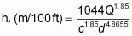
where:
|
Q |
is the flow rate in the pipe (Q = L/sec or gpm). |
|
d |
is the inside diameter of the pipe (d = mm or in). |
|
c |
is the roughness coefficient and is dependent on the material of the pipe. Approximate values are as follows: |
|
Material |
c |
|
PVC or polyethylene |
150 |
|
new steel pipe |
135 |
|
old steel pipe |
100 |
Friction losses in pipe fittings and valves may be computed by determining the equivalent length of pipe that will create the same loss. To obtain the equivalent length, we can multiply the nominal diameter by a factor. Some common fittings and their factors (Ref. 27) are:
|
Fitting |
Length Multiplier |
|
Union |
7 |
|
Elbow (90°, short radius) |
33 |
|
Gate valve (fully open) |
7 |
|
Free entrance |
29 |
|
Tee (straight run) |
27 |
|
Tee (90 degree side) |
68 |
For example, a 5 cm close radius elbow has the same loss as an
equivalent length of pipe of 165 cm, i.e. (5 33).
33).
For long pipelines normally used in irrigation, an increase of 10% in the friction losses calculated without fittings will account for fitting losses.
5.2.9 Water hammer
Water hammer is the pressure pulsation that occurs in a pipe when a valve is suddenly opened or closed. The shock pressure, or water hammer, may be several times greater than the working pressure of the pipe. Water hammer is a frequent cause of failure in PVC lines when valves are closed suddenly. The effect is greater with longer pipelines, higher velocities, and rapid valve closing. The maximum pressure rise in PVC pipe that will result from rapid valve closure can be determined with the following equation:
metric: P = 0.053with P(kg/cm2); V(m/sec); L(m); T(sec)
English: P = 0.070with P(psi); V(ft/sec); L(ft); T(sec)
where:
P = pressure rise above the static pressure.
V = liquid velocity in the pipe.
L = length of pipe ahead of valve causing the hammer.
T = time required to close the valve.
Example: Given a pipeline with a length of 61 m (200 ft); water velocity at 1.07 m/sec (3.5 ft/sec); valve closure in 0.1 sec; static pressure of 1.4 kg/cm2 (20 psi); then P = 34.6 kg/cm2 or 490 psi from the equations presented. Next add 1.4 kg/cm2 (20 psi) to 34.6 kg/cm (490 psi) to get 36 kg/cm (510 psi) as the instantaneous pressure under the selected service conditions.
The water hammer analysis indicates how important it is to close valves slowly in long pipelines.
5.2.10 Air relief. Vacuum relief, and pressure relief
Air vents or air relief valves are necessary for allowing air to escape from pipelines as they fill with water, thus preventing air pockets, which restrict flow. Vacuum relief valves are necessary to prevent vacuum pressures (sub-atmospheric pressures) from collapsing pipelines (especially plastic lines) at times when pressures may fall below atmospheric.
Air and vacuum relief are often combined into one valve and are often called air/vacuum relief valves. Air and vacuum relief valves should be installed at the beginning and end of a pipeline, at high points or summits in a line where air could be entrapped, or periodically where air could otherwise be entrained by the water.
In low pressure lines, the air and vacuum relief can be accomplished simply with a stand pipe that is taller than the expected maximum operating pressure, expressed as the height of a column of water with a freeboard of 30 cm (1 ft). (See Figure 5.20 for dimensions.) For higher pressures, a commercial valve for air/vacuum relief is available.
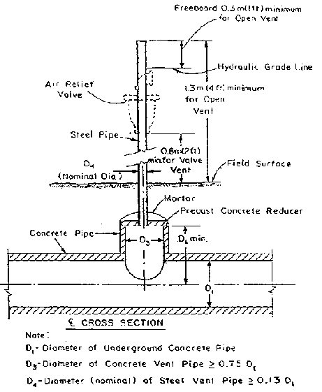
Figure 5.20 Air Vent for Low
Pressure Pipelines (Ref. 41)
The sudden escape of large amounts of air from a pipeline as it fills can cause high momentary pressure rises - as high as 4 times the operating pressure - when automatic air relief valves close suddenly. Thus, it is important that pipelines be filled slowly. The velocity at which an empty pipeline should be filled should not exceed 0.7 m/sec, or 2 ft/sec. The orifice of a pressure/vacuum relief valve should be at least 1/2 inch for pipelines of 5 inches or less, and 1 inch for pipelines of 6 to 10 inches.
Pressure relief valves prevent pressures that would be significantly above normal operating pressures from building up. This helps to protect against breakages in the pipeline from pressure build-up due to blockages.
Open vent stands can be used for pressure relief; however, pressure relief valves are often used for pressurized systems. They are often made for a specific pressure, which should be marked on the valve.
Some pressure relief valves are adjustable and can be set for different pressures. The valves should be capable of discharging the design flow rate without elevating pipeline pressures by more than 50% above the working pressure. One valve at the lowest point in a pipeline, or the point of maximum expected pressure, is usually sufficient to provide necessary protection.
Pressure relief valves do not provide sufficient protection against water hammer. The Soil Conservation Service suggests that pressure relief valves be no smaller than 1/4 inch nominal size for each diameter inch of the pipeline. Pressure relief valves should be set to open at pressures no greater than 5 psi above the design working pressure of the pipe.
5.2.11 Other pipeline structures and accessories
Pipelines require couplers to join pipeline sections together. Reducers are required when one size pipe is coupled to a pipe of a smaller diameter. Elbows are required for directional changes. Tees and crosses are required where the flow will be split. Globe, gate, and check valves are used to control the flow of water.
Valves should be capable of being closed slowly to prevent water hammer. Check valves are installed between the pump discharge and pipeline wherever necessary to prevent backflow. Foot valves are used with pumps to prevent the loss of prime in a pump or siphon. Hydrants are used to allow the withdrawal of water from a pipeline. Thrust blocks are used to prevent the pipe from coming apart at places where the flow velocity changes direction. Drain valves at low points in the system may be necessary to permit drainage. A valve at the very end of the system is often required to allow for flushing of sediment periodically from the lines.
5.2.12 Pipeline materials
Aluminum, rubber, plastic, or metal pipelines are often used in irrigation pipelines. The pressure rating of a pipeline is an important aspect of pipeline design. The Soil Conservation Service suggests that the working pressure should not exceed 72% of the rated pipeline pressure, and the design flow velocity should not exceed 1.5 m/sec (5 ft/sec).
The most common type of materials used in small Peace Corps projects are PVC and polyethylene plastic. Pipe made from these materials is sold based on the IPS (Iron Pipe Size) or PIP (Plastic Irrigation Pipe) size. IPS pipe sizes start at 1/2 inch in diameter and can be used with iron fittings without special adapters. For example, a 3/4 inch plastic pipe can use 3/4 inch metal fittings. PIP plastic pipe is sold in diameters of 4 inches and greater.
To connect PIP pipe to other PIP pipe requires PIP fittings, and to connect to IPS pipe requires special adaptors. It is important to remember in pipeline design that a nominal size of pipe will have different I.D.'s (inside diameters) and O.D.'s (outside diameters) depending on the system used. Thus, it is important that the system be specified.
<<TOC3>> 5.3 Land leveling
Land leveling for irrigation is a process by which the surface relief of a field is modified to a desired grade to provide a more suitable surface for efficiently applying irrigation water. Land leveling requires moving a lot of soil and for practical purposes is not done on a large scale without special machinery. Land leveling is probably the most intensive practice that is applied to agricultural land and is very costly. Considering the high investment required for this activity, only deep and fertile soils should be considered for leveling. The land should already be fairly level to reduce construction costs and earth movement, which greatly increase with slope. Land smoothing, a rough grading, is less intensive than land leveling and much less expensive. It may result in dramatic improvements in the ability of water to spread evenly over the surface.
The factors that influence the design of a land-leveling project are land slope, depth of soil, topography, crops to be grown, and method of irrigation. A major problem with land leveling is the removal of the topsoil and the influence of that removal on plant growth. Therefore it is important to determine the soil depth of a field so that after the leveling is done, an adequate depth of topsoil covers the entire field.
Because of the high cost and need for heavy machinery, farmers on a small scale may be more inclined to rough grade their fields. This is the practice of removing knolls, mounds, or ridges and filling pockets and depressions. This requires less soil movement and simpler, less costly tools and implements can be used. Figure 5.21 shows a wooden land-smoothing implement and a buck scraper. They can easily be constructed in the field and revisions in the design and materials can be made to adapt to local conditions. The implements can be pulled by a team of oxen across the field. The back plank on the buck scraper is hinged to the box so the operator can make cuts or fills by lowering or lifting the handle. The rectangular box is filled when making cuts and emptied when making fills. The addition of rocks or some other heavy object on the implements often improve their cutting and carrying ability.
Before leveling a field, several different locations in the field should be checked to assure sufficient soil depth and good uniformity. A topographical map will provide a basis for planning the irrigation system. Lastly, the land should be plowed to loosen the soil. This will make the smoothing process easier and more effective.
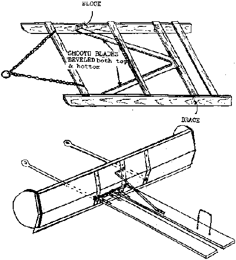
Figure 5.21 Land Smoother and
Buckscraper
Using the buck scraper requires that several passes be made across the field. Elevation differences need to be checked periodically against a permanent benchmark. Remember that the grade must be taken into consideration when taking field elevation shots from a set point in the field. Rough grading is time consuming and may also require final touches done manually. This process can be accomplished over several years with the grade being refined with each planting season.
<<TOC3>> 5.4 Irrigation methods
There are a number of irrigation methods in use throughout the world. They may be broadly classified as:
1. Surface - water is spread over the land surface;2. Sprinkle, Drip, or Low Volume Irrigation - water is applied as artificial rainfall;
3. Localized - water is applied as droplets or very small streams of water to specific points on the surface; and
4. Sub-irrigation - water is supplied to the root zone of the crop by maintaining a high water table.
The methods may be broken down further. For example, surface methods include graded or level border, basin, graded furrow, level furrow, contour furrow, contour ditch, wild flood, or corrugation methods.
Factors to consider when selecting and planning an irrigation system are:
· slope and topography of the field;
· crops to be grown - water requirements, tolerance to salt, moisture stress, wetness of surface, waterlogging, value of the crop, crop height, and cultivation required;
· field size and shape;
· soil texture, structure, depth, infiltration characteristics, water-holding capacity, erosivity, and variability within a field;
· soil and water salinity;· availability and quantity of water, and availability of time;
· amount and intensity of rainfall;
· economics - initial costs, amortized costs, operating costs (fuel, labor, water maintenance), availability of capital, marketability of crop, and net profitability; and
· farmer, social, and institutional constraints.
5.4.1 Characteristics of irrigation systems
(Adapted from Ref. 57)
A. Surface Irrigation (Figure 5.22) - level basins, level borders, and level furrows
1. Water is ponded on an enclosed level field and allowed to infiltrate in basins, borders, or furrows.
2. Advantages
a. Management is very easy.
b. Adapts easily to flat topography.
c. Low cost required.
d. Can function with no outlet drainage facilities.
e. Allows easy leaching of salts.
f. Allows full utilization of rainwater.
g. High application efficiencies can be achieved.
h. Adapts well to moderate to low infiltration rates.
i. Works well with short-term water supplies.
j. Adapts well to small land holdings.
3. Disadvantages
a. Requires level land to achieve high efficiencies (maximum land elevation fluctuation shouldn't be greater than half the applied irrigation depth).
b. Soils with high infiltration rates require small field sizes, which interferes with mechanization.
c. It is difficult to remove excess water, particularly during times of excess rainfall.
d. Plants are partly covered with water sometimes offer extended periods (in low infiltration rate soils).
e. It is difficult to apply small irrigations.f. Small basins require extensive delivery channels.
g. Small basins are not easily adaptable to tractor mechanization.
B. Surface Irrigation (Figures 5.22 and 5.23) -graded systems.
1. Water is put on the high end of a field and allowed to run slowly to the low end. Types of graded surface irrigation are:
a. furrows
- straight on medium slopes,
- contour on steep slopes;
b. borders;
c. corrugations; and
d. unguided (wild flooding).
Figure 5.22 Surface Irrigation Methods 1 (Ref. 10)
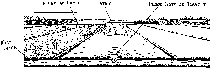
Level border (basin) irrigation
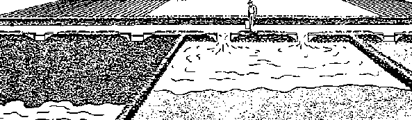
Graded border irrigation
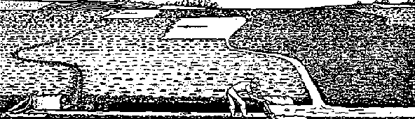
Contour ditch irrigation
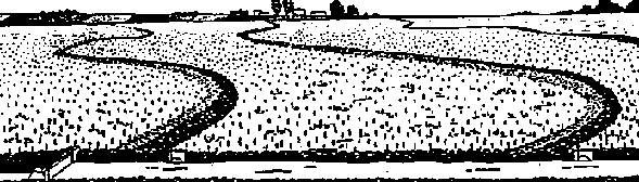
Contour levee Irrigation
Figure 5.23 Surface Irrigation Methods 2 (Ref. 10)
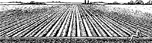
Level furrow irrigation
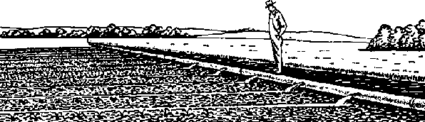
Graded furrow irrigation
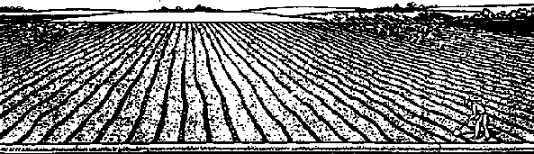
Corrugation irrigation
Contour furrow irrigation
2. Advantages
a. Requires low capital and energy costs.
b. Allows irrigation on sloping land (as is found in many irrigated areas).
c. Allows irrigation of long fields with relatively small flows.
d. Is applicable to soils with moderate to fairly high intake rates.
e. Field drainage of excess rain is made possible.
3. Disadvantages
a. To get relatively high efficiencies, a high degree of management and water control is required.
b. To get relatively high efficiencies, the land must be uniformly graded and shaped.
c. With moderate to slow infiltration rates, long irrigation times are required. Irrigation time must be close to the required intake opportunity time.
d. Except for soils with high infiltration rates, a drainage outlet must be available from every field to dispose of tailwater and rainwater.
e. Is labor intensive.
C. Sprinkler Irrigation
1. Pressurized water flows through pipes to outlets that spray the water over the area to be irrigated.
2. Types of sprinkler systems:
a. permanent,
b. semi-permanent, and
c. movable.
3. Advantages
a. Can achieve high efficiencies.
b. Applicable to most terrains - land leveling not required.
c. Applicable to soils of all infiltration rates.
d. Can have low labor requirements.
4. Disadvantages
a. Requires high capital and energy costs.
b. Requires moderately high technology.
D. Localized Irrigation
1. Water is constantly applied at very low rates through small holes in plastic tubing or from emitters to points or small areas in the field. Only part of the field is wetted.
2. Advantages
Has many of the same advantages as sprinklers, plus very high water efficiencies can be achieved, and it can be successfully utilized with highly saline waters.
3. Disadvantages
a. Requires high capital costs.
b. Requires high technology level.
c. Salinity may cause problems.
<<TOC3>> 5.5 Surface irrigation systems
Surface irrigation is the predominant method of irrigation throughout the world and has been used for thousands of years to irrigate a wide range of crops. Through the years, great improvements have been made to the wild flooding practice. Today there are a wide range of surface irrigation practices that allow the farmer an opportunity to select the practice that best fits conditions in the field.
Since the distribution of water with a surface system is dependent on the natural flow of water over the area to be irrigated, the land slope becomes very important. Some types of systems are for level land while other types are for land with some slope.
5.5.1 Criteria for design and operation
1. Factors that are important in designing surface irrigation systems include:
a. flow rates available,
b. soil and topography,
c. length water must run on given plot of irrigated land,
d. depth of water application,
e. slope of the land surface in the direction of the flow,
f. uniformity of the land (relief),
g. erodibility of the soils to be irrigated,
h. form of distribution of water from the conveyance ditch to the cultivated land (e.g turnout, siphon)
i. area and geometry of the land, and
j. system management with regard to the design and operation.
2. Criteria for the efficient use of irrigation water are:
a. Storing the required amount of water in the root zone. This amount depends primarily on the water-holding capacity of the soil and the root depth of the grown crop.
b. Obtaining a relatively uniform application of water. This requires that the amount of time the water remains on different parts of the field does not vary appreciably. Generally, the variation in depth infiltrated should not vary by more than 25%.
c. Minimizing erosion. Although erosion cannot be totally eliminated, it should be minimized as much as possible. This requires good management and adjustments made in the field.
d. Minimizing runoff. One efficient method to reduce losses in furrows is to reduce the flow when it has arrived, or is about to arrive, at the end of the furrow. This reduction is not as important when the runoff water can be reused in another plot.
e. Minimizing overwatering and percolation losses, with the exception of the need to leach salts.
f. Minimizing the land surface occupied by ditches, paths, and other components of the irrigation system.
g. Adapting the system to the geometry and dimensions of the field. When the physical, social, and legal factors permit, plots can be combined to eliminate boundaries, which allows design and management of the entire system with greater efficiency.
h. Adapting the system to the soils, topography, crop, and other physical factors that influence and determine the best design.
5.5.2 Description of different surface irrigation methods
(See Figures 5.22 and 5.23)
Wild Flooding
Wild flooding is a system used primarily for low income crops on steep land where the uniformity of water distribution is not an important factor. Water is delivered at several points along a head ditch that runs along the upper edge of a sloping field. The water advances on to the field without any attempt to control or restrict flow. The distribution is generally not uniform, with too much water applied on some parts of the field and inadequate amounts on others.
The converging of water on irregular topography can create concentrations of flow that can initiate erosive forces, and this must be monitored and controlled. This type of irrigation is used in places where there is an abundance of water and water costs are low. It is most suitable for close-growing perennial forage grasses and low value permanent pasture crops that will protect the soil from erosion. The spacing between the supply ditches is usually between 15 to 45 m, depending on the land slope, water flow rate, texture and depth of soil, and the crop grown. The minimum amount of land preparation and low cost of the system installation are the main advantages.
Level Basin Irrigation
The basin method of irrigation involves dividing a field into small, level plots. It is, therefore, most suited to flat lands but can be used on sloping land, provided that the soil is deep enough to allow leveling without exposing the subsurface. Small ridges or dikes of earth 30 to 50 cm high are constructed around the area to form the basin. The basins are filled with the amount of water required to fill the.i.pond and infiltrate into the soil. Basins may be square, rectangular, or irregular in shape, and may vary in size.
The size of basins depends primarily on the flow rates available and the texture of the soil. The practice involves flooding the plot as rapidly as possible so that all parts are uniformly covered with water. Therefore, for a given flow rate, basins in sandy soils will be smaller than basins in heavy clay. Table 5.6 gives suitable areas for basins with relation to flow rates and types of soils.
TABLE 5.6 Suitable Areas for Basins (m2) (Ref. 47)
|
Flow |
|
Soil Type |
| |
|
Liters/sec |
Sand |
Sandy Loam |
Clay Loam |
Clay |
|
10 |
65 |
200 |
400 |
700 |
|
20 |
130 |
400 |
800 |
1,400 |
|
50 |
325 |
1,000 |
2,000 |
3,500 |
|
100 |
650 |
2,000 |
4,000 |
7,000 |
When land is sloping, basins should be constructed in steps or terraces following the contour of the slope. Normally, the width of the terraces will depend on the depth of topsoil. A minimum topsoil depth of 30 cm is recommended to ensure good plant growth. Where soils are shallow and slopes are steep, very little land levelling can be done, and terraces will be narrow.
Basins adapt well to pre-irrigation or water harvesting that diverts stream flow during rainfall to the plots to store moisture in the soil profile. In areas of intensive rainfall, it may be necessary to provide for some means of drainage to prevent overtopping of the levee.
This type of irrigation is used with crops that can withstand contact with water for long periods of time (such as rice and cotton), with close-growing crops with deep rooting (such as alfalfa), and with some types of orchards, where each tree may have its own basin.
Border Irrigation
The layout of graded borders is similar to that of basin, except that the irrigated surface has a slight slope to it. The method is designed so that a sheet of water advances down the border and covers all the plot uniformly. A field is divided by borders into a series of strips 3 to 30 m wide and generally from 60 to 800 m long. See Table 5.7 for suitable dimensions for border strips.
Cross slopes should be eliminated whenever possible. This allows the water to spread evenly over the entire surface.
The levees or ridges forming the borders to the strips should be 20 to 25 cm high. When irrigating, each strip is flooded at the upper end. The amount of flow must be sufficient to reach the end of the strip. When the sheet of water has advanced 80%-85% of the length, the supply flow can be reduced. Several field tests, with variations in the flow rate and time of irrigation, may be necessary to determine the optimum combination that assures a uniform distribution with minimum runoff losses. A tail ditch is generally needed to remove the excess water at the end of the border.
This type of irrigation is best suited for close growing crops, such as small grains, alfalfa, and grasses.
TABLE 5.7 Suitable Dimensions for Border Strips (Ref. 47)
|
Type |
Soil Infiltration Rate |
Slope |
Width |
Length |
Flow |
|
Sands |
25 and over |
0.2 |
15-30 |
60-90 |
220-450 |
| | |
0.4 |
10-12 |
60-90 |
100-120 |
| | |
0.8 |
5-10 |
75 |
30-70 |
|
Loams |
7 to 25 |
0.2 |
15-30 |
250-300 |
70-140 |
| | |
0.4 |
10-12 |
90-180 |
40-50 |
| | |
0.8 |
5-10 |
90 |
12-25 |
|
Clays |
2.5 to 7 |
0.2 |
15-30 |
350-800 |
45-90 |
| | |
0.4 |
10-12 |
180-300 |
30-40 |
5.5.3 Contour ditch
This method of irrigation utilizes a system of contour ditches that are laid out over the entire field, and which divide the land into several strips. The water from the head ditch is directed into one ditch at a time and fills the entire ditch.
The overflow spills over the ditch edge and flood- irrigates the strip of land below. There are no ridges or dikes to restrict the water flow. The water flows across the strip of land to the next contour ditch. Any excess water is collected in the next lower ditch to be used on the next strip. This process is repeated until the entire field is irrigated. The field ditches must be placed closely together to keep the water distribution even throughout the field. The spacing depends on the slope, intake rate of the soil, and the amount of water needed to irrigate each area.
The contour ditch method is often used for close-growing crops in pastures on sloping and rolling land that cannot be easily levelled for other methods of irrigation.
5.5.4 Contour levee
The contour levee type of surface irrigation is similar to the level border method, except it is adapted to sloping land. The strips have been graded until they are level, and instead of rectangular fields bordered by ridges, the fields are bounded on the contour by levees at the lower edge of the strip.
This method of irrigation is often used on fields where the slope is greater than 0.2% but less than 4%, and where land leveling would be impractical or too expensive. The distance between levees depends on the slope and crop to be irrigated, but typically the difference in elevation between levees should not exceed 10 cm; therefore, the distance between levees varies between 3 to 15 m.
When irrigating, the procedure is the same as for the level border system. Water is applied from a head ditch, and it spreads rapidly over the area where it infiltrates into the soil. Since contour levee systems consist of leveled areas on the side of a slope, there are more strips below the highest one. Therefore, water can be reused from the higher strips to the lower strips. The excess water from a strip is directed into the one immediately below. Good drainage must be provided at the lowest strip to remove all excess water. This type of irrigation is well suited to rice cultivation and can be used with crops that can tolerate being submerged in water for long periods of time, such as cotton and some forage grasses.
5.5.5 Furrow irrigation
With this type of irrigation, the water is applied to small channels, known as furrows, that are between the rows of plants. Furrow irrigation adapts better than any other method to crops that are grown in rows with more than a 30 cm spacing, such as vegetables, tomatoes, maize, and potatoes. In contrast to basin and border irrigations, furrow irrigation wets only part of the ground surface. This reduces evaporation losses, improves aeration of the root zone, and permits earlier cultivation after irrigation.
Furrows are usually V-shaped in cross section, 25-30 cm wide at the top, and 15-20 cm deep. Wider, U-shaped furrows with a greater wetted area are sometimes used on soils with slower water intake rates.
There are three different types of furrow irrigation:
· level furrow,
· graded furrow, and
· contour furrow. (The furrows are laid out across the slope on a uniform grade. This type of furrow irrigation can be used on hillside slopes of up to 25%.)
Table 5.8 suggests maximum furrow lengths for different soils, slopes, and water applications.
TABLE 5.8 Suggested Maximum Furrow Lengths (meters) (Ref. 47)
|
Furrow Slope % |
Clays |
Loams |
Sands |
|
0.05 |
|
270 - 400 |
90 - 190 |
|
0.10 |
450 - 500 |
340 - 470 |
120 - 220 |
|
0.20 |
510 - 620 |
370 - 530 |
190 - 300 |
|
0.30 |
570 - 800 |
400 - 600 |
220 - 400 |
|
0.50 |
540 - 750 |
370 - 530 |
190 - 300 |
|
1.00 |
450 - 600 |
300 - 470 |
150 - 250 |
|
1.50 |
400 - 500 |
280 - 400 |
120 - 220 |
|
2.00 |
320 - 400 |
250 - 340 |
90 - 190 |
 400
400 Water is admitted to the head of each furrow, and the rate of flow is adjusted so that the furrow flows full without overtopping. As the water reaches the end of the furrow, the required amount of water has infiltrated into the soil to satisfy the irrigation requirements. The rate of flow into the furrow depends primarily on the intake rate of the soil and the length of the furrow. Table 5.9 gives infiltration rates for various soils textures and suitable furrow flow rates per 100 m length of furrow.
To determine the correct flow rate per furrow requires testing in the field. A simple advance and recession test can be done. To do this, the irrigationist marks off three points along the furrow - a point near the beginning, the midway point, and a meter from the end of the furrow. The water is directed into the furrow at the desired operating flow rate, and the times when the water passes the three markers are noted. At the end of the irrigation, the irrigationist, using the same points along the furrow, notes the time that it takes the water to infiltrate and regress from the end of the furrow to the beginning. With these two sets of data, the irrigationist plots the advance and recession curves for the flow rate in the furrow (x-y axis graph: x-axis is length of furrow and corresponding marks; y-axis is time) on the same graph paper. If the two curves are more or less parallel, this indicates that the flow and time for the length of furrow gave a good water distribution. If this is not the case, the flow rate and/or time of irrigation should be changed. This test should be done for each alteration until the desired results are achieved. This field test is easy to perform and should be done regularly to assure a good water distribution application.
Table 5.9 Soil Infiltration Rates and Suitable Furrow Inflows per 100 Meters of Furrow Length. (Furrow spacing 1 meter) (Ref. 47)
|
Soil |
Infiltration Rate |
Furrow Inflow |
|
Clay |
1-5 |
0.03-0.15 |
|
Clay loam |
5-10 |
0.15-0.30 |
|
Silt loam |
10-20 |
0.30-0.50 |
|
Sandy loam |
20-30 |
0.50-0.80 |
|
Sand |
30-100 |
0.80-2.70 |
5.5.6 Corrugation irrigation
This method of irrigation is very similar to graded furrows, except that the furrows are much smaller in size. The corrugations or rills are evenly spaced in the field. The spacing and size of the corrugations vary with different soil textures. The method is generally more applicable on fine-textured soils that intake water slowly. The more porous the soil, the closer spaced the corrugation should be because of the lateral movement of water. This method is also used on soils that seal over and crust when other types of flood irrigation are used.
Table 5.10 gives suggested maximum lengths and spacings for corrugations for different slopes, and for deep and shallow soils.
TABLE 5.10 Length and Spacing of Corrugations (Ref. 47)
| | |
CLAYS |
LOAMS |
SANDS | |||
| |
Slope |
Length |
Spacing |
Length |
Spacing |
Length |
Spacing |
| |
% |
m |
m |
m |
m |
m |
m |
|
Deep |
2 |
180 |
0.75 |
130 |
0.75 |
70 |
0.60 |
|
soils |
4 |
120 |
0.65 |
90 |
0.75 |
45 |
0.55 |
| |
6 |
90 |
0.55 |
75 |
0.65 |
40 |
0.50 |
| |
8 |
85 |
0.55 |
60 |
0.55 |
30 |
0.45 |
| |
10 |
75 |
0.50 |
50 |
0.50 |
-- |
-- |
|
Shallow |
2 |
120 |
0.60 |
90 |
0.60 |
45 |
0.45 |
|
Soils |
4 |
85 |
0.55 |
60 |
0.55 |
30 |
0.45 |
| |
6 |
70 |
0.55 |
50 |
0.50 |
-- |
-- |
| |
8 |
60 |
0.50 |
45 |
0.45 |
-- |
-- |
| |
10 |
55 |
0.45 |
40 |
0.45 |
-- |
-- |
5.5.7 Operation and maintenance of farm surface irrigation systems
1. Clear the head ditch and conveyance canal of weeds and debris on a regular basis. Obstructions greatly influence the flow rate.
2. Check for washouts around the edges of all control structures along the conveyance system to the field.
3. Conduct micro-levelling in the border or basin: the need will become evident after the first couple of irrigations.
4. Regulate the flood gate or other means of turning in the water so that the water advances across the plot(s) as quickly as possible without creating erosion.
5. Make sure the operator knows how much water is being placed on the field.6. Reform the ridges, levees, or furrows when necessary. Conduct land smoothing often.
7. Keep animals off of field.
8. Fill in or plug any rodent or ant holes.
9. If it is necessary to slow down velocity in canals, place heavy objects (e.g. rocks) in the canal to form a small check.
10. Pre-irrigate land before transplanting on to furrow beds.
11. Check field one to two days after irrigation with shovel or soil auger to assure uniform distribution of water.
5.6 Sprinkler irrigation systems
In the 1980s, the use of sprinkler irrigation in developing countries increased greatly as new technology and equipment were introduced. This large jump in technology (from not irrigating to sprinkler irrigation) has led to many problems for small-scale farmers in applying new technology correctly and efficiently. To address these problems, this section will expand upon the operation, evaluation, and maintenance factors involved in sprinkler irrigation practices and, to a much lesser extent, design procedures. As more farmers use sprinkler irrigation, understanding of system operation and methods for applying water more efficiently will become more important for the irrigationist.
Sprinkler irrigation is applicable in a wide range of circumstances. It can be used on steeper slopes than most surface systems. It is usually the most efficient irrigation method for shallow, permeable, and uneven ground. The greatest limitation of this practice with small-scale farmers is the large initial investment for the equipment. Other limitations include high energy costs for pumping stations (if required), the effects high winds have on water distribution patterns, and the need for water that is free of any debris (e.g. sand, leaves, sticks) that clog or damage the system.
5.6.1 Principal components
As shown by Figure 5.24 the main components of a sprinkler system are:
· pumping station (if required - in a gravity flow system, no pump is needed),
· main line pipe,
· lateral pipe,
· riser,
· sprinkler, and
· accessories.
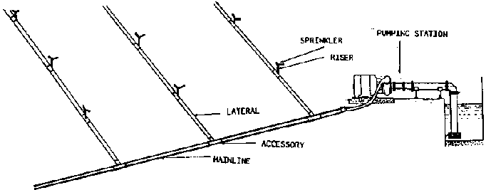
Figure 5.24 Typical Sprinkler
Irrigation System Components
- The pumping station is located at the water source, and the pump lifts the water and makes it available under pressure to the system. The pump is required to overcome elevational differences between the water source and the field, counteract frictional losses within the system, and provide adequate pressure at the nozzle for good water distribution. A gravity flow system uses the potential energy in an elevational drop to create pressure for its operation.
- The main line delivers water from the water source to the field. It may be either permanent or movable.
- The lateral pipe delivers the water from the main line to different sections of the field. The lateral line is usually movable.
- The riser delivers the water from the lateral line to the sprinkler. The length of the riser depends on the crop, although a minimum value of 30 cm is recommended to assure a good distribution pattern.
- The sprinkler is the unit that sprays the pressurized water through an orifice and rotates to distribute water on to the field.
- The accessories are parts of the system that generally connect all of the other units together to form a watertight system. These parts are very important to an efficient system and should be installed whenever possible. Examples of accessories are tees, unions, elbows, and reducers.
5.6.2 Pine specifications
1. Types of materials are:
· galvanized steel,
· aluminum,
· polyvinyl chloride (PVC),
· polyethylene, and
· soft plastic (e.g. garden hose).
2. Pressure limits are:
a. PVC Standard Dimension Ratio (SDR): pressure rating
- 51:80 psi
- 41:100 psi
- 32.5:125 psi
- 26:160 psi
(above ratings are for PVC tubing 1120, 1220 or 2120; other materials will have lower pressure ratings.)
b. polyethylene - 30 to 100 psi for SDR 41 to 17 depending on material.
5.6.3 Sprinkler heads and nozzles
Types of materials
· metal (generally brass)
· plastic
· combination metal and plastic
Types of Sprinkler
· microjets - a mist-type sprinkler used primarily in seedbeds and underneath foliage of certain crops;
· one-nozzle sprinkler -- components include hammer, range nozzle;
· two-nozzle sprinkler -- components include hammer, range nozzle, and spreader nozzle.
NOTE: One-nozzle sprinklers are notorious for poor water distribution. They create a doughnut of wetted soil because they don't have a spreader nozzle. Therefore, a special effort must be made in their installation so that they overlap properly to compensate for unwetted areas.
General Sprinkler Specifications
|
Type |
Class |
Pressure Range |
Capacity |
Wetted Diameter |
|
Microjet |
Low pressure |
5-15 psi |
5-30 gpm |
2-6 m |
|
One-nozzle |
Medium pressure |
15-45 psi |
1-3 gpm |
8-12 m |
|
Two-nozzle |
High pressure |
45-95 psi |
3-8 gpm |
12-60 m |
Nozzle Sizes
Nozzle size, pressure, and type affect application rates, size of wetted diameter, and water droplet size. Higher pressures and smaller nozzle size result in smaller water droplet sizes. Certain nozzle sizes are difficult to find or simply not available in developing countries Frequently, sprinklers are sold with the nozzle already in place. In this case, the irrigation system capacity must be designed around a specific sprinkler. See Figures 5.25 and 5.26. The manufacturer will give specifications for the sprinkler for different applied pressures.
Figure 5.25 Example 1 of Sprinkler Characteristics
20JH/20EJH
1/2 In (15 mm) Full Circle Impact Sprinklers
· Full circle brass impact sprinklers
· Standard trajectory angle for maximum distance of throw
· Small nozzle sizes; low flow rates
· Low water application rate; ideal for heavy soils and slopes
· "E" model has non clog vane in nozzle for greater distance of throw
· Durable brass construction; excellent for many types of field applications
· Superior "H" bearing for longer life
· New die cast spoon drive for greater durability on portable pipe systems
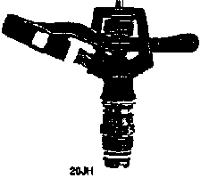
20 JH
Application:
· Undertree
· Overtree
· Overvine
· Field Crops
· Row Crops
· Permanent Systems
· Solid Set Systems
· Portable Systems
· Vegetables
· Nurseries
Common Spacings Range:
2035 ft to 40
50 ft
6
9 m to 12
15 m
Models:
|
Sprinklers |
20JH |
20EJH |
|
Nozzles |
SB |
RFN-1 |
Specifications:
Bearing Size/Type -1/2 in (15 mm) male NPT
Body trajectory - 23°
Materials:
Body: Cast Bronze
Arm: Cast Bronze
Bearing Sleeve: Brass
Bearing Nipple: Brass
All Springs: Stainless Steel
All Washers: Chemically resistant
20JH/ST. BORE NOZZLES
Stream Height 6 ft*
U.S. UNITS
| |
Nozzle 7/64" ** |
Nozzle 1/8" |
Nozzle 9/64" |
Nozzle 5/32" | ||||
|
PSI @ Nozzle |
Dia. GPM |
Dia. GPM |
Dia. GPM |
Dia. GPM | ||||
|
35 |
76 |
2.05 |
77 |
2.68 |
79 |
3.39 |
79 |
4.19 |
|
40 |
77 |
2.19 |
78 |
2.86 |
79 |
3.62 |
79 |
4.41 |
|
45 |
78 |
2.32 |
79 |
3.03 |
80 |
3.82 |
80 |
4.73 |
|
50 |
78 |
2.45 |
79 |
3.20 |
81 |
4.05 |
81 |
5.00 |
|
55 |
78 |
2.57 |
80 |
3.35 |
81 |
4.24 |
81 |
5.23 |
|
60 |
79 |
2o8 |
80 |
3.50 |
82 |
4.43 |
82 |
5.47 |
Stream Height-1,8m*
METRIC UNITS
|
Bars |
Nozzle 2,78 mm ** 7/64" |
Nozzle 3,57 mm 9/64" |
Nozzle 3,57 mm 9/64" |
Nozzle 3,97 mm 5/32" | ||||||||
| |
Rad. M |
Flow M3/h |
Flow L/s |
Rad. M |
Flow M3/h |
Flow L/s |
Rad. M |
Flow M3/h |
Flow L/s |
Rad. M |
Flow M3/h |
Flow L/s |
|
2.5 |
11,6 |
0.47 |
0.13 |
11.8 |
0.62 |
0.17 |
12.0 |
0.78 |
0.22 |
12.0 |
0.97 |
0.27 |
|
3.0 |
11.8 |
0.52 |
0.14 |
12.0 |
0.68 |
0.19 |
12.2 |
0.86 |
0.24 |
12.4 |
1.06 |
0.29 |
|
3.5 |
11.9 |
0.56 |
0.16 |
12.1 |
0.73 |
0,20 |
12.3 |
0.93 |
0.26 |
12.3 |
1.14 |
0.32 |
|
4.0 |
12.0 |
0.60 |
0.17 |
12.2 |
0.78 |
0.22 |
12.4 |
0.99 |
0.27 |
12.5 |
1.22 |
0.34 |
20EJH/ST. BORE NOZZLES
Stream Height 7 ft*
U.S. UNITS
| |
Nozzle 7/64" ** |
Nozzle 1/8" |
Nozzle 9/64" |
Nozzle 5/32" | ||||
|
PSI @ Nozzle |
Dia. GPM |
Dia. GPM |
Dia. GPM |
Dia. GPM | ||||
|
35 |
77 |
2.05 |
79 |
2.68 |
82 |
3.39 |
84 |
4.19 |
|
40 |
78 |
2.19 |
80 |
2.86 |
83 |
3.62 |
85 |
4.41 |
|
45 |
79 |
2.32 |
81 |
3.03 |
84 |
3.82 |
85 |
4.73 |
|
50 |
80 |
2.45 |
82 |
3.20 |
85 |
4.05 |
86 |
5.00 |
|
55 |
81 |
2.57 |
82 |
3.35 |
86 |
4.24 |
87 |
5.23 |
|
60 |
81 |
2.68 |
82 |
3.50 |
87 |
4.43 |
88 |
5.47 |
Stream Height-2,1m*
METRIC UNITS
|
Bars |
Nozzle 2,78 mm ** 7/64" |
Nozzle 3,57 mm 9/64" |
Nozzle 3,57 mm 9/64" |
Nozzle 3,97 mm 5/32" | ||||||||
| |
Rad. M |
Flow M3/h |
Flow L/s |
Rad. M |
Flow M3/h |
Flow L/s |
Rad. M |
Flow M3/h |
Flow L/s |
Rad. M |
Flow M3/h |
Flow L/s |
|
2.5 |
11.8 |
0.47 |
0.13 |
12.1 |
0.62 |
0.17 |
12.5 |
0.62 |
0.17 |
12.8 |
0.97 |
0.27 |
|
3.0 |
12.0 |
0.52 |
0.14 |
12.3 |
0.68 |
0.19 |
12.8 |
0.86 |
0.24 |
13.0 |
1.06 |
0.29 |
|
3.5 |
12.2 |
0.56 |
0.16 |
12.5 |
0.73 |
0,20 |
13.0 |
0.93 |
0.26 |
13.1 |
1.14 |
0.32 |
|
4.0 |
12.4 |
0.60 |
0.17 |
12.5 |
0.78 |
0.22 |
13.2 |
0.99 |
0.27 |
13.3 |
1.22 |
0.34 |
1 bar = aprox. 100 kPa.
GENERAL NOTE: Performance data are obtained under ideal test conditions and may be adversely affected by mind, hydraulic conditions, and other factors
SHADED AREAS: Nozzle/pressure combinations in shaded area of chart result in marginal water distribution.
* Shown for standard nozzle at mid-range operating
pressure
** Standard nozzle
NOTE A: Distance of throw data are based on a 30 in (76 cm) riser height.
Figure 5.26 Examples 2 of Sprinkler Characteristics
30H/30WH/30WSH/30EH/30EWH
3/4 in (20 mm) Full Circle
Impact Sprinklers
· Full circle brass impact sprinklers
· Standard trajectory angle for maximum distance of throw
· Durable brass construction; excellent for many types of field applications
· "H" models have rear spreader nozzle; "WH" models have plugged spreader outlet; "WSH" model has single nozzle body
· "E" models have non-clog vane in nozzle "for greater distance of throw

30H
Applications:
· Overtree
· Field Crops
· Row Crops
· Vegetables
· Nurseries
· Permanent Systems
· Solid Set Systems
· Portable Systems
· Wheel Lines
Common Spacings Range:
3050 ft to 60
60 ft
12
15 m to 18
18 m
Models:
|
Sprinklers |
30H |
30WSH |
30EWH |
| |
30WH |
30EH | |
|
Drive nozzles |
SB |
LPN-3 |
RFN-3 |
|
Spreader nozzles |
slotted (7° or 20°) | ||
Specifications:
Bearing Size/Type - 3/4 in (20 mm) male NPT
Body trajectory - 27°
Materials:
Body: Cast Bronze
Arm: Cast Bronze
Bearing Sleeve: Brass
Bearing Nipple: Brass
All Springs: Stainless Steel
All Washers: Chemically resistant
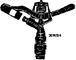
30WSH
30H / ST. BORE DRIVE NOZZLE
3/32 in (2,38 mm) 7°
SPREADER
Stream Height 9 ft*
U.S. UNITS
| |
Nozzle 9/64" |
Nozzle 5/32" |
Nozzle 11/64" |
Nozzle 3/16" | ||||
|
PSI @ Nozzle |
Dia. GPM |
Dia. GPM |
Dia. GPM |
Dia. GPM | ||||
|
25 |
80 |
4.2 |
82 |
4.8 |
83 |
5.6 |
85 |
6.4 |
|
30 |
81 |
4.6 |
85 |
5.3 |
88 |
6.1 |
91 |
7.0 |
|
35 |
82 |
4.9 |
87 |
5.7 |
90 |
6.6 |
94 |
7.5 |
|
40 |
83 |
5.2 |
88 |
6.1 |
92 |
7.0 |
96 |
8.1 |
|
45 |
84 |
5.6 |
89 |
6.5 |
93 |
7.4 |
98 |
8.5 |
|
50 |
85 |
5.9 |
90 |
6.8 |
95 |
7.9 |
100 |
9.0 |
|
55 |
86 |
6.1 |
91 |
7.1 |
96 |
8.2 |
101 |
9.4 |
|
60 |
87 |
6.4 |
92 |
7.4 |
97 |
8.6 |
102 |
9.9 |
|
65 |
88 |
6.7 |
93 |
7.8 |
98 |
8.9 |
103 |
10.2 |
|
70 |
89 |
6.9 |
94 |
8.1 |
99 |
9.3 |
104 |
10.7 |
|
75 |
90 |
7.2 |
95 |
8.3 |
100 |
9.6 |
105 |
11.0 |
|
80 |
91 |
7.5 |
96 |
8.7 |
101 |
10.0 |
106 |
11.5 |
 3/32" -
7°
3/32" -
7°  3/32"
-7°
3/32"
-7°  3/32" -
7°
3/32" -
7°  3/32" -
7°
3/32" -
7° Stream Height-2,7 m*
METRIC UNITS
|
Bars |
Nozzle 3,57 |
Nozzle 3,97 |
Nozzle 4,37 |
Nozzle 3,97 | ||||||||
| |
Rad. M |
Flow M3/h |
Flow L/s |
Rad. M |
Flow M3/h |
Flow L/s |
Rad. M |
Flow M3/h |
Flow L/s |
Rad. M |
Flow M3/h |
Flow L/s |
|
2.5 |
11.8 |
0.47 |
0.13 |
12.1 |
0.62 |
0.17 |
12.5 |
0.62 |
0.17 |
12.8 |
0.97 |
0.27 |
|
3.0 |
12.0 |
0.52 |
0.14 |
12.3 |
0.68 |
0.19 |
12.8 |
0.86 |
0.24 |
13.0 |
1.06 |
0.29 |
|
3.5 |
12.2 |
0.56 |
0.16 |
12.5 |
0.73 |
0,20 |
13.0 |
0.93 |
0.26 |
13.1 |
1.14 |
0.32 |
|
4.0 |
12.4 |
0.60 |
0.17 |
12.5 |
0.78 |
0.22 |
13.2 |
0.99 |
0.27 |
13.3 |
1.22 |
0.34 |
 2,38 mm 9/64"
 3/32" - 7°
  2,38 mm 5/32"
 3/32" - 7°
  2,38 mm
11/64"
2,38 mm
11/64"  3/32" - 7°
  2,38 mm 3/16"
 3/16" - 7°
 30H / ST. BORE DRIVE NOZZLE
118 in (3.18 mm) 20.
SPREADER
Stream Height 9 ft*
U.S. UNITS
| |
Nozzle 9/64" |
Nozzle 5/32" |
Nozzle 11/64" |
Nozzle 3/16" | ||||
|
PSI @ Nozzle |
Dia. GPM |
Dia. GPM |
Dia. GPM |
Dia. GPM | ||||
|
25 |
80 |
5.2 |
82 |
5.8 |
83 |
6.6 |
85 |
7.4 |
|
30 |
81 |
5.6 |
85 |
6.4 |
88 |
7.2 |
91 |
8.1 |
|
35 |
82 |
6.1 |
87 |
6.9 |
90 |
7.7 |
94 |
8.7 |
|
40 |
83 |
6.5 |
88 |
7.3 |
92 |
8.3 |
96 |
9.3 |
|
45 |
84 |
6.9 |
89 |
7.9 |
93 |
8.8 |
98 |
9.9 |
|
50 |
85 |
7.3 |
90 |
8.2 |
95 |
9.3 |
100 |
10.4 |
|
55 |
86 |
7.6 |
91 |
8.6 |
96 |
9.7 |
101 |
10.9 |
|
60 |
87 |
7.9 |
92 |
9.0 |
97 |
10.1 |
102 |
11.4 |
|
65 |
88 |
8.2 |
93 |
9.4 |
98 |
10.5 |
103 |
11.8 |
|
70 |
89 |
8.5 |
94 |
9.7 |
99 |
10.9 |
104 |
12.3 |
|
75 |
90 |
8.8 |
95 |
10.0 |
100 |
11.3 |
105 |
12.7 |
|
80 |
91 |
9.1 |
96 |
10.3 |
101 |
11.6 |
106 |
13.1 |
 1/8" -
7°
1/8" -
7°  1/8"
-7°
1/8"
-7°  1/8" -
7°
1/8" -
7°  1/8" -
7°
1/8" -
7° Stream Height-2,7 m*
METRIC UNITS
|
Bars |
Nozzle 3,57 |
Nozzle 3,97 |
Nozzle 4,37 |
Nozzle 3,97 | ||||||||
| |
Rad. M |
Flow M3/h |
Flow L/s |
Rad. M |
Flow M3/h |
Flow L/s |
Rad. M |
Flow M3/h |
Flow L/s |
Rad. M |
Flow M3/h |
Flow L/s |
|
2.0 |
12.3 |
1.27 |
0.35 |
12.8 |
1.42 |
0.40 |
13.1 |
1.61 |
0.45 |
13.5 |
1.81 |
0.50 |
|
2.5 |
12.5 |
1.41 |
0.39 |
12.9 |
1.60 |
0.44 |
13.7 |
1.79 |
0.50 |
14.3 |
2.02 |
0.56 |
|
3.0 |
12.8 |
1.54 |
0.43 |
13.0 |
1.75 |
0.49 |
14.1 |
1.96 |
0.54 |
14.9 |
2.21 |
0.61 |
|
3.5 |
13.0 |
1.66 |
0.46 |
13.3 |
1.89 |
0.53 |
14.5 |
2.11 |
0.59 |
15.3 |
2.38 |
0.66 |
|
4.0 |
13.2 |
1.77 |
0.49 |
13.5 |
2.02 |
0.56 |
14.8 |
2.26 |
0.63 |
15.6 |
2.54 |
0.71 |
|
4.5 |
13.4 |
1.87 |
0.52 |
13.9 |
2.13 |
0.59 |
15.0 |
2.39 |
0.66 |
15.8 |
2.69 |
0.75 |
|
5.0 |
13.6 |
1.97 |
0.55 |
14.2 |
2.24 |
0.62 |
15.2 |
2.52 |
0.70 |
15.9 |
2.83 |
0.79 |
|
5.5 |
13.9 |
2.06 |
0.57 |
14.6 |
2.33 |
0.65 |
15.3 |
2.65 |
0.74 |
16.0 |
2.97 |
0.83 |
 2,38 mm 9/64"
 3/32" - 7°
  2,38 mm 5/32"
 3/32" - 7°
  2,38 mm
11/64"
2,38 mm
11/64"  3/32" - 7°
  2,38 mm 3/16"
 3/16" - 7°
 Angle of Nozzle Flow
Generally, water flows out of a sprinkler at different angles relative to the horizontal plane. This angle depends on the particular sprinkler, and the range of angles are 0° to 23°. The lower angles will result in a smaller wetted diameter, the water droplets will be larger, and the impact force with which the droplets strike the foliage or the ground surface is greater. Generally, the higher angle sprinklers are used in vegetable or cash crop irrigation because the droplet impact is less damaging to the leaf or fruit. Lower angle sprinklers are used under trees in orchards because their almost flat trajectory avoid wetting the foliage and gives better water distribution in windy areas.
5.6.4 Sprinkler system design
Preliminary Study
1. Topographical study.
2. Soil
- texture,
- water-holding capacity,
- intake rate, and
- density/compaction or filth.
3. Crop
- density of planting,
- depth of rooting, and
- height of growth.
4. Climatic conditions
- precipitation,
- temperature, and
- consumptive use/hydraulic balance.
5. Available materials and equipment.
6. Quality of water
- salts and
- contaminants
Design Parameters
1. Maximum daily requirement for peak crop water use.2. The system application efficiency (65%-85%).
3. Peak use/efficiency = the depth of water that the design of the system must achieve.
4. Frequency of irrigation. This is determined by the amount of available water in the root zone. When water in the root zone is depleted by 50% by plant consumption, it needs to be replenished by irrigation. The amount of water applied should bring the soil at rooting depth to field capacity. Applying more water than is needed is not recommended because the excess water passes through the root zone and leaches plant nutrients downward out of reach of the plant. (See Table 5.11)
5. Time required to irrigate. The time required to irrigate is directly related to the rate of water infiltration into the soil. (See Table 5.12) To design an efficient application time, the rate of application should be as close as possible to the soil infiltration rate without exceeding it (this would cause run-off and possible erosion). The required irrigation time is then minimized. The amount of time to irrigate varies with plant water needs during different stages of growth.
TABLE 5.11 Available Water-Holding Capacities for Various Soil Texture a (Ref. 10)
|
Texture |
Available Water-Holding Capacities cm of Water/Meter of Soil |
|
Coarse sand and gravel |
2 to 6 |
|
Sands |
4 to 9 |
|
Loamy sands |
6 to 12 |
|
Sandy loams |
11 to 15 |
|
Fine sandy loams |
14 to 18 |
|
Loams and silt loams |
17 to 23 |
|
Clay loams and silty clay loams |
14 to 21 |
|
Silty clay and clays |
13 to 18 |
TABLE 5.12 Infiltration Rates and Associated Soil Textures (Ref. 10)
|
Final Infiltration Rate |
Cm per Hour |
Probable Soil Texture |
|
High |
3.0 to 8.0 |
Sandy loam, sandy clay loam |
|
Medium High |
1.5 to 3.0 |
Loam, silt loam |
|
Medium Low |
0.5 to 1.5 |
Clay loam, clay, silty clay loam |
|
Low |
0.2 to 0.5 |
Clay, adobe clay |
Area and Geometric Shape of Field
Farmers will often want to irrigate much larger areas than are economically, socially, or technically feasible. The factors that determine the area that can be irrigated by a small-scale system are the application rate, how many hours it takes to restore the field to field capacity during peak consumptive use, and how many times the farmer is willing and able to rotate the system to different plots for the determined irrigation interval during peak water use of the plant. The majority of sprinkler systems adapt well to fields that are either square or rectangular in shape because the lateral lines rotate well within these shapes and give a uniform water distribution to the entire field.
5.6.5 Lateral design
It is recommended that the total pressure variance in the lateral should not exceed 20% of the operating system pressure. This standard maintains a uniform water application efficiency along the entire lateral. The total allowable pressure variance must also take into account elevational differences along the lateral sprinkler settings. For this reason, the lateral should be placed at the contour or on a slightly decreasing slope to compensate for the friction loss (when possible). Such placement will maintain acceptable uniform sprinkler applications. If there is too much variance in the design of a lateral, the diameter of the pipe will have to be increased to lower frictional loss.
The Hazen-Williams equation is used to compute frictional losses in pipes. The formula is:

where
hf = frictional loss per 100 m of pipe (m per 100 m).
c = coefficient of friction based on the pipe material (see Table 5.13).
Q = the flow of water in the line (L/sec).
d = the pipe diameter.
If d is in inches then KF = 1.76105.
If d is in mm then KF = 1.19
1012.
TABLE 5.13 C Values for Given Pipe Materials
|
15-year-old steel pipe |
C = 100 |
|
Aluminum pipe with couplers |
C = 120 |
|
Polyethylene |
C = 140 |
|
PVC (polyvinyl chloride) |
C = 150 |
To calculate the frictional loss in the lateral:
1. determine the length of pipe in the lateral and the number of outlets for the lateral;
2. calculate the frictional loss using the Hazen-Williams equation as if the lateral carried the full flow through its length; and
3. multiply the calculated frictional loss by the factor (F), which is a function of the number of outlets (Table 5.14).
TABLE 5.14 Friction Factor (F) for Multiple Outlets (Approximate)
|
No. of Outlets |
1 |
2 |
3 |
4 |
5 |
6 |
8 |
10 |
|
F1 |
1.0 |
.63 |
.53 |
.48 |
.45 |
.43 |
.41 |
.40 |
|
F2 |
1.0 |
.51 |
.43 |
.41 |
.39 |
.38 |
.37 |
.36 |
NOTE: Use F1 when the first sprinkler on the lateral is one full sprinkler spacing from the beginning of the lateral. Use F2 when the first sprinkler on the lateral is 1/2 of one normal sprinkler spacing from the beginning.
The slide rule calculator for frictional losses also calculates the losses in lateral pipes and can be used without the calculations performed above. If the slide rule calculators are available, they are quick and easy to use.
Sprinklers should generally be spaced closer than 65% of the wetted diameter to achieve adequate uniformity. Lateral spacings, or the spacings between successive positions of the sprinkler, should take into account wind conditions. The following are recommended spacings:
|
Wind Conditions |
Lateral Spacing as a % of Wetted Diameter |
|
No wind |
65% |
|
8 Km/hr or 5 mi/hr |
60% |
|
8-16 Km/hr or 5-10 mi/hr |
50% |
|
Above 16 Km/hr or 10 mi/hr |
30% |
Sprinkler spacings along the lateral should generally be less than 50% of the wetted diameter for adequate coverage.
5.6.6 Sprinkler system installation
At the Water Source
A check dam or diversion should be constructed in the stream to pond water where the pump suction line or gravity flow inlet will be placed. The ponded water should be non-turbulent so that the majority of air from the turbulent flow in the stream will be released. Also, sediment and debris should either float to the top or sink in the ponded area so that the water will be clean of debris. It is recommended that the suction line be suspended by tying it to an airtight container (e.g. motor oil container) and weighing the container to the bottom with a rock or heavy object. Suspending the suction line assures that it is not taking water off the bottom, where sediment and debris settle. In the case of the gravity flow inlet, it is recommended the end of the pipe be submerged at least 50 cm deep in the pond to create a head of water. This head will then actually push water into the tube. The inlet should be placed at least 20 cm off the bottom so that debris does not enter. A metal or plastic screen can be tied over the entrance so that no large particles that would clog the sprinkler nozzles enter.
Main line Placement
The main line should be placed on a continually ascending path from the pumping station to the field (a descending path for gravity flow systems), with as many depressions and rises eliminated as possible. The pipe can be tied to stakes or gauged wire to cross difficult areas. The main line should also be placed on a shortest distance path from the water source to the field to reduce the length of the main line and frictional losses.
If the main line will be stationary, the possibility of burying it should be discussed with the farmer. Burying helps protect the main line from sunlight, vehicle or animal traction damage, or sabotage. The pipe should be buried at least 50 cm deep. It is important to use all needed accessories, in particular unions, if burying the main line, so that there are no leaks in the line. Check for leaks before burying the line.
Installation of Gate Valve
A gate valve should be installed at the end of the main line if economically feasible. This valve is used to shut off the water flow if there is any break in the lateral line so that the operator does not have to go to the water source to shut off the pump or stop flow into the inlet pipe. It should be noted that closing the valve should be done slowly so that water hammer does not occur and break unions in the main line. The gate valve is also the easiest place to make a reduction in pipe diameter size from main line to lateral line.
Installation of Lateral Line
To ensure adequate uniformity, the lateral line should be placed on the contour so that water pressure does not vary by more than 20%. Lateral line placement greatly affects the water distribution of the system. If possible, lateral lines should be installed perpendicular to the expected wind direction.
Placement of Risers
The sprinklers should be adjusted so that they are perpendicular to the ground surface to assure correct water distribution. Taller risers may need to be tied to well-anchored vertical poles to keep sprinklers perpendicular and reduce vibration.
Accessories
All required accessories should be installed with the system if they can be found and purchased. Although a very minimum part of the system, accessories are imperative to high operational efficiency. They should be securely installed in the system with pressure clamps or by some other mechanical means. Inner tube or strips of plastic bags can be used to wrap nipples that are inserted into the pipe for a snug fit.
Water Distribution Test
Once all parts of the sprinkler system are properly installed, a
water distribution check should be conducted to assure that the designed
sprinkler spacings give a uniform distribution. Perform this test during a calm
time of the day or observe the wind direction to better interpret data. Stake
out a rectangular grid about the same size as your riser  lateral spacings. Set cans in a square grid 3 to 4
meters apart; containers should be weighed down or anchored so that they do not
tip over. Turn on the irrigation system until the cans have an average of 1.5 cm
or 0.5 inch of water in them. Afterward, with a ruler or graduated cylinder (a
syringe works well also), measure the depth of water (or volume) in each
container and record the data. Arrange the data from smallest to largest values.
Determine the average depth of water in the lowest 25% of the cans, and the
average in all the cans and determine the distribution uniformity.
lateral spacings. Set cans in a square grid 3 to 4
meters apart; containers should be weighed down or anchored so that they do not
tip over. Turn on the irrigation system until the cans have an average of 1.5 cm
or 0.5 inch of water in them. Afterward, with a ruler or graduated cylinder (a
syringe works well also), measure the depth of water (or volume) in each
container and record the data. Arrange the data from smallest to largest values.
Determine the average depth of water in the lowest 25% of the cans, and the
average in all the cans and determine the distribution uniformity.
The Distribution Uniformity (DU) is the ratio (expressed as a percent) between the depth of water applied by sprinkler irrigation in the low quarter (lowest 25%) to the mean depth applied.

Example: A farmer has sprinklers set up on a 40'
 40' (12 m
  12
m) grid. He or she sets up 16 cans in a grid at 10 feet (3 m) apart. The values
in the cans are as follows:
12
m) grid. He or she sets up 16 cans in a grid at 10 feet (3 m) apart. The values
in the cans are as follows:
|
Can: |
1 |
2 |
3 |
4 |
5 |
6 |
7 |
8 |
9 |
10 |
11 |
12 |
13 |
14 |
15 |
16 |
|
Depth: |
20 |
16 |
17 |
22 |
25 |
22 |
18 |
26 |
28 |
23 |
21 |
23 |
22 |
16 |
15 |
20 |
|
Ordered depth: |
15 |
16 |
16 |
17 |
18 |
20 |
20 |
21 |
22 |
22 |
22 |
23 |
23 |
25 |
26 |
28 |
The average water measured in the 4 cans (1/4 of all the cans) with the lowest water application was 16 mm. The average water applied in all the cans is 20.9 mm. The DU is then:
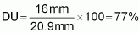
This uniformity is very acceptable in most cases.
In sprinkler irrigation, the infiltrated depths may be represented by applied depths. Acceptable DU values depend on the value of the irrigation water, crop, energy costs, and labor. Generally, DU values below 67% are unacceptable; however, with low value water and crops, a 50% DU may be acceptable. With high value, moisture sensitive crops and high water costs, DU values of 80% or higher may be considered acceptable.
5.6.7 System operation and maintenance
1. Sprinklers must always have nozzles. Often farmers will remove nozzles because they can see more water exiting sprinklers without nozzles. Removing nozzles greatly affects the water distribution and water droplet size, and frequently the sprinkler will not even rotate without the nozzle, since the flapper arm is not hitting pressurized water.
2. Move the irrigation system as a unit to irrigate plots. Attempt to irrigate fields in geometric patterns of rectangles or squares. Squares and rectangles will give a more uniform water distribution over the entire field, and crops will also grow and mature uniformly.
3. Remove the suction line or inlet pipe from the stream if there are chances of rain. The stream flow will often rise considerably with rainfall and will wash out any equipment on or near the banks.
4. Operate the system when there are no high winds in order to reduce droplet drift and pattern distortion.
5. Operate the system before fumigating so the pesticide is not washed off.
6. Operate the system after fertilizing to move the fertilizer nutrients into the root zone.
7. In areas where plant fungus is a problem, it is preferable to irrigate in the morning hours so that the plant leaves can thoroughly dry during the day hours.
8. Maintain the sprinklers so that they rotate properly. Water is the lubricating medium in the majority of sprinklers, so do not apply oil based lubricants. Frequently, the rotation problem arises from malfunction of the bearing washer, which has to be cleaned of sand or grit regularly.
9. The screen tied over the entrance of the inlet pipe in gravity systems should be checked and cleaned frequently. Large particles can be sucked into the screen. Particles plug sprinkler nozzles and create more frictional losses in the system.
<<TOC3>> 5.7 Localized irrigation systems
Localized irrigation is a method of applying water that results in wetting only a small area of the soil surface and sometimes only part of the root zone. Water is applied near the base of the plant so that the application is concentrated in the root zone. Water is generally applied at a low flow rate, in small amounts, and frequently. The application devices may be small tubes, orifices, nozzles, or perforated pipes. The water may either be applied above or below the soil surface. The main components of a localized irrigation system are the water supply (including flow and pressure regulators), the filtration system, main lines, sub-main lines, laterals, and distributors. Figure 5.27 shows some basic components of a localized irrigation system.
The primary advantages of localized irrigation systems are the high efficiency rates that can be achieved, sometimes as high as 90%. High efficiency may result in very significant water savings. Often a localized irrigation system will allow a farmer to irrigate twice the area possible with surface irrigation. Precise control of water and nutrient application often results in much higher yields and quality. Control of weeds and pests may be better as the entire soil surface is not wetted nor is the foliage. A localized irrigation system may allow the use of more saline water, and can be used effectively with low infiltration soils that cannot be sprinkler irrigated. Some disadvantages are the higher initial costs of the systems, salinity buildups, more limited root development, and higher technology requirements. Later savings may be offset by higher maintenance costs. There are low cost methods, however, for irrigating garden sized plots with localized irrigation.
Drip or trickle irrigation is a localized irrigation method that applies water in very low flow rates. Pressures required in drip irrigation are typically between.7 and 1.4 kg/cm2 (10 and 20 psi). Drip irrigation is suitable for most soil types and most types of topography. It is very well suited to situations of limited water supplies or high water costs. Its high cost ($2,000-$5,000/hectare) can be justified only in orchard crops or other high-value crops.
There are two basic methods of drip or trickle application line source (used mainly for row crops) and point source (used primarily for tree crops). The line source method consists of one- or two-chamber polyethylene-type plastic tubing, 4-15 mm thick, and with small holes (usually laser cut) every 20 to 60 cm. The single outlet type uses emitters, usually a button-type plastic device with a barbed fitting that attaches to a polyethylene lateral hose having a diameter of 1/2" to 1".

Figure 5.27 Basic Components of a
Localized Irrigation System
Potential clogging or mineral deposition are significant disadvantages because of the very small water passages and the slow water velocities. Filtration and clean water is, therefore, a very important consideration. Periodic maintenance to prevent clogging is required. Thus, more operator knowledge is required than for most other types of irrigation.
A typical soil-wetting pattern under a single emitter is shown in Figure 5.28. Inadequate wetting of the root zone can seriously limit crop growth of crops such as avocados or bananas, which have a shallow, expansive root system. For this reason, a minimum of 33% wetting of the total surface area is required. Line source systems will usually wet about 70% of the surface area.
5.7.1 Characteristics
Field slope can significantly affect the uniformity of performance due to the fairly low operating pressures. Some design characteristics for drip or trickle systems are listed below.
1. Emitters should be spaced so that at least 33% of the total field area is wetted.2. Commonly used emitter flow rates are 4 to 8 L/hr (1 to 2 gal/hr).
3. Depending on the tree crop layout, use one or two lateral lines per tree row.
4. For the line source method, one line per row of crop is usually sufficient. Wider, raised beds of strawberries or carrots may require two lines.
5. Try to run line source or lateral line for emitters on contour or slightly downhill slopes in order to maintain a high degree of uniformity.
6. Manifolds should be strategically located to reduce lateral lengths; therefore, smaller line sizes can be used, resulting in lower costs and better long-term operation. Typically, on flat ground the lateral lines would be split in half by placing the manifold in the center of the field.
7. Allow for shrinkage and expansion of PE lines. The smaller diameter lines used for laterals will absorb the sun's heat, causing considerable expansion and contraction. Therefore, leave some slack (at least 3%) in the laterals as they are laid out; otherwise, the emitters will not stay where they are placed. Such displacement can lead to quite a disappointment.
Figure 5.28 Typical Pattern of soil Wetting Under Trickle
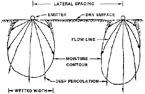
8. Provide for flushing: make allowance at the ends of the laterals or line sources to facilitate occasional flushing. Flushing is imperative immediately after installation. Flushing can be done easily by folding or doubling the end of the line 45" back on to itself, and then either slipping a piece of PVC pipe (approximately 4-5") over the folded end or tying the folded end with wire or string. When the system needs flushing, simply pull off the PVC pipe or untie the wire/string and run water through the open line until all debris is flushed out of the system. This should be done on a regular basis.
9. Operating pressure differentials between the maximum and minimum pressure emitters should not exceed 20%-25%, if at all possible.
Low cost localized irrigation methods that incorporate some of the advantages and avoid some of the clogging problems of drip irrigation have been used in developing countries for small garden plots. These systems may operate with pressures as low as 0.1 to 0.2 meters. One such low flow rate system uses a small 1/2" to 3/4" diameter hose with 2 to 4 mm holes drilled in the wall next to the location of the trees to be irrigated. Small basins constructed around the tree are filled every few days with this system. The larger orifice sizes do not plug easily and can easily be cleaned. However, a sedimentation basin and a screen at the inlet are required to keep out bigger particles that could plug the orifices if surface supplies are used.
5.7.2 Operation and maintenance
1. Maintain clean water through periodic checking and cleaning of the filters.2. Flush after installation and every few months, or more often if source water is fairly dirty.
3. Check pressures periodically to ensure that they are close to the design pressure.
4. If algae growth within the lines is a problem (typical with stream or pond water), chlorine should be used during flushing.
5. Irrigation times should be long enough to refill the root zone and achieve at least 33% wetting of the entire area, unless the orchard is young.
6. Walk the lateral lines weekly or biweekly to ensure good emitter operation and that none have plugged up or popped out.
<<TOC2>> Chapter 6 - Farm water management
|
References |
Primary: |
(11), (42), (44) |
| |
Other: |
(12), (22), (34), (43), (51) |
6.1 Farm water management
6.1.1 General concepts
On-farm irrigation water management involves the manipulation of such factors as the timing and amounts of irrigation applied to the crop, the flow rates to be used, and the methods of controlling the water. These and other parameters can be modified to achieve desired crop production goals within the restrictions imposed by soils, crop, climate, water supply, and economics, as well as social and other constraints.
The benefits of good on-farm water management are many. A good on-farm water management program generally helps to maximize or optimize yields and crop quality. It can help reduce water and energy consumption, thus making these supplies available for irrigating more land, as well as decreasing the cost for a given irrigation system. It can reduce the loss of fertilizer which is leached out with excess water application, which in turn decreases the amount of fertilizer necessary to achieve desired yield goals. A good management program ensures that root zone salinity is controlled at desired levels and that waterlogging of soils and excess deep percolation losses are either diminished or eliminated. It can help to eliminate problems such as erosion and control crop diseases related to excessive or deficient water application. Water control can reduce machine and labor time. A good farm water management program takes the guess work out of irrigation so that the farmers can consistently make the best use of their water resources.
In setting up an effective irrigation water management program, the engineer, technician, or farmer must first be intimately familiar with the irrigation system. He or she must be aware of the different possible modifications in design and management and must know how changing one or more design or management factors will affect the crop and soil system and other operational characteristics. For example, it may be possible to change the control structures in order to ensure a more flexible and responsive system. It may also be possible to change the rotation and supply of water so that the availability is more in tune with crop requirements.
On-farm design and management factors that should be considered for modification are: irrigation method, irrigation system geometry (width, length, depth, spacing), slope and topography, crop, tillage practices, flow rates, and irrigation timing and duration. Changes in the tools used for irrigation, such as the use of siphons, can ensure the ability to apply uniform, non-erosive irrigations. In sprinkler and trickle irrigation, it may be possible to change pressures, pipe sizes, or other system components.
In all cases, a good maintenance and monitoring program is essential to good management. Before undertaking any modifications or setting up a management program, certain data must be obtained and analyzed. These include crop data such as varieties, length of growing seasons, crop water requirements, and acceptable soil moisture levels at different stages of growth. For a given crop and area, the manager must know when the crop will reach certain stages of growth, when the critical periods for moisture stress are, how stress or excessively high moisture levels affect the crop in terms of yield and quality, and how moisture levels and irrigation frequency affect the resistance to disease or the propagation of diseases. Also important is how the roots develop through the season and what the moisture extraction pattern is. In the case of poor drainage, saline soil, or saline water, it is necessary to know how yield and quality will be affected by different management practices. For example, maintaining a high moisture level may dilute salts enough so that they will not affect yield significantly. Leaching to control salt levels in the soil profile can minimize the effect on the crop.
Soil data that must be known include the soil(s) water-holding capacity, depth(s) of the different soil layers, and the infiltration characteristics of the soil. Knowledge of soil texture, structure, and organic matter content will also help to determine whether the moisture-holding capacities or the intake rate can be improved. Knowledge of soil salinity and how to control the salt levels is essential. Drainage conditions such as depth to water table and capillary rise of water to the root system should be known. Topography (slope and relief) and soil erosivity must also be known if changes in the irrigation system, land leveling, or even changes in the flow rates in furrows, borders, or basins are contemplated.
Irrigation system data, such as conveyance and application efficiencies and uniformity of water application and penetration in the present system, are necessary, as well as the effects of wind, evaporation, and infiltration rate on these. The geometry of the irrigation system, control structures, system flexibility, energy requirements, water availability and cost, the cost of system design (or redesign) and construction, and the return on investment are all essential data. The quality of the irrigation water may be important in determining proper system capacity. If the system is also going to be used for crop cooling or heating, these requirements must be accounted for.
Climatic data on the time and space distribution of precipitation, solar radiation, temperature, and wind are necessary in determining crop irrigation requirements, and even in determining what crops are suitable to a given set of conditions. Hydrologic data, including stream flows, reservoir capacities, and water supply data, are necessary for determining the amount of irrigable area, possible crops and planting dates, and how the water supply will be distributed to that irrigated area.
Of course, we must not forget the very important data on the farmer. We must know their preferences and schedules, educational and economic level, and progressiveness, as well as the restrictions imposed by the community, religion, irrigation district, or any of the institutions that must be dealt with.
Those in charge of developing the water management program should be critically aware of the consequences that changing the management in any given area may have on the other areas. They should consider how the management in one area will impact on other water users downstream or in low-lying areas. For example, the more efficient use of water in a project upstream may mean that more land can be irrigated in that area. Users downstream, however, may need to count on the return flows from upstream users to continue irrigating.
The implementation of a successful on-farm water management program is a very definite and deliberate process consisting of certain steps. Typically, the person(s) setting up such a program will need to:
1. Conduct an evaluation of the farming system, including soils, crops, and irrigation methods. This helps identify major problems associated with the present management system and the constraints imposed by soil, crop, irrigation system, water supply, and social considerations. The evaluation also helps estimate what the benefits of implementing the required changes will be.
2. Determine the design, redesign, and management alternatives for the system and select the best alternative(s).
3. Ensure that the system is modified according to the selected design and/or redesign.
4. Set up a detailed management program for the system; it should include irrigation schedules, maintenance, and other management parameters.
5. Train the technicians and farmers so that they are capable of implementing the program that was set up.
6. Monitor the system in order to make necessary changes through the season(s) and change the management program to reflect changing conditions. The system monitoring phase is an essential part of good water management. Initially, after the program is implemented, monitoring is conducted both by technical personnel and by the farmer. After a good working program is in place, however, the farmer does the day-to-day monitoring of his or her own irrigation system, with perhaps occasional technical assistance.
A good water management program requires that the technical personnel who design and monitor the program, and the farmer who ultimately implements the program, be well trained. Those technical personnel who conduct the training, as well as those who set up the water management programs, should have extensive field experience in working with people and irrigation at the farm level, or they should be given the opportunity to acquire this experience before they are allowed to conduct training or develop the programs. These personnel should be selected for their knowledge of irrigation, as well as their ability to understand the farmer and his or her system and develop rapport with farmers.
The training itself should consist of some classroom instruction, with extensive hands-on field exercises. The types of subjects to be covered would include:
· Irrigation control structures and tools (selection, construction, and maintenance).
· Basic irrigation concepts: crop water requirements, water-holding capacities, infiltration, uniformities, efficiencies, runoff, and erosion.
· Irrigation methods: advantages, disadvantages, selection, construction, and maintenance of irrigation systems.
· Design and redesign of existing irrigation systems for better management.
· Management of new or existing systems: how to determine correct flow rates and timing and amount of each irrigation; evaluate uniformities and efficiencies in an irrigation system; monitor the soil profile and the crop to ensure good irrigations; minimize runoff; detect simple visual indicators of poor or good irrigations; evaluate the impact of changing one or more management parameters on the soil (erosion, infiltration characteristics, and water-holding capacities), the crop, or the overall distribution of water in the field (uniformities, efficiencies, and amount of deep percolation and/or runoff).
The training of both the technical personnel and farmer can cover essentially the same subjects, but the farmer training will be on a more basic level. The training should, however, give farmers enough fundamentals so that he or she can monitor the system well and make changes in timing, duration, flow rates, and other operational characteristics as needed. The farmer should also have the ability and motivation to perform the necessary maintenance.
Extensive hands-on field training is a must. Classroom exercises, slide shows, videotapes, training bulletins, and classroom instructors are important, but they are no substitute for hands-on training.
This chapter summarizes technical information and procedures for developing farm water management programs. It avoids theoretical developments and presents primarily methods that are compatible with data and equipment available to Volunteers working in small farm situations in developing countries. It includes a section of a training manual, "Water Management on Small Farms," which has been used successfully in a number of countries for training small-scale farmers and the technicians who assist them.
<<TOC3>> 6.2 Farm irrigation scheduling
The questions of when to irrigate and how much water to apply cannot be answered simply in a textbook approach with a series of equations. To provide guidelines for answering these questions, however, we do resort to equations whose results must be tempered with experience and knowledge of the field situation. To avoid oversimplification, we begin with a discussion of the factors that farmers should consider when they determine the irrigation schedule.
6.2.1 Factors affecting irrigation scheduling
Outside the growing season, a farmer's need to irrigate will depend on several factors. The farmer must consider irrigation requirements for tillage and leaching of salts or to ensure adequate moisture for planting. He or she may consider filling the soil profile to avoid having to irrigate early in the growing season or to ensure an adequate soil water reservoir in times of drought or insufficient water availability during the growing season. A farmer may also irrigate to germinate weeds that can then be removed through cultivation before planting.
After planting and during germination, irrigation requirements are a function of the soil moisture around the seed. Shallow or variable planting depths may require several light irrigations to obtain a good stand while deeper planted crops may require one irrigation or possibly no irrigations, if good moisture is available at planting. Other factors, such as the need to push salts below the seed and seedling, may influence the number of irrigations and amounts of irrigation water to be applied. Crusting of the soil surface may inhibit plant emergence, thus one or two irrigations specifically for the purpose of softening the soil to allow uniform seedling emergence may be required.
After emergence and during the vegetative development of the crop, the irrigation schedule is a function of the rate of crop water use (evapotranspiration), the soil water reservoir available to the roots, the specific crop, and the flexibility of the system. As the crop grows and the rooting system develops, the soil water reservoir accessible to the plant increases. As the plants grow, however, they require higher moisture levels in the root zone. Thus, during vegetative development, the schedule should take into account the change in the soil water reservoir, water use, and crop sensitivity. In addition, factors such as the unevenness of the soil surface, surface methods of irrigation, intake characteristics, and water control may limit the maximum or minimum efficient depth of application. Thus, a farmer may increase or decrease irrigation intervals and application depths to avoid deep percolation or runoff with less concern for the level of soil moisture at which yield decreases begin.
Irrigation intervals may be increased to avoid leaching of nutrients at this stage. Soil salinity considerations may require greater depths of application for leaching, or closer intervals to dilute the salts in the root zone. Other factors such as the need to germinate weeds, prevent wind erosion, and modify soil temperatures may be important.
During mid-season, the soil water reservoir is fully or almost fully developed. Most crops are especially sensitive to moisture stresses at this time, and their potential to use water is greatest. The irrigation schedule during this part of the season can often be a constant if weather conditions are constant. It could, however, vary with changes in crop water use or the amount of effective precipitation. The same factors (previously mentioned) that influence the maximum or minimum application depths should be considered. Nutrient leaching and soil salinity may be considerations. Disease or pest problems that result from frequent irrigations or wet conditions are often reasons for lengthening irrigation intervals. Crop cooling and frost protection may also be factors influencing a schedule, especially in sprinkler irrigation. In irrigation systems that are used for application of fertilizers, pesticides, or other chemicals, the timing of these may be the overriding consideration for certain irrigations. The fruit formation stage of many crops occurs sometime during mid-season. This is usually the most sensitive period of the whole crop season; thus, proper irrigation scheduling during mid-season is a key to good production.
Late in the growing season, irrigation schedules are influenced by the same factors as during vegetative and mid-season periods. During this time, however, crop yields are not as easily affected as during mid-season. The soil water reservoir in the root zone is developed to a maximum, water use is decreasing, and the crop is less sensitive to high soil moisture depletions. As a result, irrigations can typically be less frequent and of greater depths. The quality of the crop can often be greatly influenced by the irrigation schedule during this time. The protein content in grains can be increased, potato storage ability is improved, and the sugar content of cane is increased by withholding water as these crops mature. The color of some crops can be altered. Harvest moisture is a definite consideration, since the last irrigation usually must be scheduled with enough time to allow the soil and crop to dry for harvesting. For root and tops, however, sufficient soil moisture to allow harvesting must be assured. Post-harvest tillage moisture requirements may also be considered at this time.
For any irrigation, the availability of water and the flexibility of the delivery and farm system are often the most important factors in scheduling. The importance of a farmer's personal preferences, religious and social obligations, and other cultural aspects should also be taken into account.
6.2.2 The practice of irrigation scheduling
In theory, farmers should be able to apply irrigation water when they consider their soils to have reached an acceptable soil water depletion, or Management Allowed Deficit (MAD). At that time, the farmer should be able to apply an amount of water that will either fully or partially refill the soil profile. The farmer may opt to only partially fill the soil profile if the water supply is limited, if he or she wants to avoid deep percolation and leaching, or if he or she wants to leave room for precipitation storage.
MAD may be equal to the depletion at which crop yields begin to decrease, or it may be greater or lesser than this depth. It is also common to allow a lower MAD on trickle irrigation systems as labor and flexibility do not pose a problem, or to insure adequate down time during system malfunctions. Sprinkler systems may require a smaller MAD and application amounts to avoid runoff problems or to allow for application of chemicals. Irrigating with a lesser MAD may also be practiced if the water is delivered frequently, but in small amounts. On the other hand, a farmer may select a MAD that corresponds to significant crop stress. The farmer may do this to increase his or her irrigation efficiencies by building up larger deficits before irrigating, or by spreading the water over a greater area, thus maximizing yield over the farm.
6.2.3 Techniques for preparing irrigation schedules
Determinations on the timing and amounts of water to apply are made by the farmer in a variety of ways. Farmers may visually inspect the crop for signs of stress and then apply an amount of water consistent with their experience, availability of the supply, or by other means. The farmer may inspect the soil in the root zone by feel and by visual methods to determine timing and/or amounts. Another farmer may use moisture sensing or stress sensing devices such as tensiometers, neutron probes, or infrared sensors. Still others may rely on soil water budget models that use soil, crop, climate, and irrigation system factors. Many will use combinations of the different methods, and many will use no method but irrigate when water is available.
A good scheduling technique should be able to predict with some anticipation the timing and amount of irrigation required so that the farmer can plan water deliveries. In the following sections, two common and useful scheduling techniques are presented.
6.2.4 Useful relationships in irrigation scheduling
Knowledge of the soil, crop, climate, and system parameters can be integrated into useful relationships for irrigation scheduling. Irrigation intervals, net application and gross application depths, volume of water required for irrigation, and irrigation duration versus flow rate are some of the essential results that can be derived by using the following basic relationships:
1. Net Irrigation Requirement
Irn = ET - Pe - Gw - Wb,
where:
|
Irn |
is the net irrigation requirement for the time period under consideration for a given crop. |
|
ET |
is evapotranspiration for the crop being considered. For non-stressed conditions, ET = ETc. |
|
Pe |
is the effective precipitation, or that portion of precipitation that provides water for the ET requirements of the crop or for tillage and other beneficial uses related to crop growth. |
|
Gw |
is the ground water contribution to the crop requirements. Gw is generally negligible if water tables are not within a meter of the surface. |
|
Wb |
is that portion of stored soil water at the beginning of the period that can be used to satisfy ET requirements of the crop. With shallow soils and shallow rooted crops this is usually negligible. |
2. Management Allowed Depletion
MAD = p'AW
D
where:
|
p' |
is the allowable depletion of the soil water that will not result in unacceptable yield reduction, expressed as a fraction of the moisture that a soil can hold between field capacity (fc) and percent wilting point (pwp). For example, a value commonly used is 0.5, although for a farm with moisture-sensitive crops and high water availability, lower values usually around.35 would be appropriate. For stress-tolerant crops and limited water availability, higher values (0.6 to 0.7) may be better. |
|
AW |
is the amount (depth) of water that a soil can hold between field capacity (fc) and percent wilting point (pwp) per unit depth of soil. |
|
D |
is the root zone depth, which varies with crop, stage of development and soils. |
Example: A sandy loam soil holds 140 mm/m between fc and pwp. The root depth is 30 cm, and the depletion not resulting in yield decrease is 35%. What is the allowed depletion if moisture stress is to be avoided?
Solution: MAD = 0.35140 mm/m
0.3 m = 14.7 mm
3. Typical Irrigation Interval Required
Assume the soil is filled at least to field capacity at each irrigation.
I = MAD/(ETc - Pe - Gw) + Ts
where:
|
I |
is the allowable interval between irrigations if the crop is irrigated when the management allowable depletion has been reached. |
|
ETc |
is the daily crop water use, assuming that the crop is kept at near optimum moisture conditions. |
|
Pe |
is the mean daily effective rainfall. |
|
Gw |
is the mean daily contribution of the ground water or saturated zone below the root system to crop requirements. Neglect this component unless water tables are within one meter of the surface. |
|
Ts |
is time (days) for soil to drain from saturation to field capacity after an irrigation if more water than that required to fill the soil to field capacity is applied. (Use 1 day for sandy soils, 2 days for sandy loams, and 3 days for loams, clay loams, and other heavy soils.) |
Example: The daily crop water use of the lettuce crop in the previous examples is approximately 5 mm/day. What is a desired frequency, assuming that the soil will be filled above capacity at each irrigation to allow for a longer interval between irrigations? Assume no rainfall or ground water contribution.
Solution: 
Comment: Coarse-textured soils can retain saturation moisture in the root zone approximately 1 day after irrigation, medium-textured soils 2 days, and fine-textured soils 3 to 4 days. Thus, the 4-day interval should be conservative.
4. Net Application Depth Desired (dn)
For a known irrigation interval and ET, assume the profile was filled to field capacity at the previous irrigation and will be filled again with the present irrigation.
dn = I(ET - Pe - Gw)
where:
|
I |
is irrigation interval. |
|
ET |
is average daily evapotranspiration over the period. |
|
Pe |
is the average daily effective rainfall contribution. |
|
Gw |
is the average daily ground water contribution. |
Comment: With
I = 4 days of previous example, then:
dn = 4 days
5 mm/day = 20 mm
In the case of limited water availability when the deficit will not be totally replenished, dn will be diminished by the amount of deficit allowed after irrigation.
5. Gross Application Depth
dg = dn/Ea
where:
|
dg |
is the gross depth to be applied at each irrigation in order to apply net dn. |
|
Ea |
is expected application efficiency (fraction). |
Example: We want to a apply net depth of 20 mm. The application efficiency with furrow irrigation is 40%, and with sprinkler irrigation is 65%. How much water do we need with furrow irrigation? With sprinklers?
Solution (sprinkler irrigation):
dg = 20/0.65 = 30.8 mm
Solution (surface irrigation):
dg = 20/0.40 = 50 mm
6. Continuity Equation
Va = Qt = dgA
where:
|
Va |
is the gross volume applied. |
|
Q |
is the discharge or flow rate. |
|
t |
is the irrigation duration. |
|
A |
is the area over which water is applied. |
|
Dg |
is the gross applied depth. |
Example: With a 28 liter per second (28 liters/sec) flow rate, how long will it take to irrigate a 1/2 hectare surface irrigated plot from the previous example?
Solution:
28 liters/sec = 101 m3/hr
dg = 20/0.4 = 50 mm = 0.050 m
Va = 0.050 m
5,000 m2 = 250 m3
t = Va/Q = 250 m3/101 m3/hr = 2.5 hours
6.2.5 The soil water budget approach
To schedule individual irrigations by the soil water budget approach, estimates of the net irrigation requirements during an interval are estimated with Equation 1 or similar equations. The depletions are then compared with MAD (Equation 2). Irrigation is effected when Irn is approximately equal to MAD. Equation 3 is used to estimate the desired irrigation interval. Equation 4 may be used for estimating net application depths when the irrigation interval is known. Equation 5 is used in establishing gross irrigation. Equation 6 is used to determine required flow rates or irrigation duration once the gross depth and area to be irrigated are known.
The depletion at the start of the season must be estimated or measured. Usually, excess rainfall or irrigation is assumed to be lost to deep percolation. Saturation moisture, however, is usable by plants (1 to 4 days after irrigation). Especially in heavier soils, saturation moisture should be considered by the scheduler. If water tables are deeper than 40 cm below the root zone, then ground water contributions may be neglected for scheduling purposes.
The ETc estimates are usually provided by private or public agencies or can be estimated from knowledge of weather and crop conditions. The budgets (balance) can be updated by hand, by computer, or hand programmable calculators.
Typical schedules based on normal climatic conditions, crop development, soils, and other considerations may be developed as an aid to irrigators.
Efficiencies may vary through the irrigation season. Predictions are affected by the accuracy of inputs. Because of this, the predictions of water balance techniques should be field verified periodically.
6.2.6 The feel and appearance method
The Feel and Appearance Method correlates the "when" and "how much" of irrigation to the feel and appearance of the soil (Table 6.1). This method is rapid and simple and, when used by experienced personnel, can be quite accurate. It permits a large number of samples to be analyzed quickly in the field. It requires only the use of a soil probe or shovel to obtain the samples. Proper location for sampling and correct depth of sampling are important in obtaining a true status of moisture in a field. Some considerations are:
1. Where are the critical soils, i.e., which soils have the greatest and the least moisture retentivity, which have the fastest and slowest infiltration rates? Keep in mind the proportion of the field that has these critical soils in order to determine whether or not it would be economical or practical to base the irrigation schedule on conditions at those locations.
2. Where is the application (or penetration) of water the least? For example, with sprinkler irrigation, this could be where the pressures in the system are the least. In border strip irrigation, it could be where the contact time of the water on the soil is the least (the head or the tail of the strip). In furrows, it is usually at the end of the furrow if the water has not ponded there.
3. In which part of the field is irrigation initiated, and where is it terminated? These two points generally show the greatest differences in moisture content if the soils are uniform in other aspects.
4. Where are plant population and development representative? Generally, where the plants have greater foliar area and where the foliar development is more active, is where the plants utilize more water. With other conditions being uniform, this will be where the soil will become the driest until full plant coverage is reached.
5. Where are different crops, or varieties of the same crop, planted? Even within different varieties of the same crop, there can be great differences of water use.
6. In which part of the field is access convenient for the farmer or a technician to take readings?
7. What is the root depth of the crop and what is the critical depth for moisture monitoring? For example, at effective cover, small grains have rooting depths of a meter or more if roots do not encounter obstacles. If the soil is uniform and deep, it is important to periodically verify the moisture status in the entire profile. However, if the good soil is very superficial (say 30 cm) and below is only coarse gravel, it is important to monitor in the top 30 cm. Critical depth may be quite different from total rooting depth. For example:
Potatoes can have roots to one meter. During tuber enlargement, however, it is very important to monitor the top 45 cm, especially the first 30 cm. Therefore, the soil moisture monitoring is conducted to 45 cm of depth. The root depth changes from the time of planting, so the important zone for monitoring also varies from planting time until about the effective cover stage.
8. Where is the greatest root concentration? In potatoes, for example, root development initiates at the seed tuber and the greatest water use begins there. Therefore, it is important to place the sensors near the planted tuber in the initial growth stage.
6.2.7 Summary of scheduling techniques
Many types of moisture sensors and scheduling techniques have been developed. Because of the limited technical background of many farmers, however, the acceptability of a scheduling technique by farmers may hinge on the simplicity of the method. An acceptable scheduling technique for them may consist simply of field probing and use of the feel method for determining when to irrigate and whether the irrigations are adequate. In spite of its simplicity, monitoring of root zone moisture by this technique may result in dramatic improvements in efficiencies and crop yields.
Table 6.1 Guide for Judging How Much Moisture is Available for Crops (Ref. 51)
| |
Feel or appearance of soil and moister deficiency | |||
|
Available soil moisture |
Loamy Sand |
Sandy Loam |
Loam and Silt Loam |
Clay Loam or Silty |
|
remaining | |
| |
Clay Loam |
| |
Course Texture |
Moderately Course Texture |
Medium Texture |
Fine and Very Fine |
| |
| | |
Texture |
|
0 to 25 percent |
Dry, loose, single grained, flows through fingers |
Dry, loose, flows through fingers |
Powdery dry, sometimes slightly crusted but easily broken down into powdery condition. |
Hard baked, cracked, sometimes has loose curmbs on surface. |
|
25 to 50 percent |
Appears to be dry, will not from a ball with pressure. 1* |
Appears to be dry, will not form a ball. 1* |
Somewhat crumbly but holds together from pressure. |
Somewhat pliable, will ball under pressure. 1* |
|
50 to 75 percent |
Appears to be dry, will not form a ball with pressure. |
Tends to ball under pressure but seldon holds together. |
Forms a ball somewhat plastic, will sometimes slick slights with pressure. |
Forms a ball, ribbons out between thumb and forefinger. |
|
75 percent to field capacity (100 percent). |
Tends to stick together slightly, sometimes forms a very weak ball under pressure. |
Forms weak ball, breaks easily, will not slick. |
Forms a ball, is very pliable, slicks readily, is relatively high in clay. |
Easily ribbons out between fingers, has slick feeling. |
|
At field capacity (100 percent). |
Upon squeezing, no free water appears on soil but wet outline of ball is left on hand. |
Upon squeezing, no free water appears on soil but wet outline of ball is left on hand. |
Upon squeezing, no free water appears on soil but wet outline of ball is left on hand. |
Upon squeezing, no free water appears on soil but wet outline of ball is left on hand. |
1* Ball is formed by squeezing a handful of soil very firmly.
6.2.8 A comparison of scheduling criteria for surface, sprinkler, and drip irrigation
Surface Irrigation Scheduling
The inability of many surface irrigation systems to apply small amounts of water efficiently, and the inflexibility sometimes associated with them, often requires a different scheduling criteria than is associated with sprinkler or drip irrigation.
A farmer typically irrigates to fill the soil profile on the higher parts of his or her field or at the tail end of his or her runs. Unless a surface irrigation system is well designed, levelled and managed, it is difficult for farmers to irrigate with less than 8 or 10 cm of water application. Net irrigation requirements (deficits) of 2 to 4 cm at the time of irrigation can result in extremely wasteful and inefficient irrigations. Thus, even though yields may decrease due to water stress, a much higher MAD (perhaps 4 or 5 cm) might be most economical. With greater MAD, irrigation efficiency is often increased, leaching of fertilizers decreases, and total irrigated area often increases. Thus, yield per unit of water may increase significantly. For sensitive crops or light soils, or heavy soils with infiltration problems, the economically allowed MAD may be only 2, 3, or 4 cm. In this case, it may be necessary to consider well levelled basins or graded furrows that can be operated to apply 3 to 6 cm of water uniformly and efficiently.
Once MAD and irrigation interval are determined for a surface system, the task is to determine how to apply the desired net depth of application. Intake rates, surface roughness, geometry of furrows, and required net application depths may change from one irrigation to the next and from season to season. Thus, advising the irrigator on the flow rates and durations of irrigation requires a very good understanding of the hydraulics of the system and its variability, or monitoring and experience by the farmer. In the absence of technical help, the farmer may experiment with various flow rates and durations that are possible and convenient. Probing the soil one, two, or three days after irrigation, he or she can determine whether irrigation depth was adequate in the critical parts of the field (tail, heavier or lighter soils, high spots, etc.). The farmer can then make adjustments in future irrigations.
Sprinkler Irrigation Scheduling
Well-designed sprinkler systems can be managed to apply water with a minimum of runoff and deep percolation. Proper management can result in application efficiencies of 70% to 90%. Infiltration rates, soil surface storage, labor availability, automation, and various factors other than rooting depth, water holding capacities, and crop type are important in determining MAD.
With hand move systems (and others requiring significant labor), it is often economically desirable to make the MAD as high as possible and develop 8, 12 or 24-hour sets to minimize labor costs and maximize convenience.
Drip Irrigation Scheduling
Net irrigation requirements may be less with drip irrigation than with surface or sprinkler irrigation, primarily because the area wetted is reduced and evaporation is decreased. This reduction in water requirement usually occurs early in the growth stage of plants when the soil surface is bare. Once the ground is 50% to 75% shaded, the difference in water requirements is minimal. As most ET estimating methods assume a significant evaporation component early in crop growth, estimates of ET may need to be reduced in relation to the soil surface area wetted by the drip system. On the other hand, frequent irrigations associated with drip irrigation may increase ET of the wetted area; thus ET may not necessarily be much less than on surface or sprinkler irrigation. Observation of the wetted area, soil moisture levels, and plant response will provide the experience necessary for making such adjustments.
Crop water requirements are often converted from units of depth per unit time, to units of water volume per unit land area per unit time, e.g., liters/ha/day. Application rates are often expressed as units of water volume per plant per unit time.
In drip irrigation systems, the wetted volume of the root zone is usually only a portion of that wetted by other methods. The system is usually designed for continuous, or nearly continuous, operation during peak use periods. Cost factors do not allow for significant oversizing of the system. In addition, flexibility due to control and automation permit the crops to be maintained at high moisture levels conducive to maximum yields while maintaining high irrigation efficiencies. Thus, the concept of drip irrigation implies a high frequency (short irrigation intervals) and small amounts of application (small MAD) at each irrigation as compared with conventional methods.
Because of the limited wetted volume, the concept of MAD applies to that portion of the root zone that is wetted by the drip system. The scheduling process is simple. MAD is usually selected to be less than or equal to RAW (see Chapter 2.4) in the wetted volume. The wetted volume is replenished daily, or at the preselected MAD. A slight excess (10% to 20%) above that required to eliminate the deficit is applied to account for non-uniformities to application.
For a well-managed system, the efficiencies are a function of emitter flow variations caused by hydraulic design and manufacturing variations, as well as whether or not the entire system will be replenished to capacity or some deficit will be allowed in areas of least water application. Efficiencies of 85% to 90% can usually be used in well-designed and managed systems for scheduling without noticeable yield effects.
6.2.9 Rice irrigation scheduling
The water use (Et) by a non-stressed rice crop can vary between 450 and 700 mm per day, depending on climate and variety. Kc for the initial 2 months varies from 1.1 to 1.15, depending on the wetness of the soil surface. Mid-season Kc varies from 1.1 to 1.3 and, for the final month, it varies from 0.95 to 1.05.
Saturation or near saturation conditions must be maintained during most of the growing season. After transplanting, saturation is maintained by a film of water (about 10 cm) over the surface. Flowering and head formation are most sensitive to a lack of water. Some scheduling approaches for rice follow.
In continual saturation scheduling, water is maintained at approximately 10 cm depth for about one week after transplanting. Through tillering, a maximum depth of about 3 cm is maintained. From 30 days before head formation and flowering to the start of maturity, soil is covered with water often to a depth of 8 or 10 cm. A continual flow of water is frequently maintained. The fields should be drained completely 30 to 45 days before harvest to ensure that they will be dry enough for harvest. This method generally results in maximum potential yield.
Intermittent irrigation is another scheduling approach used on rice when water is more scarce. Irrigations are applied periodically to maintain the crops at near-saturation level when possible. Yield may be reduced significantly with this method if moisture cannot be maintained at saturation from heading to flowering.
In the controlled water savings method of irrigation, the field is maintained as close to saturation as possible, except that the field is flooded at transplanting and then for about 30 days (from heading through flowering). Maximum yields can be achieved with this method.
Rice is an aquatic plant and thrives on saturation conditions. Total submersion of the rice plant for extended periods of time, however, decreases yields. Thus, it is important that both the supply and the drainage be closely controlled. As rice is usually irrigated in basins, the basin bottoms should be well levelled to prevent excessive submergence in places and inadequate wetting in others.
<<TOC4>> 6.2.10 Scheduling and management strategies for limited water supplies
Intentional under-irrigation is the practice of deliberately applying less than the soil moisture deficit (SMD) over all or part of the field. This may be done to conserve water during peak use periods through less percolation and runoff losses. Application efficiencies are generally higher. It is sometimes done to allow for precipitation storage in the root zone. This practice does not necessarily reduce yield, but makes more effective use of water. It also makes good use of the total moisture stored in the root zone.
Stress irrigation or deficit irrigation is the practice of extending the interval between irrigations to the point that crop water use is limited below potential or peak use. Thus, MAD is selected at values that will limit crop production. This practice may reduce system capacity requirements and obtain maximum yields per unit of water or unit of capital cost. With a limited but flexible water supply, it may be possible to stress a crop at periods other than critical periods and still obtain near-peak yields. This practice may result in better root development and better ability to use deep moisture storage. Where a significant drying of the soil in the lower root zone develops, the nutrients may not be available for plant growth; thus, the whole root zone should be wetted periodically. In addition, a limited supply will cause less stress if applied in enough depth that soil surface evaporation is limited and the lower root zone reservoir is filled or almost filled. A smaller concentration of roots in the deeper root zone will result in slower moisture extraction and less severe stress than application of small amounts that are quickly withdrawn from the upper root zone by the plant.
During periods of short water supply, a choice needs to be made between conducting deficit irrigation (in which the crops will be stressed) or reducing the area to be irrigated. The choice may be made at the project level if the administration is capable of enforcing the decision or at the farm level if the farmer can foresee the extent of the shortage. In some areas, water supply forecasts published by different agencies may help in making the decision.
If there is significant water storage in project or farm reservoirs, the time of water delivery can be controlled. Each crop has critical periods during which water stress has maximum effect on the reduction of crop yields. This period is usually during the flowering, fruit setting, or yield formation stages. Thus, short water supplies might be best distributed by holding back on the normal irrigation supplies except during these critical periods.
When water is scarce, the various irrigation efficiencies should be evaluated. Much water is frequently lost in the conveyance system. Observational evaluations of losses at turnouts and other distribution points on the canal system, and of vegetation in and along the canal that may be using water and increasing seepage losses, should be conducted. Seepage losses in sandy soils or permeable stretches of canal can be evaluated to determine what parts of the canal have greater losses and what the magnitude of these losses are. The value of water lost, as compared with production losses, may provide the economic basis of whether or not to line parts of the canal or pursue other measures to reduce the losses.
Increasing irrigation efficiencies through evaluation and improvement may lessen the impact of shortages. Land leveling, reuse of runoff water, use of better water control devices, and use of management techniques are important. Continual evaluation and monitoring of the irrigation system to determine frequency and amounts of irrigation, along with necessary operational changes, are of great importance.
Techniques such as runoff interception by ridges on the contour or contour seepage furrows permit more water to be absorbed by the soil. Mulching to reduce evaporation from the soil can significantly improve moisture availability for plant use. Plant residues and even thin gravel layers have been used. Proper tillage of the soil for moisture conservation leaves the soil loose so that the upper soil layer becomes a mulch that impedes capillary movement. Filling the soil during periods of high water availability may provide necessary moisture for crops during shortages, especially on deep soils with good water-holding capacities.
If the irrigation supply depends on stream flows that are partially sustained by ground water contributions, then water infiltration needs to be promoted during years of excess. The same holds true when ground water provides a major supply of irrigation water through pumping. In both cases, the water tables can be raised; therefore, the water stored for future use can be enhanced by water spreading on idle lands, ponding in gravel beds, areas of permeable materials, ditches, and drains, and recharging wells directly.
Excess water availability for irrigation tends to result in over-irrigation by farmers and can be as detrimental as a water shortage. Proper timing and amounts of irrigation and drainage of excess rain and irrigation water is necessary for maintaining high yields. Thus, it is of primary importance that farmers recognize that good management is necessary even in times of excess.
Some of the key elements in setting up acceptable irrigation scheduling programs are as follows:
1. The schedules must be compatible with the farmer's other schedules (e.g. cultivation, herbigation).
2. The scheduling techniques must be simple and reliable and must not make a great demand on the farmer's time.
3. The scheduling program must be economically attractive.
4. To be most successful at the farm level, water supplies must be flexible in terms of timing and quantity.
6.2.11 Delivery system schedules
In irrigation projects where several users are served from the same water supply, it is often economically unfeasible to supply each irrigator according to optimal timing and amount. In such cases, the delivery system may be scheduled to meet the needs (timing and amount) of the major crops of the area.
The distribution of water within the delivery system is accomplished in different ways. The main methods are:
On-Demand: The farmer takes water at any time up to the capacity of his or her outlet or at a predetermined discharge.
Semi-Demand: The farmer generally requests water within 2 to 7 days before delivery.
Canal Rotation and Free Demand: The secondary canals receive water by turns, and when the canal is receiving water the farmers can take how much they need when they need it.
Rotational System: The canals receive water by turns and the farmers under each canal also receive water by turns when it is available in the canal.
Continuous Flow: The farmer receives a continuous supply of water sufficient to cover evapotranspiration needs of his or her crop.
Demand systems generally require higher level technology, very good communication, large design capacities, high initial costs, and a high degree of flexible operational control.
Rotation supply schedules are the most common methods for distributing water in irrigation projects. There are several ways in which a rotational supply may be scheduled:
1. Fixed interval-fixed depth (amount). The farmer receives water at a fixed interval (e.g. every 7, 10, 14, 21 days) with the same amount (usually same discharge and duration) at each irrigation of the season. The amount may be proportional to land holdings or cropped area.
2. Fixed interval-variable depth (amount). The farmer is given less water per turn early and late in the season when crop water use is less.
3. Variable interval-fixed depth (amount). The same amount of water is given at each irrigation, but the interval is varied (shorter during high water use periods and longer during low water use periods).
4. Variable frequency-variable depth (amount). Both irrigation intervals and amounts are varied as the root zone water reservoir expands and the water use of the crop varies through the season.
Method 1 is the simplest to manage and administer but is the least in tune with crop requirements and has the highest potential for inefficiency. Method 4 is most in tune with crop requirements and would theoretically result in higher efficiencies. However, standardization of crops, varieties, plantings, dates, are seldom possible. A more in depth discussion of each rotation method follows.
Fixed depth-fixed interval scheduling typically results in inefficient irrigation during initial stages when roots are shallow and water use is low and late growth stages when water use is low. This sheduling may result in reduced yields on shallower soils due to leaching and moisture stress, or waterlogging problems on heavier, deeper soils.
Fixed interval-variable depth schedules typically have problems because present design and construction of irrigation systems do not permit application of small amounts. For example, unless a field is well designed and well levelled, farmers may need to apply 8 cm or more per irrigation to cover the high and dry areas. Cropping patterns and sowing dates would need to be standardized for each project area; systems would need to be redesigned and reconstructed; land levelling would be essential; and farmer training would necessary if the farmer is to be able to apply varying doses uniformly. Unless the farmer is able to adjust flow rate and duration on border and furrow systems, then uniform depths with various doses are impossible. Uniform application of different doses is much more easily accomplished with level basins by simply varying irrigation duration.
A variable interval-fixed dentin schedule based on applying water each time a given net deficit developed would result in stress early in the season when applications may need to be light and frequent to assure germination and initial development when roots are shallow. As most surface irrigation systems are efficient when designed and constructed for a given net depth of application, this could be a very efficiently operated system. If crops, varieties, and planting dates were standardized, this system could be made very useful as long as some flexibility were allowed during germination and initial development, i.e. the first two or three irrigations. A change in irrigation interval will require good communication between project managers and farmers as irrigators will not receive water on the same day of the week each time. If systems are modified to allow smaller but uniform application depths, the fixed depth-variable interval schedule could be adapted to soils with significant variability without creating problems, i.e. a net depth of depletion allowed at each irrigation (MAD) could be selected that would not stress crops or leach nutrients on shallow soils or waterlog heavier soils.
Implementation of a variable interval-variable dentin schedule usually has several major constraints. A flexible water supply would be needed, such as that available to well irrigators. Water would need to be available at all times in the canal to satisfy a mix of crops, varieties, planting dates, and soils. Farm irrigation systems are not designed and constructed to allow variable application depths. Farmers would need to account for changes in the water needs of crops and other aspects of soil, plant, water, and irrigation system interrelationships to apply the variable doses efficiently.
This schedule requires great accuracy in management and more skilled labor. Communication between farmers and administrators would have to be excellent. Farmers are accustomed to receiving water on the same day each week. Additionally, since some farmers are unable to read, they may have problems measuring depths.
Although difficult, it may be possible to:
· standardize crops (i.e. block farming) and varieties;
· standardize planting dates within 10-14 days;
· redesign farm systems, including leveling and use of level basins, sprinklers, alternate furrow irrigations, contour furrows, or other means of allowing variable doses;
· train farmers in adjustment of flow rates and duration, depth measurement in basins, and other aspects of management;
· standardize irrigation blocks in areas of similar soils; and
· improve communication between project and farm levels.
It may be possible to adjust doses and/or intervals once or twice during the season as climatic, crop, and other conditions change. It may also be possible to shorten intervals or increase amounts during critical growth periods with a minimum of administrative difficulty.
6.2.12 Project scheduling a summary
Some attempts at improved project irrigation scheduling have succeeded and others have failed to produce the desired results. A careful evaluation of ET requirements does not ensure that water will be made available at the right time, in the right place, and in the right amount. Poor land preparation and uneven surface topography often make satisfactory uniformity of surface irrigation impossible. Inflexibility and lack of capacity often form a major constraint. Training of all persons involved in water management from project level to farm level is often nonexistent. Failure to monitor the conditions adequately and adjust the schedule accordingly can lead to either excessive or deficit irrigation.
The flexibility of irrigation systems can often be improved through better communications, addition of regulating reservoirs, and modified canal structures, among other means. Uniform project- wide scheduling can be altered to increase flexibility by considering the differences in soils, crops, and flexibilities of the delivery system in various areas. The most flexible schedule possible should be used in each canal command area. For example, canals closer to the water supply source may be provided with greater flexibility than canals farther away. Rigid schedules may be considered for the peak season, with more flexibility being allowed during off-peak periods.
Generally, increased flexibility at the project level increases the cost of the system but allows the farmer to maximize his or her yields. Rigid (rotational) systems minimize capital costs and can be scheduled in various ways to increase efficiencies and improve the productivity of water. As water is often in limited supply, it is often necessary to consider scheduling strategies for maximizing yield per unit of water or for objectives other than the farmer's own objectives.
<<TOC3>> 6.3 Evaluation of existing irrigation systems
6.3.1 Strategies for farm management
Good farm irrigation management assures:
· correct frequency of irrigations,
· correct application depth,
· uniform irrigation,
· minimum runoff,
· minimum deep percolation except for that required for salt management,
· minimum erosion, and
· optimal return on irrigation investment.
Proper design, construction, and management are essential for achieving high efficiencies. A key to good management is the periodic evaluation of the irrigation system. System evaluation provides information on the actual operation and management of existing systems and potential improvements. Improvements can result in water, labor, soil, and fertility conservation, decreased drainage and salinity problems, and increased yields or profitability.
Detailed evaluation criteria for evaluating and managing most farm irrigation systems is presented in Reference 34. It is often impossible due to economic and other constraints, however, to evaluate systems in great detail. Thus, simple evaluation criteria that can help determine the magnitude of on-farm management problems and possible solutions are presented here.
Properly conducted evaluations provide answers to the following questions:
1. Is the system properly designed? In other words, are lengths, widths, flow rates, pressures, slopes, and other design factors within acceptable ranges to permit good irrigation when the system is properly managed?
2. Are the irrigations conducted at the right time and in the right amount? If not, what is the proper timing and amounts of typical irrigation applications?
3. Are the irrigations acceptably uniform? If not, how do we improve them?4. Are runoff losses acceptable? If not, how do we lower these losses?
5. Is soil erosion a problem? If so, then how can the problem be eliminated?
In recommending modifications for a given crop, climate, soil, and irrigation system through the irrigation season, the following information is required:
· Planting dates, crop development data, and climatic data;
· Typical irrigation frequencies and amounts of water applied or flow rates and irrigation durations;
· Water availability through the season from rainfall and irrigation;· Irrigation water quality and soil salinity;
· Soil textures, water-holding capacities, and intake rates;
· Climatic, crop, soil, and ground water data that will permit development of typical good management models;
· A physical system inventory including irrigation structures and tools and their condition;· Maintenance programs, available labor, and capital;
· Social and economic constraints to system modification.
For furrow, border strip, or basin irrigation the types of design or management modifications that may be considered for improved irrigation include:
1. Flow rate adjustment: to increase or decrease advance rates, minimize runoff after the advance phase, or minimize erosion.
2. Frequency of irrigation: to achieve better yields or quality or permit higher efficiencies due to adjustment in MAD.
3. Duration of irrigation and depth of irrigation: to ensure adequate infiltration depths but minimize runoff and leaching losses.
4. Dimensions of space, length, width and geometry: to match soil types, flow rates, and topography.
5. Land leveling and smoothing.6 Orientation or slope of furrows and borders (e.g., contour furrows).
7. Tillage and cultural practices: to change soil characteristics such as infiltration, soil surface storage, and erosion.
8. Return flow or tail water reuse systems: to eliminate runoff losses.
9. Storage and regulating reservoirs: to provide a more flexible and stable water supply and sometimes permit adjustments in flow rates.
10. Maintenance program: frequency and types of maintenance should be clearly defined.
11. Crop selection and planting dates: to be compatible with water availability over time and to take into account the rooting and moisture extraction patterns of crops. For example, deeper rooted crops develop a much greater moisture reservoir than shallow rooted crops and can be irrigated more efficiently on coarse soils. Deeper rooted crops are also less affected by micro uniformity problems as they have a more extensive rooting system.
Sprinkler irrigation systems may require the same type of adjustments as surface systems. However, modifications of the following should also be considered:
1. Operating pressure: to assure adequate drop breakup, wind fighting ability, uniformity, and actual rotation of the sprinkler heads throughout the system.
2. Riser height: to assure clearance of stream above crop and adequate coverage.3. Sprinkler and lateral spacings: to provide uniformity.
4. Lateral orientation: to minimize terrain effects on uniformity.
5. Pipe sizes: to assure sufficient capacity and economy of operation.
6. Trash elimination: to prevent sprinkler plugging.
7. Alternate set sequencing: to improve uniformity and water penetration.
8. Operation during low evaporative conditions, i.e., nighttime or non-windy conditions.
Trickle irrigation may require the same types of modifications as sprinklers. In addition, the density of emitters and wetted volume should be considered to ensure adequate capacity for down time and adequate nutrient storage. The selection of the proper type of emitters, pressure regulators, and filtering and chemical purification systems and the maintenance of these is essential to adequate, trouble free operation.
6.3.2 Rapid on-site evaluations
A very basic evaluation to determine the adequacy of a specific irrigation requires only that simple observations and measurements be made before, during, and after irrigation. A soil probe or auger for sampling, along with experience in judging soil texture and moisture, are basic requirements. The following simple steps can be followed:
1. Observe the uniformity of crop growth, soil surface relief, and soil texture variation. Obviously stressed (stunted, wilted, yellow) crops can indicate location and extent of over or under watering, while observations of relief, texture variation, and patterns of non-uniformity can help determine the cause.
2. Determine the SMD by probing the soil in different parts of the field. Comparison of SMD with the MAD for that crop, soil, climate, and irrigation system indicates whether the irrigation interval is approximately correct or not.
In trickle irrigation the wetted volume is taken as the point of reference. Thus SMD and MAD are both determined for this volume.
The percent of wetted area, P is defined as: P = wetted area at the surface (30 cm below the surface) divided by the total cropped area.
The area wet by each emission point is small at the surface. The volume of the root zone under this point is the wetted volume.
Usually, 1/3 to 1/2 of the area is wetted. In areas with substantial rainfall the most economical P might be only 20 percent while in arid areas 50 percent may be more appropriate so that a greater volume of soil moisture and nutrient reservoir are brought into action.
3. Establish any magnitude of uniformity problems. Observations of the advance and recession rates in surface irrigation during irrigation can indicate the magnitude of uniformity problems if soil variations are not extreme. The time between when water first reaches a point in the field until the water recedes from that point is the intake opportunity time (To). Noting To at the beginning, middle and end of the field provides a uniformity indicator. If the times that water remains over different parts of the field are within 25 to 30 percent of each other on coarse soils and 40 percent on fine soils, the uniformities are usually acceptable.
Some simple empirical criteria useful in rapid evaluation of uniformities in specific system follow:
1. In basin irrigation systems where the surface is not continuously flooded the total volume of water should be introduced into the basin in 0.2 to 0.4 times the time that is required for the required amount of water to infiltrate. If erosion would occur with high flow rates, the number of inlets may need to be increased or the size of the basin and flow rate reduced.
2. With graded furrow systems, the water should advance the length of the furrow in 1/3 (heavy soils) to 1/4 (coarse soils) the time of the total irrigation duration.
3. With border systems, the water should advance to 2/3 to 4/5 of the border length before being turned off. Recession time should be about equal to advance time.
4. In sprinkler irrigation, 20 percent differentials in operating pressure at extreme points in the system will provide adequate discharge uniformity through the system. Spacing of sprinklers closer than the wetted radius and lateral spacings up to 50 percent greater than the sprinkler radius of throw provide adequate uniformities. With winds in excess of 5 mph, the lateral should be placed more closely. For better uniformities the laterals are usually placed vertical to the direction of prevailing winds.
5. The emission uniformity (KU) in trickle irrigation is a measure of the distribution uniformity. It is defined as the discharge per plant in the low quarter (of emitters) divided by the average rate of discharge of the emitters. It is affected by the manufacturing and pressure variations as well as condition of the emitters.
Emission uniformity values greater than 90 are considered excellent, 80 to 90 good, 70 to 80 fair, and less than 70 poor. Generally about 10 percent more water than the SMD or evapotranspiration is applied to the least watered areas. The potential efficiency of the low quarter can thus be estimated as PELQ = 0.9KU.
After irrigation, simple probing of the soil in different parts of the field (and laterally into the bed with furrows) will provide a measure of uniformity.
6. Determine whether optimum and actual schedules coincide. Use the equation presented in the scheduling section (6.2) to determine desired irrigation intervals, depth of water application, etc. Then, compare what the optimal would be with what the farmer is actually doing.
7. Conduct additional observations on erosion, unevenness of spread of the water over the surface, fluctuations in the water supply, lateral penetration of water into the furrow bed during an irrigation event. Check pressure to ensure that sprinkler heads are operating within recommended ranges. Check for puddling of water, which would indicate incompatibility of the sprinkler and soil system.
8. Evaluate the adequacy of irrigation. The extent to which a soil profile is filled can be assessed 1, 2, or 3 days after an irrigation on coarse, medium, or fine-textured soils, respectively, by probing the soil to determine if any dry layers remain.
In evaluating irrigation systems and management alternatives at the farm level, it is imperative that the constraints beyond the farmer's control be carefully weighed. The irrigation district delivery schedules, and availability of power, machinery, and irrigation equipment may make many alternatives infeasible.
6.3.3 Evaluation of multiple farm irrigation systems
Rapid observational evaluations by experienced engineers and technicians along with a quick analysis of available or easily obtainable data can permit the development of useful management programs for a group of farms within an irrigation project. Such a procedure could encompass the following phases.
1. Compile information on
· soils, crops, and climate;
· seasonal, monthly, and weekly water delivery schedules;
· inventories of the typical irrigated area: number, size, condition, and location of canals, drains, reservoirs, and farm structures;
· administrative control of water;
· typical farmer management practices -- irrigation, cultural, and fertility;
· availability of power, machinery, and irrigation equipment;
· farmer progressiveness and sociological aspects; and
· typical yields of irrigated vs. non-irrigated land and well-irrigated vs. poorly irrigated lands.
2. Conduct observational evaluations of typical areas:
· maintenance and condition of canals and structures;
· uniformity of crop growth in irrigated fields -signs of excess or deficit watering; and
· indicators of high water tables, salinity problems, and erosion.
3. Determine water requirements and availability through the season.
4. Determine typical optimal irrigation schedules and compare with existing irrigation schedules.
5. Compare system designs and management with typical well-designed systems.
6. Determine possible changes within the constraints of the system to improve potential efficiencies. Improvements may involve changes in irrigation district management or changes in irrigation method, delivery and storage systems, adjustments in crops and irrigated acreages, or improved scheduling in the delivery system. Changes in fertility and other aspects of farm management may bring about on-farm improvements. Some changes will necessitate farmer training programs.
7. Select the better alternatives based on short and long-term economic, environmental, and social benefits.
<<TOC3>> 6.4 Training small-scale farmers in irrigation management
The following section is taken from the Water Management Synthesis Publication, "Water Management on Small Farms: A Training Manual for Farmers in Hill Areas" (Ref. 42). The manual resulted from work with small-scale farmers in the Peruvian highlands. Much of the agriculture in Peru takes place on steep slopes, shallow soils, and small farm plots. Extension personnel found the bulletin to be useful in training literate and semi-literate farmers and technicians.
The irrigation workshops conducted in Peru consisted of:
1. An audiovisual presentation (slides) that interpreted pertinent parts of the bulletin.
2. Extensive, practical hands-on training in which the farmers learned to use the material presented.
3. Field days during which farmers could observe the techniques taught to them "in action" on demonstration sites.
4. An evaluation of the farmers' new skills with such tools as simple levels and siphons and in evaluating and improving their management practices.
5. The bulletin was given to the farmers for reference.
This material should serve as a source from which basic concepts can be taken and applied to specific situations such as those encountered in developing countries.
An instructor guide (Ref. 42) is a companion to this manual.
THE IMPORTANCE OF IRRIGATION WATER AND ITS MANAGEMENT IN CROP PRODUCTION AND SOIL CONSERVATION
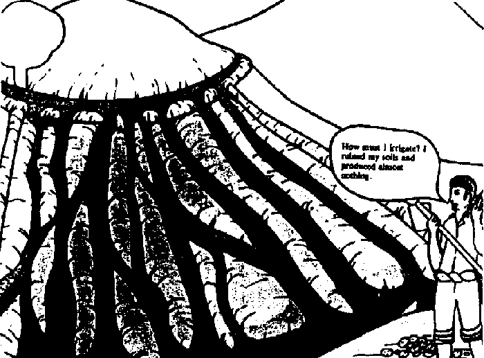
Bad irrigate
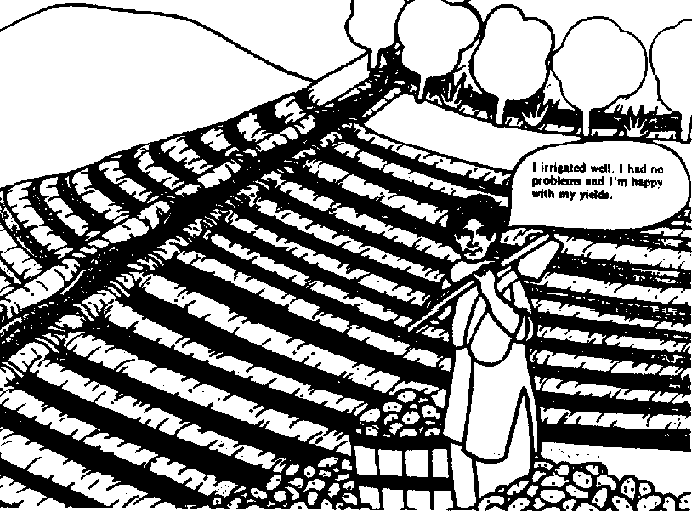
Good irrigate
The Role of Water in Plant Development
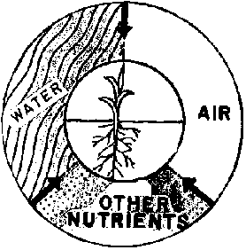
Growing plants need water, sun, air
and nutrients to form roots, stems, leaves, fruits and seeds.
- Water is a large part of the plant's structure. It carries food through the plant and it cools the crop during hot weather.
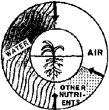
Roots can't get enough air if there
is an excess of water.
- A lack of water makes plants unable to draw needed nutrients (food) from the soil.
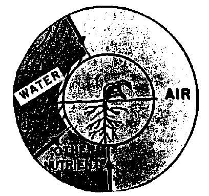
Too much or too little water results
in lower
For good production, crops need the right amount of water throughout their development.
Enough water
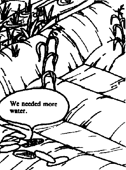
Needed water
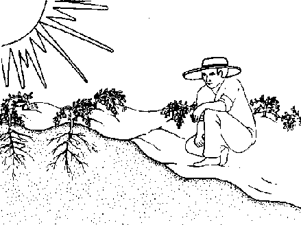
Irrigation can insure a good yield
even during drought if we have provided the crop with its other needs.
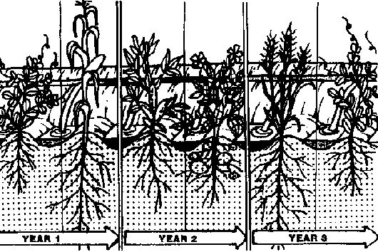
In many parts of the world
irrigation allows the harvest of two or more crops each year.
Sufficient water throughout the growing season helps insure healthy crops, thus enabling the plants to resist insects and. disease better.
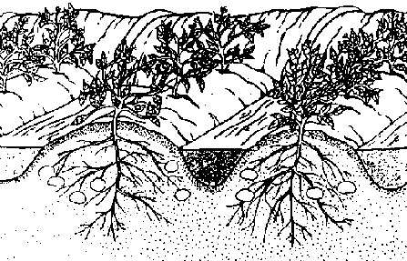
Good example
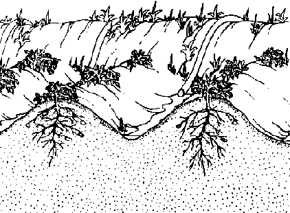
Bad example
Irrigation Can Have Harmful Effects
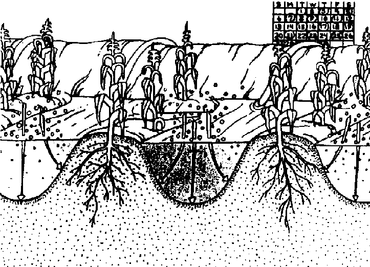
1. More frequent irrigations than
necessary result in a root zone which stays too wet for too long. Insufficient
aeration and root rot may result.

2. Excessively heavy water
applications may wash fertilizers and other nutrients away from the root zone.
3. Some farmers waste water when they irrigate, which means that other farmers may not have enough water for their fields.
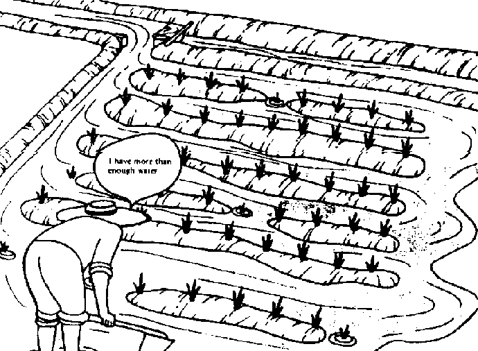
Good example
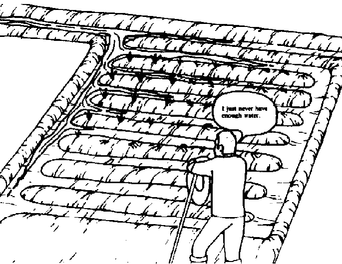
Bad example

4 Careless maintenance of canals can
result in weed, silt, or erosion problems, and not having water where it is
needed.
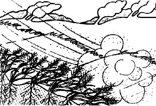
Erosion is the loss of soil through
the action of water and wind.
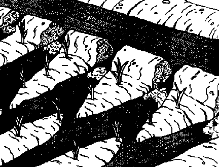
5 Uncontrolled irrigation water can
be a primary cause of erosion.
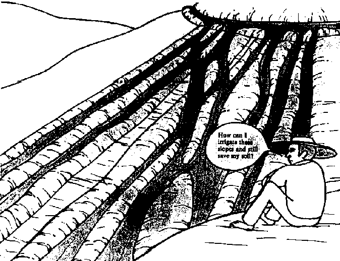
On steep slopes there is greater
danger of erosion than on flat land.
BASIC IRRIGATION CONCEPTS

1. Water holding capacity
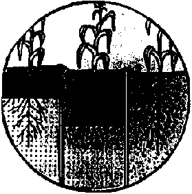
2. Water entry Into soil

3. Deep percolation
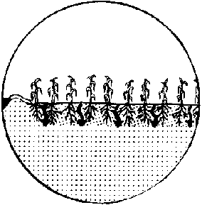
4. Uniformity of water penetration

5. Runoff

6. Erosion
Concept 1.
WATER HOLDING CAPACITY
The soil in which the crop's roots grow is the reservoir from which plants can take their water. The amount of water which a soil can store within reach of the plant depends on the texture and structure of the soil and the depth to which the roots grow.
Organic matter within the soil helps increase the soil's capacity to store water. The best plants and plant residue for improving a soil are green legumes such as alfalfa, clover, peas and beans.
WATER HOLDING CAPACITY
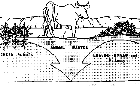
Sources of Organic Matter
Soils low in organic matter
Soils high in
The Effect of Soil Texture and Structure on Water Holding Capacity
SOIL TEXTURE
Sandy or Coarse-Textured Soils
· contain much sand
· are rough when rubbed between the fingers
· are easy to plow and till
· do not form clods when dry
· generally these soils have low water holding capacity
Medium-Textured Soils
· contain coarse, medium and fine (clay) particles in almost even amounts
· form clods when dry which are easily broken with a pick, shovel, disc or other tillage equipment
· generally these soils have good water holding capacities.
Clayey or Fine-Textured Soils
· contain many fine particles
· are hard to plow if they are not wet
· form cracks on soil surface when the soil dries
· form very hard clods when dry
· these soils have high water holding capacity
SOIL STRUCTURE
Structure is the way soil particles are held together. Soils with good structure have different sized clumps of soil particles held together by decomposed organic matter. Well-structured soils can hold more water and air for plants to use.
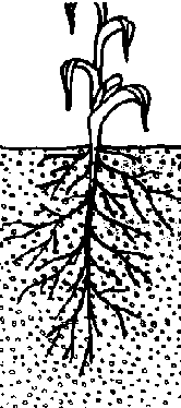
COARSE
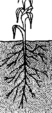
MEDIUM

FINE

SOIL STRUCTURE
ROOT DEPTH
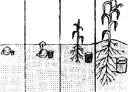
Root depth increases with plant
development until the plant is full grown unless the plant roots encounter
obstacles. Thus, the moisture reservoir available to the plants expands as the
root depth increases.
The area where roots are present is called the root zone.
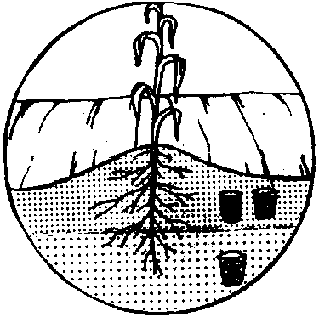
Plants use more water from the upper
part of the root zone because that is where they have more roots.
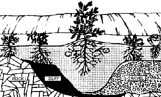
The maximum depth of roots depends
on the crop and on the depth of good soil.... Layers of rock, hard soil, gravel,
salts or other (...)
Where roots do not encounter obstacles in soils, they will reach to at least the following depths when they are fully developed.

Example 1

Example 2
Concept 2.
RATE OF WATER ENTRY INTO SOIL
(infiltration or intake
rate)
How quickly water can penetrate into a soil varies with the kind of soil, the amount of moisture already present in the soil and the condition of the soil surface.
Water penetrates faster
· through sandy soil than clay soil
· through dry soil than wet soil
· through well-structured soil than compacted soil
· early in the irrigation season than later.
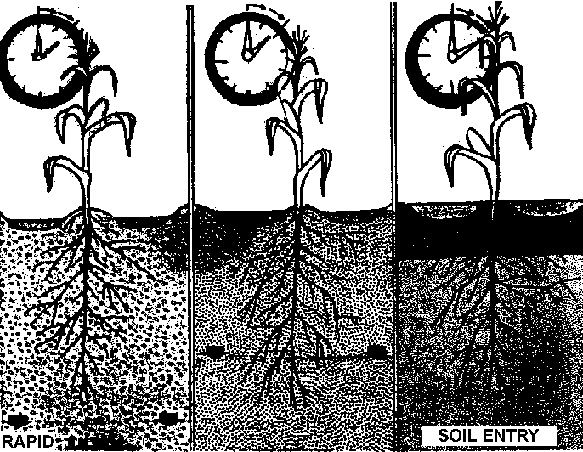
RATE OF WATER ENTRY INTO SOIL
Concept 3.
DEEP PERCOLATION
The penetration of water below the root zone is called deep percolation. Sometimes it is necessary to apply excess water so accumulated salts can be washed from the root zone.
This excess water may be costly, and it carries nutrients away. Thus, it should be limited to the amount necessary to eliminate harmful salts from the root zone.
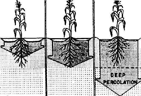
DEEP PERCOLATION
Soils with flat, impermeable layers or high water tables will have their drainage problems compounded by deep percolation in the following ways.
· soils can become waterlogged
· a rising water table can bring more harmful salts into the root zone
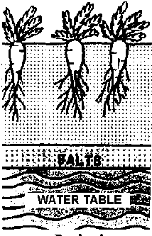
Undesired
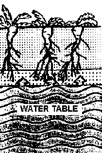
Desired
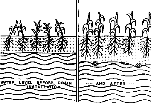
When the water table rises to the
point where crop production declines, the resulting drainage problem will have
to be eliminated by constructing a costly drainage system.
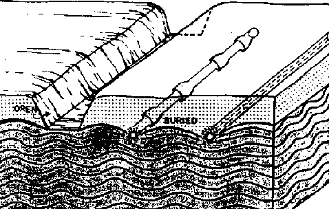
The drainage system may consist of
open drains or buried drains. The design and construction of these generally
require technical assistance.
Concept 4.
UNIFORMITY OF WATER PENETRATION
In a uniform irrigation, water penetrates to the same depth or about the same depth over the entire field.
Uniform penetration of water results in a uniform crop.
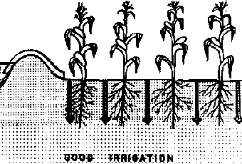
Good Irrigation
Non-uniform penetration of water creates uneven growth and yield.
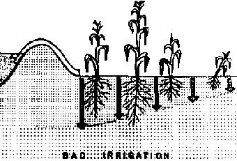
Bad Irrigation
Causes of non-uniform penetration:
· variations of texture within the field
· uneven soil surface
· improper water management
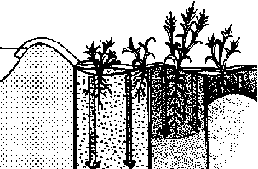
Causes of non-uniform penetration
When the terrain is very uneven
· low spots receive too much water
· high spots remain dry
· water flowing through low areas can quickly erode the soils
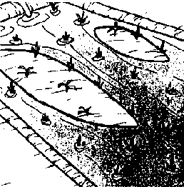
water flowing through low areas can
quickly erode the soils
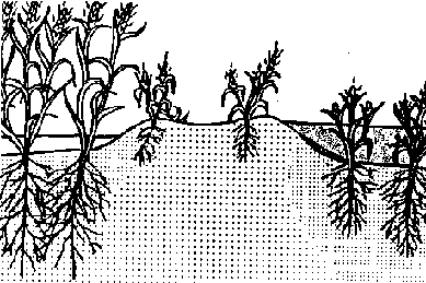
terrain is very uneven
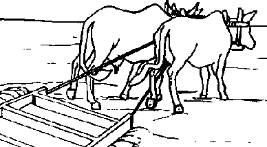
Planing or leveling the field can
eliminate problems of uneven water distribution due to uneven terrain, but
technical assistance should be used when precision land leveling is required.
Concept 5.
RUNOFF
Runoff is water that does not penetrate the soil and flows out of the irrigated field, or water which runs off of the high spots in a field and accumulates in the low areas.
On steep slopes runoff can erode fields and drains.
If irrigation water is scarce, runoff may be an unnecessary loss of precious water.
There are ways, discussed later, to reduce or eliminate these losses.

RUNOFF
Concept 6.
EROSION
Erosion due to irrigation occurs when water moves so fast over the soil surface that it begins to move soil particles. Slope, crop type, and water control together determine the amount of soil loss.
Slope is the steepness, grade, or inclination of a field.
Slope is a factor which determines what irrigation system to use and what methods or structures of water control are necessary for avoiding erosion.
Nearly flat terrain has very little slope.

EROSION
SLOPE: The slope of a field is measured in percent.
As slope increases, the danger of erosion increases.

3%: Terrain rises or falls 3
meters in 100 meters.

10%: Terrain rises or falls
10 meters in 100 meters.
20%: Terrain rises or falls
20 meters in 100 meters.
30%: Terrain rises or falls
30 meters in 100 meters.
Canals, Drains and Other Farm Installations
1. Canals and drains transport water.
Unlined
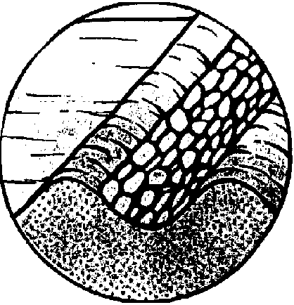
Rock masonry
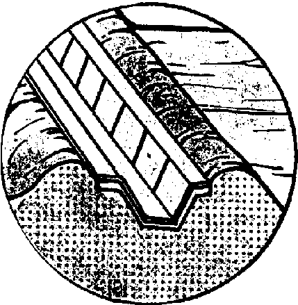
Concrete
2. Flow division structures proportion the required water to the irrigated areas.
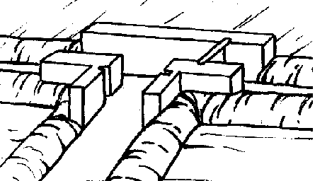
Example 1
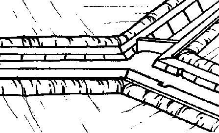
Example 2
3. Check dams raise the water in the canal for distribution to other canals and to the field.
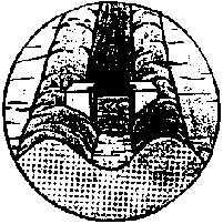
Wood, rock masonry,
concrete

Canvas or plastic
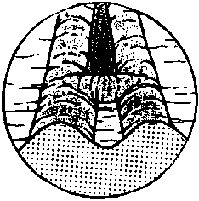
Other canal
4. Headgates control the flow of water from the canals.
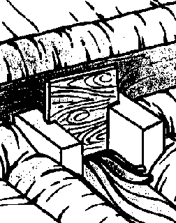
Example 1
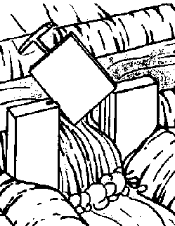
Example 2
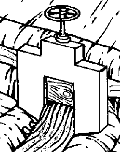
Example 3
Conservation and Maintenance of Canals, Drains, and Other Installation
Canals can be eroded very easily, especially on steep slopes. The following methods can help prevent canal erosion.
1. Construct your canals with very little slope - usually with a slope of one-half percent or less (50 cm/100 m or less).
2. You may consider using the following:
· rock masonry or concrete lining
· grasses of a suitable kind to hold the soil in place.
· on steeper slopes drop structures to bring the water down in steps. Be sure to protect the downstream side of the structure.
Do not build drop structures that allow water to fall more than 30 cm without technical help.
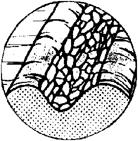
Rock masonry
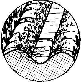
Grass
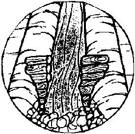
Wood
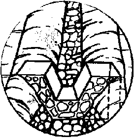
Rock or concrete
All water control structures must be periodically checked and maintained. Follow these recommendations:
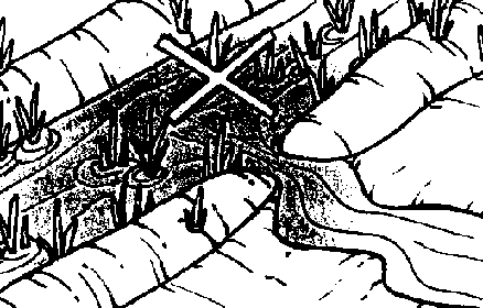
1. Don't let weeds and trash
restrict the flow of water. Clean the canals and raise their banks when
necessary.
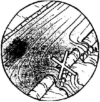
2. Don't put more water in the canal
than it can carry.
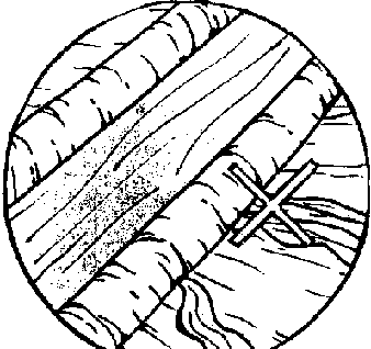
3. Don't let water seep through the
canal banks. This usually occurs over fractured rock, sandy soil, or where
animals have dug holes in the banks. Line the canals with concrete or clay in
places where they would lose much water through seepage.
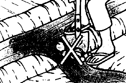
4. Don't cut ditchbanks just
anyplace when water is needed. Select a few places and use the appropriate
outlet structure.
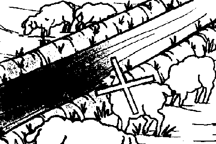
5. Don't pasture animals in the
canal or on its banks. They destroy the banks and protective vegetation.
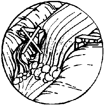
6. Don't let breaks in the
structures go unrepaired. Fix them before they become serious.
IRRIGATION TOOLS
SHOVEL
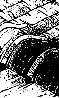
SIPHON
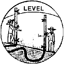
LEVEL
HOE
LONG-HANDLED PICK

PROBE
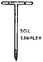
SOIL SAMPLER

CANVAS OR PLASTlC CHECKDAMS
RAKE
Because the construction and use of siphons, soil probes and soil samplers are not known to many farmers, these simple and effective irrigating tools are explained here.
SIPHONS
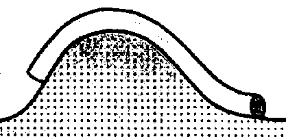
Siphons are curved tubes used to
take water from a canal into a field.
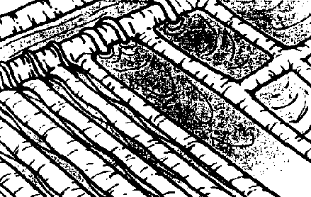
WITH SIPHONS
· it is easy to control the amount of water going into furrows, borders and basins.
· water can be distributed fast, evenly, and without damaging the canal banks.
To use a siphon, the water must be higher in the canal than at the outlet of the siphon.
Siphon sizes for different uses:
1.9 cm - very short furrows
2.5 cm - longer furrows
3.8 cm - long furrows or very sandy soils
5 cm - very large, long furrows or small borders and basins
7.5 to 10 cm - small borders and basins
12.5 to 15 cm - large borders or basins
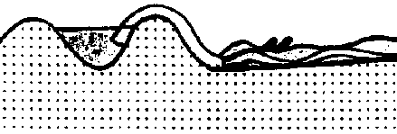
Use a siphon
How Are Siphons Used?
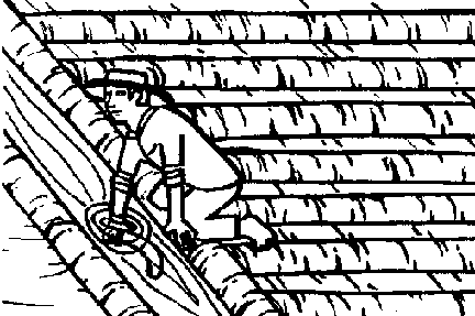
1. Completely submerge the siphon in
the water, with the curve lower than the ends so that the air escapes...
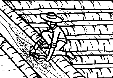
2. Place your hand over the outlet
side of the siphon.
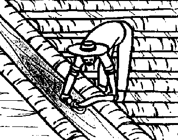
3. Take the outlet side of the
siphon out of the water, keeping it covered. Leaving the other end in the water,
place the outlet end of the siphon tube in the bottom of the furrow or border.
4. Take hands off the siphon, and
water will flow by itself
There are easier ways of priming siphons but they require experience

To get water to flow in 7.5 to 15 cm
diameter siphon (3, 4 and 5 inches), use a piece of rubber inner tube fastened
over the outlet of the siphon. When the tube is full (primed), it can be twisted
with one hand so that the tube stays full while the siphon outlet is pulled out
of the water.
You Can Make Your Own Siphon
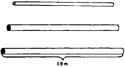
1. Buy as much plastic conduit of
the correct size as you need at a hardware store. Conduit for electrical
installations works very well. Cut the conduit to the proper lengths. 1.2 meters
is usually adequate for 1 to 1 ½ inch siphons; 1.5 meters for 2-inch
siphons.

2. Observe the form of the farm
ditch banks.

3. Make a mold with nails on a
board, according to your observations.

4. Fill a tube with sand and compact
it.
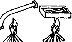
5. Heat parts of the tube over a
fire or in a very hot water (at least 92°C) or in hot sand.

6. Press the heated tube against the
nails on the mold to give it shape. Continue the procedure until the tube has
the desired form. Then remove the sand; the siphon is ready for use.
Siphons larger than 5 cm (two inches) are harder to make. They are usually made of metal and can be bought in irrigation equipment stores.
SOIL SAMPLER AND PROBE
The tools described on this page are very useful for sampling a soil to determine its moisture condition.
An auger-type soil sampler can be made easily from two metal rods welded into a 'T' and a 1 ¼ or 1 ½ inch drill bit as indicated in the drawing.
Weld the drill bit to the 'T' handle.
The sampler can then be introduced into the soil to obtain a soil sample from the depth desired.
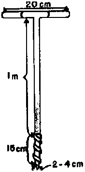
An auger-type soil sampler can be
made easily from two metal rods
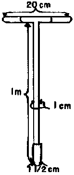
An auger-type soil sampler
To determine how deep the water penetrates during an irrigation, construct a simple tool:
Weld a smooth round bulb to a 'T' handle.

The depth at which the round-tipped
probe becomes significantly harder to push into the soil is the depth that the
water penetrated during irrigation. The probe may not work on soils which are
rocky or which have hardpans. Use a shovel or auger-type soil sampler instead.
FARM WATER MANAGEMENT

What is a good irrigation?
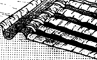
What are crop water needs?
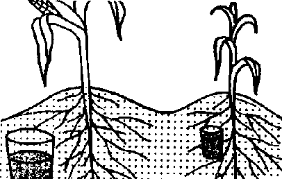
How do I know when to
irrigate?
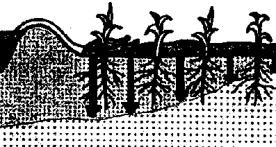
How do I keep my irrigations
uniform?

How can I keep my runoff losses
down?
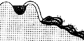
Figure
WHAT IS A GOOD IRRIGATION?
A good irrigation is when:

1. water is applied when the crop
needs it...not when the plants look like this...
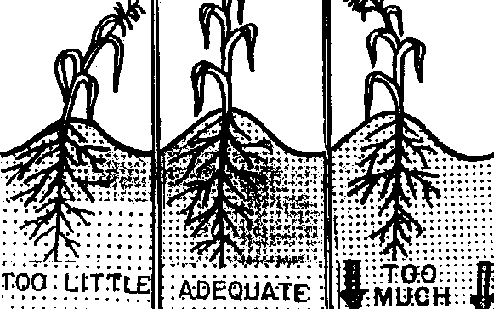
2. the right amount of water is
applied to the root zone.
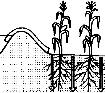
3. the penetration is uniform or
almost uniform.

4. Irrigation does not result in
excessive runoff and wasted water.
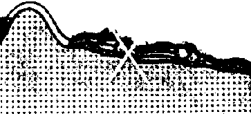
5. The water does not erode the
soils.
To irrigate well, the farmer must know:
1 The water needs of the crops.
& 2 The approximate time that should elapse between irrigations; how to tell
with certainty if it is time to irrigate crops.

3 When to cut off the water.
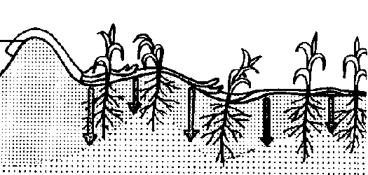
4. If the irrigations are uniform.
If not, how to improve them.
5. How to keep runoff losses low.

6. How to identify erosion problems
and eliminate them.

WHAT ARE CROP WATER NEEDS?
- Water requirements vary as the crop develops, but in general:
MOST TOLERANT to low moisture
Maintain high moisture levels from flowering through grain formation on cereal crops so that yield is not affected.
Most crops have periods when a lack of water results in great reductions in yield. Make adequate moisture available especially during these stages!!
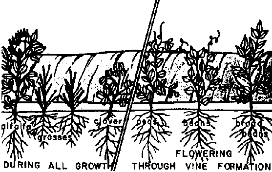
Stage 1
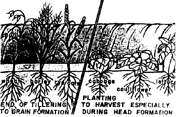
Stage 2
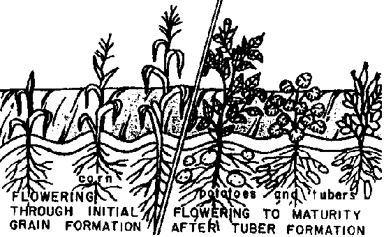
Stage 3

Stage 4
HOW DO I KNOW WHEN TO IRRIGATE?
The frequency of irrigation depends on the amount of water used by the crop and the amount of water which can be removed from the soil by the crop without stress to the plant.
Consider the same crop and the same soil depth.
Sandy soils hold less water, so
irrigations must be more frequent than on fine soils - but less water should be
applied at each irrigation.
Consider the same soil and different crops:
Crops with shallow roots have less water within their reach, so the irrigations should be more frequent and lighter (less depth per irrigation) than deeper rooted crops
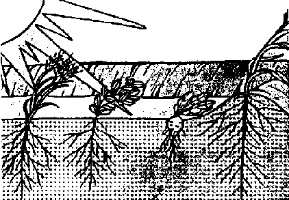
On sunny, hot days, crops use more
water than on cool, cloudy days and irrigations must be more frequent.
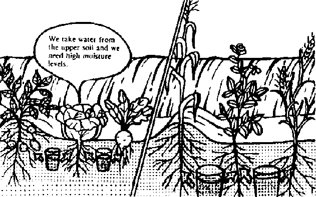
Crops with shallow roots
Apply only light irrigations during germination; just enough to wet the seed bed. Heavy irrigations wash the nutrients down from the upper part of the soil where they are needed for initial development.
Fill the soil profile with moisture early in the season so that you will have a reservoir for your plants to draw water from when the supply becomes deficient.,
Use the following procedure to determine if it is time to irrigate.
1. Take some soil from the root zone area.
· if the crop has 12 inches of roots, check at least to six inches, and sometimes to 12.
· if the crop has 24 inches of roots, check to at least 12 inches, and sometimes to 24, etc.
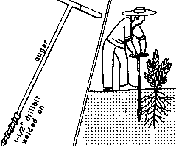
2. Squeeze the soil in your hand.
3. Open your hand and observe the soil. Irrigate most crops when the soil gets to the following state:
Coarse or sandy soil:
The soil falls apart (crumbles) when the hand is opened. (A)
Medium textured soil:
The soil retains the form of the compressed hand when opened, but crumbles when pressed by the finger. (B)
Fine textured soils:
The soil retains its form when the hand is opened. The ball will not crumble when pressed by the finger. However a thin cylinder cannot be formed with the soil. (C)
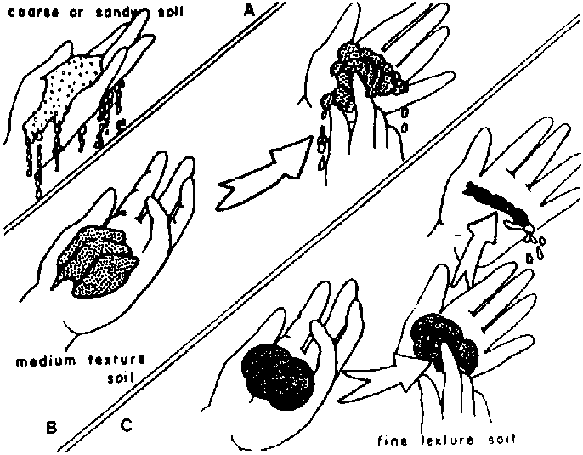
Crops which are not tolerant to
stress should be Irrigated BEFORE they get to the conditions indicated
above.
You can determine if the irrigation has removed the moisture deficit from the root zone

1. Dig down to the root depth:
1 day after irrigating coarse-textured soils
2 days after irrigating medium-textured soils
3 days after irrigating fine-textured soils
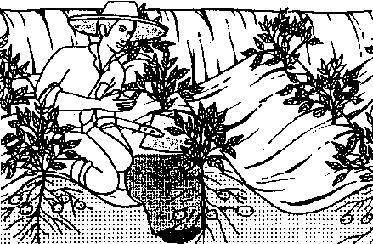
2. Check the moisture depth.
A change in moisture will usually be obvious if the water has not penetrated enough
WHEN CAN THE WATER BE CUT OFF?
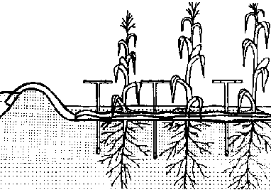
In furrows:
Cut the water off when the round-tipped probe (see tool section) penetrates easily ½ to ¾ of the root depth along the whole run.
Water will penetrate the soil for a significant time after an irrigation. This is why it does not need to penetrate to root depth during the irrigation.
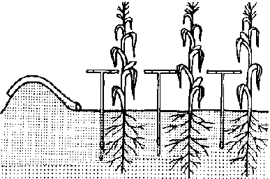
In borders or basins:
The round-tipped probe should penetrate from ½ to ¾ of the root depth, after the water disappears from the surface.
Adjust the irrigation duration, stream size, and how far it must travel along the surface before being cut off.
In border irrigation, the stream usually proceeds 2/3 to ¾ of the border length before being cut off.
HOW DO I MAKE SURE THAT MY IRRIGATIONS ARE UNIFORM?
First look for any of the following indicators of non-uniformity.
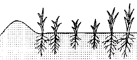
1. Variations in plant height
through the field.
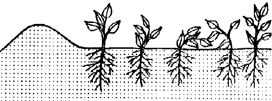
2. Plants wilting in some parts of
the field and not in others.
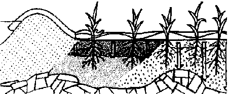
3. Large differences in texture and
depth of soil along the field
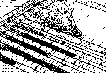
4. Large variations in the time that
water remains on different parts of the field. (For example, if the water
advances slowly over the field and disappears at almost the same time over the
whole field, the water may have penetrated more at the head than at the tail end
of the field.)

5. Fields with uneven
surfaces...water ponds in low spots and high spots remain dry.
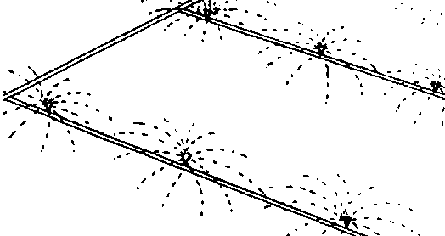
6. Sprinklers spaced so far apart
that the water from one does not overlap with that of another, or does so very
little.
There are usually solutions to the problem of non-uniformity.
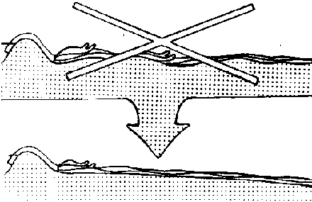
1. An uneven soil surface can be
leveled or planed
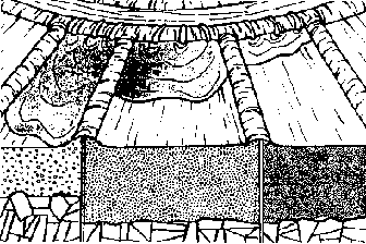
2. Soils of different textures or
structures and depths may be irrigated separately.
3. If the difference in time that
water stands on the surface at the head and tail end of the system is great, we
may be able to:
a. cut down the length or width of furrows, borders, or basins
b. increase the size of stream at the inlet of the furrow, border, or basin.
c. increase the irrigation duration.
4. If the water did not advance
evenly a all the furrows, your irrigations tools. Use siphons and adjust them so
that the necessary amount goes into each furrow.
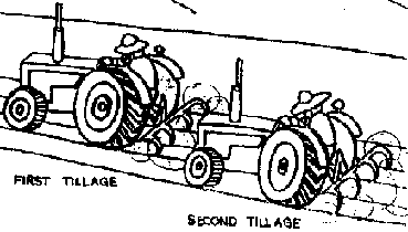
5. If some (...) are more compact
then other because of tillage practices change so that each furrow gets the same
amount of tillage traffic.
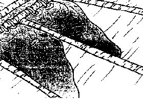
6. When water in a border tends to
flow along one side, there is too much cross slope. Change the direction of the
borders to that of the primary slope, or level or plane each border to eliminate
cross slope.
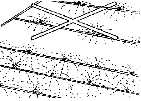
7 Decrease sprinkler spacing and/or
increase pressure.
To determine definitely if the irrigation was uniform or not:
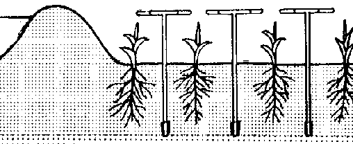
1. Introduce the long, round-tipped
probe into the soil along the irrigation run after an irrigation and note at
what depth it meets significant change in resistance. This is the depth the
water penetrated to. Check the depth of penetration in different parts of the
field and compare.
2. On rocky soils this probe will
not work. Excavate with a shovel, soil auger or other instrument to observe the
depth of penetration.
HOW CAN I KEEP MY RUNOFF LOSSES DOWN?
1. Decrease the size of the stream
into the furrows, borders, and basins.
2. Decrease the duration of each
irrigation. Give lighter, more frequent irrigations. & 3. Reduce the inflow
into the furrows when the water reaches the end.

4. Gather the runoff water in
reservoirs and pump it back to the head or take it to other fields.
5. With borders, build small dikes
at the end (outlet) to hold some of the water back.
6. Increase sprinkler pressure to
break up drops so the water penetrates more easily.
HOW CAN I STOP EROSION?
First of all observe:

1. Does water enter the field,
furrow, border or basin clear and come out looking muddy?
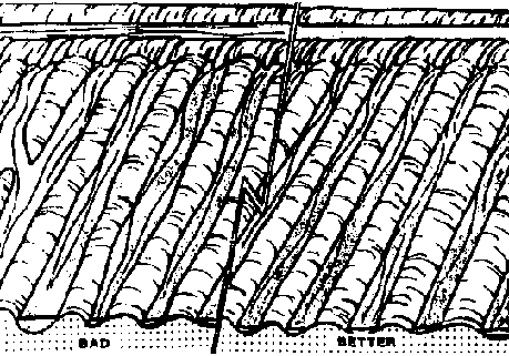
2 Do the shape of the furrows
change? Are there galleys in the fields, furrows, borders or basins?
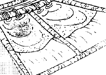
3. Is soil being deposited at the
end of the furrow, border, basin, drain or outlet of the field?
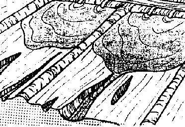
ALL OF THESE ARE SIGNS OF
EROSION.
To control erosion, consider one or more of the following:
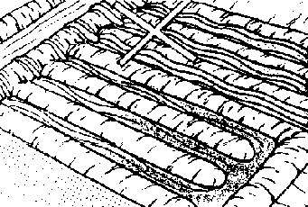
1. Reduce stream size into the
furrow border or basin You may need to cut run lengths when you cut stream size
to maintain uniform irrigation.
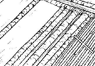
2. Make wider borders or furrows so
that the stream will not be as concentrated
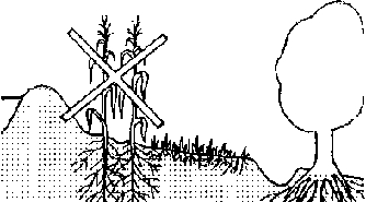
3. Plant crops which will hold the
soil in place--permanent pastures etc.
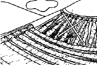
4. Change furrow slopes.
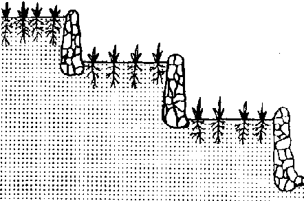
5 Construct terraces.
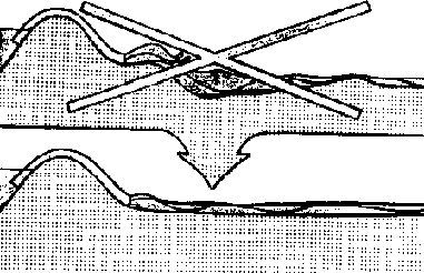
6. Level or plane the soils.

Especially on steep slopes, always
guard against the dangers of erosion.
1 Plant crops which will fix the soil in place-permanent pastures, shrubs, trees, etc.
2. Don't pasture the hillsides constantly, as this destroys the vegetation that protects your sod. Rotate your livestock from one pasture to another.
3. If gullies start to form, eliminate pasturing totally. Plant protective shrubs and trees. You may have to place erosion barriers in the gullies.
4. If you must plant the hillsides, leave strips of permanent grasses and vegetation between cultivated plots.
5. Don't plant to the edge of steep banks. Leave strips of permanent vegetation.
6. Make sure excess water from irrigation and rain is taken away to adequately protected canals and drains.
7. Do not destroy existing protective vegetation.
Take care of your soils and insure food for your children!
We repeat these recommendations for insuring good irrigation management
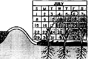
Irrigate frequently enough so
that you do not hurt your crop.

Make sure your irrigations are
uniform.
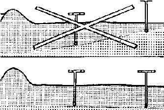
Add enough water to your soil
moisture reservoir, but don't over-irrigate.
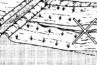
Don't erode your soils.
To obtain good irrigations you can control many factors:
FREQUENCY & DURATION

TOOLS AND STRUCTURES
STREAM SIZE
SLOPE
RELIEF-SOIL SURFACE UNEVENESS
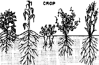
CROP
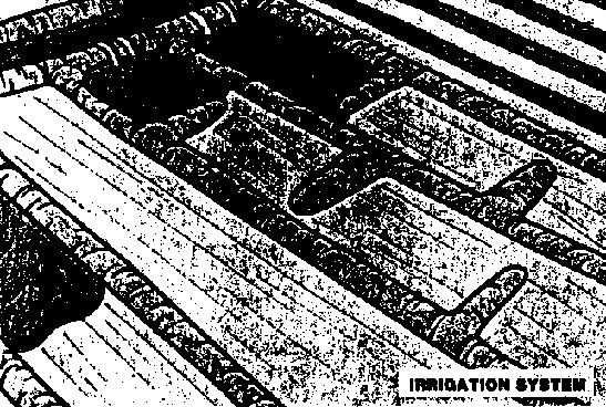
IRRIGATION SYSTEM
But remember, when you change one aspect of the operation to eliminate a problem, you may cause other problems. So be careful and make sure everything contributes to "good" irrigation.
<<TOC2>> Chapter 7 - Waterlogging and
salinity
|
References |
Primary: |
(1), (53) |
7.1 Basic concepts in waterlogging and salinity
Excess water in the plant root zone restricts the aeration required for optimum plant growth. It also may affect the availability of several nutrients by changing the environment around the roots.
Excess salts in the root zone inhibit water uptake by plants, affect nutrient uptake, and may result in toxicities due to individual salts in the soil solution. Excess exchangeable sodium in the soil may destroy the soil structure to a point where water penetration and aeration of the roots become impossible. Sodium is also toxic to many plants.
Waterlogging and salinity in the soil profile are most often the result of high water tables resulting from inadequate drainage or poor quality irrigation water. Adequate surface drainage allows excess irrigation and rainwater to be evacuated before excess soil saturation occurs or before the water is added to the water table. Adequate subsurface drainage insures that water tables are maintained at a sufficient depth below the soil surface to prevent waterlogging and salt accumulation in the root zone. Salinization of the soil profile is prevented because upward capillary movement of water and salts from the water table does not reach the root zone. Adequate subsurface drainage also allows salts to be removed from the soil profile through the application of excess irrigation water (leaching).
To understand how we may prevent, eliminate, or otherwise deal with a waterlogging or salinity problem, we must first understand how crops and soils respond to excess water and salts.
7.1.1 Waterlogging and high ground water tables
The growth of most crops is affected when ground water is shallow enough to maintain the soil profile in the root zone wetter than field capacity. This excess water and the resulting continuously wet root zone can lead to some serious and fatal diseases of the root and stem. Working the soil when overly wet can destroy soil structure and thus restrict root growth and drainage further. The chemistry and microbiology of waterlogged soils is changed due to the absence of oxygen. These changes can affect the availability of many nutrients. For example, nitrogen can undergo denitrification more readily and be lost to the atmosphere as a gas. The anaerobic (reducing) environment results in changes to metals and other cations that can result in deficiencies or toxicities. For example, sulfide, and ferrous and manganese ions will accumulate in waterlogged soils.
Crops vary in their tolerances to waterlogging and high water tables. Some crops, such as rice, are adapted to these conditions and can thrive. Table 7.1 presents the different tolerances of some crops.
TABLE 7.1 Tolerance Levels of Crops to High Ground water Tables and Waterlogging (Ref. 12)
|
GROUND WATER AT 50 CM |
WATERLOGGING | |
|
HIGH TOLERANCE |
sugarcane, potatoes, broad beans |
rice, willow, plum, strawberries, some grasses |
|
MEDIUM TOLERANCE |
sugarbeet, wheat, oats, barley, peas, cotton |
citrus, bananas, apple, pears, blackberries, onion |
|
SENSITIVE |
maize, tobacco, |
peaches, cherries, olives, peas, beans, date palm |
The capillary fringe is a saturated zone that extends some distance above the water table. Water moves into this zone by capillary movement. The roots on many crops do not generally penetrate closer than 30 cm above the water table. The capillary fringe is thinner in sandy soils than in loam or clay soils. Thus the following depths to ground water are suggested as a minimum for most crops:
|
Sandy Soils - - - - - - - - - - |
Rooting Depth + 20 cm |
|
Clay Soils - - - - - - - - - - |
Rooting Depth + 40 cm |
|
Loam Soils - - - - - - - - - - |
Rooting Depth + 80 cm |
7.1.2 Soil and water salinity
Crop yields decrease linearly with increasing salt levels above a given threshold level. This threshold level will vary according to the tolerance of the crop. Yield decreases in the presence of toxic salts such as boron are mainly due to the difficulties the crop has in taking up water when concentrations of salt in the soil solution are high. Often crops have a droughty or dry appearance in high salt soils.
Table 7.2 presents the tolerance of different crops to soil and water salinity levels and the effect that increasing salinity levels has on yield. In this table, the ECe (Electrical Conductivity of the Saturated Paste Extract) is a measure of soil salinity, and ECw (Electrical Conductivity of the Irrigation Water) a measure of water salinity. The Max ECe is the highest ECe that the plant can tolerate. "Yield Potential" is the percent of an optimum yield that can be attained under given growing conditions. Table 7.2 is used as follows: A farmer can produce 50 kg per hectare of corn on good soil. The farmer has a field with an ECe of 3.8, which gives him or her many problems. Using the table, an estimate can be made of an expected yield of roughly 37 kg per hectare (i.e. a 75% Yield Potential) for this field.
TABLE 7.2 Crop Salt Tolerance Levels for Different Crops as Influenced by Irrigation Water or Soil Salinity (Ref. 12)
|
FIELD |
YIELD POTENTIAL | |||||||||
|
CROPS |
100% |
90% |
75% |
50% |
0% | |||||
| |
ECe |
ECw |
ECe |
ECw |
ECe |
ECw |
ECe |
ECw |
ECe |
ECw |
|
Barley |
8.0 |
5.3 |
10 |
6.7 |
13 |
8.7 |
18 |
12 |
28 |
19 |
|
Cotton |
7.7 |
5.1 |
9.6 |
6.4 |
13 |
8.4 |
17 |
12 |
27 |
18 |
|
Sugarbeet |
7.0 |
4.7 |
8.7 |
5.8 |
11 |
7.5 |
15 |
10 |
24 |
16 |
|
Sorghum |
6.8 |
4.5 |
7.4 |
5.0 |
8.4 |
5.6 |
9.9 |
6.7 |
13 |
8.7 |
|
Wheat |
6.0 |
4.0 |
7.4 |
4.9 |
9.5 |
6.3 |
13 |
8.7 |
20 |
13 |
|
Wheat, Durum |
5.7 |
3.8 |
7.6 |
5.0 |
10 |
6.9 |
15 |
10 |
24 |
16 |
|
Soybean |
5.0 |
3.3 |
5.5 |
3.7 |
6.3 |
4.2 |
7.5 |
5.0 |
10 |
6.7 |
|
Cowpea |
4.9 |
3.3 |
5.7 |
3.8 |
7.0 |
4.7 |
9.1 |
6.0 |
13 |
8.8 |
|
Peanut |
3.2 |
2.1 |
3.5 |
2.4 |
4.1 |
2.7 |
4.9 |
3.3 |
6.6 |
4.4 |
|
Paddy Rice |
3.0 |
2.0 |
3.8 |
2.6 |
5.1 |
3.4 |
7.2 |
4.8 |
11 |
7.6 |
|
Sugarcane |
1.7 |
1.1 |
3.4 |
2.3 |
5.9 |
4.0 |
10 |
6.8 |
19 |
12 |
|
Corn (Maize) |
1.7 |
1.1 |
3.4 |
2.3 |
5.9 |
4.0 |
10 |
6.8 |
19 |
12 |
|
Flax |
1.7 |
1.1 |
3.4 |
2.3 |
5.9 |
4.0 |
10 |
6.8 |
19 |
12 |
|
Broadbean |
1.5 |
1.1 |
2.6 |
1.8 |
4.2 |
2.0 |
6.8 |
4.5 |
12 |
8.0 |
|
Bean |
1.0 |
0.7 |
1.5 |
1.0 |
2.3 |
1.5 |
3.6 |
2.4 |
6.3 |
4.2 |
|
VEGETABLE CROPS | ||||||||||
|
Zucchini |
4.7 |
3.1 |
5.8 |
3.8 |
7.4 |
4.9 |
10 |
6.7 |
15 |
10 |
|
Beet, Red |
4.0 |
2.7 |
5.1 |
3.4 |
6.8 |
4.5 |
9.6 |
6.4 |
15 |
10 |
|
Squash |
3.2 |
2.1 |
3.8 |
2.6 |
4.8 |
3.2 |
6.3 |
4.2 |
9.4 |
6.3 |
|
Broccoli |
2.8 |
1.9 |
3.9 |
2.6 |
5.5 |
3.7 |
8.2 |
5.5 |
14 |
9.1 |
|
Tomato |
2.5 |
1.7 |
3.5 |
2.3 |
5.0 |
3.4 |
7.6 |
5.0 |
13 |
8.4 |
|
Cucumber |
2.5 |
1.7 |
3.3 |
2.2 |
4.4 |
2.9 |
6.3 |
4.2 |
10 |
6.8 |
|
Spinach |
2.0 |
1.3 |
3.3 |
2.2 |
5.3 |
3.5 |
8.6 |
5.7 |
15 |
10 |
|
Celery |
1.8 |
1.2 |
3.4 |
2.3 |
5.8 |
3.9 |
9.9 |
6.6 |
18 |
12 |
|
Cabbage |
1.8 |
1.2 |
2.8 |
1.9 |
4.4 |
2.9 |
7.0 |
4.6 |
12 |
8.1 |
|
Potato |
1.7 |
1.1 |
2.5 |
1.7 |
3.8 |
2.5 |
5.9 |
3.9 |
10 |
6.7 |
|
Sweet Potato |
1.5 |
1.0 |
2.4 |
1.6 |
3.8 |
2.5 |
6.0 |
4.0 |
11 |
7.1 |
|
Pepper |
1.5 |
1.0 |
2.2 |
1.5 |
3.3 |
2.2 |
5.1 |
3.4 |
8.6 |
5.8 |
|
Lettuce |
1.3 |
0.9 |
2.1 |
1.4 |
3.2 |
2.1 |
5.1 |
3.4 |
9.0 |
6.0 |
|
Radish |
1.2 |
0.8 |
2.0 |
1.3 |
3.1 |
2.1 |
5.0 |
3.4 |
8.9 |
5.9 |
|
Onion |
1.2 |
0.8 |
1.8 |
1.2 |
2.8 |
1.8 |
4.3 |
2.9 |
7.4 |
5.0 |
|
Carrot |
1.0 |
0.7 |
1.7 |
1.1 |
2.8 |
1.9 |
4.6 |
3.0 |
8.1 |
5.4 |
|
Turnip |
0.9 |
0.6 |
2.0 |
1.3 |
3.7 |
2.5 |
6.5 |
4.3 |
12 |
8.0 |
|
FORAGE CROPS | ||||||||||
|
Ryegrass, per. |
5.6 |
3.7 |
6.9 |
4.6 |
8.9 |
5.9 |
12 |
8.1 |
19 |
13 |
|
Vetch, Common |
3.0 |
2.0 |
3.9 |
2.6 |
5.3 |
3.5 |
7.6 |
5.0 |
12 |
8.1 |
|
Sudan Grass |
2.8 |
1.9 |
5.1 |
3.4 |
8.6 |
5.7 |
14 |
9.6 |
26 |
17 |
|
Forage Cowpea |
2.5 |
1.7 |
3.4 |
2.3 |
4.8 |
3.2 |
7.1 |
4.8 |
12 |
7.8 |
|
Alfalfa |
2.0 |
1.3 |
3.4 |
2.2 |
5.4 |
3.6 |
8.8 |
5.9 |
16 |
10 |
|
Clover, Berseem |
1.5 |
1.0 |
3.2 |
2.2 |
5.9 |
3.9 |
10 |
6.8 |
19 |
13 |
|
Other Clover |
1.5 |
1.0 |
2.3 |
1.6 |
3.6 |
2.4 |
5.7 |
3.8 |
9.8 |
6.6 |
|
Date Palm |
4.0 |
2.7 |
6.8 |
4.5 |
11 |
7.3 |
18 |
12 |
32 |
21 |
|
Grapefruit |
1.8 |
1.2 |
2.4 |
1.6 |
3.4 |
2.2 |
4.9 |
3.3 |
8.0 |
5.4 |
|
Orange |
1.7 |
1.1 |
2.3 |
1.6 |
3.3 |
2.2 |
4.8 |
3.2 |
8.0 |
5.3 |
|
Peach |
1.7 |
1.1 |
2.2 |
1.5 |
2.9 |
1.9 |
4.1 |
2.7 |
6.5 |
4.3 |
|
Apricot |
1.6 |
1.1 |
2.0 |
1.3 |
2.6 |
1.8 |
3.7 |
2.5 |
5.8 |
3.8 |
|
Grape |
1.5 |
1.0 |
2.5 |
1.7 |
4.1 |
2.7 |
6.7 |
4.5 |
12 |
7.9 |
|
Almond |
1.5 |
1.0 |
2.0 |
1.4 |
2.8 |
1.9 |
4.1 |
2.8 |
6.8 |
4.5 |
|
Plum, Prune |
1.5 |
1.0 |
2.1 |
1.4 |
2.9 |
1.9 |
4.3 |
2.9 |
7.1 |
4.7 |
|
Blackberry |
1.5 |
1.0 |
2.0 |
1.3 |
2.6 |
1.8 |
3.8 |
2.5 |
6.0 |
4.0 |
|
Strawberry |
1.0 |
0.7 |
1.3 |
0.9 |
1.8 |
1.2 |
2.5 |
1.7 |
4.0 |
2.7 |
Table 7.2 includes general information about relative tolerances to salt, but varietal differences are also very important. Much effort has been put into developing salt tolerant varieties of many crops because of the worldwide salinity problem. In some cases, minor problems can be alleviated by selecting the correct variety.
Electrical Conductivity (EC) is the reciprocal of resistance (1/ohms) and is measured in mmhos/cm or in dS/m (dS/m = mmhos/cm). EC is measured with a salinity or conductivity meter, which is a standard piece of equipment in all soil labs and can often be purchased at a reasonable price for field use. ECw (salinity of water) is measured by simply inserting the conductivity meter in the irrigation water and adjusting for temperature. Measuring EC (soil salinity) is a little more complicated, requiring a saturated paste of the soil from which the water is then extracted and the salts measured.
Exchangeable sodium in the soil becomes a problem when the predominant salts in irrigation water or in the soil solution are sodium salts. Soil constituents that determine soil structure, such as clays and organic matter (soil colloids), have negative charges (exchange sites) on their outer surface that loosely attach to positive ions and molecules (cations), such as calcium (Ca++), ammonium (NH4+), and sodium (Na+) (see Figure 7.1). These cations can readily be replaced by other cations (they are exchangeable). If there is excessive sodium in the soil solution, it will occupy most of the exchange sites. Sodium is a small cation, so when present in large quantities on the exchange sites, it destroys the separation between soil particles. Then the clay or organic matter collapses on itself, leaving no air spaces or pores (deflocculation) (See Figure 7.1). In some cases, the structureless organic matter is dispersed and can be lost in the drainage water, hence the old-fashioned term for these soils is Black alkali soils.

Figure 7.1 "Normal" and "Sodium"
Affected Clay Particles
Sodium is measured as the Exchangeable Sodium Percent (ESP) or as the Sodium Absorption Ratio (SAR). The ESP is simply the percent of all the exchange sites in the soil occupied by sodium. The SAR is more complicated and is merely an index of the extent of the problem.
Very high sodium levels not only affect soil structure but are toxic to many crops.
7.1.3 Classification of salt affected soils
Saline Soils
These soils contain sufficient amounts of soluble salts to interfere with germination, growth, and yield of most crop plants. They do not contain enough exchangeable sodium to alter soil characteristics. Technically, a saline soil is defined as a soil with an ECe greater than or equal to 4 mmhos/cm and an Exchangeable Sodium Percent (ESP) less than 15. The soil pH is usually less than 8.5. These soils may have a white crust or white salt crystal accumulation on the surface (salt blooms) so they are sometimes called "white alkali soils." Excess soluble salts can be removed by leaching if drainage permits, as will be discussed.
Saline-Sodic Soils
These soils contain soluble salts and exchangeable sodium in sufficient quantities to interfere with the growth of most crops. Technically, a saline-sodic soil is defined as a soil having an ESP greater than 15 and an ECe greater than or equal to 4 mmhos/cm. The soil colloids (charged particles) are collapsed (deflocculated), and drainage and aeration are very poor, pH is usually in the range of 8-10.
Sodic Soils
These soils contain sufficient exchangeable sodium to interfere with the growth of most crops but do not contain appreciable quantities of soluble salts. Technically, they are soils with an ESP greater than 15 and an ECe of less than 4 mmhos/cm. Drainage and aeration are very poor because soil colloids are very dispersed. The pH is generally above 8.5. These soils are sometimes called ''black alkali soils." High pH values generally can be used as a indicator of possible sodium problems, but this is not always true.
7.1.4 Evaluating waterlogging and salinity problems
The evaluation of the extent of waterlogging and salinity problems can usually be conducted through simple observation, communication, and possibly some soil analysis. The following steps can be followed:
1) Interview local agronomists, agricultural technicians, and agribusiness personnel. Ask them questions about water table depths, and salinity problems. If such problems exist, how are local farmers taking care of them?
2) Conduct a field reconnaissance to find out if the problem exists in your area. Wells, gravel pits, and deep channels that show the depth to ground water should be observed. If there are few of these, then install pits or auger small observation wells into the soil to depths of 30 to 80 cm below the expected rooting depths (30 cm for sandy soils, 80 cm for loams and fine-textured soils). If soil horizons are reached that are grey, wet, and possibly contain black or red mottles, you have hit "gleyed" or waterlogged horizons. You can assume at this point that soils are poorly drained at this level.
As part of the reconnaissance, observe fields for signs of excess water or salinity, such as:
a) White crusts on the soil surface. There may be a problem even when these are not present.
b) Plants that are stunted, appear droughty, or irregular even though the soil is fairly moist. In cases of high salinity, the leaves may be curled up and yellow. The margins of the leaves may burn, a reddish color is often seen and in some cases the plant may actually die during or shortly after germination and emergence.
c) Use of drainage water, tailwater, or water that has been used extensively for washing, irrigation, or industrial purposes before reaching the field. This problem may exist when the farmer is a tail end user on a major irrigation system. The water can accumulate salts.
d) Soils with poor structure, which appear sticky and plastic when wet and which do not grow a crop. Hard, structureless soil pans can develop at different depths in sodic soils.
e) Standing water or wet spots in parts of the field where crops grow poorly. Standing water in spots after a prolonged drying period are also useful indicators.
f) Soil that is dry and smooth or has slicked over areas without vegetation, sometimes with a thin peeled up skin, can indicate infiltration and sodic soil problems.
g) Absence of field drains for removing excess water.
h) Condition of field drains: Are surface drains full of vegetation or otherwise plugged? Are surface and subsurface drains operating properly?
i) If the opportunity presents itself, take soil samples and have them analyzed if you suspect a salinity problem or look at past samples if any are available.
<<TOC3>> 7.2 Control of waterlogging and salinity problems
7.2.1 Surface and subsurface drains
The first requisite in the prevention or elimination of waterlogging and salinity problems is an adequate drainage system. Very often the natural drainage in an area, along with good water management, is sufficient to eliminate excess water and preclude the need for expensive subsurface drainage systems. Almost every farmer who applies water by surface irrigation, however, or who deals with significant rainfall, should have adequate surface drainage facilities to remove excess water. This will allow the farmer to avoid waterlogging and possible salinity problems at the tail end of borders, furrows, or basins after irrigation or intense rainstorms. Drainage facilities will also allow the prevention of erosion associated with natural movement of excess water over the soil surface.
Surface drains are open channels that collect water as it runs off or into irrigated fields. These drains convey water to a stream or channel where it can be carried safely. The design procedures for these drains are the same as for any open channel (see Chapter 5). The main requirement is that they are able to convey the maximum expected flow rate without erosion. At the tail end of irrigated fields, these drains are often broad and shallow to allow farm machinery to operate efficiently.
Subsurface drainage may be accomplished either through the construction of open trenches or through buried clay or concrete tiles or perforated pipe. Subsurface drainage systems can be classified as Natural, Herringbone, Gridiron or Interceptor (Cutoff) types.
Natural systems are used in fields where there are small and isolated wet areas. The buried drain lines follow natural draws or depressions.
Herringbone systems are useful in situations where the land slopes toward a draw on either side. The main line follows the draw, and the laterals empty into this from both sides.
Gridiron systems are similar to the Herringbone except that they enter the main drain from only one side.
Interceptor drains are installed across a slope to intercept the passage from higher ground. These drains can prevent the waterlogging of soils below irrigation ditches, springs, or at the foot of a hill. They can be useful in collecting water for recycling into the irrigation system.
The design, drain size, spacing, and depth of these drainage systems are a function of the water table depth desired, the soil permeability (hydraulic conductivity), amount of water to be drained, and economics of construction. Generally, the deeper the drains are installed, the wider the spacing between drains can be. In humid regions, drain spacings of 10 to 50 meters (30 to 150 feet) are common. The closer spacing is used in heavier soils with higher value crops and greater rainfall. In more arid irrigated areas, spacings of 50 to 200 meters (150 to 600 feet) are common.
Tile drain is common in 10, 13, and 15 cm (4, 5, and 6 inch) sizes but can be obtained in greater sizes as can corrugated drainage pipe. Minimum grades are sometimes based on a minimum velocity of 0.45 m/s (1.5 feet per second) at full flow. Surface inlets, outlets and cleanouts, envelope filters, and other structures must be properly designed if the drain system is to operate correctly.
The design of subsurface drains is generally more complex than for surface drains and requires significant knowledge of ground water hydrology. Thus the reader should seek the assistance of a drainage engineer before undertaking the design of expensive subsurface drains. The one possible exception is the Interceptor drain, which can be installed as an open channel below the level of an irrigation canal to provide drainage to land that would otherwise be waterlogged by the canal.
7.2.2 Reclamation of salt affected soils
The chemical and physical analysis of soils provides a basis for the diagnosis, treatment, and management of salt affected soils. After diagnosing the problem but before actual reclamation, two steps must be observed.
1. Establish adequate drainage in the area. The water table should be lowered if it is high, and water should be at least 3 to 4 meters below the surface.
2. The land should be level or contour farmed so that the surface of the soil will be covered uniformly by water.
Saline Soil
If the soil is only saline, it can be reclaimed simply by leaching the excess salts below the root zone. The quantity of water required depends on the texture of the soils, the concentration of salts in the soil and in the leaching water (the higher, the more water needed), and the amount of salts to be leached. On the average, 0.5 to 1.25 meters of water are required.
Saline Sodic Soil and Sodic soil
If leaching is conducted on a saline-sodic soil, the soil will become sodic and could present more problems than it would have originally. Saline-sodic soils require the leaching process to be accompanied by the application of amendments. The amendments that are used are the same ones that would be utilized on a sodic soil. Sodic soils are generally very poor in infiltration, so amendments are slow to enter soil. For this reason, both compacted saline-sodic soils and sodic soils should undergo deep cultivation such as deep ripping to break up hardpans that prevent infiltration.
7.2.3 Correcting sodium problems with amendments
The presence of lime (free calcium carbonate) in soil allows for the widest choice of amendments. To test for this, a spoonful or clod of soil is treated with a few drops of sulfuric acid or hydrochloric acid. If bubbling or fizzing occurs where the acid drops fall, then lime is present. The greater the fizzing, the more lime is present. If the soil contains lime, any of the amendments listed in Table 7.3 can be used. If no lime is present, then only amendments containing soluble calcium are recommended.
TABLE 7.3 Commonly Used Amendment Materials and Their Equivalent Amendment Values (Ref. 1)
| | |
Tons of Amendment Material Equivalent to: |
|
|
(100% Basis) |
Chemical Formula |
1 Ton of Pure Gypsum |
1 Ton of Soil Sulfur |
|
Gypsum |
CaSO4.2H2O |
1.0 |
5.38 |
|
Soil Sulfur |
S |
0.19 |
1.00 |
|
Sulfuric Acid |
H2SO4 |
0.61 |
3.2 |
|
Ferric Sulfate |
Fe2(SO4)3.9H2O |
1.09 |
5.85 |
|
Lime Sulfur |
9% Ca + 24% S |
0.78 |
4.17 |
|
Calcium Chloride |
CaCl2.2H2O |
0.86 |
-- |
|
Calcium Nitrate |
Ca(NO3)2.2H2O |
1.065 |
-- |
|
Aluminum Sulfate |
Al2(SO4)3 |
-- |
6.34 |
The percent purity is generally given on the bag.
Types of Amendments
Calcium containing amendments such as gypsum react in the soil as follows:
|
GYPSUM + SODIUM-SOIL |
CALCIUM SOIL + SODIUM SULFATE |
Leaching is then undertaken to wash out the sodium sulfate. Repeated applications are necessary in many cases. The amount of gypsum used is substantial, often 1.5 or more tons of material per hectare, because gypsum is not highly water soluble, and, in many cases, the reaction described above takes a long period of time. A more precise measurement of the "gypsum requirement" is available from most soil labs, assuming a material of 100% purity.
Acids such as sulfuric acid undergo a two step process:
|
1. SULFURIC ACID + SOIL LIME |
GYPSUM + CO2 + WATER |
|
2. GYPSUM + SODIUM-SOIL |
CALCIUM SOIL + SODIUM SULFATE |
Acids are dangerous and corrosive, so handling them can be a problem. The volume applied has to be controlled because of excessive frothing. Occasionally, cheap industrial sources are available but must be used with caution because of the potential for heavy metal contamination. An analysis of spent acids is recommended. Acids are much faster than other reclamation procedures because the reaction is instantaneous.
Acid forming materials such as sulfur are much slower because they undergo a three step process, the first step requiring microbial intervention in the oxidation reaction:
|
1. SULFUR + OXYGEN + WATER |
SULFURIC ACID |
|
2. SULFURIC ACID + SOIL LIME |
GYPSUM + CO2 + WATER |
|
3. GYPSUM + SODIUM-SOIL |
CALCIUM SOIL + SODIUM SULFATE |
These steps can take years.
Effectiveness and Amount of Amendments
In the absence of a soil analysis for gypsum requirement, a rule of thumb is that something is better than nothing. Gypsum is usually used in large quantities, so 0.5 to 2 metric ton applications per hectare are not unusual. To convert the gypsum requirement to an amount of some other amendment, Table 7.3 offers a simple guideline. Simply multiply the gypsum ton equivalent by the gypsum requirement.
If the material being considered is not 100% pure, a simple calculation will indicate the amount needed to be equivalent to 1 metric ton of pure material:

For example: If gypsum is 60 percent pure, the calculation would be 100/60 = 1.67 m tons. In other words, 1.67 tons of 60 percent pure gypsum is equivalent to 1 m ton of 100% material.
Sulfur presents an additional challenge since not only purity but the fineness of the granules must be accounted for. The finer the material, the faster microbial oxidation will occur. Coarse grade materials are highly insoluble and may take years to be active.
7.2.4 Management of saline and sodic soils
Often, it is too expensive or impractical to reclaim saline or sodic soils or even maintain them at low salinity levels. It may be impossible to adequately drain an area, amendments may not be available or may be too expensive, or the water used for irrigation may be of poor quality.
In these situations, there are various management practices that will aid in controlling or reducing the impact of salts or sodium:
1. Selection of crops or crop varieties that have higher tolerances for salt or sodium (see Table 7.2).
2. Use of special planting procedures that will minimize salt accumulation around the seed (see Figure 7.2).
3. Use of the appropriate irrigation method for the root characteristics of the crop (see Figure 7.3).
4. Use of sloping beds and other special land preparation procedures and tillage methods to provide a low salt environment (see Figure 7.4).
5. Use of irrigation water to maintain a high water content to dilute the salts or leach them for germination or from the root zone.
6. Use of physical amendments such as manure and compost for improving soil structure and filth. Conservation tillage to incorporate crop residues will help create drainage.
7. Deep ripping of soil to break up sodic and other hardpans or other impervious layers to provide internal drainage.
8. Use of chemical amendments as described.9. Good, sound farming practices and careful fertilizer management.
Figure 7.2 Salt Accumulation Patterns (Ref. 1)
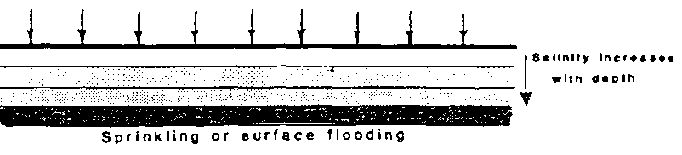
Sprinkling or surface flooding
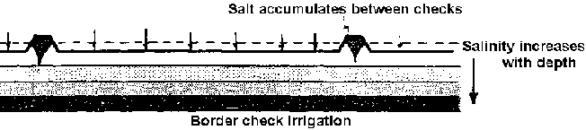
Border check

Furrow irrigation
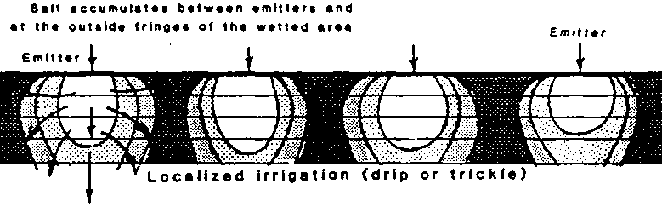
Localized irrigation (drip or
trickle)
Figure 7.3 Bed Shapes and Salinity Effects (Ref. 1)
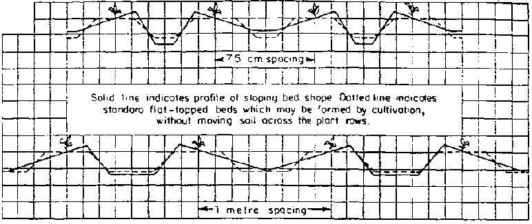
Sloping seedbeds

Sloping seedbeds used for salinity
and temperature control
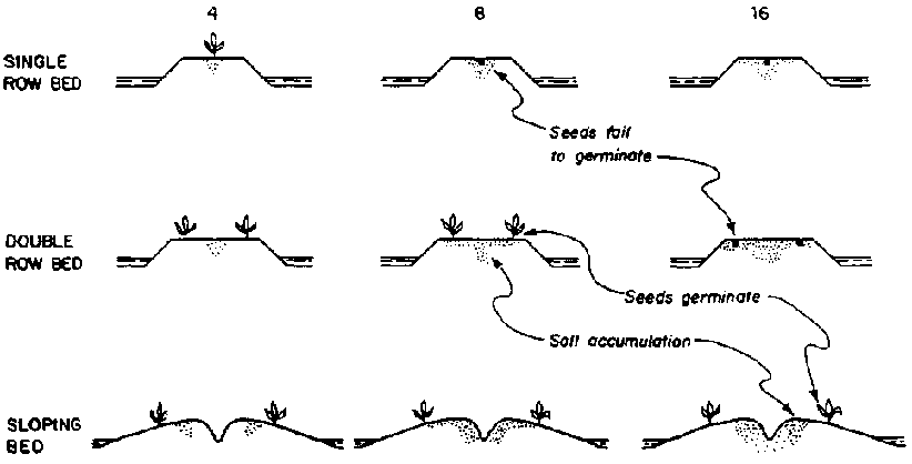
SOIL SALINITY AT PLANTING TIME
(dS/m)
- The pattern of salt build-up depends on bed shape and irrigation method. Seeds sprout only when they are placed so as to ovoid excessive salt build-up around them.
Figure 7.4 Bed Shapes and Salinity Effects (Ref. 1)
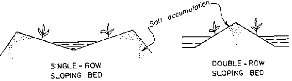
Salinity control with sloping beds

Flat top beds and irrigation
practice
<<TOC3>> 7.3 Irrigation water quality
An understanding of the quality of irrigation water is essential in any salinity or sodium control program. Often, poor quality water is the source of the salinity or sodium problem. Table 7.4 presents some quality guidelines for evaluating the riskiness of the water. If water is of poor quality, tactics such as dilution with other water sources or applications of larger leaching amounts can be implemented.
TABLE 7.4 Effect of Irrigation Water Quality on Soil Salinity, and Permeability, Toxicity (Ref. 12)
| |
Impact of Irrigation on Water Quality | |||
| |
None |
Moderate |
Severe | |
|
Salinity |
<0.75 |
0.75- 3.0 |
>3.0 | |
|
ECw (mmhos/cm) | ||||
|
Permeability | ||||
|
ECw (mmhos/cm) |
>0.50 |
0.50- 0.2 |
<0.2 | |
|
adj. SAR: | |
| | |
| |
Montmorillonite1 |
<6.00 |
6.00- 9.0 |
>9.0 |
| |
Illite2 |
<8.00 |
8.00-16.0 |
>16.0 |
| |
Kaolinite3 |
<16.00 |
16.00-24.0 |
<24.0 |
|
Toxicity (most tree crops) | ||||
|
Sodium (adj. SAR)4 |
<3.00 |
3.00- 9.0 |
>9.0 | |
|
Chloride (meq/l)5 |
<4.00 |
4.00-10.0 |
>10.0 | |
|
Boron (mg/l) |
<0.75 |
0.75- 2.0 |
>2.0 | |
|
Miscellaneous | ||||
|
Nitrogen (mg/l)6 |
<5.00 |
5.00-30.0 |
>30.0 | |
|
Bicarbonate (HCO3) |
<1.50 |
1.50- 8.5 |
>8.5 | |
|
pH |
Normal Range 6.5 - 8.4 | |||
1 Temperate clay soils, highly expandable, not suited
for ceramics or clay tiles.
2 Temperate clay soils or tropical
soils in low rainfall or wet/dry climates. Not highly expandable. Can be used
for ceramics.
3 Tropical clay soils in high rainfall areas.
Usually have a distinct red or yellow color.
4 For most field
crops (Ref. 1).
5 Sprinkler irrigation may cause leaf burn when
>3 meq/l.
6 Excess nitrogen causes excessive vegetative growth,
lodging, and delayed crop maturity.
Salinity problems can occur due to saline water being used in irrigation. Decreased soil infiltration rates can be the result of irrigation water that is low in salts but high in sodium or water that has a high sodium to calcium ratio. If infiltration problems are due to high sodium water, the effect will be noticed in the surface few centimeters of the soil.
Other water quality problems to watch for include:
1. Water high in iron, bicarbonate, or gypsum, which can result in unsightly deposits on cash crops.
2. Highly acid (low pH) or corrosive water that can result in severe corrosion of irrigation hardware such as pipelines and wells.
3. Other pH abnormalities (high or low) that can result in encrustation or other effects on crops.
4. Risks from diseases such as Bilharzia (schistosomiasis), malaria, and lymphatic filariasis, or other diseases borne by vectors such as mosquitoes. Vector breeding can often originate in situations where there is low water infiltration rates, use of wastewater for irrigation, or poor drainage.
5. Sediments that can clog irrigation structures, build films on leafy cash crops, making them unacceptable for marketing, and seal soils by depositing structureless silt on soil surfaces.
<<TOC2>> Appendix A - Math skills and tool
use
A.1 Conversion factors
Abbreviations
|
ac |
= |
acre |
|
C |
= |
Celsius |
|
cal |
= |
calories |
|
cfs |
= |
cubic feet per second |
|
cm |
= |
centimeter |
|
cusec |
= |
1 ft3/sec |
|
F |
= |
Fahrenheit |
|
ft |
= |
foot |
|
gal |
= |
gallon |
|
gpm |
= |
gallons per minute |
|
ha |
= |
hectare |
|
Hg |
= |
Mercury |
|
hp |
= |
horsepower |
|
hr |
= |
hour |
|
in |
= |
inch |
|
kg |
= |
kilograms |
|
km |
= |
kilometer |
|
kw |
= |
kilowatt |
|
L |
= |
liter |
|
lb |
= |
pound |
|
m |
= |
meter |
|
mi |
= |
mile |
|
mm |
= |
millimeters |
|
psi |
= |
pounds per square inch |
|
sec |
= |
second |
Length
|
1 inch |
= |
2.54 cm | |
| | |
|
1 foot |
= |
30.48 cm |
= |
0.3048 m | |
|
|
1 meter |
= |
39.37 in |
= |
3.281 ft | |
|
|
1 mile |
= |
5280 ft |
= |
1609.3 m |
= |
1.61 km |
|
1 kilometer |
= |
1000 m |
= |
0.62137 mi | |
|
Area
|
1 inch2 |
= |
6.452 cm2 |
| | |
|
|
1 foot |
= |
0.093 m2 |
| | |
|
|
1 acre |
= |
4047 m2 |
= |
0.4047 ha |
= |
43560 ft2 |
|
1 hectare |
= |
10000 m2 |
= |
2.471 ac | |
|
|
1 meter2 |
= |
10.76 ft2 |
| | |
|
Volume
|
1 US gallon |
= |
231 in3 |
= |
0.1337 ft |
= |
3.785 L |
|
1 foot |
= |
7.48 gal |
= |
28.32 L |
= |
0.0283 m3 |
|
1 acre-foot |
= |
43560 ft3 |
= |
1233.5 m3 |
| |
|
1 meter3 |
= |
1000 L |
= |
264.2 gal |
= |
35.31 ft |
|
1 liter |
= |
1000 cm3 |
| | |
|
Weight
|
1 kilogram |
= |
2.2 lbs |
= |
35.27 ounces |
|
1 pound |
= |
0.453 kg |
= |
453.59 g |
|
1 ounce |
= |
28.35 g | |
|
|
1 ton |
= |
907.18 kg |
= |
2000 lbs |
|
1 metric ton |
= |
1000 kg |
= |
2204.6 lbs |
Flow Rate
|
1 cfs |
= |
1 ft3/sec |
= |
1 cusec | |
|
|
1 gpm |
= |
0. 00223 cfs |
= |
0. 0631 L/sec |
= |
0.227 m3/hr |
|
1 cfs |
= |
448.8 gpm |
= |
28.32 L/sec |
= |
101.9 m3/hr |
|
1 m3/hr |
= |
0.2778 L/sec |
= |
0.00981 cfs |
= |
4.403 gpm |
|
1 L/sec |
= |
15.85 gpm |
= |
0.0353 cfs | |
|
Pressure (density of water at 39.2 F. approximately 4° C)
|
1 psi |
= |
2.31 ft water |
= |
2.04 in Hg |
= |
0.0703 kg/cm2 |
|
1 ft water |
= |
0.433 psi |
= |
0.883 in Hg |
= |
0. 0304 kg/cm2 |
|
1 kg/cm2 |
= |
10 m water |
= |
28.97 in Hg |
= |
736 mm Hg |
|
1 kg/cm2 |
= |
14.22 psi |
= |
32.8 ft water |
| |
|
1 m water |
= |
3.28 ft water |
= |
0.1 kg/cm2 | | |
Temperature
|
Degrees F |
= |
(Degrees C |
|
Degrees C |
= |
|
 1. 8) + 32
Properties of Water
|
Temperature |
Vapor Pressure |
| |||
|
°C |
°F |
mm Hg |
psi |
ft water |
Specific Gravity |
|
4 |
39 |
6.101 |
0.118 |
0.272 |
1.000 |
|
10 |
50 |
9.209 |
0.178 |
0.411 |
0.999 |
|
15 |
59 |
12.788 |
0.2468 |
0.570 |
0.999 |
|
20 |
68 |
17.535 |
0.338 |
0.782 |
0.998 |
Absolute Pressure at Various Altitudes
|
Altitude |
Atmospheric Pressure | |||
|
Feet |
Meters |
psi |
Feet of Water |
Meters of Water |
|
0 |
0.0 |
14.7 |
33.9 |
10.33 |
|
500 |
152.4 |
14.4 |
33.3 |
10.14 |
|
1000 |
304.8 |
14.2 |
32.8 |
9.99 |
|
1500 |
457.2 |
13.9 |
32.1 |
9.78 |
|
2000 |
609.6 |
13.7 |
31.5 |
9.60 |
|
2500 |
762.0 |
13.4 |
31.0 |
9.44 |
|
3000 |
914.4 |
13.2 |
30.4 |
9.26 |
|
3500 |
1066.8 |
12.9 |
29.8 |
9.08 |
|
4000 |
1219.2 |
12.7 |
29.2 |
8.90 |
|
4500 |
1371.6 |
12.4 |
28.8 |
8.77 |
|
5000 |
1524.0 |
12.2 |
28.2 |
8.59 |
|
5500 |
1676.4 |
12.0 |
27.6 |
8.41 |
|
6000 |
1828.8 |
11.8 |
27.2 |
8.29 |
|
6500 |
1981.2 |
11.5 |
26.7 |
8.13 |
|
7000 |
2133.6 |
11.3 |
26.2 |
7.98 |
|
7500 |
2286.0 |
11.1 |
25.7 |
7.83 |
|
8000 |
2438.4 |
10.9 |
25.2 |
7.68 |
|
8500 |
2590.8 |
10.7 |
24.7 |
7.52 |
|
9000 |
2743.2 |
10.5 |
24.3 |
7.40 |
|
9500 |
2895.6 |
10.3 |
23.8 |
7.25 |
|
10000 |
3048.0 |
10.1 |
23.4 |
7.13 |
Work - Power
|
1 hp |
= |
0.746 kw | |
|
|
1 kw |
= |
1.34 hp | |
|
|
1 hphr |
= |
0.746 kwhr |
= |
2546.1 BTU |
|
1 kwhr |
= |
1.341 hphr |
= |
3410.1 BTU |
1 cm water evaporated requires 590 car/cm2 of energy or 590 langleys in a day.
<<TOC3>> A.2 Common formulas
|
Area of a rectangle |
= |
length |
|
Area of a triangle |
= |
base |
|
Area of a circle |
= |
3.142 |
|
Circumference of a circle |
= |
2 |
|
Volume of a cube |
= |
base |
|
Velocity |
= |
|
 width
width  height
  1/2
1/2  radius2
  3.142
3.142  radius
  width
width  height
A.3 Trigonometric table
(All angles are given in degrees.)
|
ANGLE TANGENT |
SINE |
TANGENT |
ANGLE |
SINE | |
|
0.0 |
0 |
0 |
23 |
.3907 |
.4245 |
|
0.5 |
.0087 |
.0087 |
23.5 |
.3987 |
.4348 |
|
1.0 |
.0175 |
.0175 |
24.0 |
.4067 |
.4452 |
|
1.5 |
.0262 |
.0262 |
24.5 |
.4147 |
.4557 |
|
2.0 |
.0349 |
.0349 |
25.0 |
.4226 |
.4663 |
|
2.5 |
.0436 |
.0437 |
25.5 |
.4305 |
.4770 |
|
3.0 |
.0523 |
.0524 |
26.0 |
.4384 |
.4877 |
|
3.5 |
.0610 |
.0612 |
26.5 |
.4462 |
.4986 |
|
4.0 |
.0698 |
.0699 |
27.0 |
.4540 |
.5095 |
|
4.5 |
.0785 |
.0787 |
27.5 |
.4617 |
.5206 |
|
5.0 |
.0872 |
.0875 |
28.0 |
.4695 |
.5317 |
|
5.5 |
.0958 |
.0963 |
28.5 |
.4772 |
.5430 |
|
6.0 |
.1045 |
.1051 |
29.0 |
.4848 |
.5543 |
|
6.5 |
.1132 |
.1139 |
29.5 |
.4924 |
.5658 |
|
7.0 |
.1219 |
.1228 |
30.0 |
.5000 |
.5774 |
|
7.5 |
.1305 |
.1317 |
30.5 |
.5075 |
.5890 |
|
8.0 |
.1392 |
.1405 |
31.0 |
.5150 |
.6009 |
|
8.5 |
.1478 |
.1495 |
31.5 |
.5225 |
.6128 |
|
9.0 |
.1564 |
.1584 |
32.0 |
.5299 |
.6249 |
|
9.5 |
.1650 |
.1673 |
32.5 |
.5373 |
.6371 |
|
10.0 |
.1736 |
.1763 |
33.0 |
.5446 |
.6494 |
|
10.5 |
.1822 |
.1853 |
33.5 |
.5519 |
.6619 |
|
11.0 |
.1908 |
.1944 |
34.0 |
.5592 |
.6745 |
|
11.5 |
.1994 |
.2035 |
34.5 |
.5664 |
.6873 |
|
12.0 |
.2079 |
.2126 |
35.0 |
.5736 |
.7002 |
|
12.5 |
.2164 |
.2217 |
35.5 |
.5807 |
.7133 |
|
13.0 |
.2250 |
.2309 |
36.0 |
.5878 |
.7265 |
|
13.5 |
.2334 |
.2401 |
36.5 |
.5948 |
.7400 |
|
14.0 |
.2419 |
.2493 |
37.0 |
.6018 |
.7536 |
|
14.5 |
.2504 |
.2586 |
37.5 |
.6088 |
.7673 |
|
15.0 |
.2588 |
.2679 |
38.0 |
.6157 |
.7813 |
|
15.5 |
.2672 |
.2773 |
38.5 |
.6225 |
.7954 |
|
16.0 |
.2756 |
.2867 |
39.0 |
.6293 |
.8098 |
|
16.5 |
.2840 |
.2962 |
39.5 |
.6361 |
.8243 |
|
17.0 |
.2924 |
.3057 |
40.0 |
.6428 |
.8391 |
|
17.5 |
.3007 |
.3153 |
40.5 |
.6494 |
.8541 |
|
18.0 |
.3090 |
.3249 |
41.0 |
.6561 |
.8693 |
|
18.5 |
.3171 |
.3346 |
41.5 |
.6626 |
.8847 |
|
19.0 |
.3256 |
.3443 |
42.0 |
.6691 |
.9004 |
|
19.5 |
.3338 |
.3541 |
42.5 |
.6756 |
.9163 |
|
20.0 |
.3420 |
.3640 |
43.0 |
.6820 |
.9325 |
|
20.5 |
.3502 |
.3739 |
43.5 |
.6884 |
.9490 |
|
21.0 |
.3584 |
.3839 |
44.0 |
.6947 |
.9657 |
|
21.5 |
.3665 |
.3939 |
44.5 |
.7009 |
.9827 |
|
22.0 |
.3746 |
.4040 |
45.0 |
.7071 |
1.000 |
|
22.5 |
.3827 |
.4142 | |
| |
A.4 List of common tools
- 3-5 HP CENTRIFUGAL PUMP
- ABNEY LEVEL (HAND LEVEL)
-
AX
- BUCKETS (5-GALLON)
- CALCULATOR, SCIENTIFIC
- CARPENTER'S
LEVEL
- DIGGING BAR
- GRAPH PAPER
- HACK SAW
- HAMMER
- HOES
-
HOSE LEVEL (30 m TRANSPARENT 1/2" (phi = diameter) TUBE)
- LUMBER
-
MACHETE
- METAL SHEERS
- NAILS
- PICKS
- PIPE THREADER
- PIPE
WRENCH
- PLASTIC ZIPLOCK BAGS
- PLIERS
- PRESSURE GAUGE
- PVC PIPE
(1", 2", 3" (phi = diameter), 1 1/2 m LENGTH)
- RAIN BIRD SLIDE RULER
CALCULATOR
- ROPE
- RUBBER INNER TUBE
- SAW (RIP, CROSS-CUT)
- SCREW
DRIVERS
- SHEET METAL
- SHEETS OF PLASTIC (15-20 m2)
-
SHOVELS
- SOIL AUGER
- STOP WATCH
- STRING
- SURVEY ROD
- TAPE
MEASURE - LARGE (50 m); SMALL (3 m)
- TEFLON TAPE
- VICE GRIPS
- WOOD
AND METAL FILES
- WRENCH
<<TOC2>> Appendix B - Community organization
and
development
B.1 Community situation analysis/needs assessment
When involved in rural development, problems in poor areas can appear staggering and overwhelming. A development worker or a development committee may want to solve all problems, but villagers may be able or willing to work on only one or a few. With so many problems to solve but limited time and resources, a complete and accurate assessment of needs is essential. A needs assessment identifies and prioritizes a community's problems so they can be solved efficiently. It focuses general needs into specific obtainable goals.
Identifying a community's needs is only half the equation in development program planning. The community's resources, physical and social, must also be identified to determine the best methods and technologies required to solve a problem. A good appraisal can focus development work on important and solvable problems using technology that is locally available, understandable and transferable. Too often development projects designed by outside experts have scratched an itch that wasn't there and have used an exotic and expensive technology.
A project that addresses a pressing community need will generate genuine enthusiasm. Using appropriate technology to address a problem will ensure that villagers can afford the technology, repair it when it breaks down, and adapt it to new problems and situations. Such a project can live on beyond the funding life. Community situational analysis and needs assessment is the first step in matching a technology to local conditions.
Most irrigation projects involve a number of people in a community. Irrigation projects involve the farmers who will use the water for irrigation, local and state officials who administer water rights, irrigation equipment suppliers, and a number of other individuals and organizations. Most irrigation projects can be developed and operated successfully only with community participation during all phases. From the beginning of the planning for an irrigation project, the community must be involved. The community must feel that irrigation is a priority need if it is to devote the time, energy, and other resources to the project. Thus a community needs assessment should be part of any project in its early phases. If the project's priority is shown to be improving agricultural production or stabilizing food supplies, the idea will be well received.
Along with the needs assessment should come evaluation of the resource base -- physical, social, legal, and possibly even religious. If the right conditions are not present the project may have very limited success. For example, a project cannot be built if resources are not available or if other needs require the investment of scarce resources. Physical availability of water or limits on its availability due to water rights considerations may be serious limitations. Rapid appraisal techniques are useful in developing the need and feasibility of irrigation. This section presents some basic concepts on community analysis and needs assessment as well as some rapid appraisal techniques. It also highlights the most important human and physical resources that must be evaluated when determining whether or not irrigation will be developed and what the benefits and limitations of irrigation might be.
<<TOC3>> B.2 Rapid rural appraisal
B.2.1 General Concepts
Rapid rural appraisal (RRA) was developed to enable rapid decision making in rural development projects. Techniques have evolved from the need to get good quality data fast while avoiding the expensive and time consuming traditional survey methods used by researchers or total immersion methods used by ethnographic studies. There are various methods that can be used in RRA. The purpose of the appraisal will determine which method can be used.
As an example to illustrate the general approach to RRA, consider a village where family income is too low to meet all expenses. Families must seek temporary employment elsewhere. The Volunteer involved in rural development in this village identifies this very general need. He or she then conducts an appraisal with community leaders and indigenous agricultural experts using direct observation and guided interviews. This appraisal generates a list of more specific problems related to low income levels. A meeting with community members results in the analysis, prioritization, and development of a specific program goal.
To accomplish this goal, a situational analysis is conducted to identify community and outside resources that can be applied to solving problems and constraints. The situational analysis will also identify potential problems that need to be considered in the project design. More meetings and data collection follow to adapt and verify the program using other appraisal methods. This example illustrates that community needs assessment/situational analysis is an iterative process continually evolving as programs grow.
Quick-and-simple investigations require some general principles to avoid incomplete data collection or inappropriate and misconstrued information. These are:
1. Take sufficient time. Rushing can result in incomplete or inaccurate results.
2. Use a participatory approach. Local people's knowledge of soils, seasons, plants, domestic and wild animals, farming practices, diet, cooking practices, child care, as well as social customs, relations, and organizations is very important to consider. Ask rural people to identify the problems and resources.
3. Select community representatives carefully to avoid incomplete data or personal biases and hidden agendas. In many traditional cultures, there are hidden leaders who aren't obvious to an outsider but are instrumental in decision making in a community. A useful method for identifying community power actors and creating a committee of local participants identifies the following four power roles (Ref. 49):
· Positional Power: easily identifiable leaders, such as government officials and teachers.
· Reputational Power: leaders typically known by their reputation but their identity may be less obvious. Examples include practitioners of indigenous traditions, successful farmers, and religious leaders.
· Decision Making: instrumental leaders in the resolution of community issues who may not be represented above. Examples are elders and ax-official leaders.
· Social Participation: active leaders in community voluntary associations. Examples include religious leaders and club leaders.
4. Use key indicators that integrate several variables. Investigating, calibrating and measuring these parameters can save time.
Some examples include:
· soil color and characteristics,
· plant species present and appearance of growth,
· farm size and condition,
· nutritional condition of household members, and
· soil cover and erosion.
5. Use an iterative and continuing approach to identify trends instead of making a snapshot assessment. With experience, participants in rapid rural appraisals will improve their accuracy and completeness in identifying community needs and resources.
B.2.2 Methods of Rapid Rural Appraisal
There are many methods for rapid rural appraisal. Any one method should not be relied on alone, and a combination of methods is recommended. Local conditions and the abilities of local participants should determine the direction of the appraisal. Local participation is essential in a rural appraisal.
1. Guided interview. There is no formal questionnaire but a simple checklist of questions that the interviewer uses as a flexible guide. Not all questions are asked of all interviewees, but a composite is developed. Casual conversations result in more valuable information and encounter less distrust and resistance than formal questionnaires. Women, children, and other development projects personnel should be interviewed along with village men.
The question guide should be reviewed before direct conversation is undertaken. Notes and answers are jotted down after the interview to avoid discomfort and suspicion. The questions asked will vary with the purpose of the appraisal. They can be as varied as, for example, what disease problems occur in a certain crop; how are family economic decisions made and who makes them; what are your fertilizer sources, costs of production; and what is a typical diet.
2. Direct observation. This method will enable one to avoid being misled by myth. The importance of walking, seeing, and asking is stressed. Biases are left behind. Even the less experienced eye can identify important facts, such as the kinds of crops and livestock raised, water resources, topography, availability of transportation, and marketing possibilities. Those with more experience will collect more information.
An example of this method is walking with village leaders through the village and observing how many villagers are planting a certain crop or pruning their fruit trees. A very effective, though time consuming method, is learning by doing. For example, by hiring oneself out as a laborer to farmers, one learns local farming practices.
3. Informal transects. This method involves walking away from the road at right angles periodically and observing soil, crop, or other conditions, depending on the purpose of the appraisal. This method is best conducted after some experience has been gained as an observer or in the company of a village expert or leader. It is a useful method for gathering baseline data. Example topics for baseline information include the incidence of a crop disease or weed species, soil conditions, and watershed conditions.
4. Local researchers. Making use of ad hoc research by local students or by national university students can be a quick source of excellent and practical information. Many agricultural schools require field study, but these students are not commonly available at the local level. A variant to this method is making use of local secondary students to conduct local studies or applied research. Their knowledge of local conditions and enthusiasm can result in excellent data. Collaboration with local instructors may even add this study to their curriculum.
5. Local experts can be used to inventory local needs and resources as long as cross-checking guards against biases and hidden agendas are made. A local development committee would be able to identify these experts or might even serve in this capacity. Again, it is important to include groups that might be excluded, such as women, the poorer families, and indigenous or traditional experts.
6. Reading and collecting of local information provides baseline data. Maps, histories, census data, anthropological ethnographies, and records of local cooperatives, health posts, marketing organizations, stores, distributors, feed mills, and governmental organizations are all valid sources. Aerial inspection for general appraisals and less accessible locations is useful for a big view of the topography, soils, and vegetation, if possible.
7. Meetings with good representation involve many people, allow people to bounce ideas off one another, and discuss disagreements, and limit the potential for biases. In some cultures, people may not be accustomed to participating freely in a meeting. Information may be limited because these individuals may not express opinions that are not in agreement with other villagers, village power actors, or leaders. A good moderator is required to bring all opinions into the open.
8. Brainstorming techniques involve a panel of community leaders or group participants who meet to develop a list of community needs and resources and prioritize them from the point of view of the group members. The advantage of this method is that it not only gathers good information but is a learning and empowering process.
The first step is a brainstorming period where ideas are presented without evaluation. Then the group eliminates items that do not belong in the list, such as needs that are not true needs. The next step is to arrange the problems or resources (depending on the purpose of the brainstorming session) into similar groups and eliminate repetitions. Finally, priorities are developed by the group from the list.
9. The Sondeo or a multidisciplinary team rapid survey method is both systematic and open. It can draw information that is not obvious but very important. The process is also participatory by design. It allows the problem to determine the direction of the process as opposed to the process determining the problem. The survey team can consist of engineers, agronomists, socio-economists, and local representatives. In its traditional form, it is a six-day procedure but variations should never take longer than 2 weeks. The following method is adapted from Ref. 23:
Day 1 - General reconnaissance of the area by the whole team as a unit. Interviews are general. After each interview the team meets to interpret results. In these discussions each discipline's interpretation of facts and view is critical.
Day 2 - Team members break up into pairs for reconnaissance interviews and discussions for a half day. Then the group meets to discuss findings and plan the direction of questions for the next day.
Day 3 - Repeat of Day 2, only pair members are switched. There should be a convergence of opinions and topics forming now. Interview/discussion cycles are important at this stage as opposed to just interviews. Interview topics and questions are more specific and are determined during the discussion periods. The interview guide is not a questionnaire but a checklist of topics (guided interviews). This checklist covers and divides topics into bite-size chunks that can easily be covered with a single individual or family. The results of the previous days will set the direction of the process.
Day 4 - Repeat of interview/discussion cycles, but before 5th day, team members are given a portion of the report to write. Members need to be close for these last days to share information. Many three-cornered discussions should be included between interviewee, social scientist, and agricultural scientist to identify problems and resources and propose ideas for appropriate technologies.
Day 5 - Report writing and return to the field to clarify points if necessary.
Day 6 - Report sections are read, conclusions and recommendations are drawn. A single report is compiled by the team.
B.2.3 Information to Gather on an Area or Group
Human Resources
Economic: Sources of income, distribution of income in the community or group, alternative sources of income, who are the poorest people, how do their income sources compare to richer members, how do people save, sources of possible loans and credit, interest rates, collateral and repayment of loans, who makes decisions and how are family economic decisions made, divisions of labor in families and among community members, problems with economic exploitation, opinions about economic future. How important is irrigation to the economic well being of the community or how important could it be? If possible, compare the economic condition of farmers who have irrigation available to those who don't.
Social: How are families structured, inter-familiar relationships, do the people work well in groups, what are the rights and responsibilities of group labor, forms of group labor, what are the barriers to cooperation, examples of successes, what is respected in the village, how are innovators looked upon, who are the community leaders and why, are there seasonal migrations, is there faith in development, what development organizations exist, problems with paternalism, literacy. Are there existing water users organizations? Are they effective in distributing water equitably and efficiently? Are they capable of maintaining the irrigation systems and collecting fees for the purpose? What can be done to improve existing organizations? If there are no existing water users organizations, could one be formed with an existing organization as a basis?
Political: What government programs affect the village, government's policy towards private development, local government officials, political history, strength of local government and responsiveness to local needs, official regulations regarding water rights and land tillage. Is irrigation a political priority? If irrigation is a priority, then it is generally much easier to obtain support for new projects in terms of resources.
Legal - Water Rights: What are the water laws of the country or state? How is a water right established, transferred, or taken away? What is the water rights situation? Can new water rights be established, or is the water supply too limited to accommodate new rights? If a water right is established, how secure is it? Can other, more powerful individuals deprive the user of this water in the future?
Health: Diet, nutritional state of villagers both poor and rich, seasonal food problems, sources of food, common diseases, health care available on the local level. Could nutrition and health be improved through the use of irrigation to grow vegetables or other crops needed to improve the food supply?
Physical Resources
Area: Topography, water resources, local soils, climate, rainfall, ecological dangers, homogeneity of area, forestry resources, existing irrigation infrastructure and condition.
Agriculture: Crops grown, cropping practices, alternative crops tried in the past, fertilizer used, pest and disease problems, irrigation present and potential, size of farms in the area and distribution, tenancy relationships, price of land and market, possible land expansion, source of seed and reliability of seed sources, crop rotations, storage methods, costs of production, cash crops and subsistence crops, potential new crops, local seed selection practices, poisonous plants in the area, draft animals used, livestock present and distribution in the community, feed and fodder for livestock, vaccinations, small animals raised, local breeding practices, limiting resources of crop and livestock production.
Markets: Where are they and how do they operate, are they free, government regulation and promotion, black or informal market present, taxation, co-ops present and effect on markets, transportation used and reliability, local processing done, availability of price and marketing information, marketing bottlenecks, purchasing contracts available, monopolies present, seasonal problems in transportation, seasonal price trends.
It is often useful to view and analyze needs in terms of one of the four need dimension categories listed below.
|
Felt needs: |
a wish list, unrestrained by cost reality and priorities. |
|
Expressed needs: |
needs of a community expressed by their activities. |
|
Normative needs: |
needs from the perspective of experts in the field or public policy. |
|
Comparative needs: |
needs resulting from inequalities and services. |
This will improve the focus of a needs assessment.
<<TOC3>> B.3 Water users associations
(Adapted from Refs. 29 and 37)
Irrigated agriculture, by its very nature, is a joint enterprise. It requires cooperation between all users involved in the operation, maintenance, and improvement of the irrigation system. Experience has shown that without active participation of farmers, irrigation systems are rarely very efficient or cost effective (Ref. 37). A water users association is the connection between the physical irrigation system and the surrounding social systems. This section will attempt to address the role, formation, and structure of a water users association.
A water users association is a collaborative effort between individuals served by a common source of water to allocate, distribute, and manage water in an efficient manner for the benefit of all users. Associations vary in structure and can have important roles from early in the design of an irrigation system to daily management of an established system. Some important aspects and benefits from the formation of these organizations include:
1) A water users association can be essential to the securement and protection of water rights.
2) A water users association can get farmers involved in local decision making and give them a sense of ownership. Local ownership will tend to keep an irrigation system responsive to local needs. It will encourage users to be more involved in the management and maintenance of the system.
3) Farmer cooperation can result in less time required for system operation. In the case of a government-run system, there is less administrative time spent coordinating between a government agency and farmers on system management and maintenance. The farmers themselves are running these activities. In the case of an undefined management structure for a system, there is less disorganization and time spent trying to make management decisions, as well as less time spent repairing systems that didn't receive proper management and maintenance.
4) In the design or improvement of a system, local wisdom and experience of farmers should be applied to improve system designs. This will assure a system is adapted to local social systems, land tenure patterns, topography, and soil conditions.
5) A water users association can be an important liaison between the local system and outside government and non-government agencies, including:
· extension agencies with alternative or new sources of seed, cultural practices, fertilizers, and agro-chemicals;
· government water authorities;· engineers and other professionals; and
· funding agencies or entities.
6) The association provides local administration of the irrigation system through operation, maintenance, and management of physical facilities. This can involve hiring personnel to maintain a system or organizing group labor for the management of a system. It is more responsive to local needs than a distant government agency if users are properly trained.
7) The association, if properly organized, will provide equitable distribution of water to all users. This can involve hiring a ditch walker to supervise water distribution or organizing irrigation schedules among members. Proper training is required to assure a water users association can effectively and efficiently manage the distribution of project water, so tail end users don't get shorted.
8) A water users association may act as a third party, legal entity, or court to resolve water disputes among members.
9) The association can also collect water fees from members to pay for the upkeep and improvement of facilities. Pricing of water to its real value encourages farmers to use it wisely and provides funds for system operation. These funds can then be applied to pay for:
· salary of a ditch walker or other personnel to manage and maintain a system,
· replacing structures,
· purchase of equipment and tools,
· routine maintenance, and
· system improvement.
A water users association can have many formats to perform some or all of the functions listed above. No blueprint exists for gaining effective farmer involvement. In forming a water users association, some guidelines include:
1) Initiate an association where a predictable water supply is assured. This is especially important in regards to collection of fees and participation in group activities.
2) Start with local organizations. Build upon and strengthen these. Local informal leadership works within the local cultural context. An outside change agent should use much caution before introducing new organizational forms.
3) Do not bypass group leaders and leaders of factions. For example, equal representation is needed by head and tail water users.
4) The institutional and physical environments are important determinants in the structure of a water users association. Governmental agencies may require various levels of control of a project. The first step in building an effective water users association may be getting the water authority to release some control to the local level.
Water user associations vary in structure according to factors presented above but important and common structural components to be considered include the following:
1) Establishment
a) Voluntary - small water projects developed without extensive government assistance often form water users organizations to insure that the system is operated fairly and efficiently. These voluntary organizations may have only two water users or they may have several. Their rules and regulations are generally written within a legal framework to assure a common understanding for present and future users. The rules and regulations may be as simple as indicating when meetings will be held, how water deliveries will be scheduled, and how maintenance activities will be organized and paid for.
b) Compulsory - either by government or by a majority of the water users electing to do so. Government sponsored projects that serve a number of water users generally require that a water users organization be formed. The government may provide assistance in setting up the organization.
2) Basis for Organization
a) Water Laws and Water Rights - Water laws are developed to protect the water rights of an individual or group and provide the legal framework for establishing, transferring, and otherwise administering water rights. In some countries all water users along a stream or canal may have equal rights to water, but when water is in short supply the state may impose certain rules and regulations. These rules or laws may establish that a farmer's water right is based on landholding or antiquity of usage. The farmer's water rights are often expressed in terms of flow rate, volume of water, or time of availability. Once a water right is established the laws provide mechanisms for safeguarding these rights. Generally, to establish a water right the user must insure that he/she will not injure other users through exercise of this right (i.e. he/she will not hinder their ability to obtain water). Water rights and water laws must be clearly understood before the planning for an irrigation system begins.
b) Customary Basis for Organization - A water users organization may, in some cases, be a very informal arrangement based on culture, economics, or traditions. The organization may have few written laws but may be quite functional. If such organizations do exist and operate successfully, they will probably continue to do so for a long time.
c) Association's Title - The organization may be called a canal company, a council, a water users group, a district, a cooperative, or a number of other things.
d) Bylaws, Rules, and Regulations - The majority of organizations with more than just a few members develop bylaws, rules, and regulations within the context of local, state, and national laws. A water users organization will generally function effectively if a good set of bylaws, rules, and regulations are adopted. Some of the components that should be addressed are:
· Organizational set-up - elections and responsibilities of elected or hired personnel.
· How water will be distributed - How often will a user get water and how much? How will the water be measured? What structures will convey and distribute the water? Who will distribute the water (e.g. water commissioner, ditch rider)?
· Maintenance - What maintenance is expected of water users themselves and what maintenance will be conducted by the organization? A good maintenance plan is an essential element of any association.
· Water charges - How will water taxes or contributions be determined (e.g. on the basis of size, equally)? What will the water charges or taxes be used for (e.g. maintenance, operations, administration)? How will the water charges be collected? What will the penalties be for non-payment?
· Enforcement of bylaws, rules, and regulations -How will these be enforced in terms of procedures and penalties?
· Settlement of disputes - How will disputes be settled with a minimum of conflict? What are the procedures, and how are settlement agreements enforced?
3) Organizational Powers
The association has a mandate to distribute water according to bylaws set up by the users. To enforce these rules, an organization may have the following internal sectors:
a) A general assembly made up of all the users and having the highest authority. The general assembly decides major activities of association, approves budget and fees, decides on construction activities, and ratifies rules, regulations, and sanctions of violators. It elects representatives with duties to represent the water users.
b) A board of directors or an executive branch of the association chosen by the general assembly. The size of the board and whether members are paid depends on the local situation. Term of service of board members and reelection procedures must be set up in the association bylaws. The board of directors manages the organization, keeps records, collects fees, maintains the system, organizes rehabilitation, manages equitable distribution of water, and represents the association with outside agencies. It will hire or select water commissioners, ditch riders, and administrative, technical, or other personnel who will carry out the daily tasks associated with water distribution or maintenance.
c) A judicial sector. Water problems and conflicts among farmers are often deeply rooted and need to be routinely addressed. This can be done by:
· a judicial tribunal selected by the general assembly,
· the board of directors,
· a group of outside individuals and/or members respected by the users, or
· traditional local courts or leaders.
d) Specific people may be selected or employed by the association to carry out specific functions under the direction of the board of directors and the general assembly:
· ditch walker to supervise daily delivery of water, and
· maintenance supervisor.
Flexibility must be programmed into the bylaws and association for adaptability to membership changes, physical and governmental changes, and local social and economic changes. Flexibility will also help a water users association adapt as members gain more experience.
<<TOC3>> B.4 Formal and non-formal communication techniques
An outside development agent needs to be able to communicate well to be an effective agent of change. Communication comes in many guises, from lectures to informal chats on the street. A Volunteer who comes from a culture a high literacy rate and with a background of formal schooling needs to adapt communication techniques to the local site. Oral tradition is often very strong and literacy rates very low. Formal communication techniques that the Volunteer may be accustomed to will not be effective in this environment. Traditional communication methods can be adapted, however, and used to transmit modern messages. An example of very successful adaptations includes the use of folk theater in Asia to spread new ideas. Asia has a centuries-old tradition in folk theater. A Volunteer can use this tool to motivate villagers or introduce them to new concepts.
The old stand-by method for selecting a means of communication still works. Observe and listen to how ideas and opinions are exchanged before attempting to speak. Once the methods are understood, use them to exchange ideas. Often, the weakest link in communication is listening.
B.4.1 Review of Communication Techniques
The following section reviews the strengths, limitations, and materials needed for a wide range of communication techniques.
|
Material/Media |
Strengths |
Limitations |
|
Local circulars, pamphlets |
Low cost, ease of proliferation, self-proliferating |
Easy to ignore, little feedback |
|
Filmstrips |
Portable, low-cost, adaptable, compatible |
Requires darkness, electricity |
|
Folk theater, |
Entertains, local interaction encourages interaction |
Requires talented, motivated, facilitators |
|
Epic narratives |
Reliance on local culture, entertains |
Only available in some areas, limited |
|
Slide/tape presentations |
Entertains, motivates, complementary with other materials |
Cost and time in production, requires electricity |
|
Radio |
Low cost to reach wide audience |
Problems in encouraging feedback |
|
Radio forum |
Encourages feedback, wide audience |
Problems in feedback, interaction |
|
Television |
Wide audience, very persuasive media |
Cost, little feedback, local availability problems |
|
Audio tape |
Permits review, self-directedness |
Cost, requires some training |
|
Video tape |
Adaptable for many uses, can involve local interactive production, permits review |
Cost and time in production, requires training in use, availability problems |
|
Computer software |
Interactive, learning, permits self-pacing |
Cost, computer phobia, requires skilled producer |
|
Dramatic skits |
Entertains, can use with large groups |
Problems in reproduction |
|
Role play |
Interactive, encourages feedback, relevancy of ideas, encourages empathy |
Requires good facilitator, willing trainees |
|
Brainstorming |
Interactive, spawns many ideas, self and group introspection |
Requires respect among group members |
|
Games |
Interactive, action oriented, encourage feedback |
Difficult to produce and adapt to local conditions |
|
Simulations |
Adaptable, action oriented, encourage feedback |
Requires good facilitator, willing trainees |
|
Group discussion |
Encourages feedback, self-proliferating, active |
Requires good facilitator |
|
Lectures |
Can present many ideas, complementary |
Formality, requires good instructor |
|
Debates |
Different views, motivates analysis |
Requires good moderator |
|
Demonstrations |
Action oriented, seeing is believing |
Requires good timing and planning to be relevant |
|
Posters, photos, flip charts |
Graphic impact, wide appeal, low cost, portable |
Static presentation |
|
Field trips, exhibits |
First hand experience, seeing is believing |
Requires good planning and timing |
|
Circular response |
Equal presentation of views, interactive |
Requires willing participants and facilitator |
|
Case studies |
Permits later review, self-explanatory |
Problems in relevancy |
|
Photo storybooks |
Entertaining, self- proliferating |
Little feedback, requires skilled producer |
The method selected will depend on the situation in which it will be used. Some questions to ask before selecting a method or medium include:
- Is action orientation or static orientation required in respect to topic (to solve problems, improve skills) ?
- Is it cost effective to procure, reproduce, distribute, and store?
- Will it result in indirect versus direct interaction?
- Is it easy to reproduce and can it be used widely? Is it easy to reproduce by Volunteers or trainees in their home setting?
- Does it encourage feedback?
- Does it motivate? Does material or medium inspire people to change?
- Is it durable/repairable?
- Is it immediately relevant to the field or local culture?
- Is it adaptable material and media to a development message and to local conditions and constraints?
- Is the material self-proliferating?
- Is it complementary with other medias in mixed presentation?
- Is it self-explanatory, or does it always require a trainer?
- Is it portable?
- Is it produced from locally-produced materials?
- Is there a linkage of materials/medial with learning styles?
- Does it permit later review?
- Does it allow learning to set its own pace?
- Does it have entertainment value while still fulfilling its objective?
- Does material or media adapt to time requirements or restrictions?
- What amount of training/skill is needed for trainees to utilize?
<<TOC3>> B.5 Problem solving
B.5.1 A Problem Solving Method
This exercise is designed to help the Volunteer analyze problems when people work or live together. The exercise is programmed. That is, it is presented in a series of separate steps or "frames,'" each of which contains a complete and separate idea, question, or instruction.
Be sure to fully understand and have completed each frame before going on to the next.
1. The first step in this process of analysis is to identify the problem to be worked on. Describe the problem as you now see it.
2. Most problem statements can be rephrased so that they describe two things:
a. the situation as it is now.
b. the situation as you would like it to be (the ideal).
Restate your problem situation in these terms.
3. Most problem situations can be understood in terms of the forces that push toward improvement and the forces that resist improvement, in other words, driving forces and restraining forces.
4. It is useful to analyze a problem by making lists of the driving and restraining forces affecting a situation. Think about these now and list them below. Be sure to list as many as you can, not worrying at this point about how important each one is.
5. Now review the two lists, and underline those forces that seem to be the most important right now, and which you think you might be able to affect constructively.
Depending on the problem, there may be one specific force which stands out, or there may be two or three driving forces and two or three restraining forces that are particularly important.
6. Now, for each restraining force you have underlined, list some possible action steps that you might be able to plan and carry out to reduce the effect of the force or eliminate it completely.
Brainstorm. List as many action steps as possible, without worrying about how effective or practical they would be. You will later have a chance to decide which are the most appropriate.
For example:RESTRAINING FORCE A
Possible action steps to reduce this force:RESTRAINING FORCE B
Possible action steps to reduce this force:
7. Now do the same with each driving force you underlined. List all the action steps that come to mind which would increase the effect of each driving force.
For Example:DRIVING FORCE A
Possible action steps to increase this force;DRIVING FORCE B
Possible action steps to increase this force:
8. You have now listed possible action steps to change the key forces affecting your problem situation. Review these possible action steps and underline those that seem promising.
9. List the steps you have underlined. Then for each action step, list the materials, people, and other resources that are available to you for carrying out the action.
For example:
|
Action Steps |
Resources Available |


 $2.00/day (opportunity cost)


 .16275* = $4070/year
 0.1614 = 645.6. The cost of the pump is $645.60 per
year.
0.1614 = 645.6. The cost of the pump is $645.60 per
year. no. of annual hours of operation
  cost/unit fuel / BHP hours/unit fuel.
 #ha.
#ha. 900
hrs operation
900
hrs operation  $.30/liter diesel/2.9 BHP
hours/liter diesel = $7448/year.
$.30/liter diesel/2.9 BHP
hours/liter diesel = $7448/year. 900 hrs
  $50/gallon oil
/ 3000 BHP hours/gallon oil = $1200/year.
$50/gallon oil
/ 3000 BHP hours/gallon oil = $1200/year. annual hrs of operation
  cost per BHP/hour.
 900 hrs operation
  $.0027/BHP = $194.40/year
 0.5%.
0.5%. number laborers
  value of a day of
labor.
value of a day of
labor. number irrigations
  area of irrigated land in ha
  cost of labor per hour.
 the usually higher price for dry season produce. In
supplemental irrigation the return would be the increase in production under
irrigation
the usually higher price for dry season produce. In
supplemental irrigation the return would be the increase in production under
irrigation  the usual price. Then calculate the
total annual costs of irrigation (ownership cost + operational and maintenance
costs). Use the following:
the usual price. Then calculate the
total annual costs of irrigation (ownership cost + operational and maintenance
costs). Use the following:
 price/unit)
 20 m plots that total less than 1/2 hectare.
 $90.00/trip
  0.2638 (amortization factor) = $1,973/year.
 AW: for given soil and climate, depth of soil
water in the root zone readily available to the crop allowing unrestricted
evapotranspiration; the fraction p of available soil water (see below); mm/m or
inches/ft of soil depth.
AW: for given soil and climate, depth of soil
water in the root zone readily available to the crop allowing unrestricted
evapotranspiration; the fraction p of available soil water (see below); mm/m or
inches/ft of soil depth.
 ETo; fraction.
 Ea; fraction.